Architecture | Urbanism | Landscape
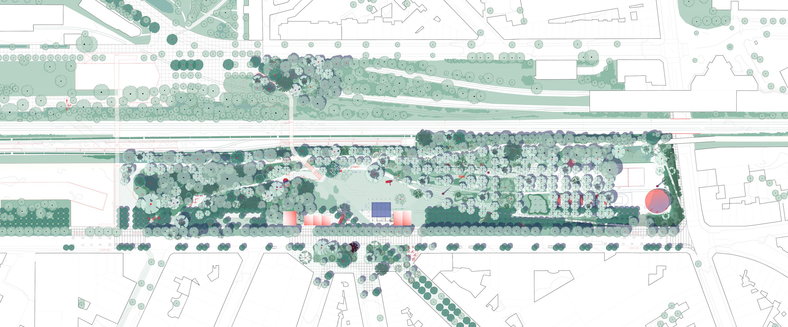
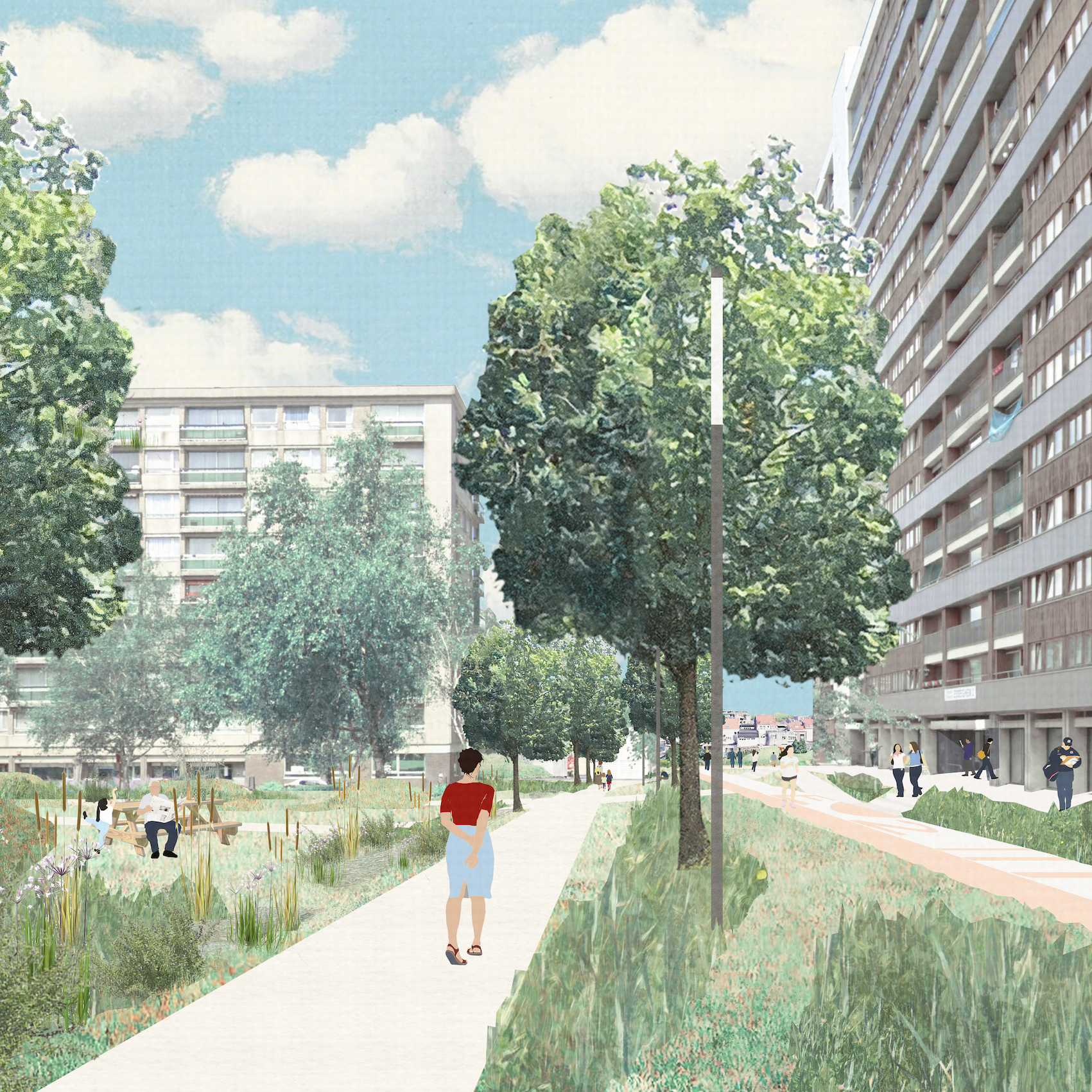
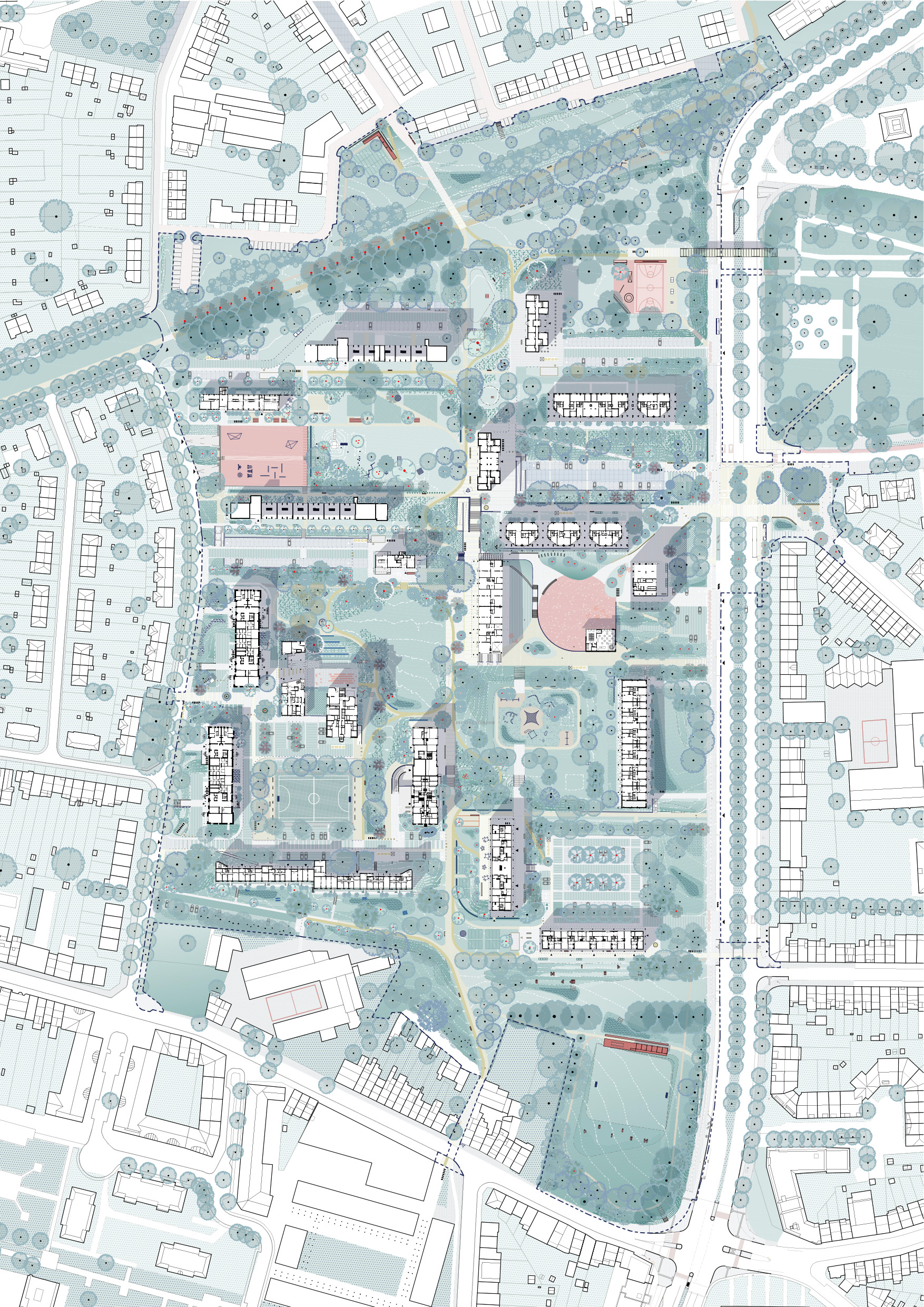
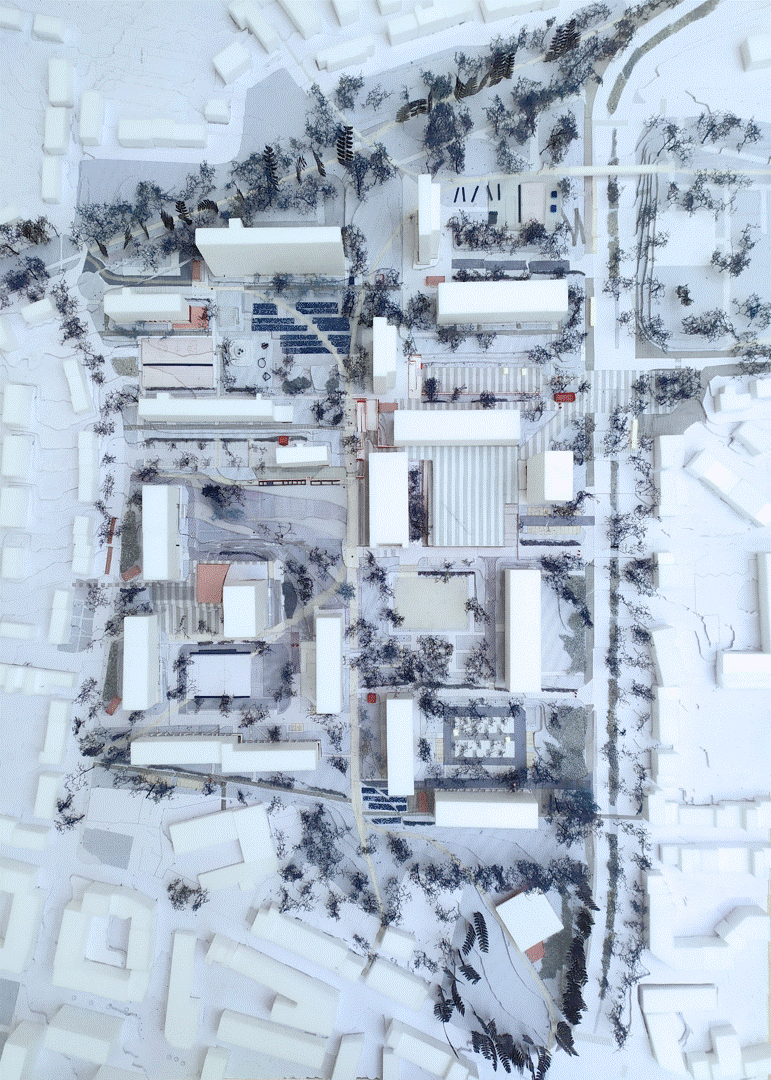
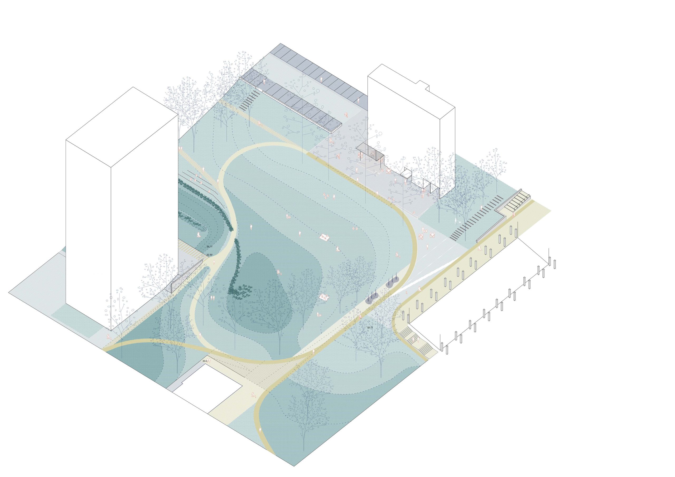
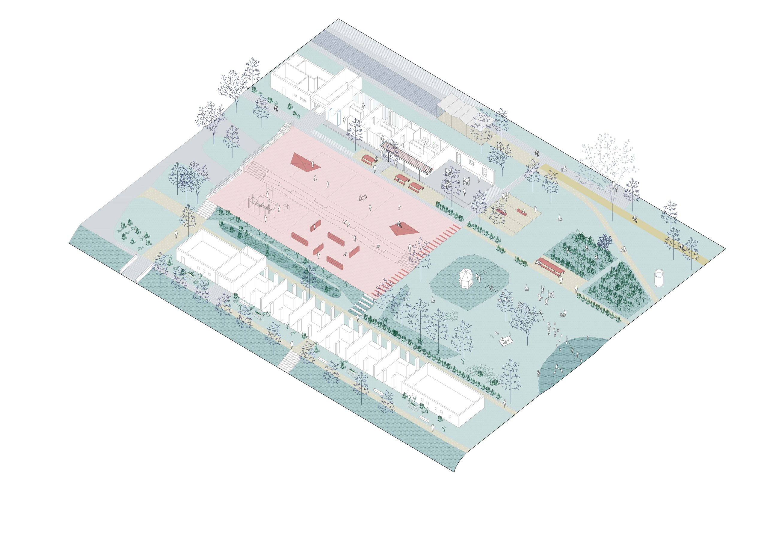
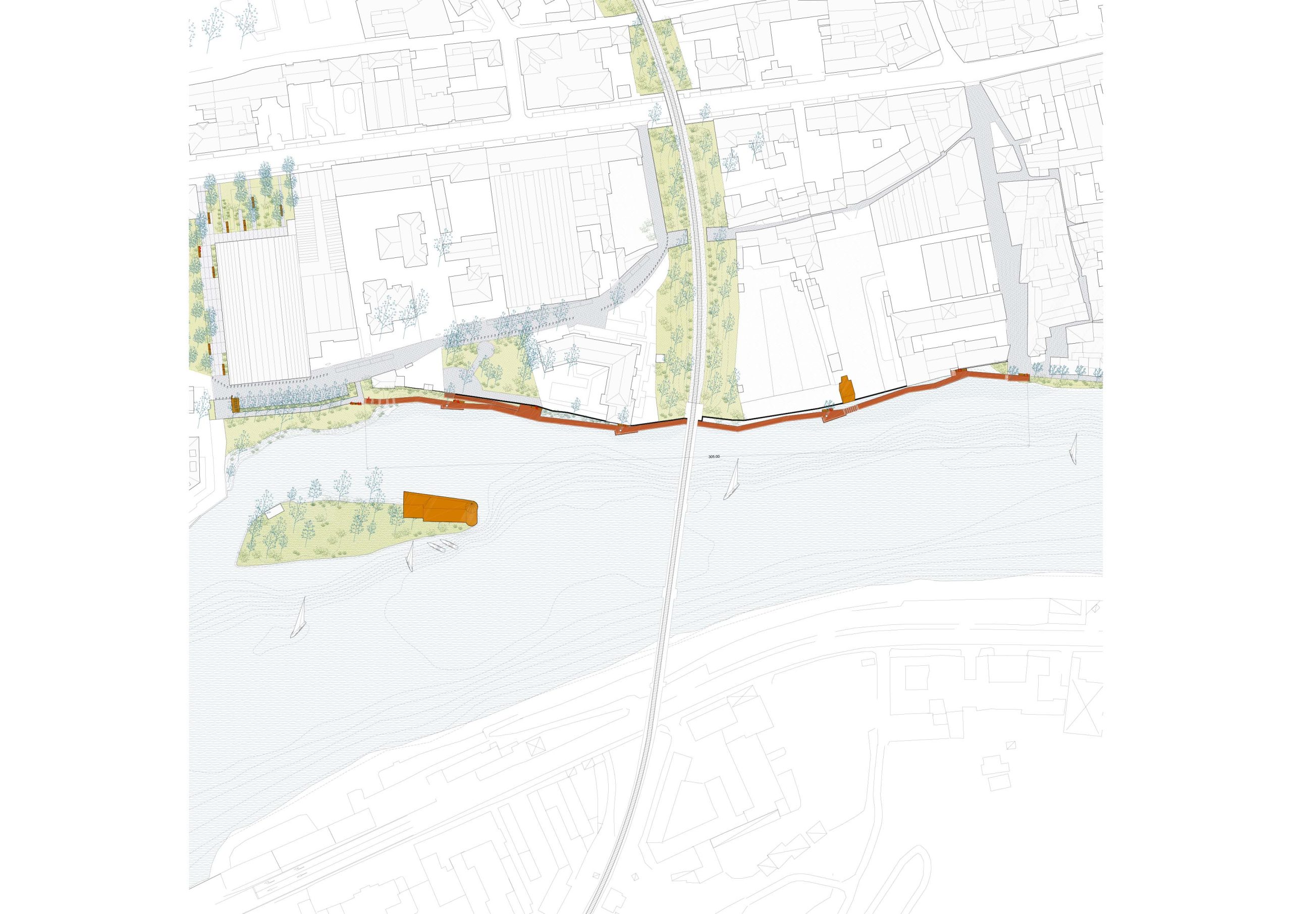
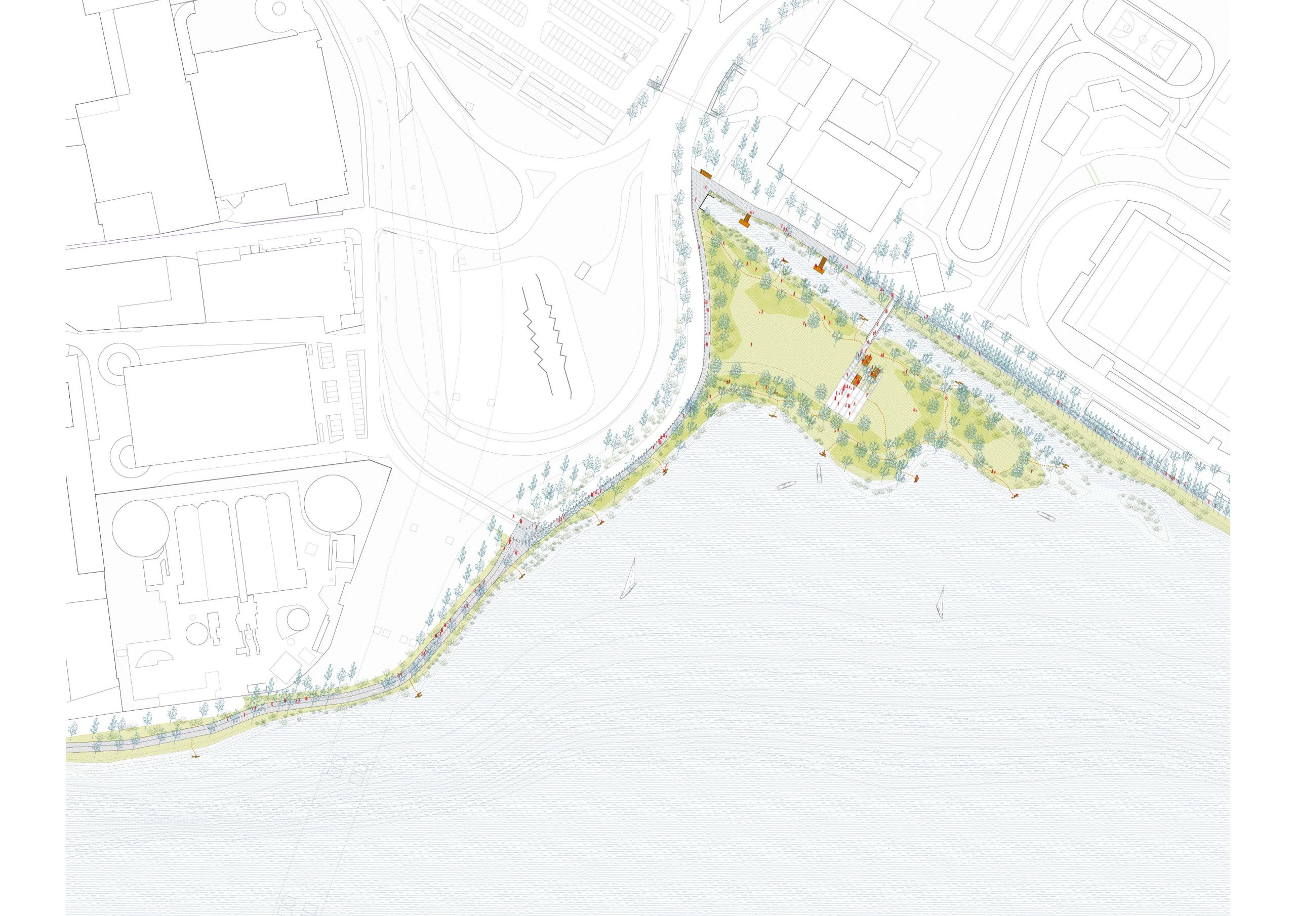
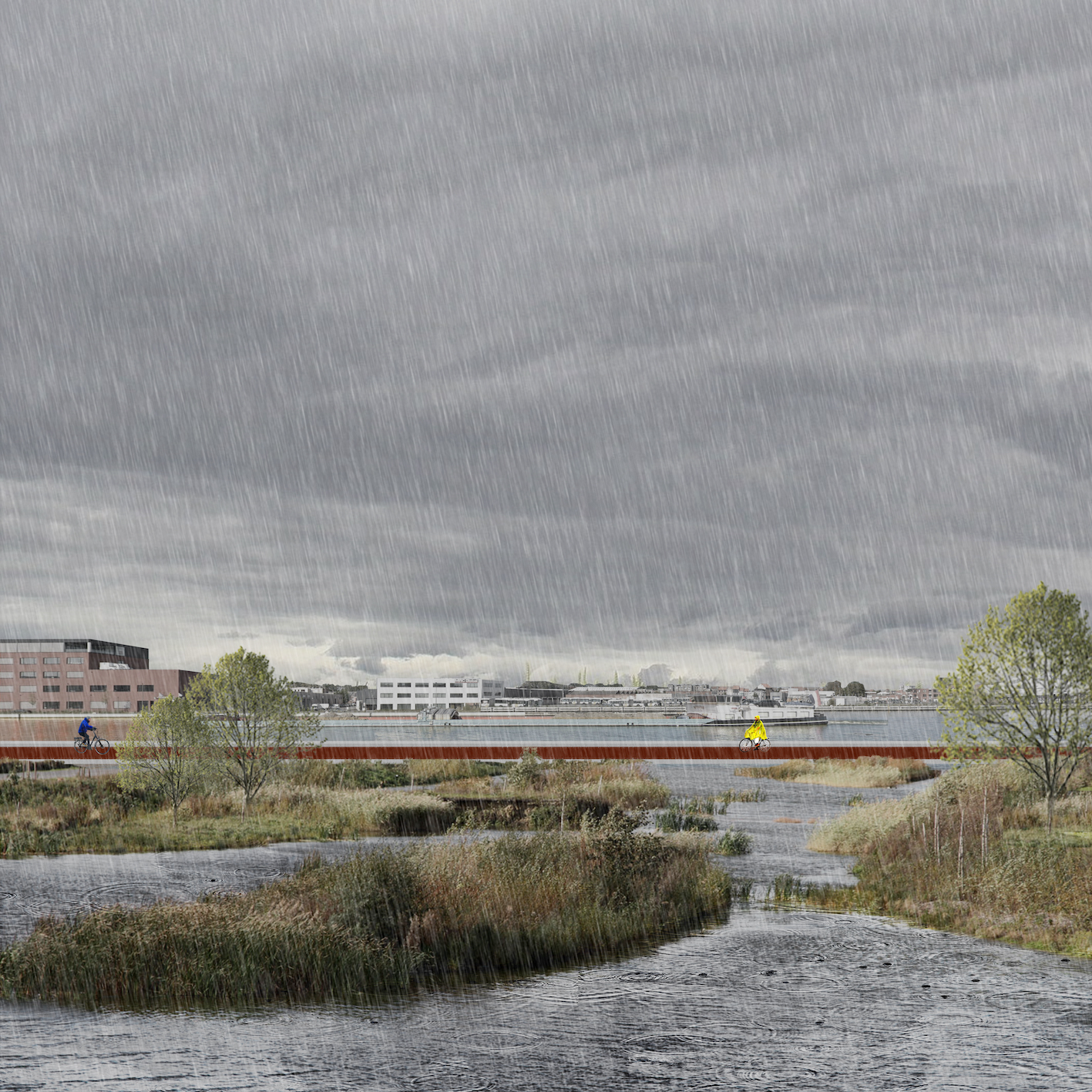
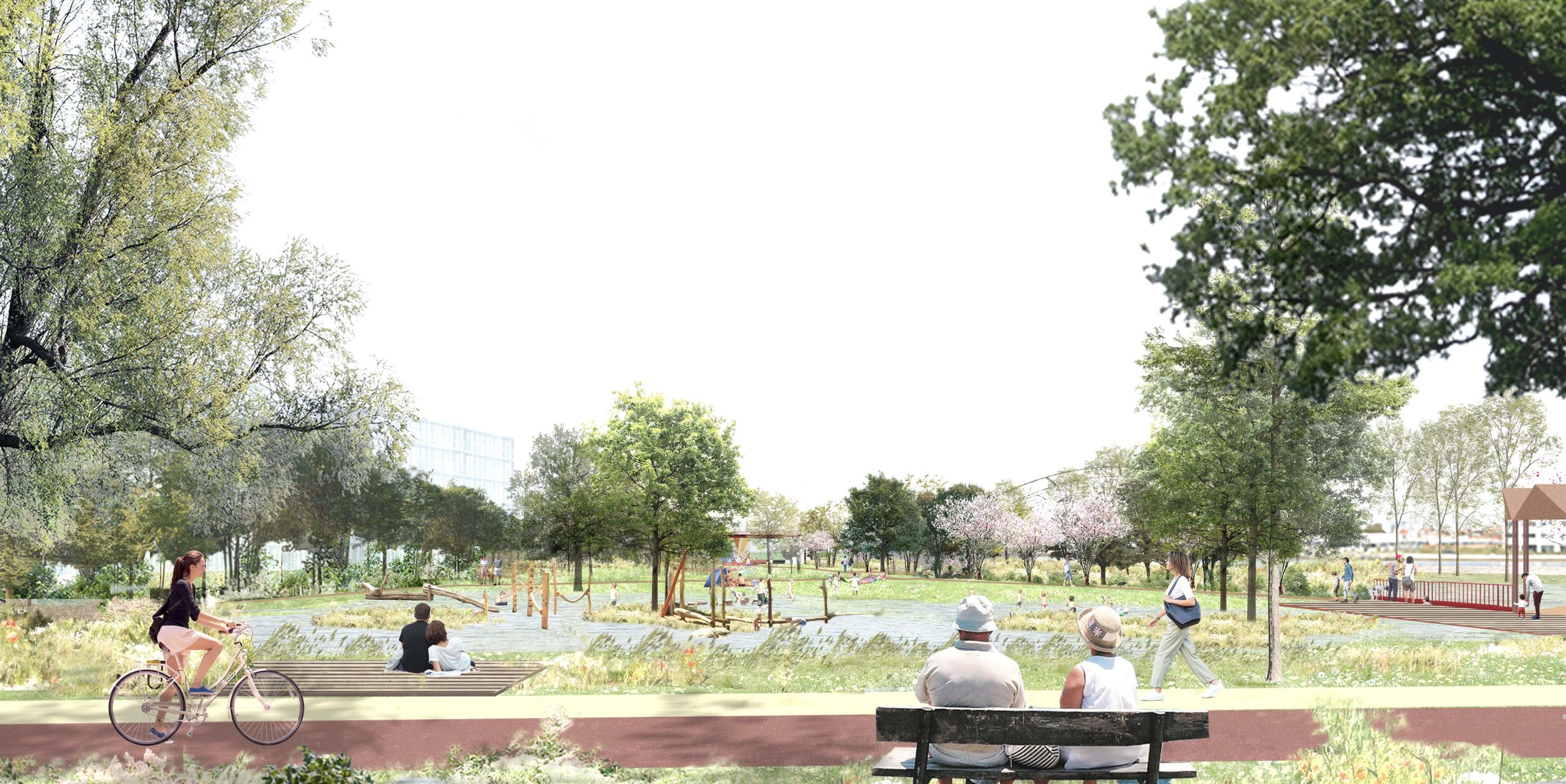
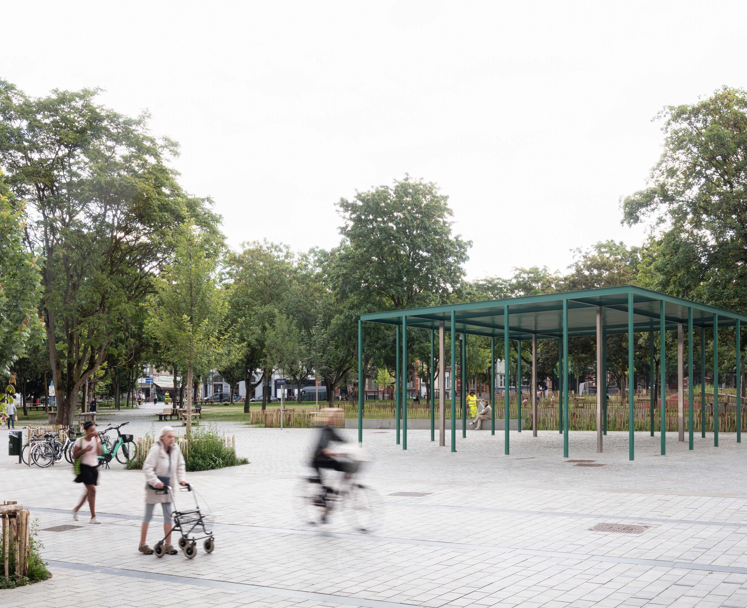
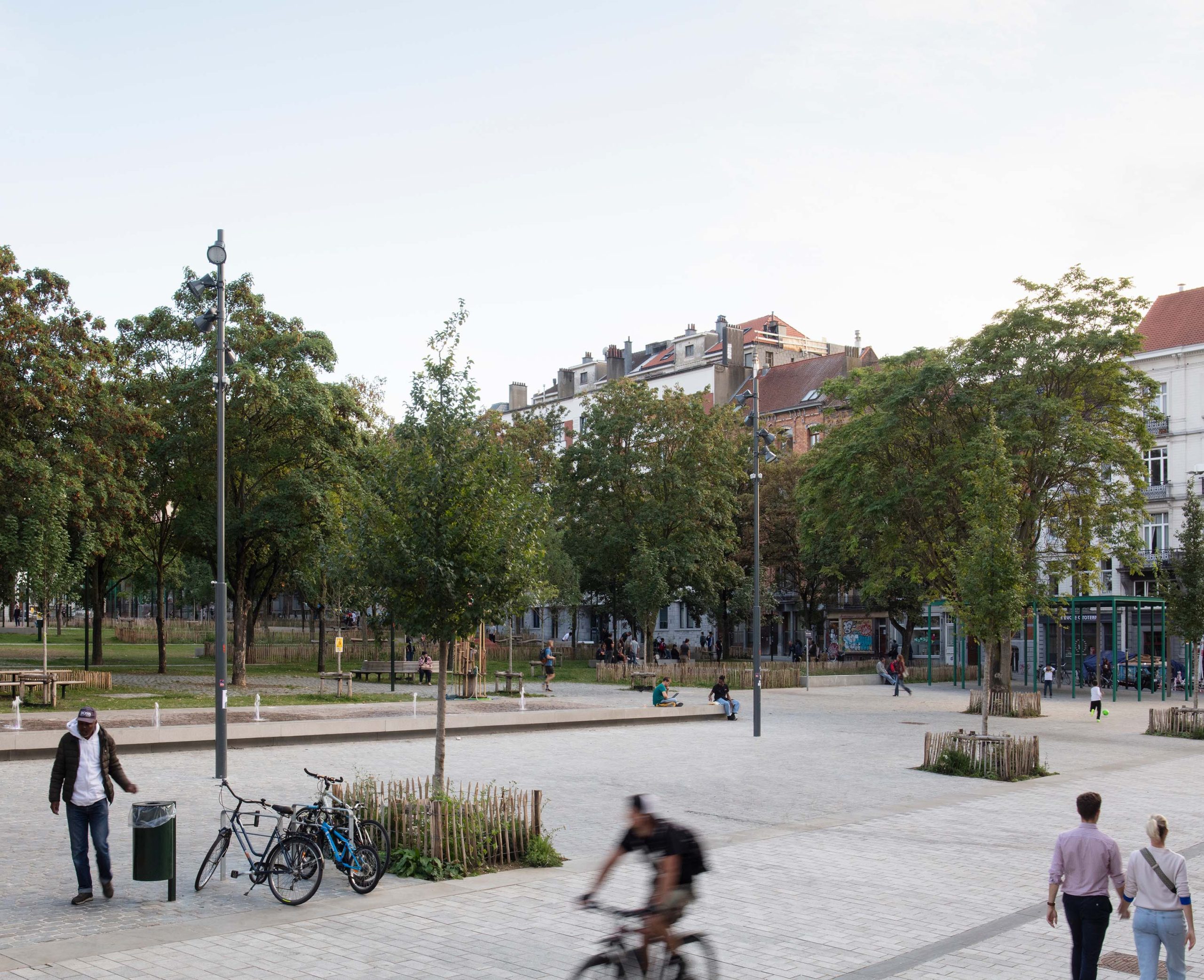
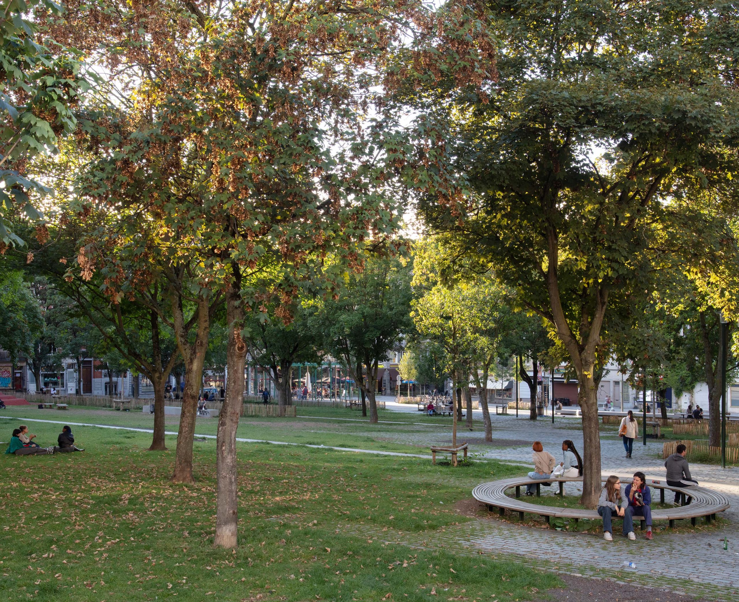
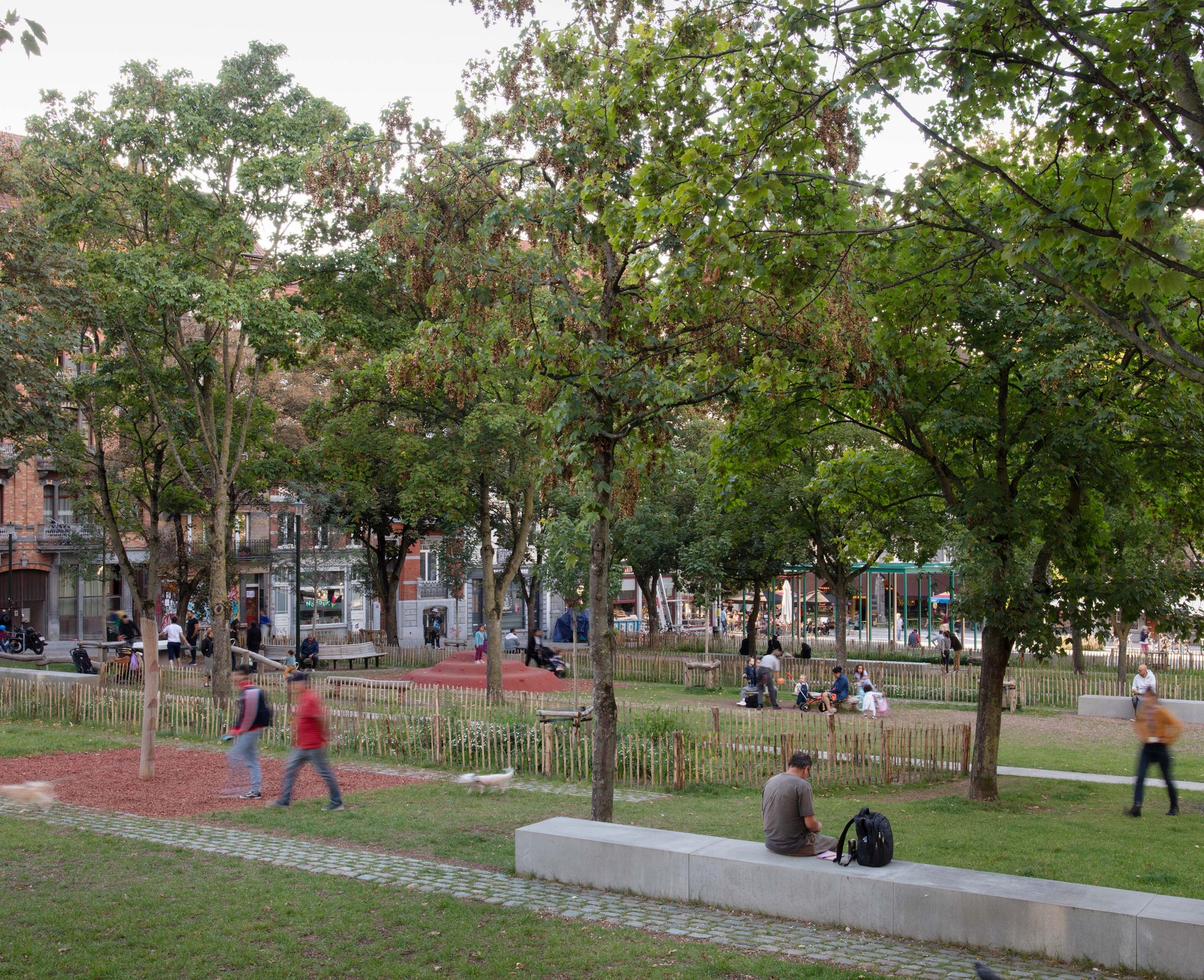
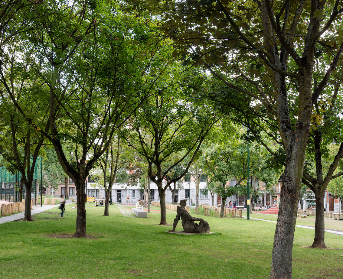
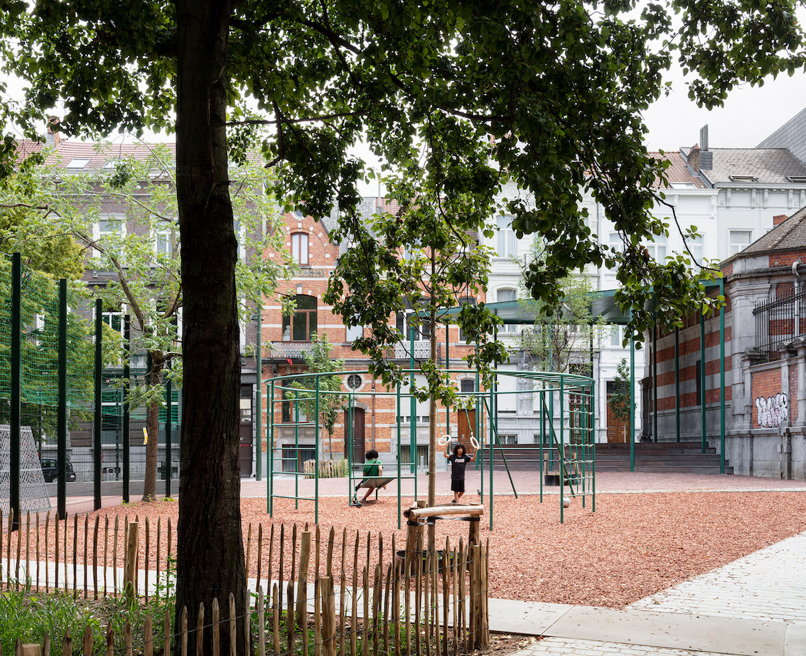
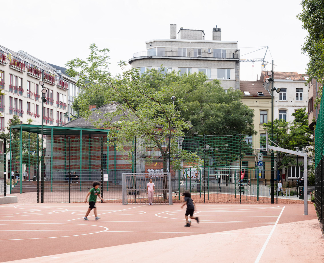
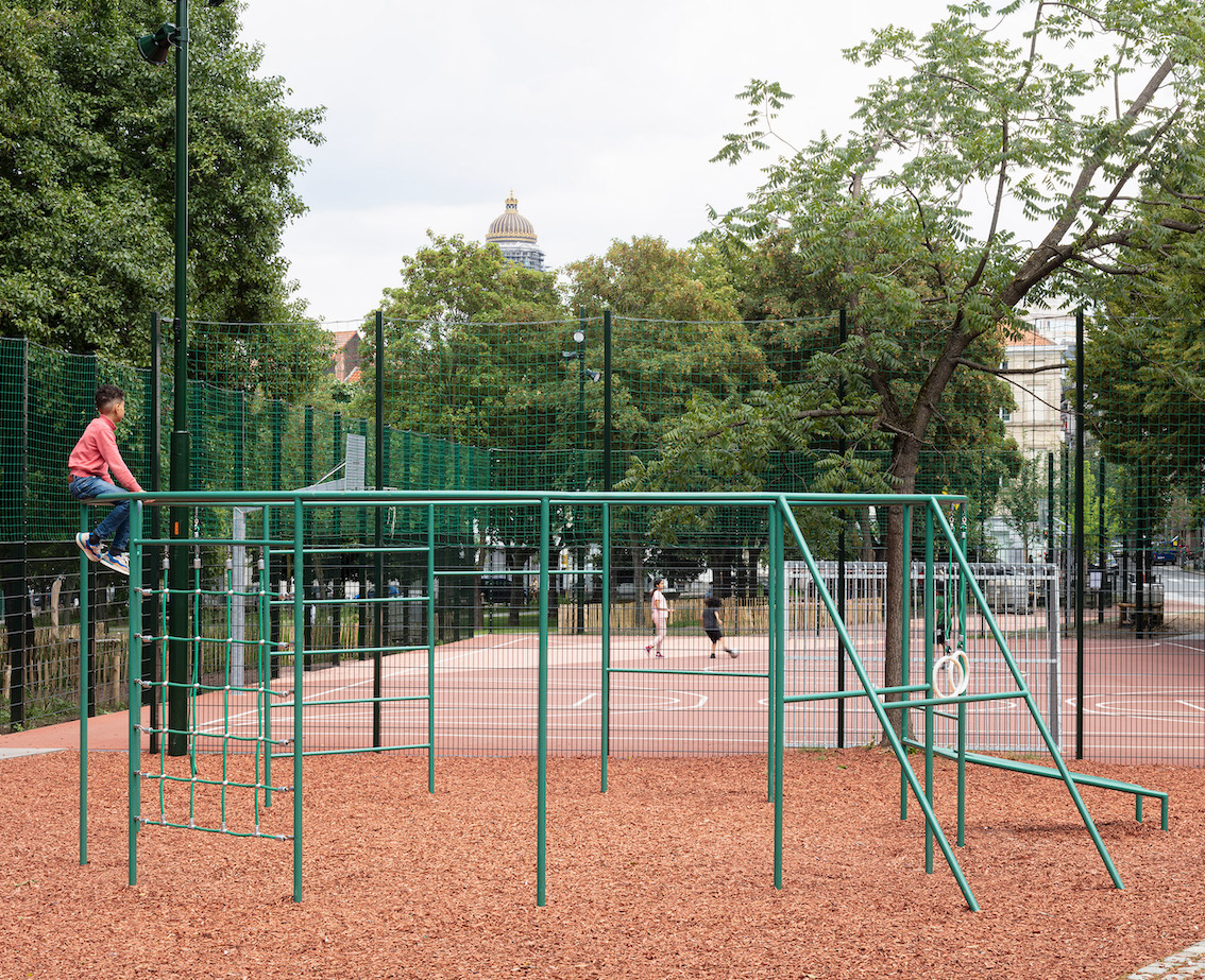
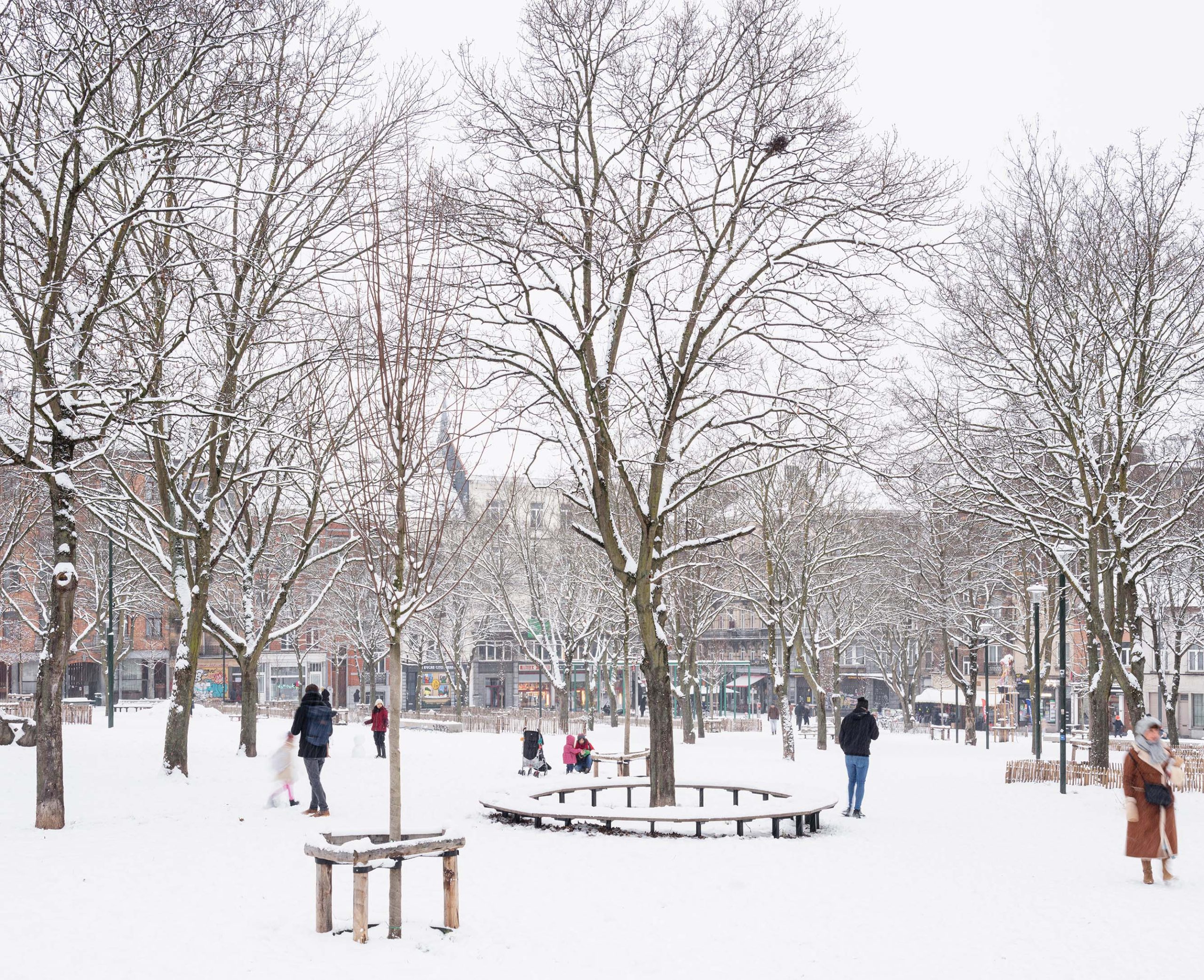
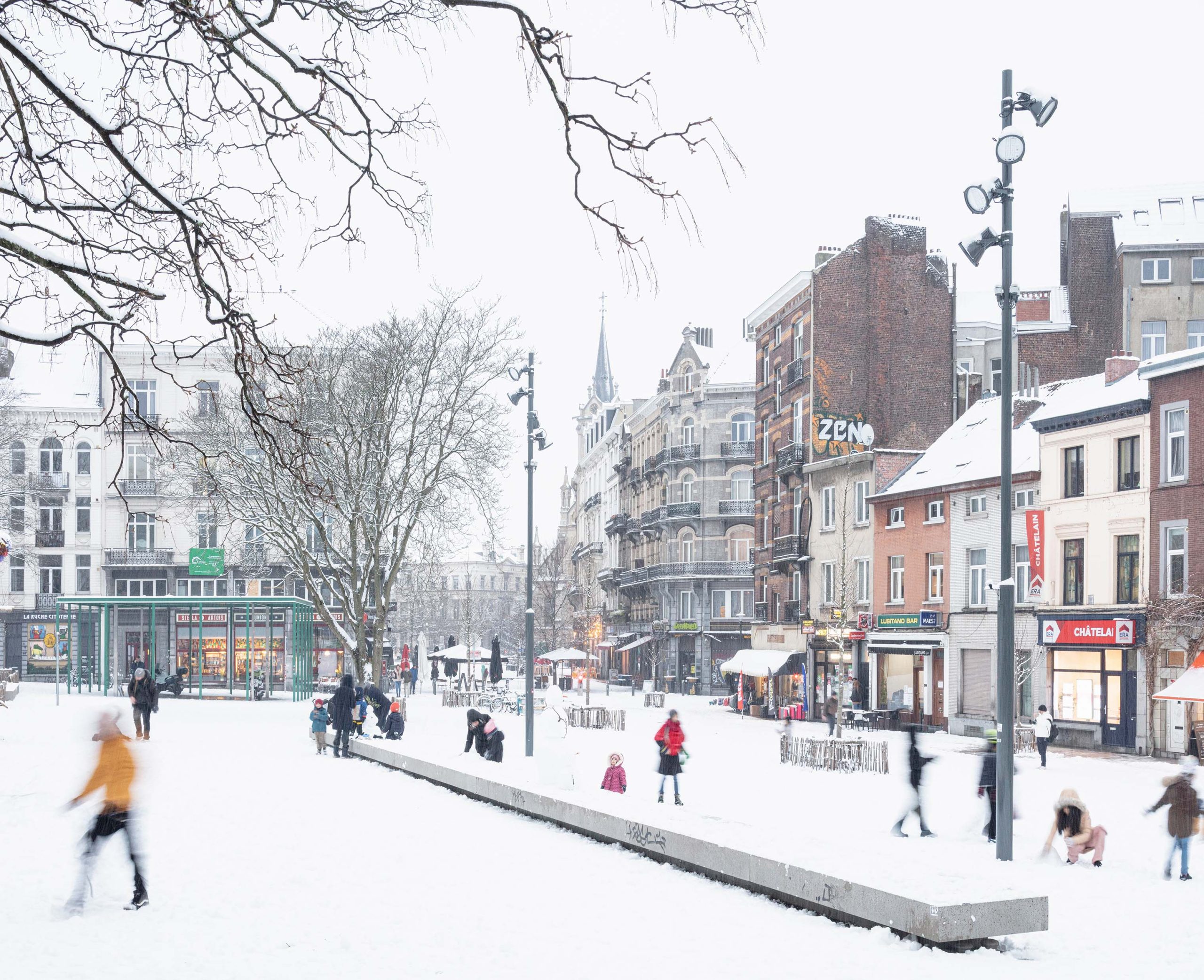
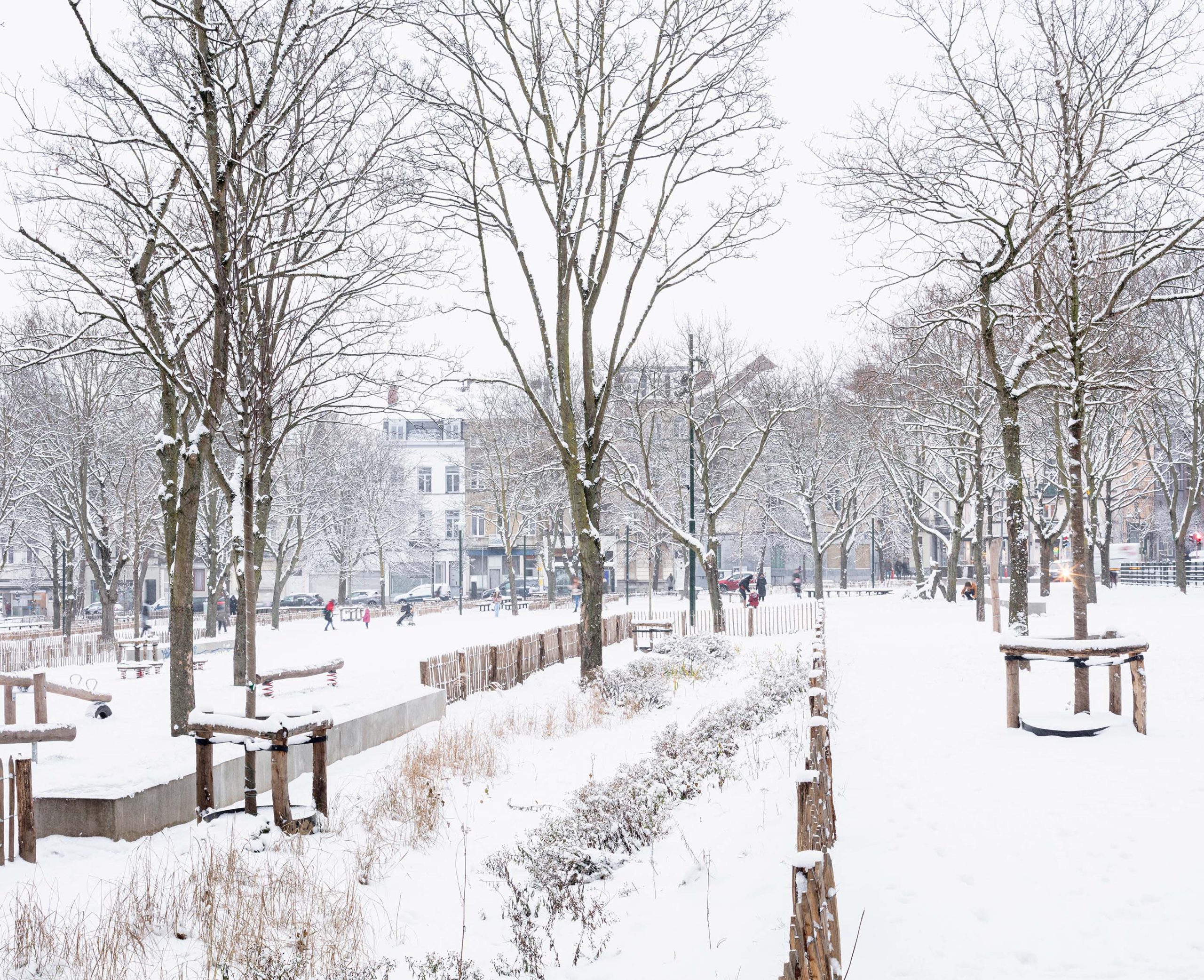
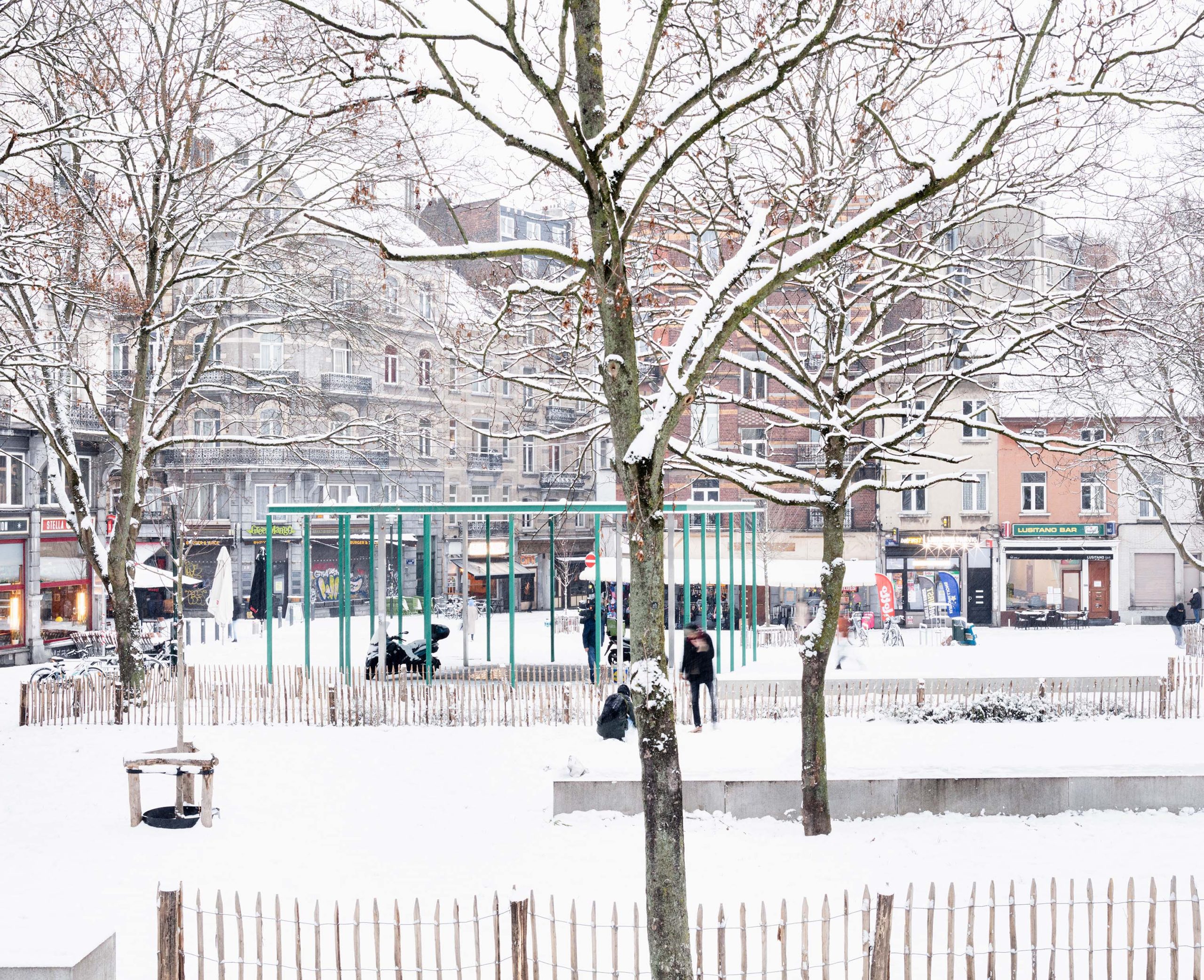
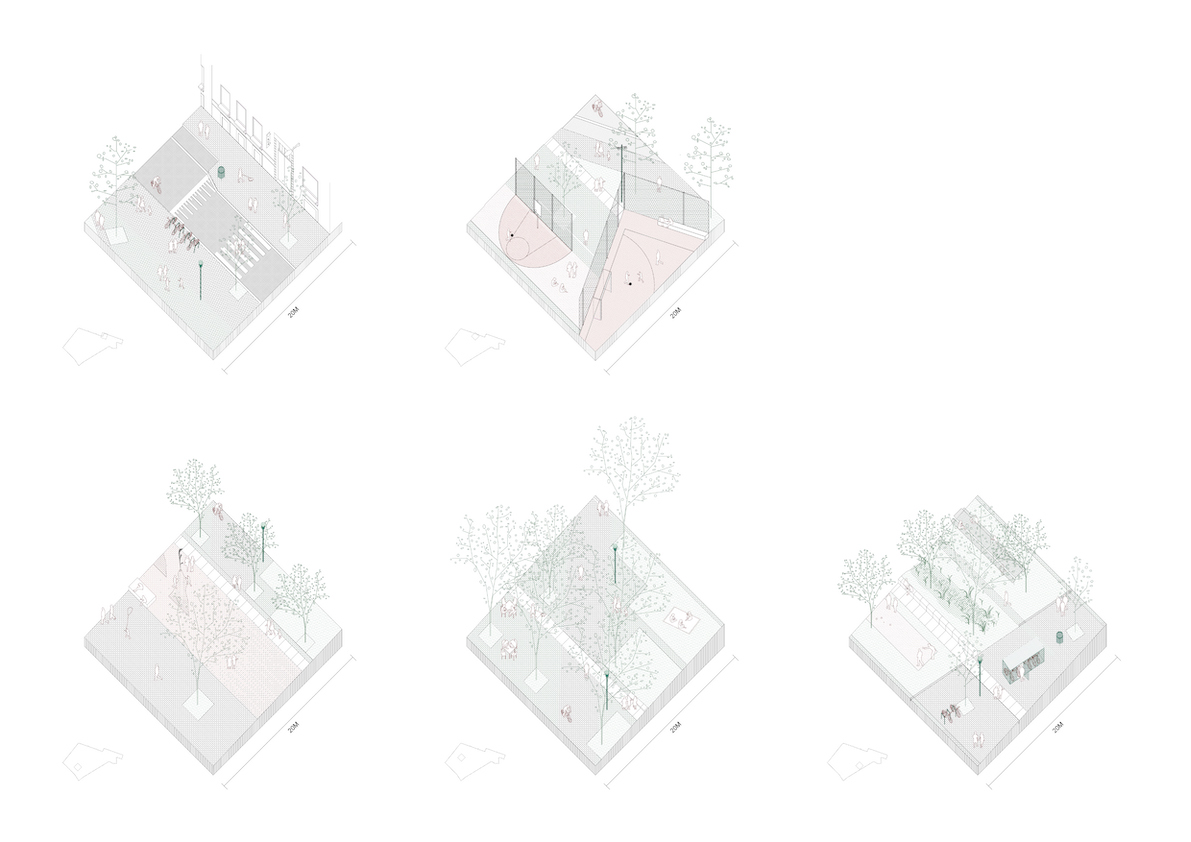
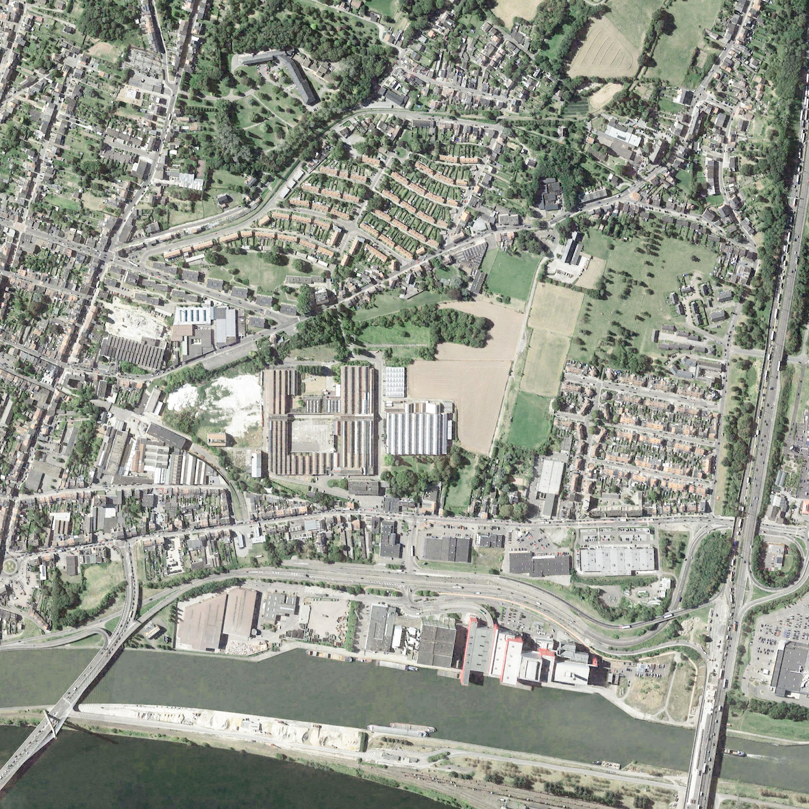
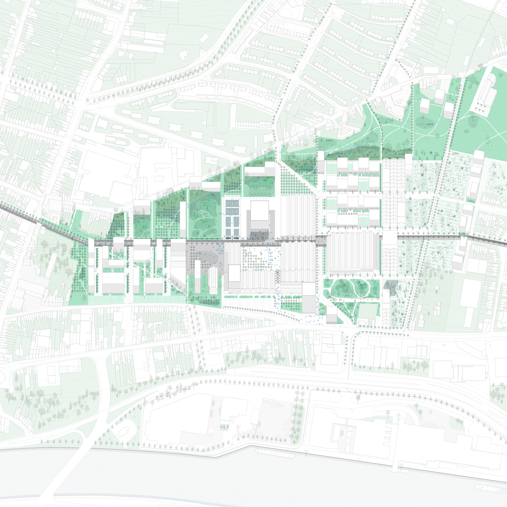
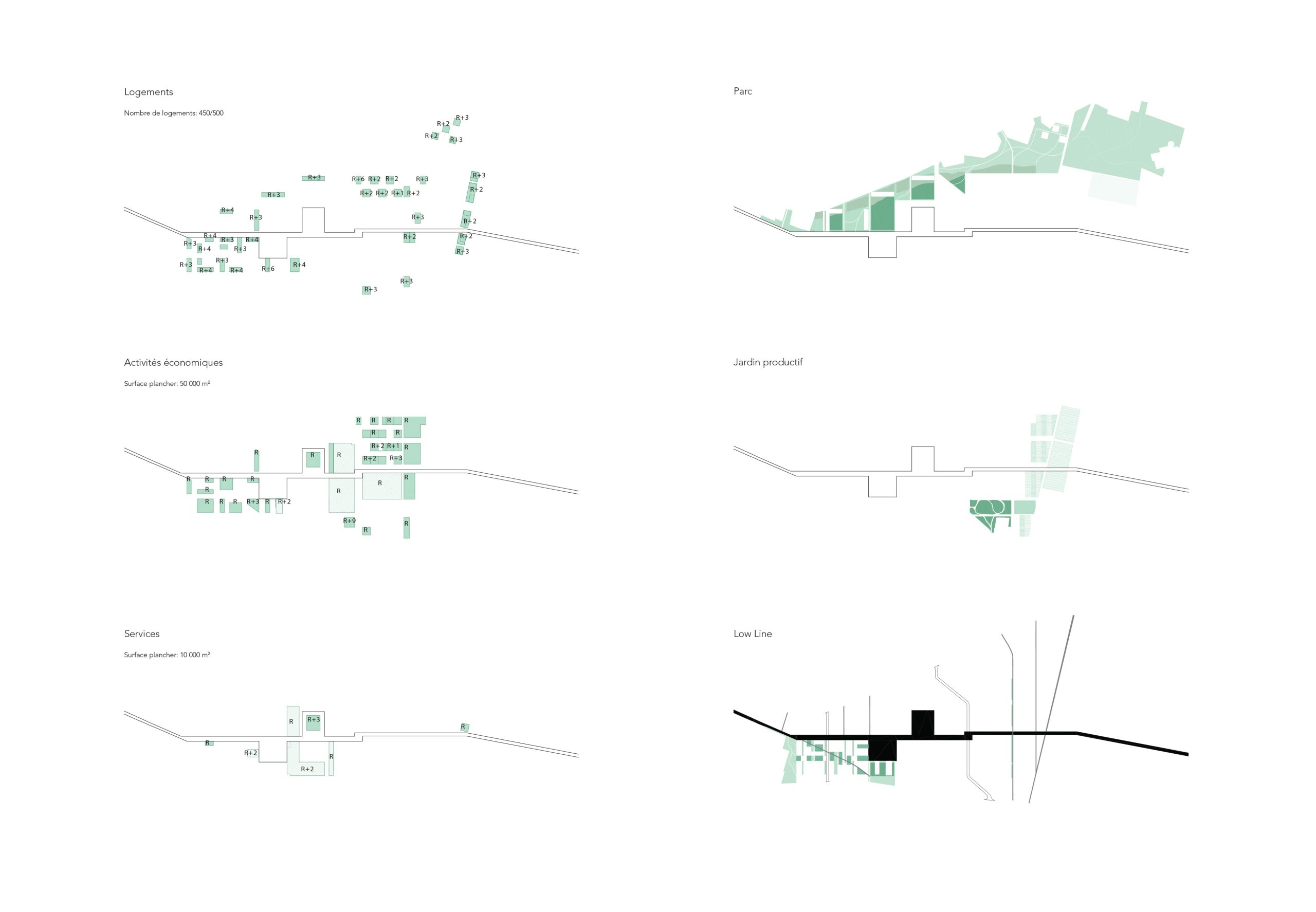
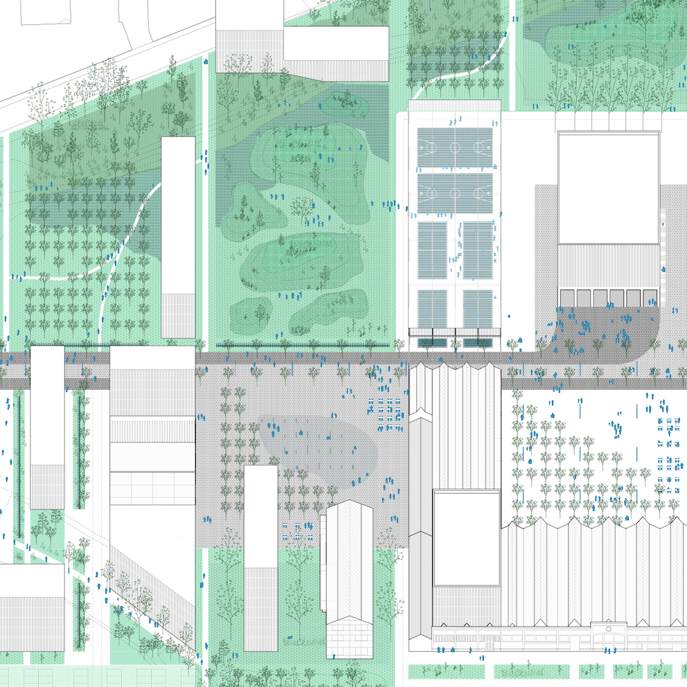
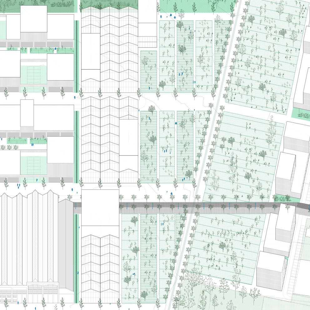
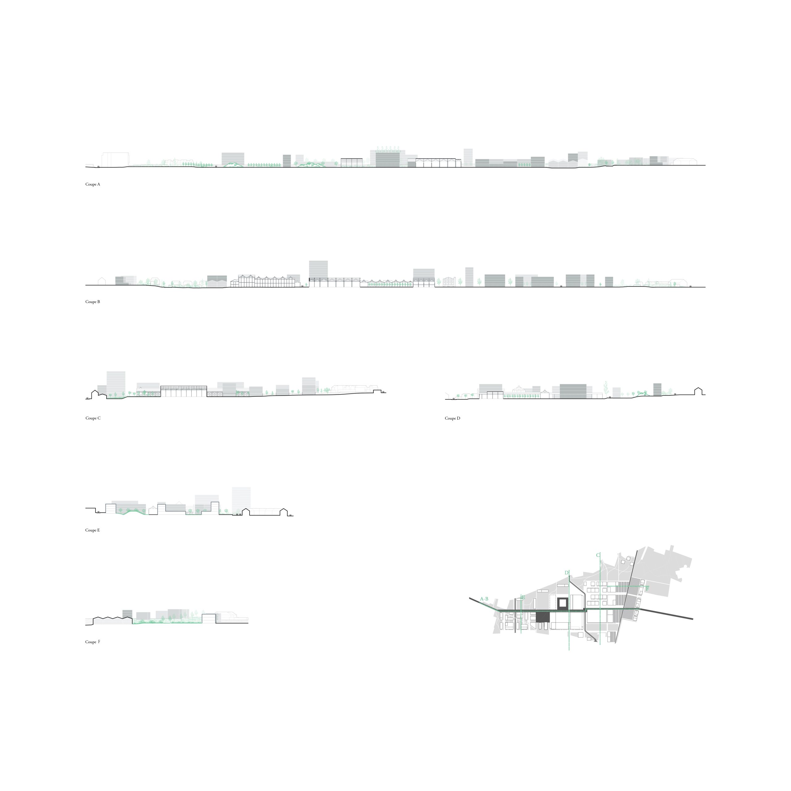
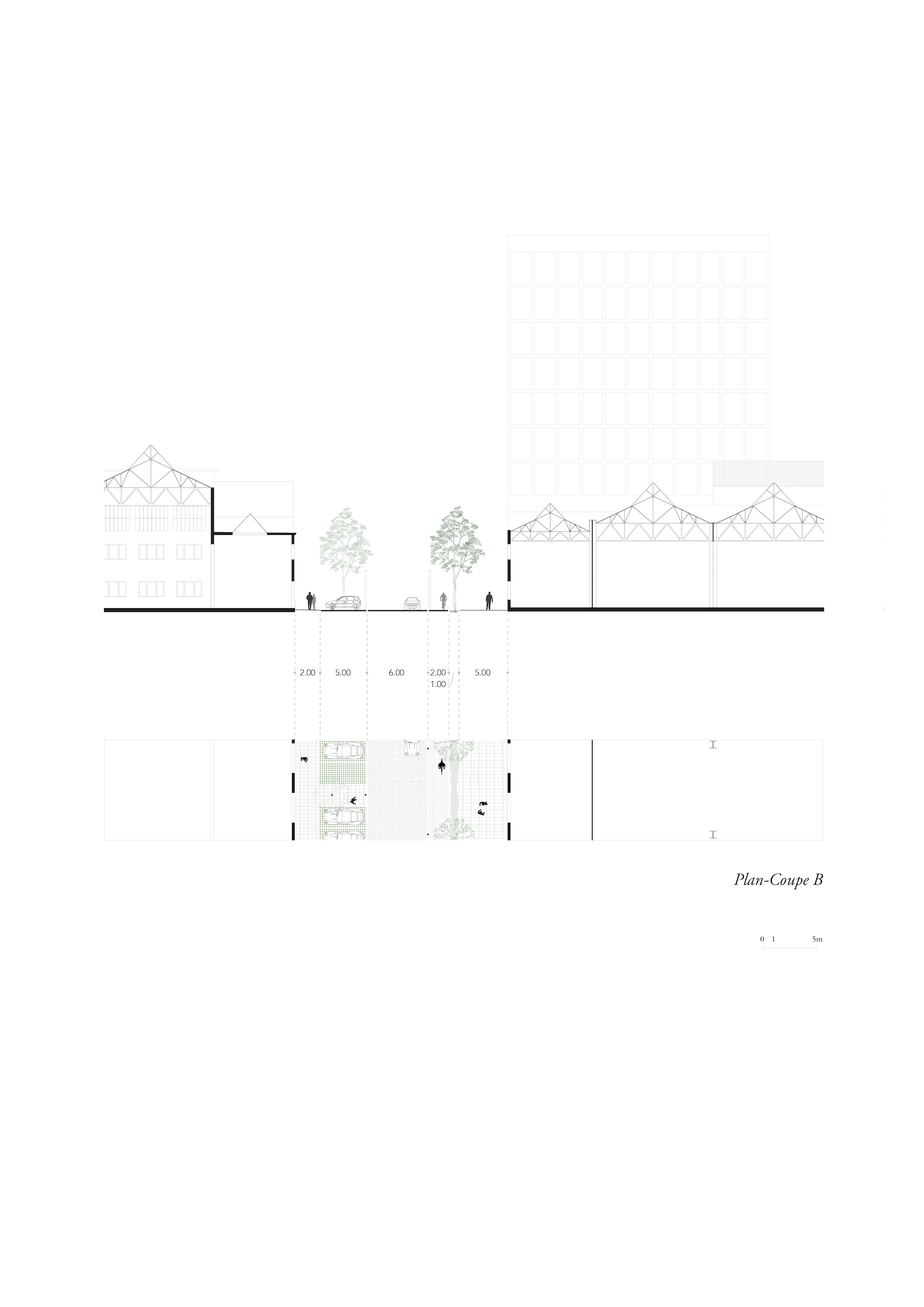
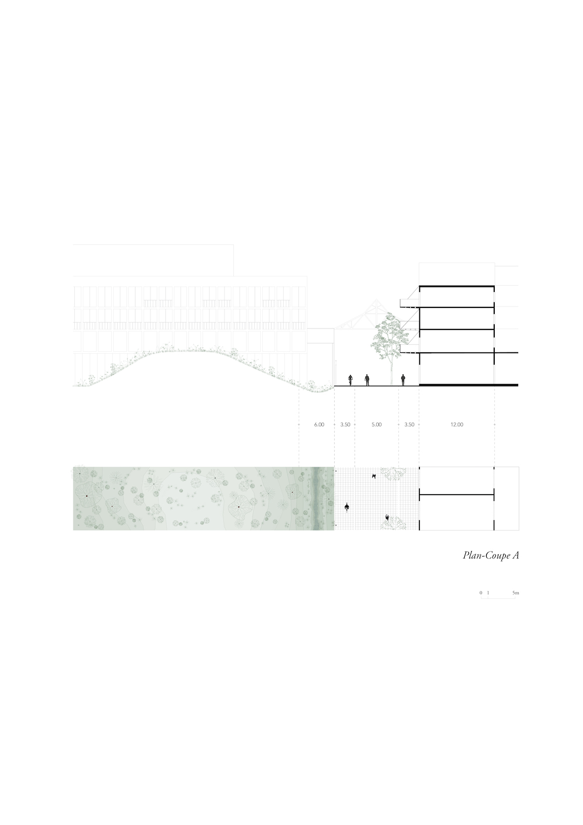
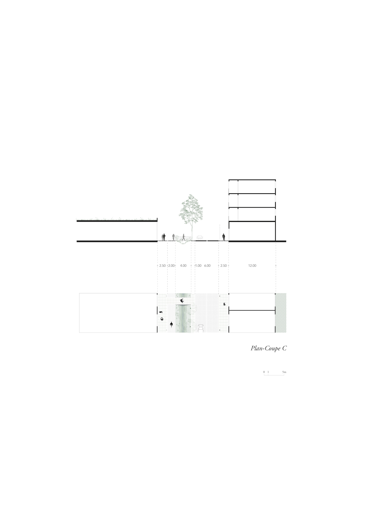
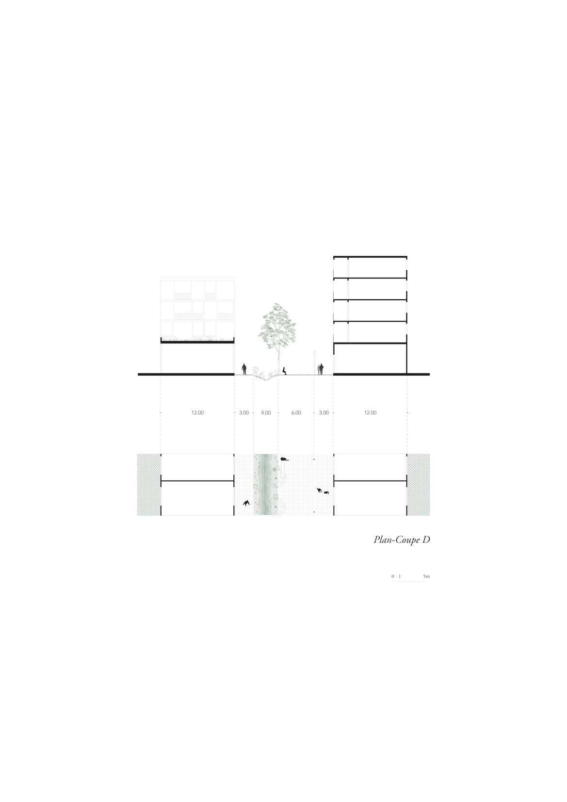
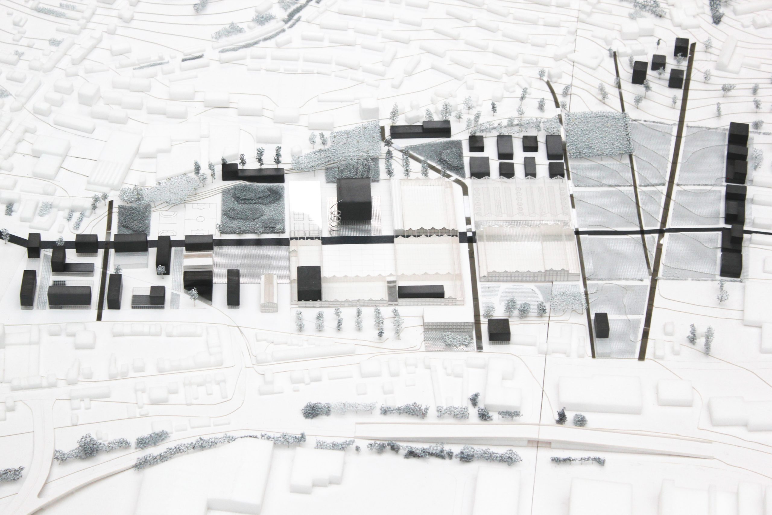
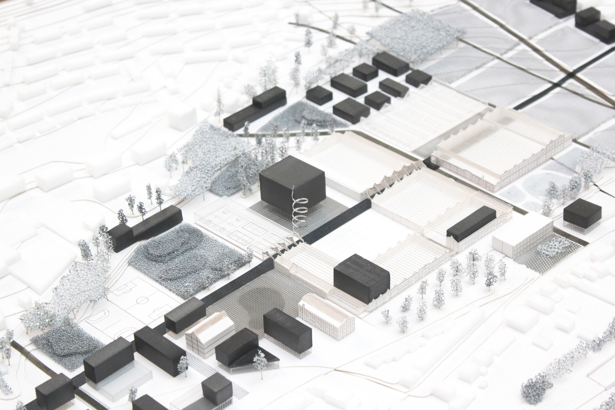
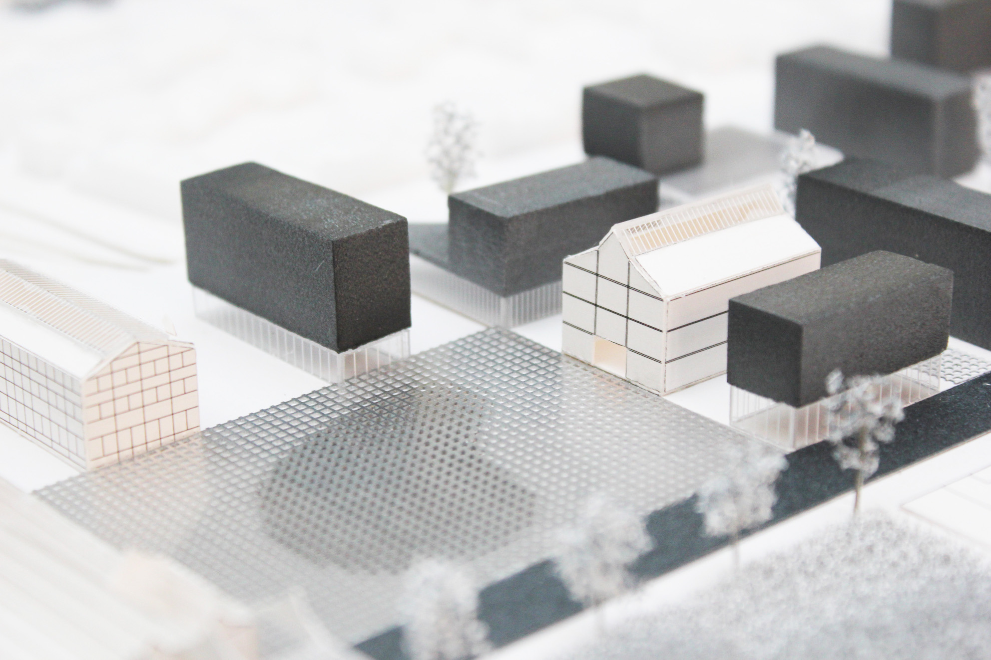
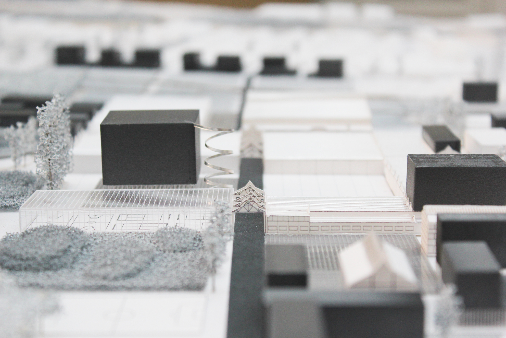
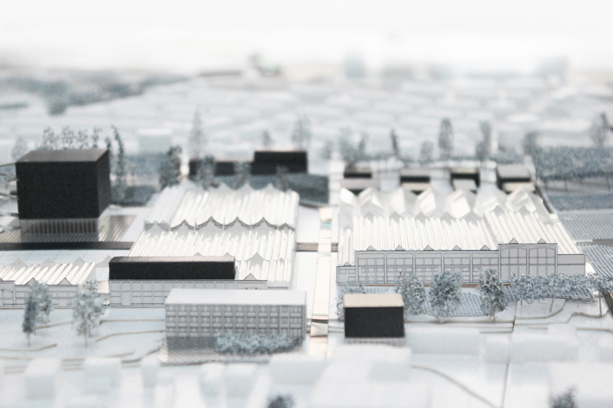
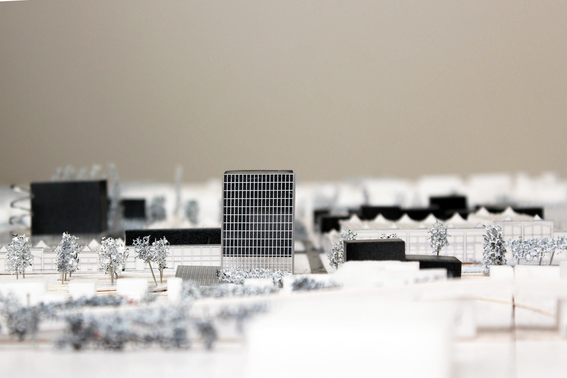
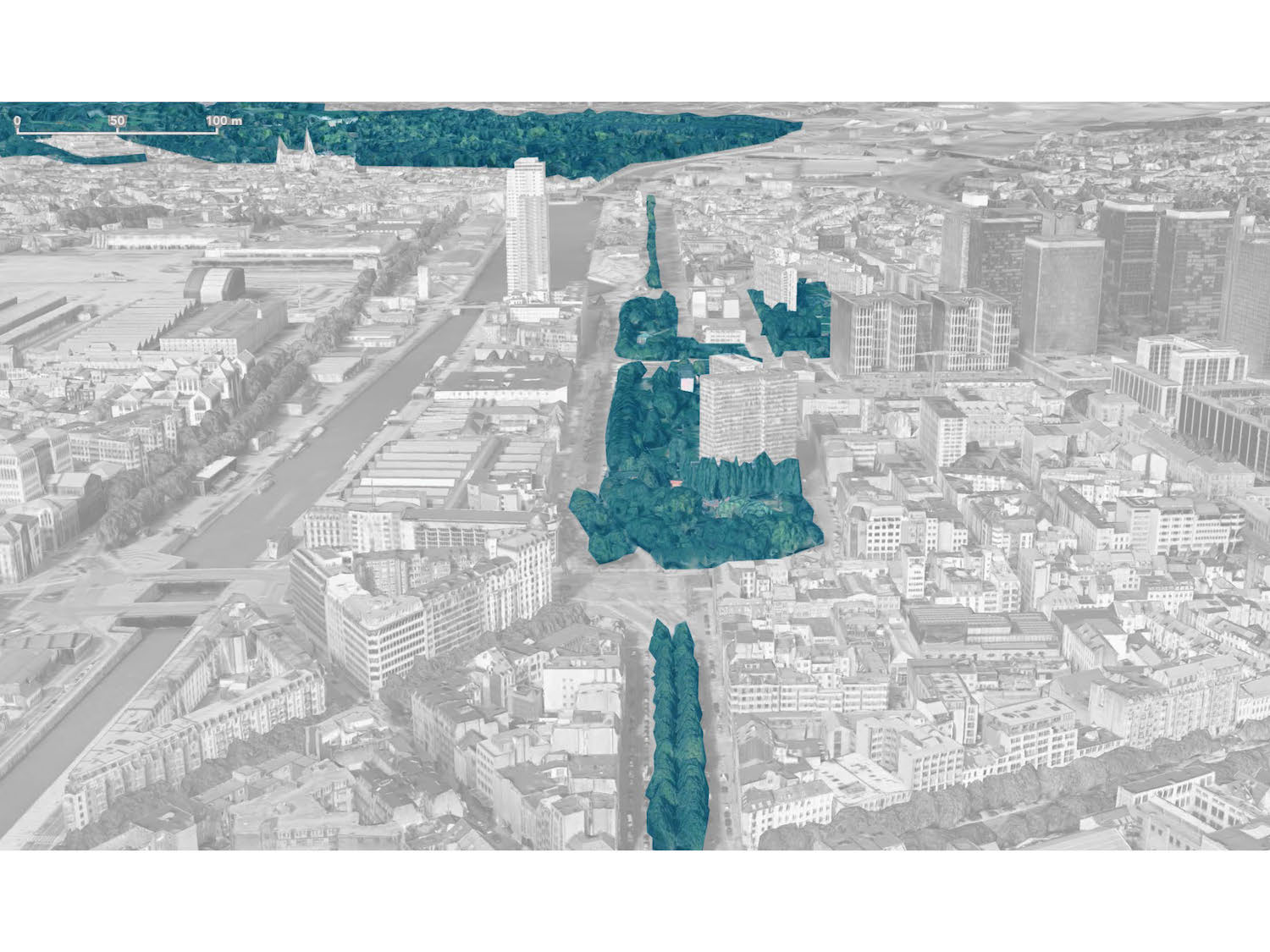
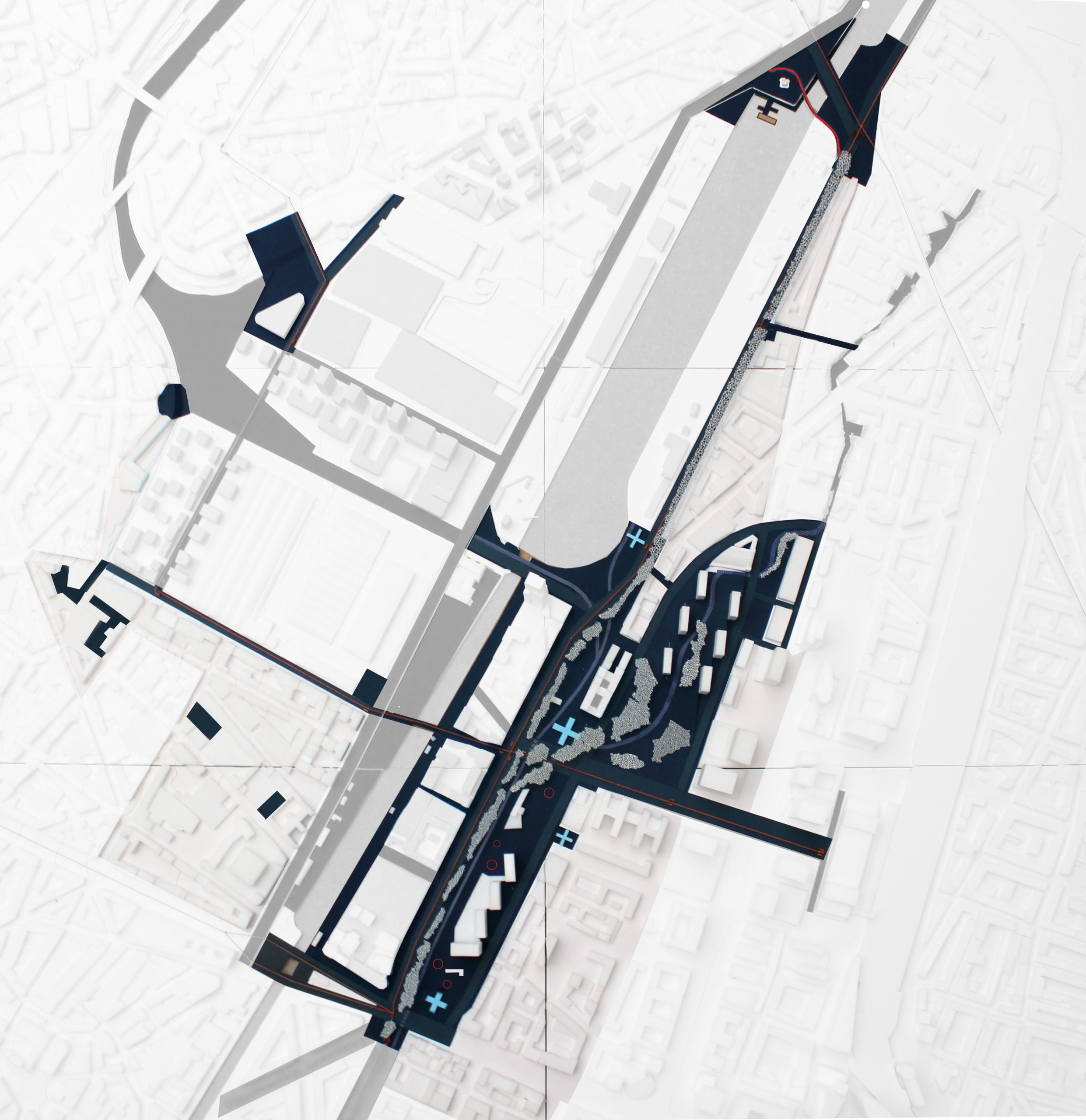
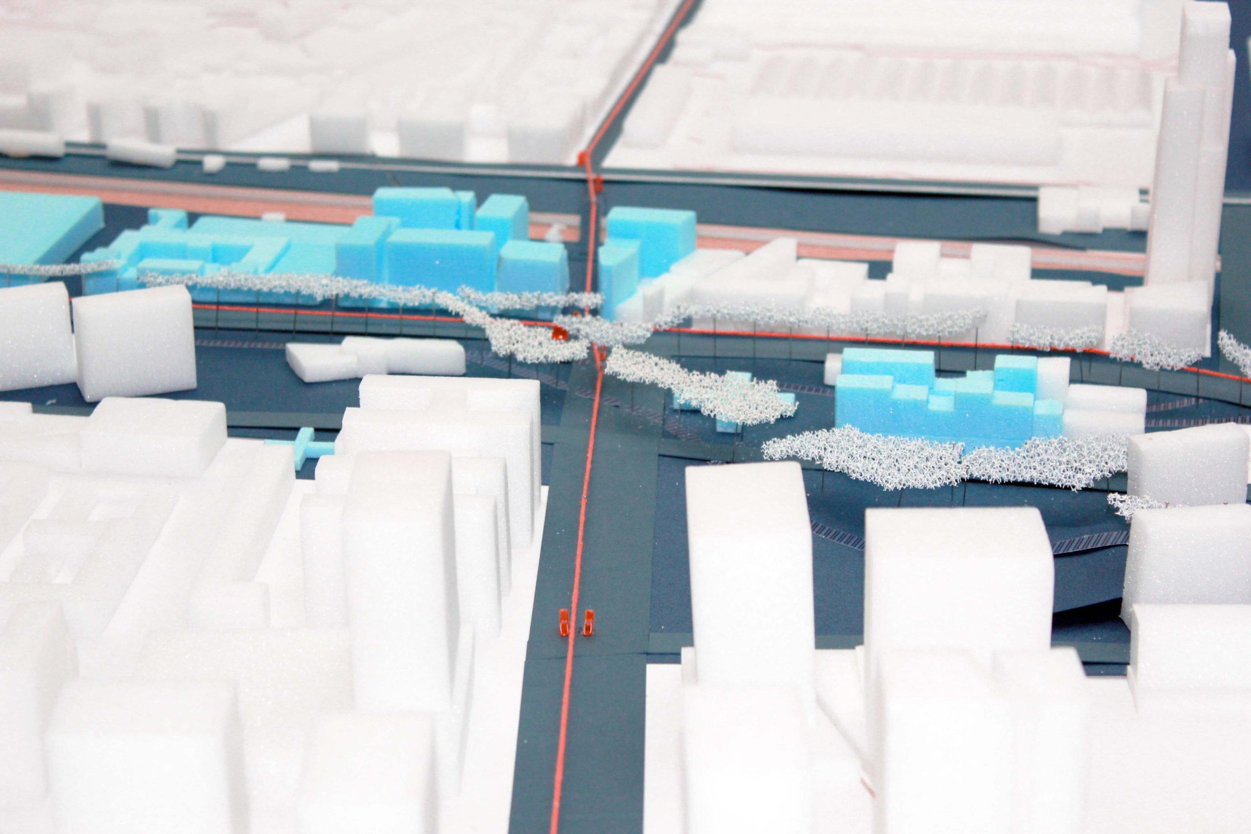
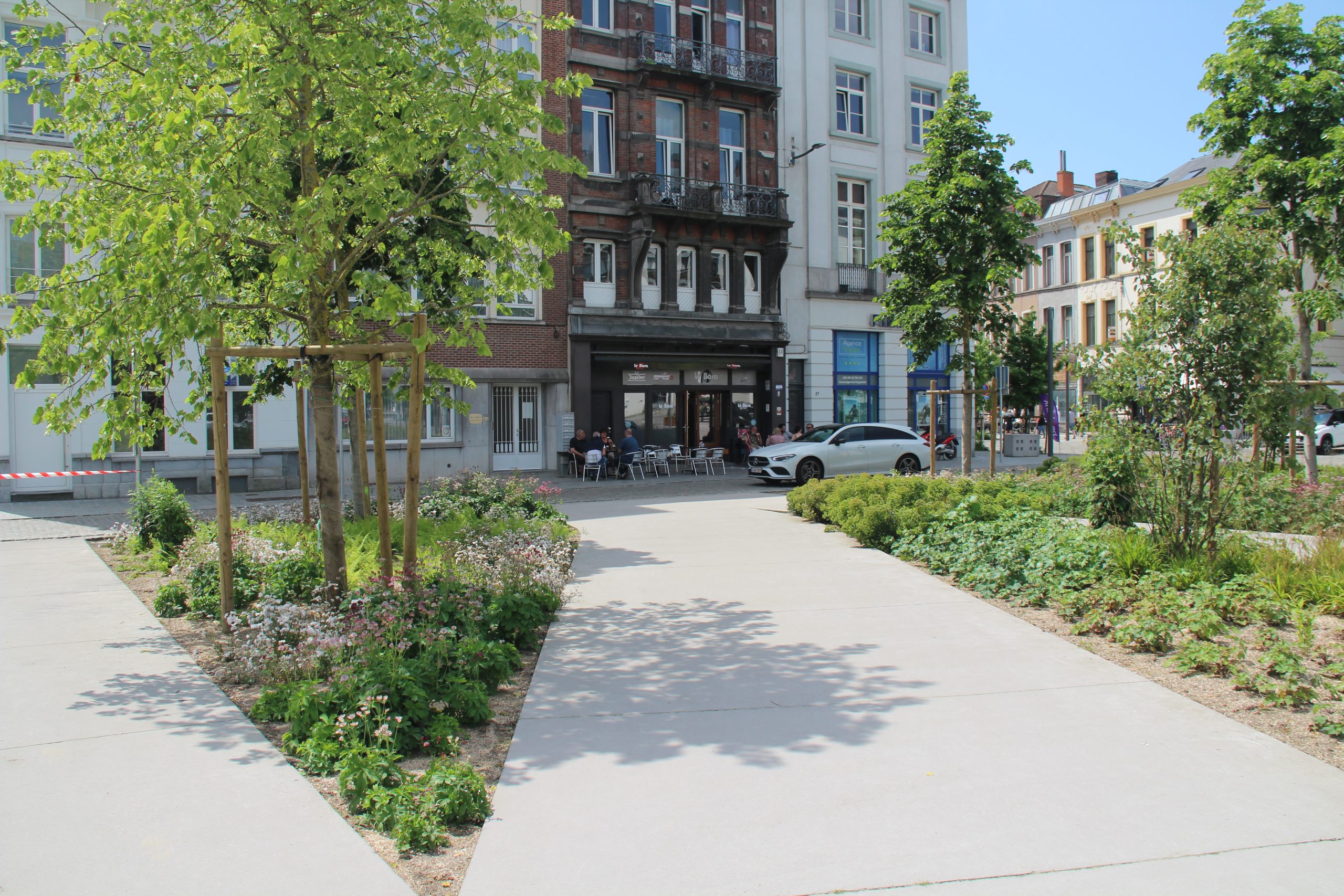
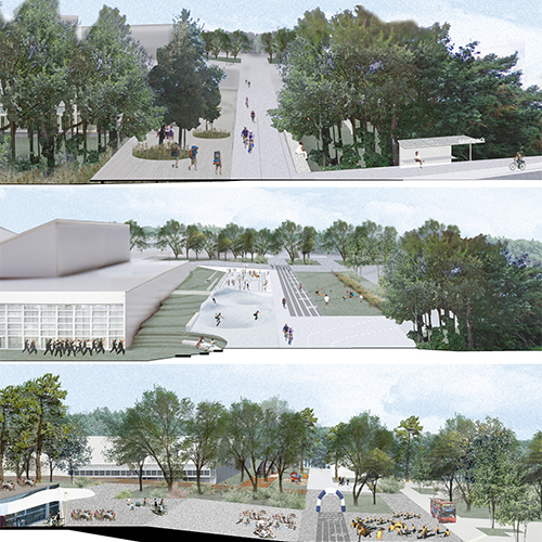
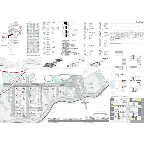
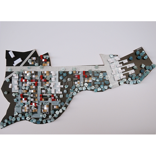
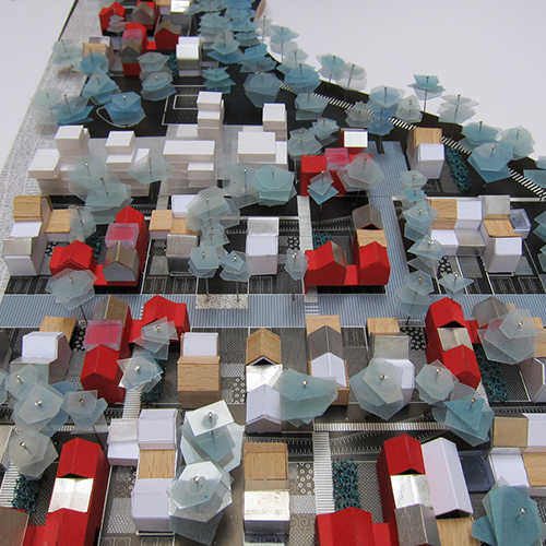
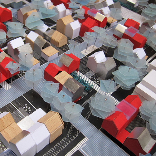
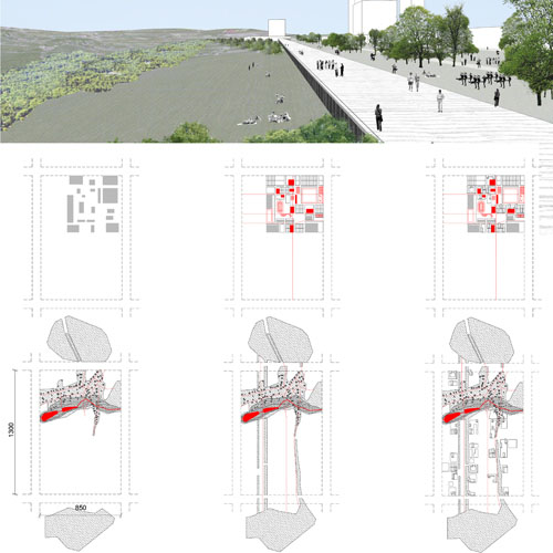
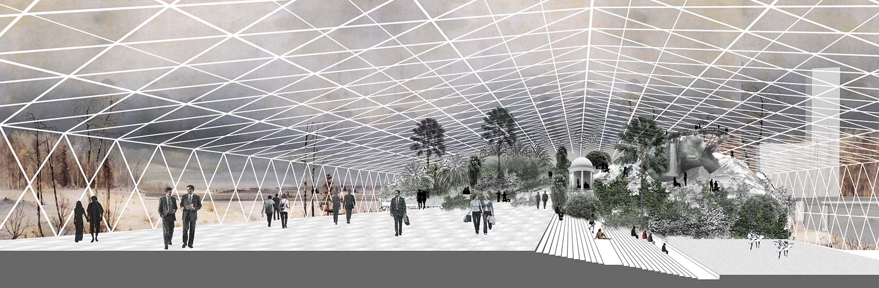
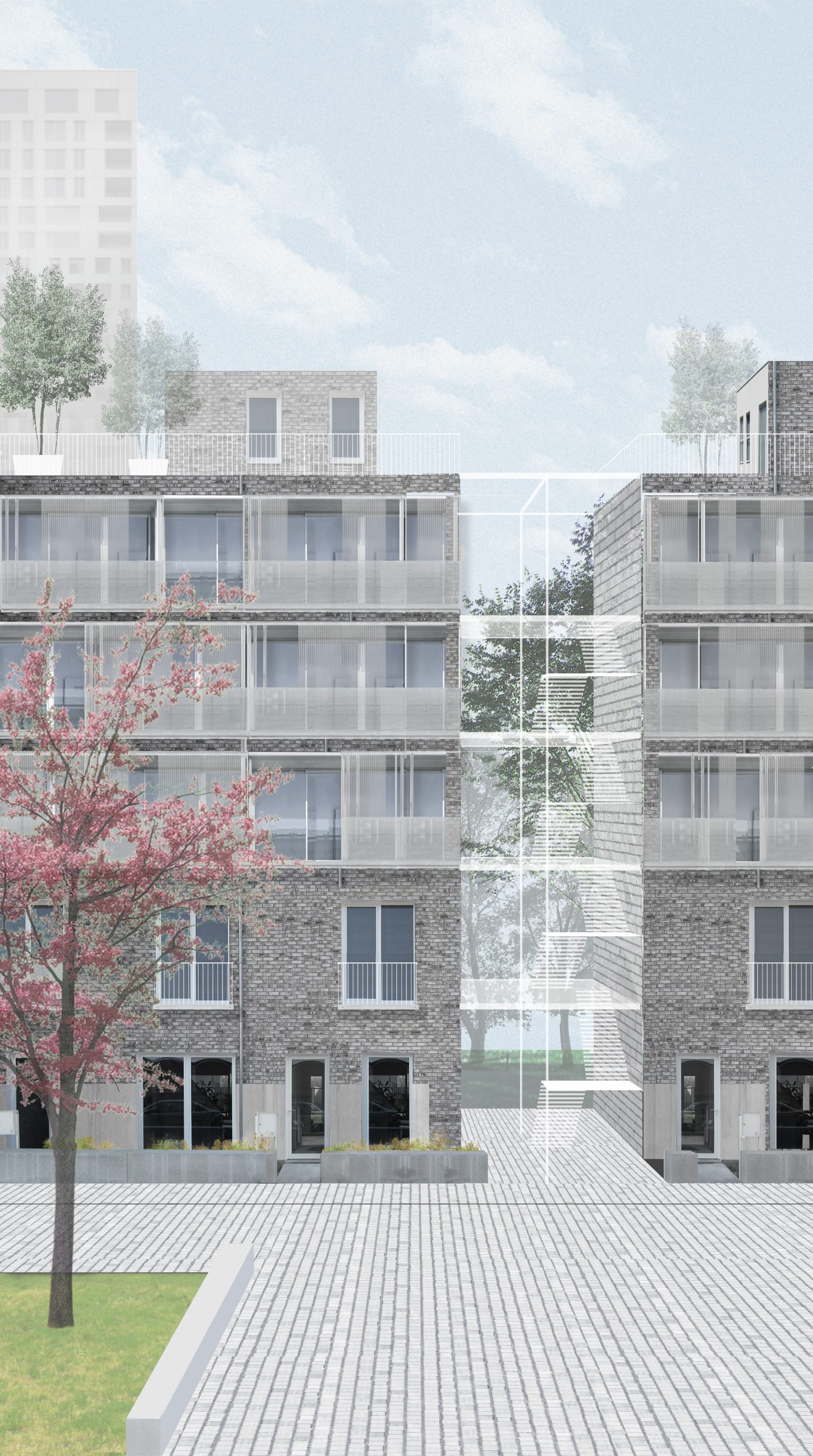
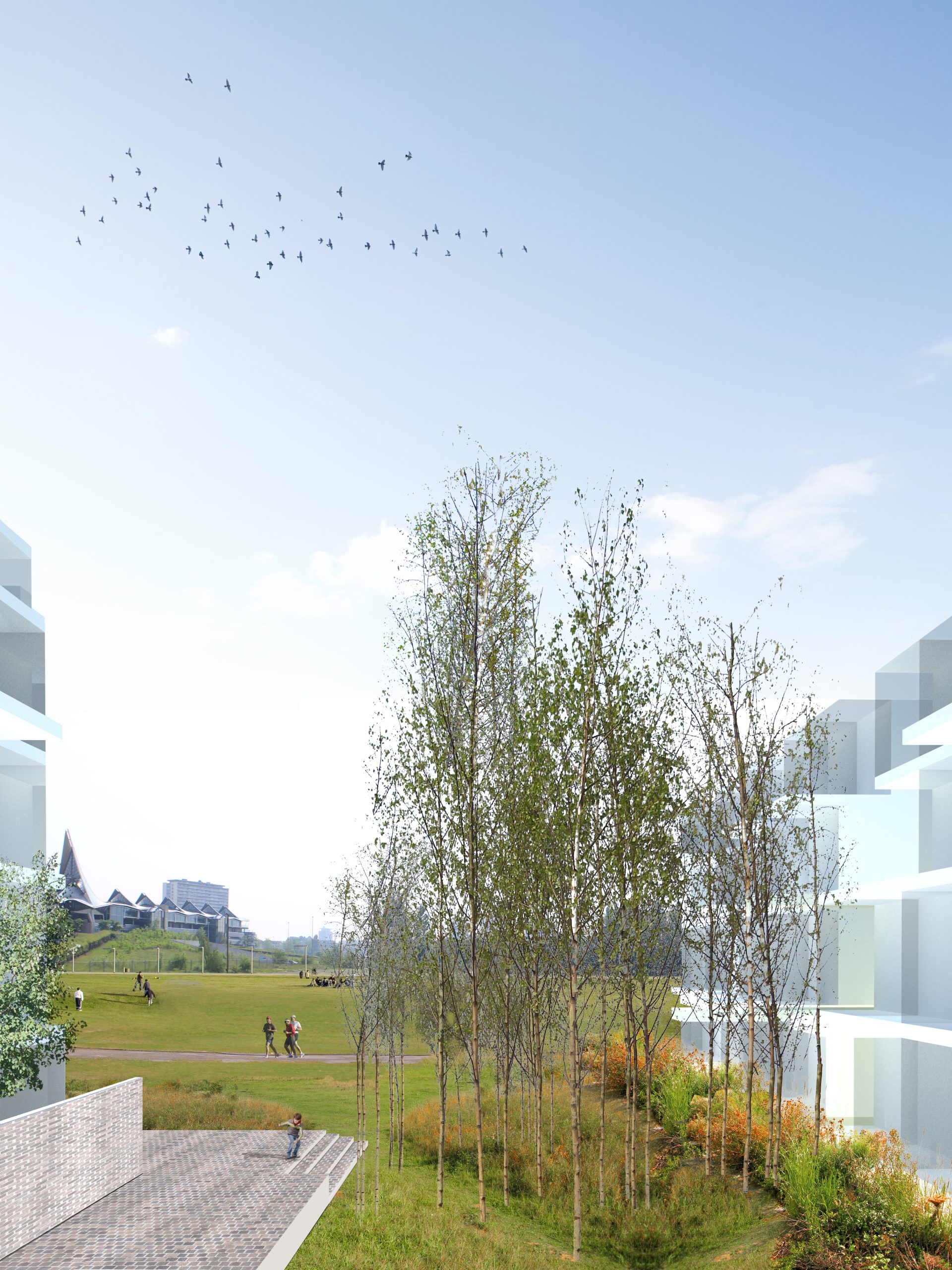
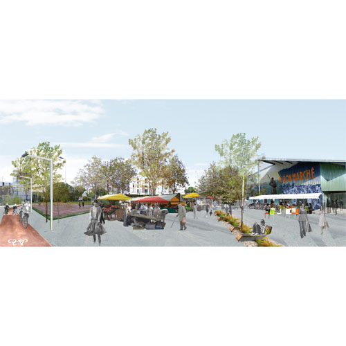
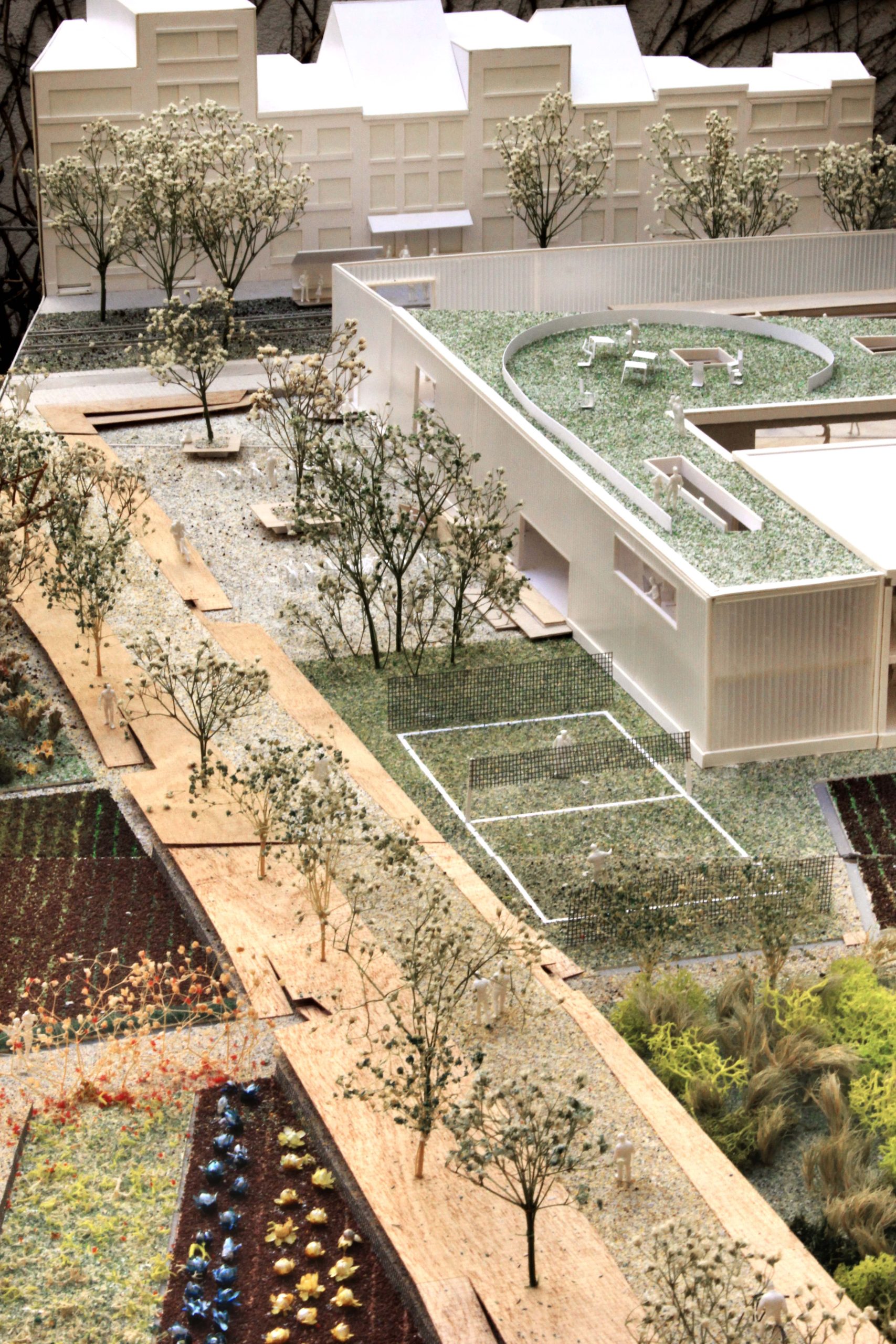
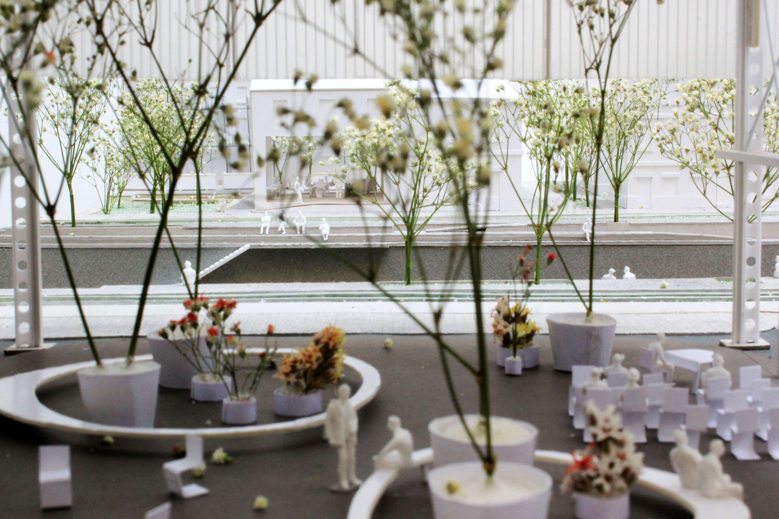
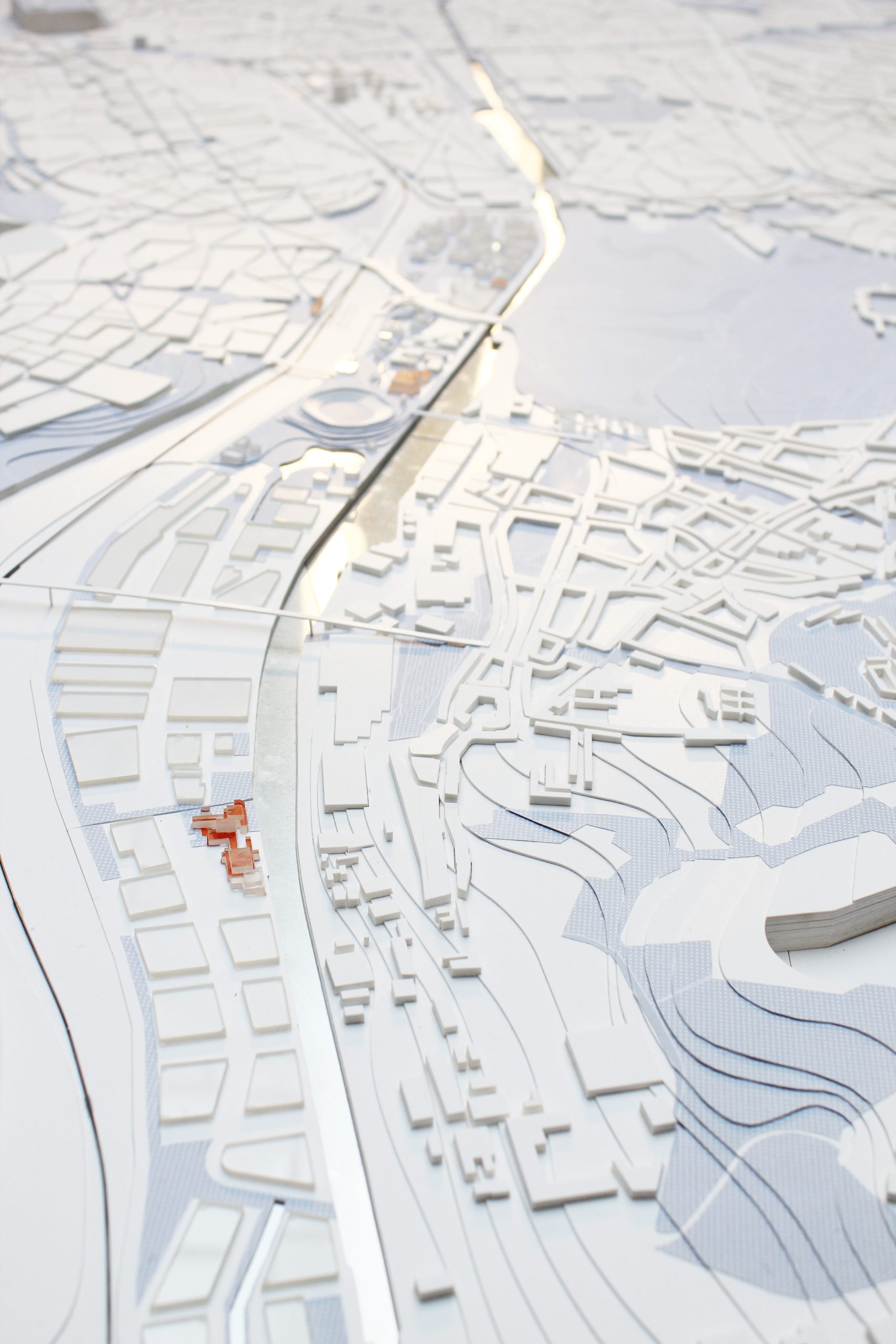
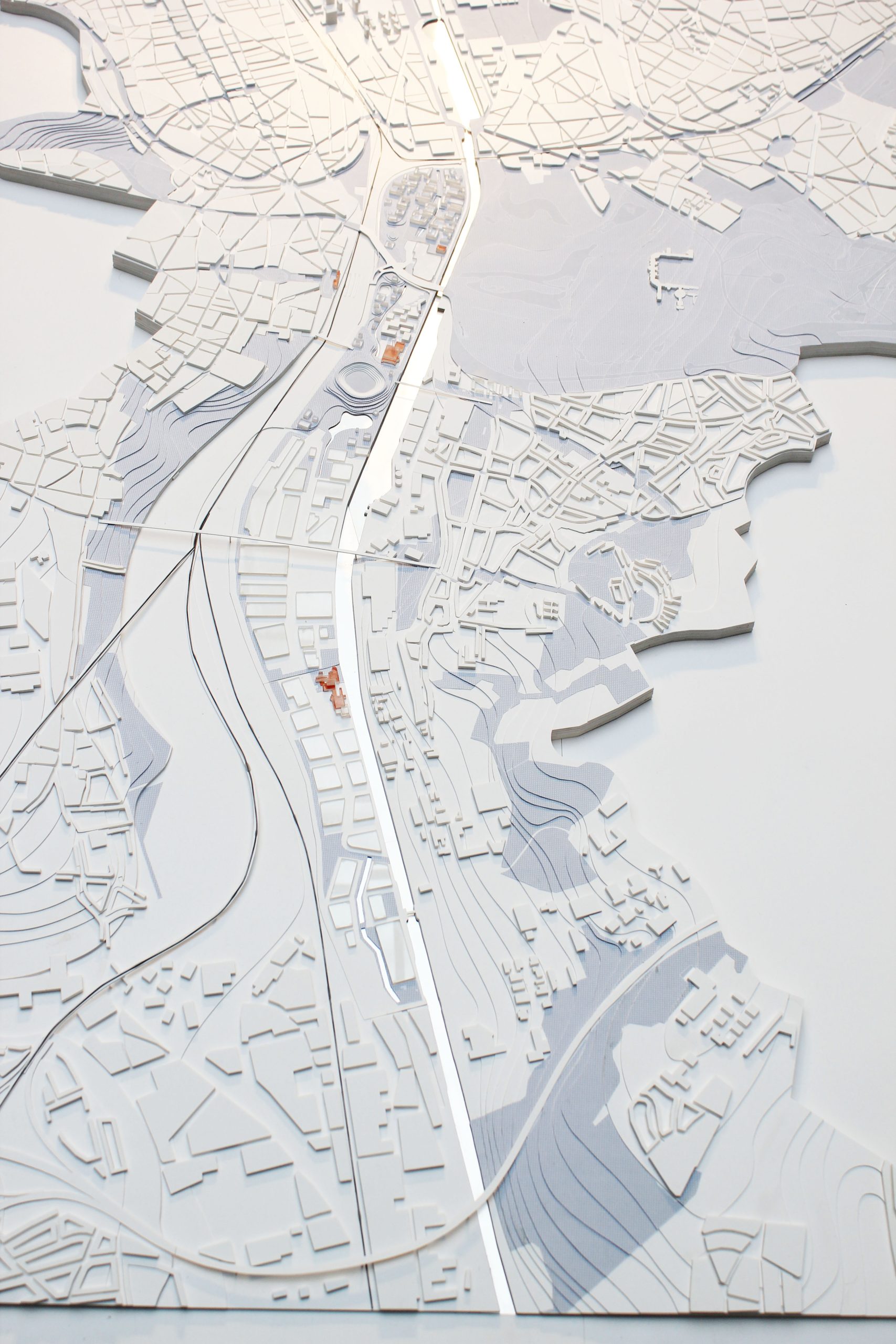
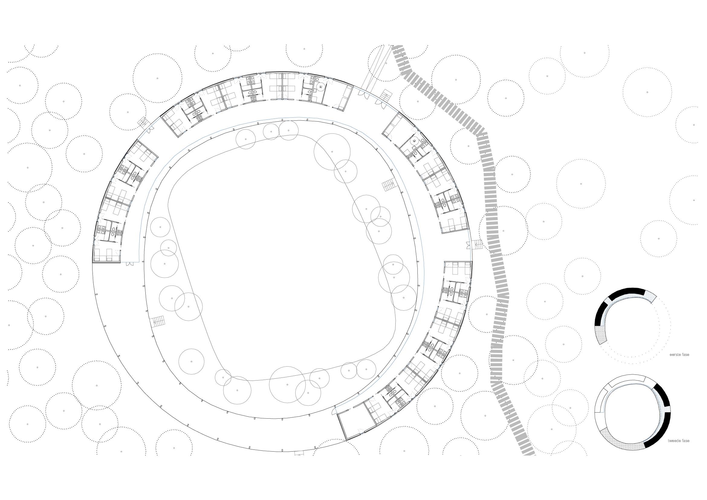
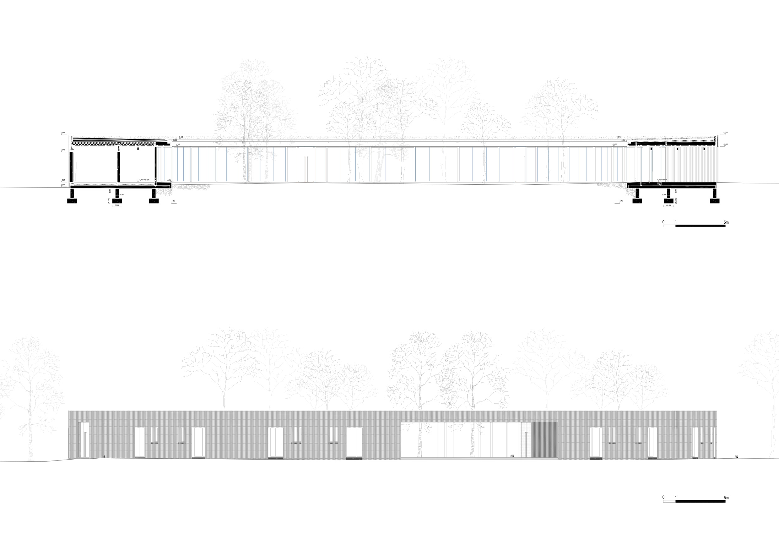
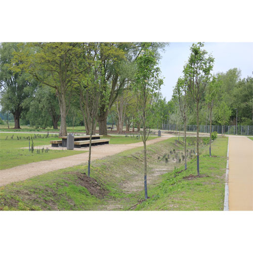
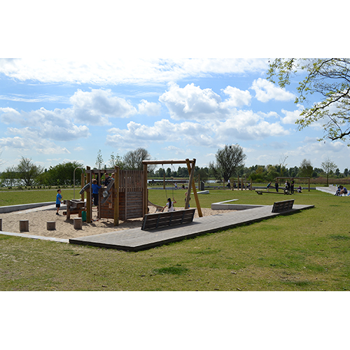
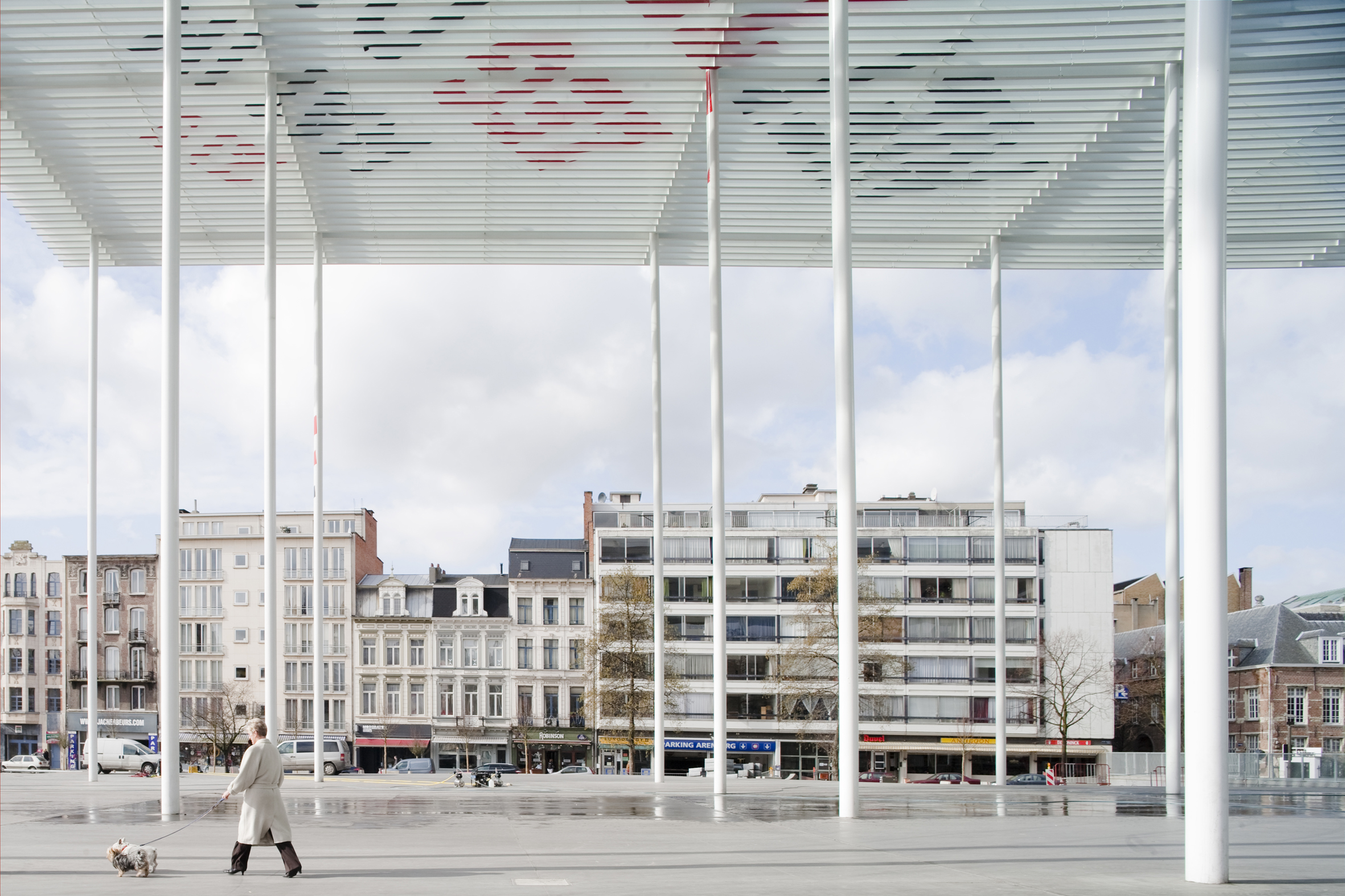
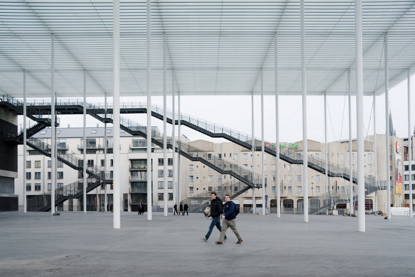
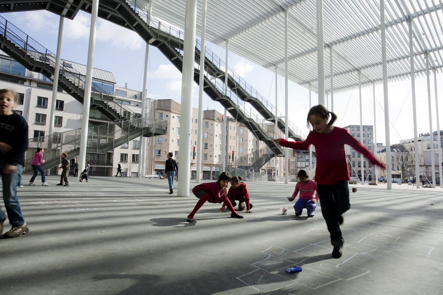
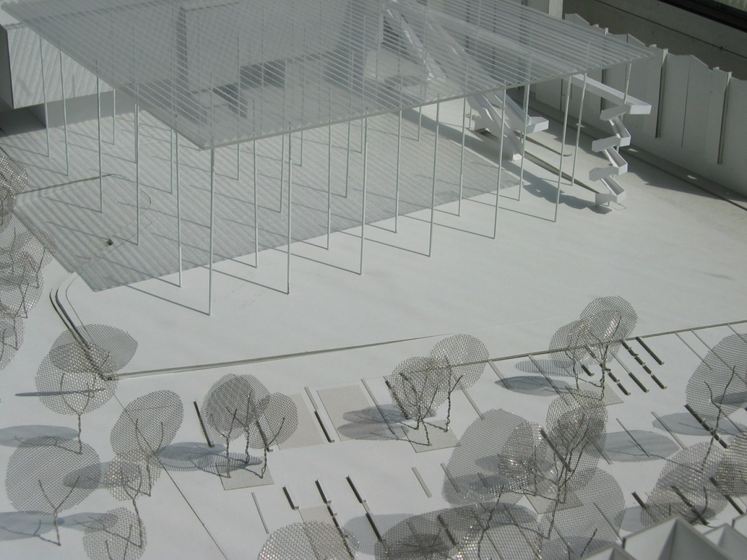
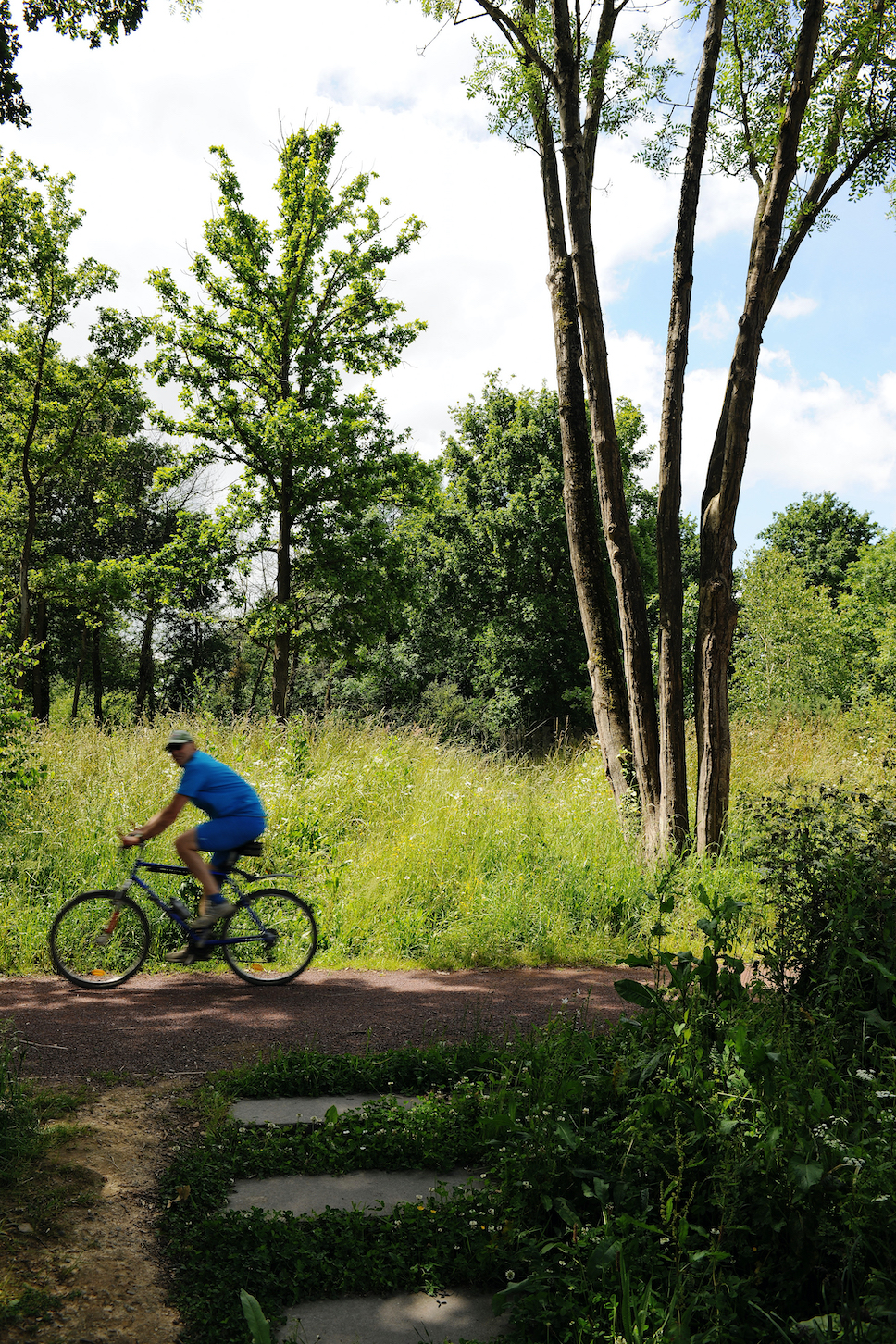
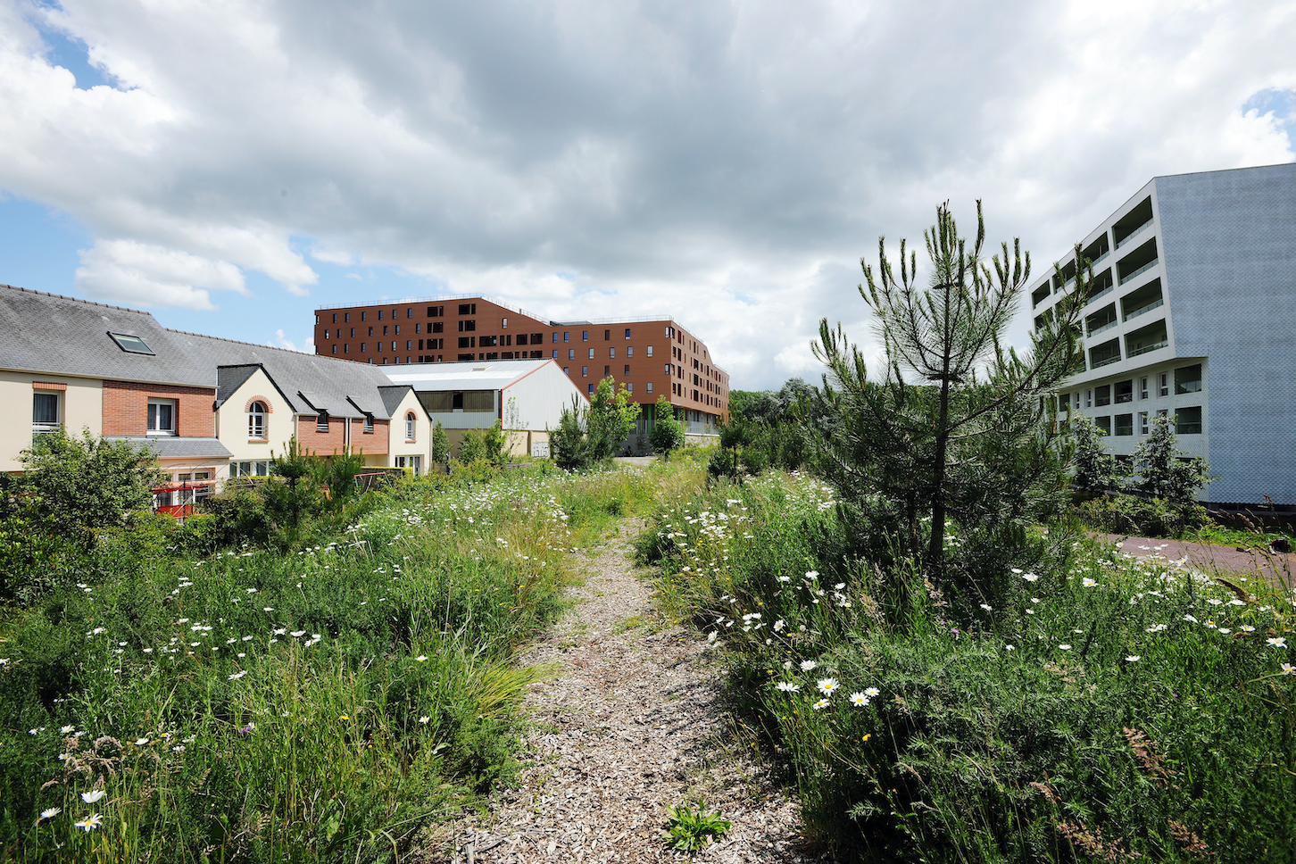
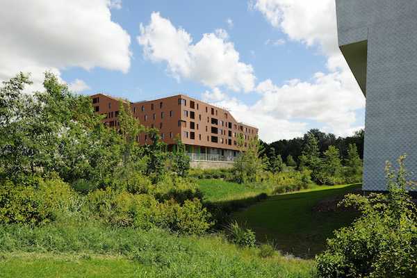
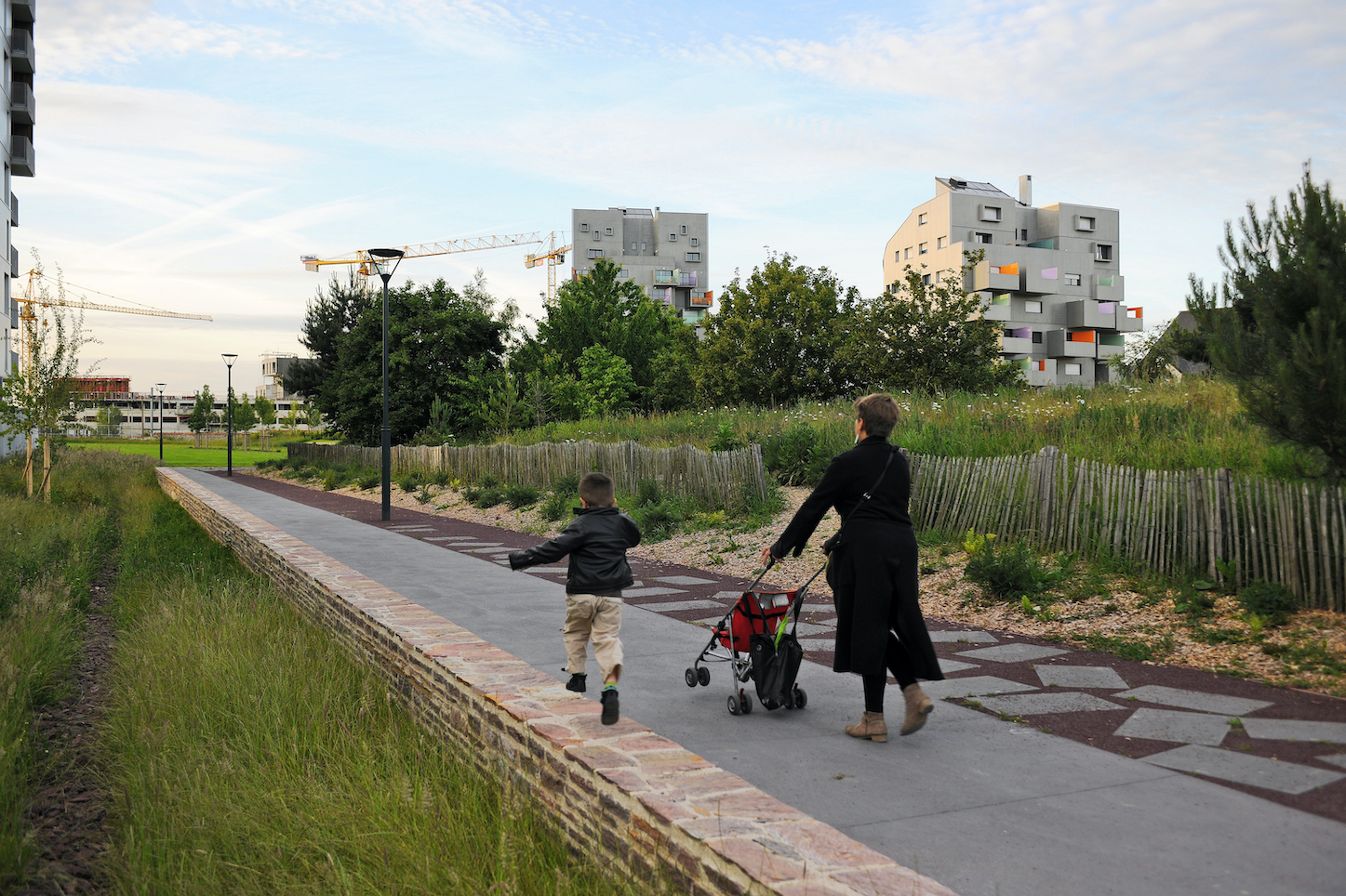
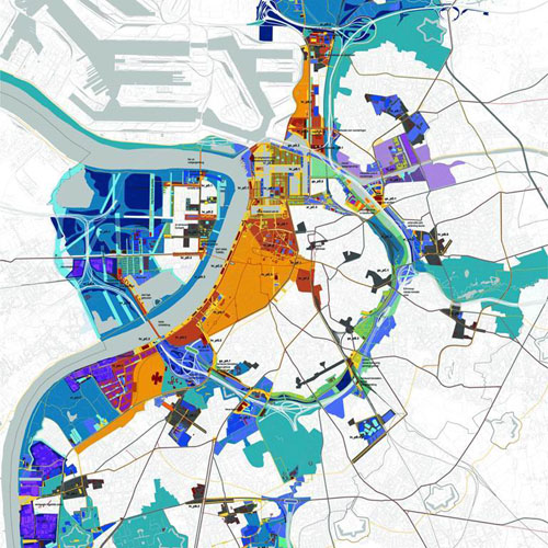
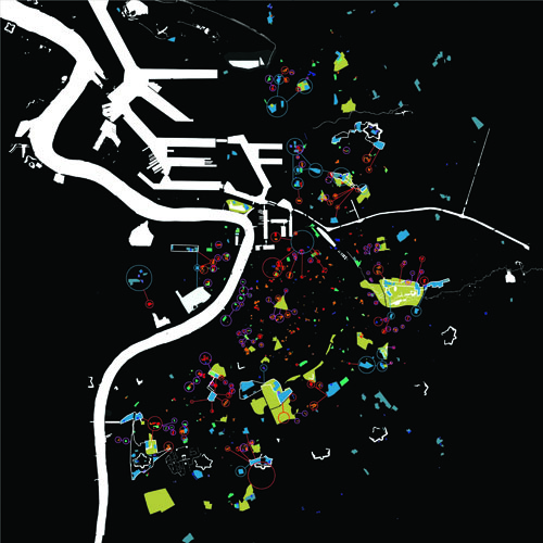
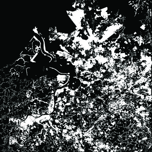
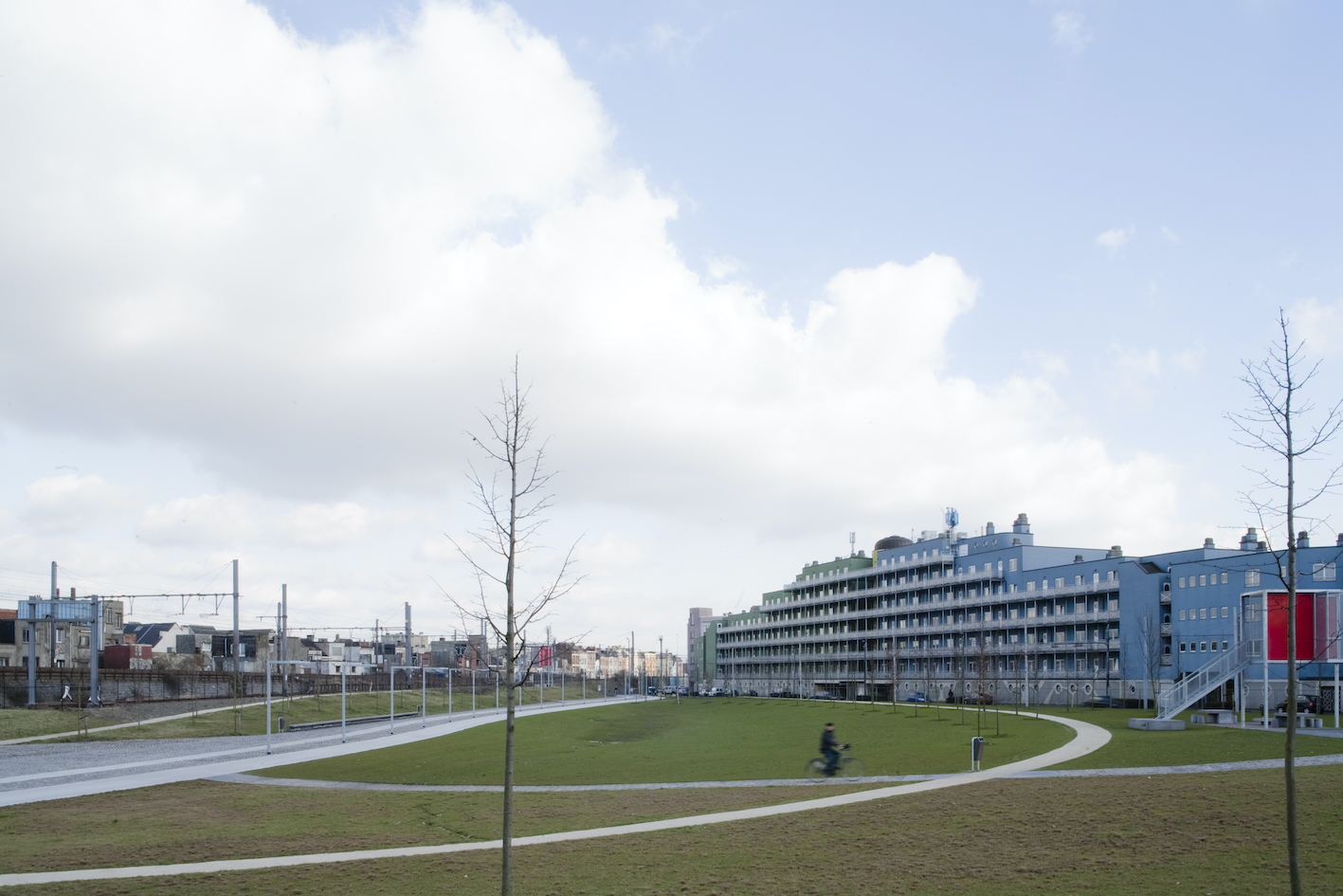
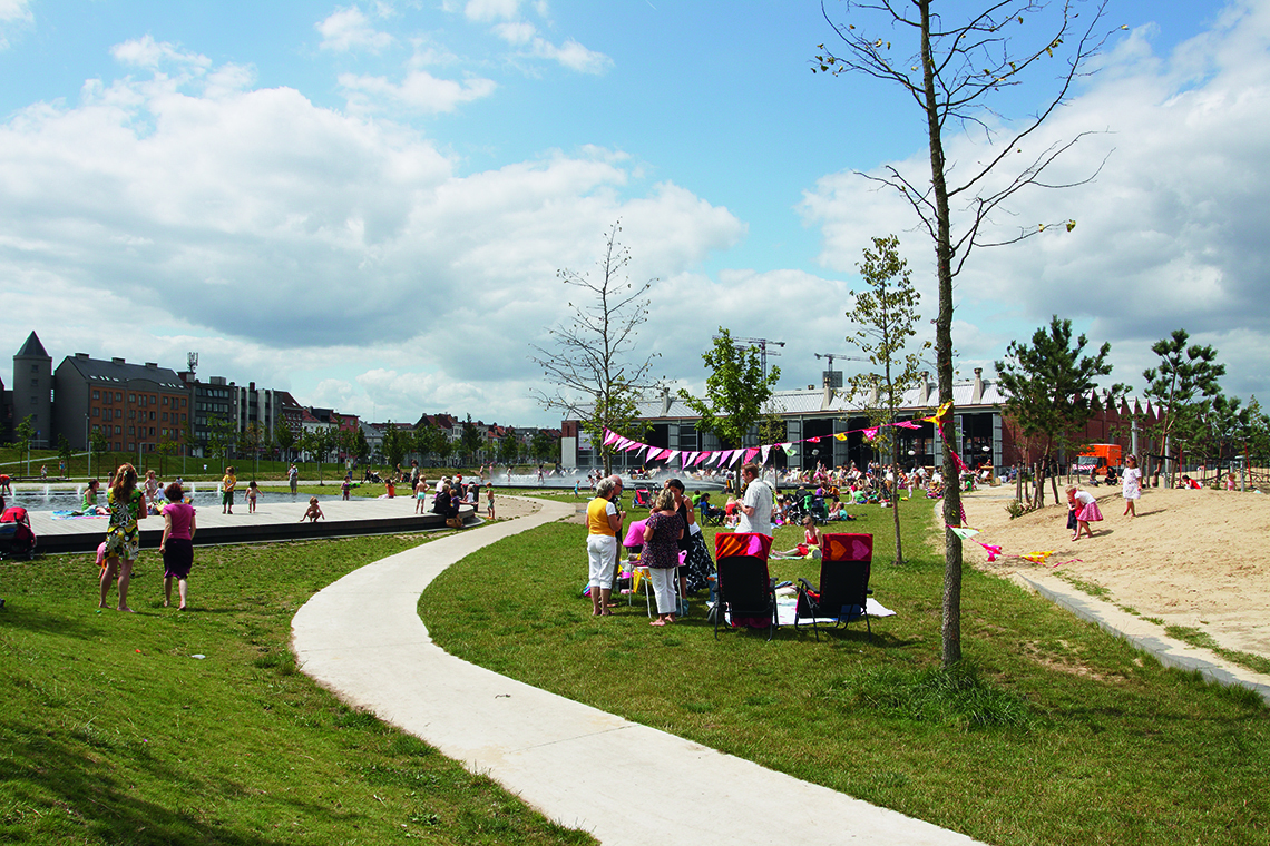
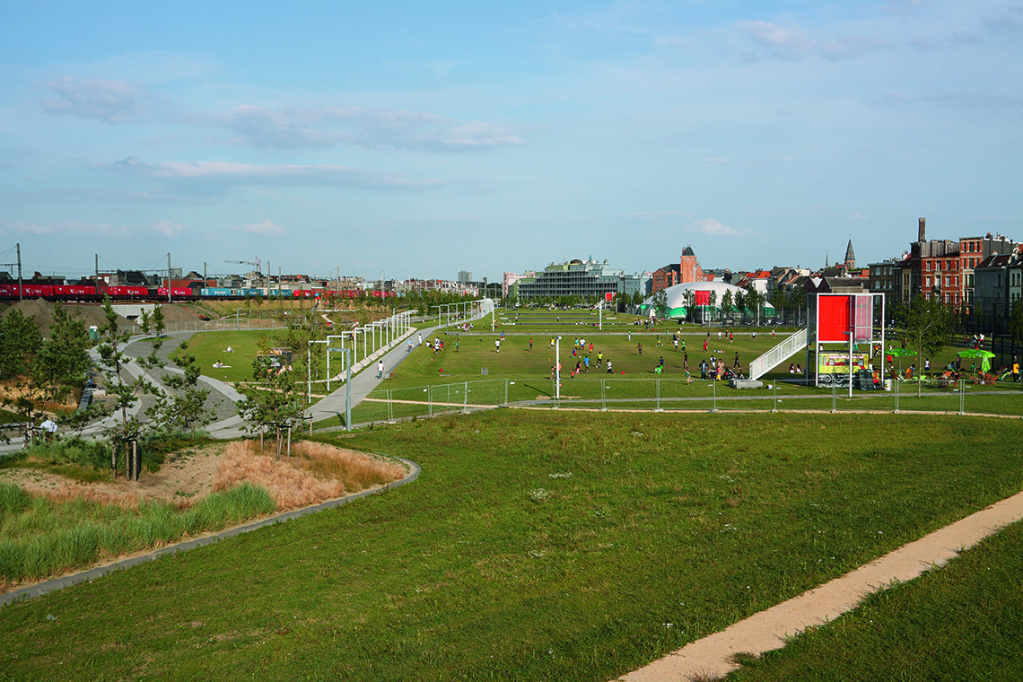
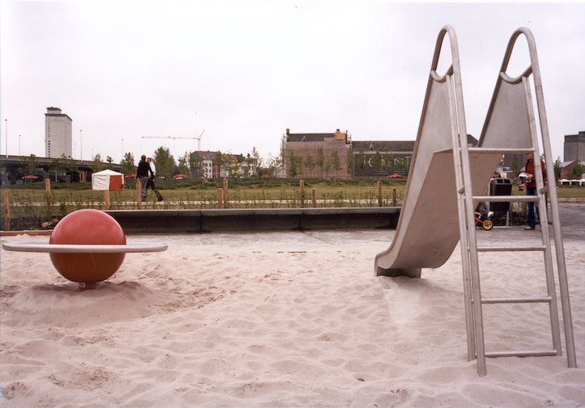
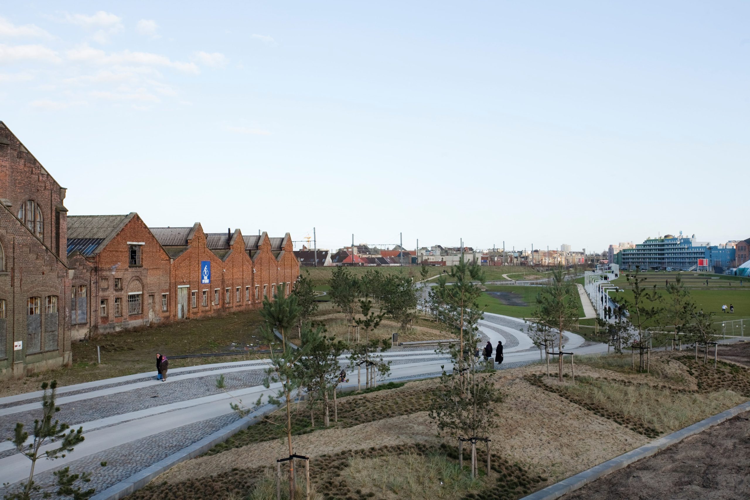
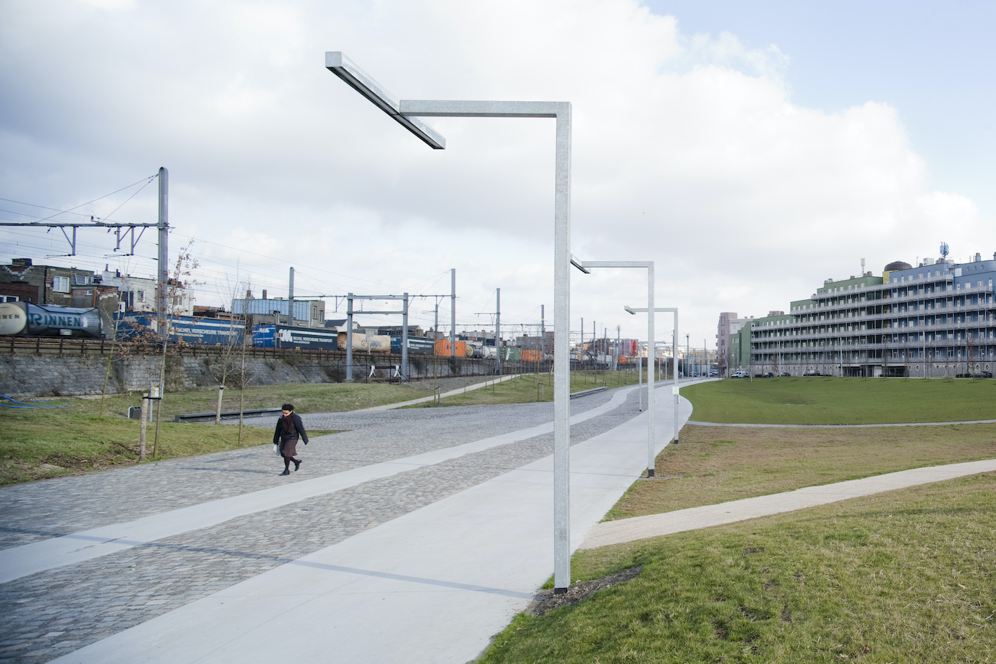
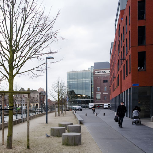
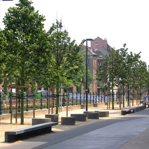
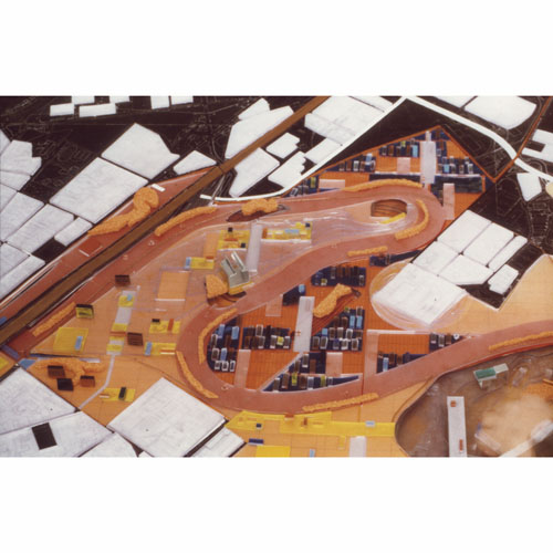
Parc Ouest
Brussels, BE
2025/...
Client: Bruxelles Environnement
Program: Public space and architecture
Team: Bertrand Plewinski, Rodin Desplechin, Etienne Schillers, Gauthier Stevens
In collaboration with: Arcadis, Plant en Houtgoed and Bas bvba
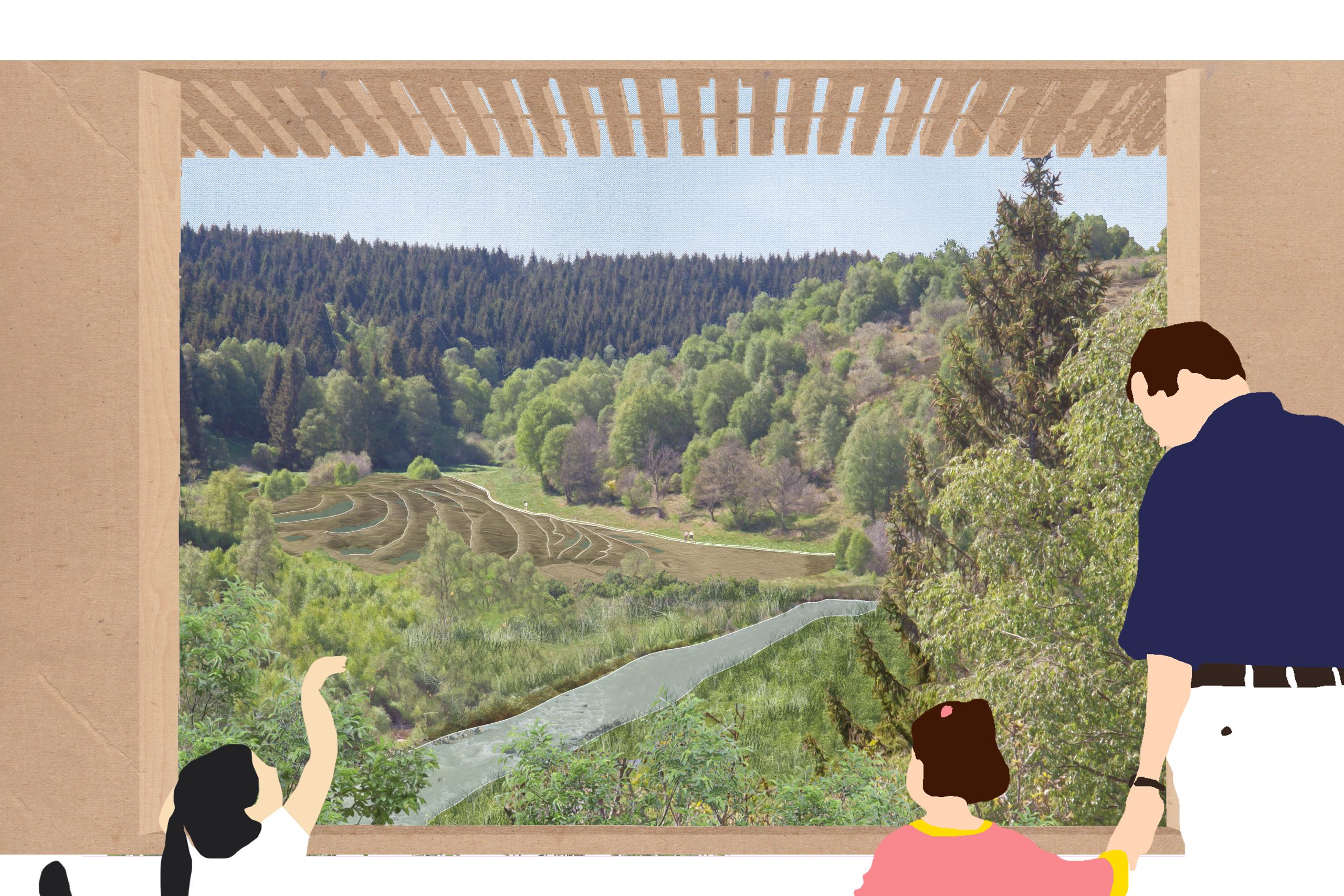
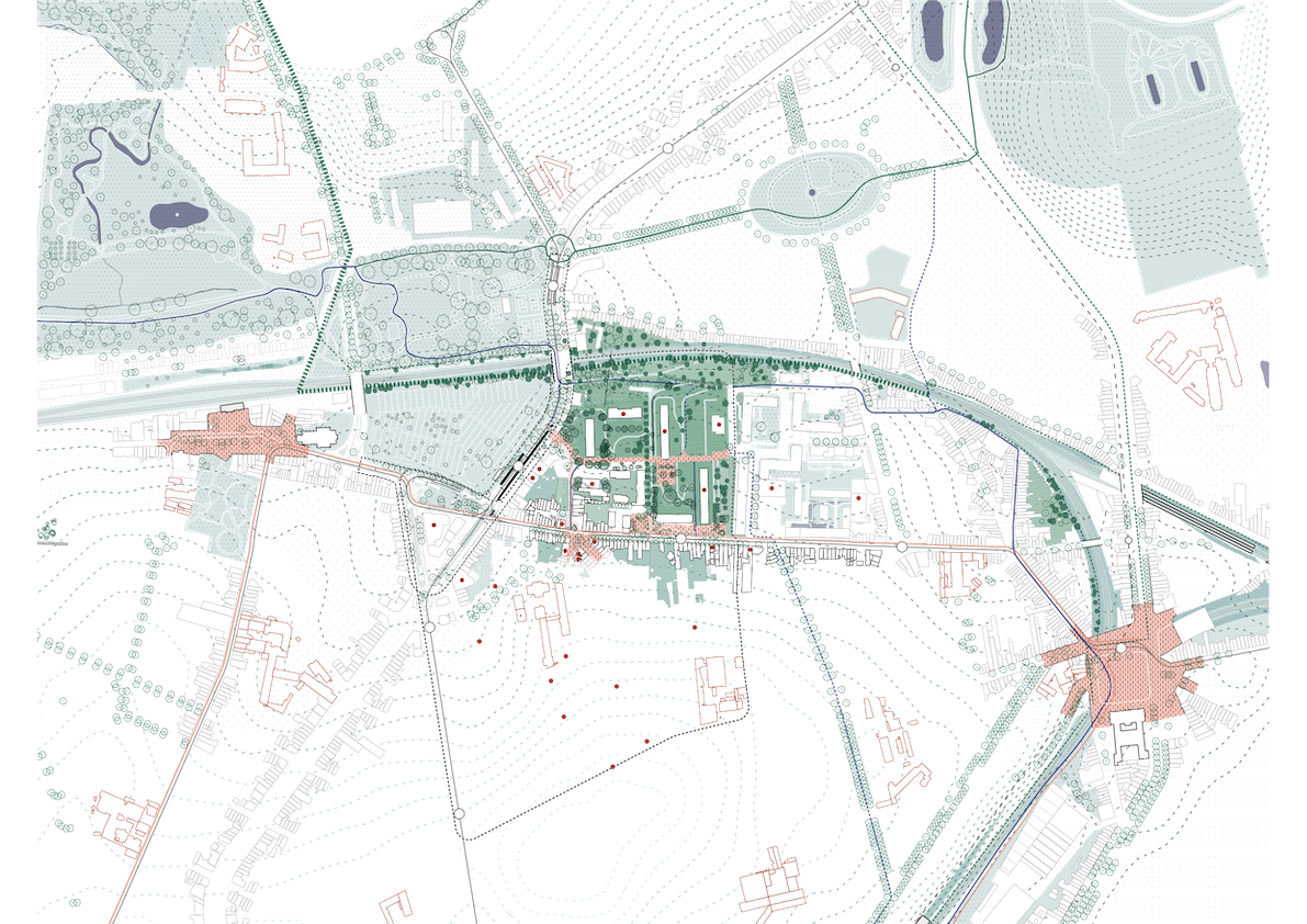
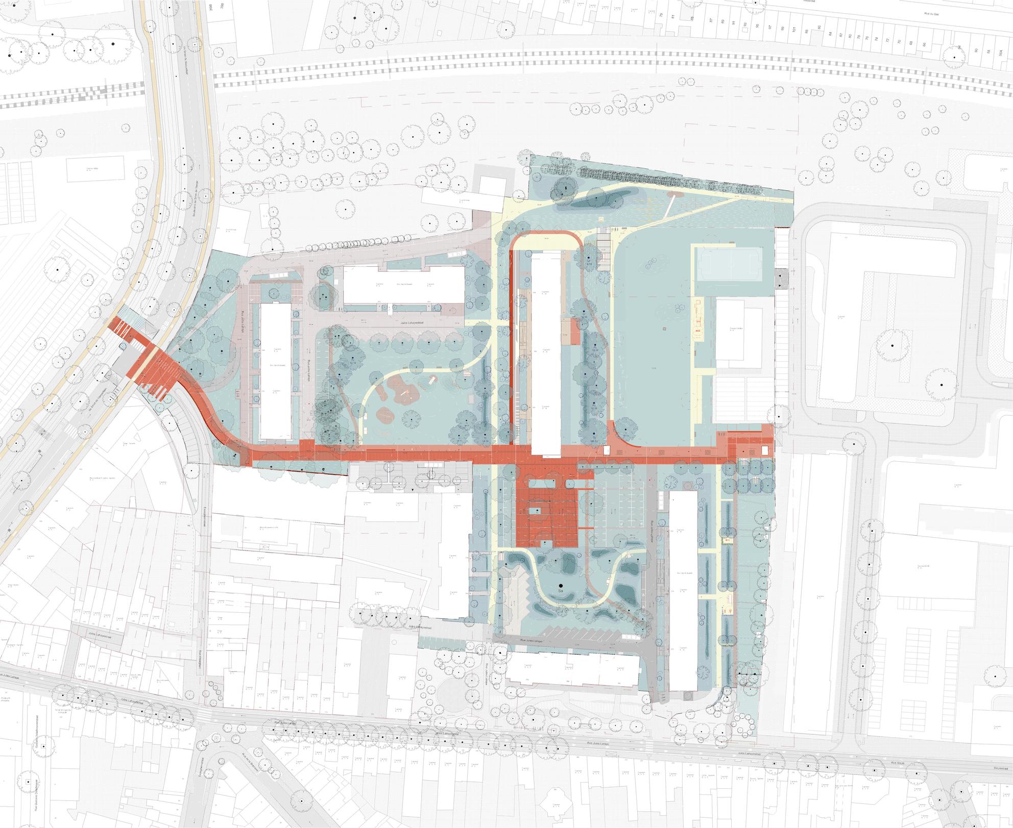
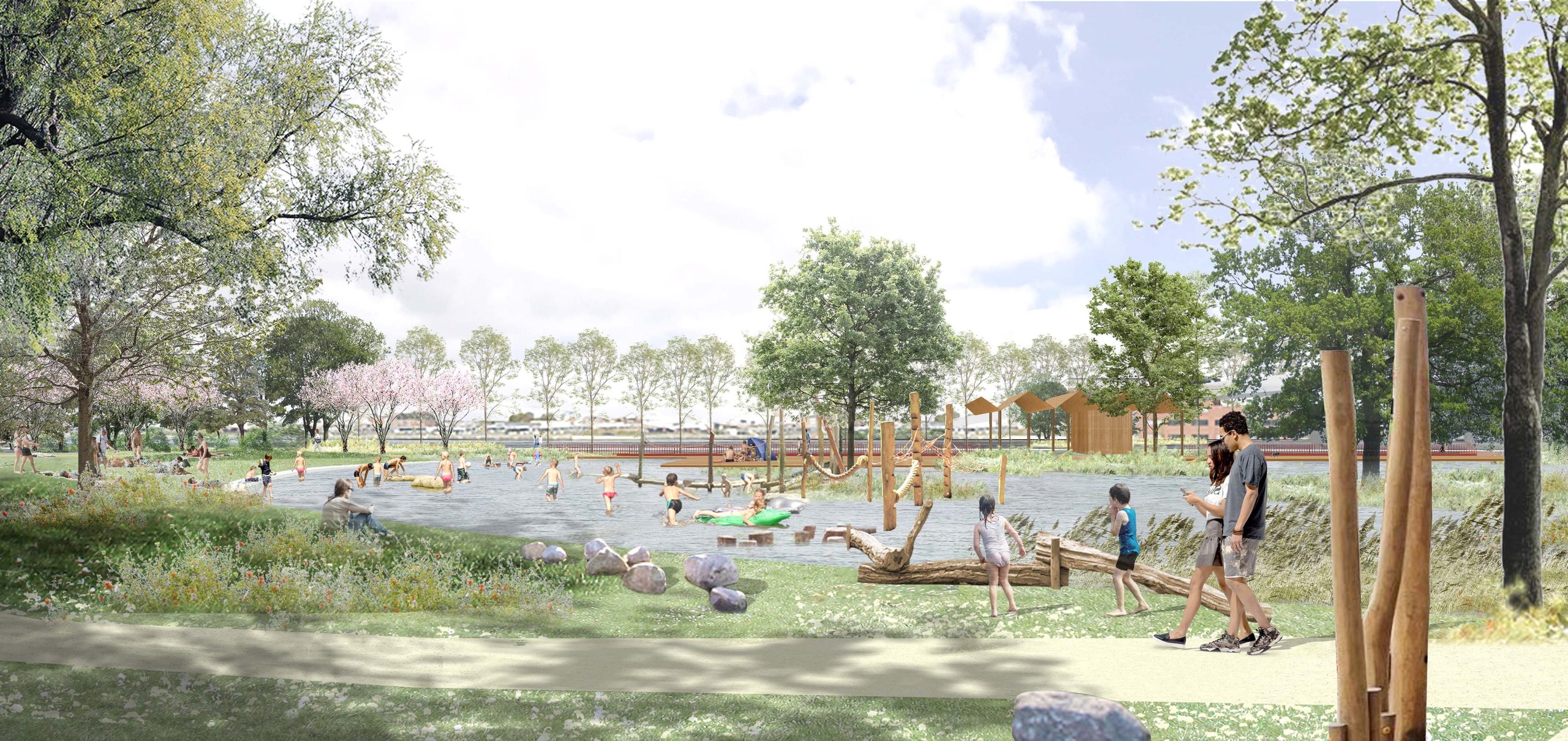
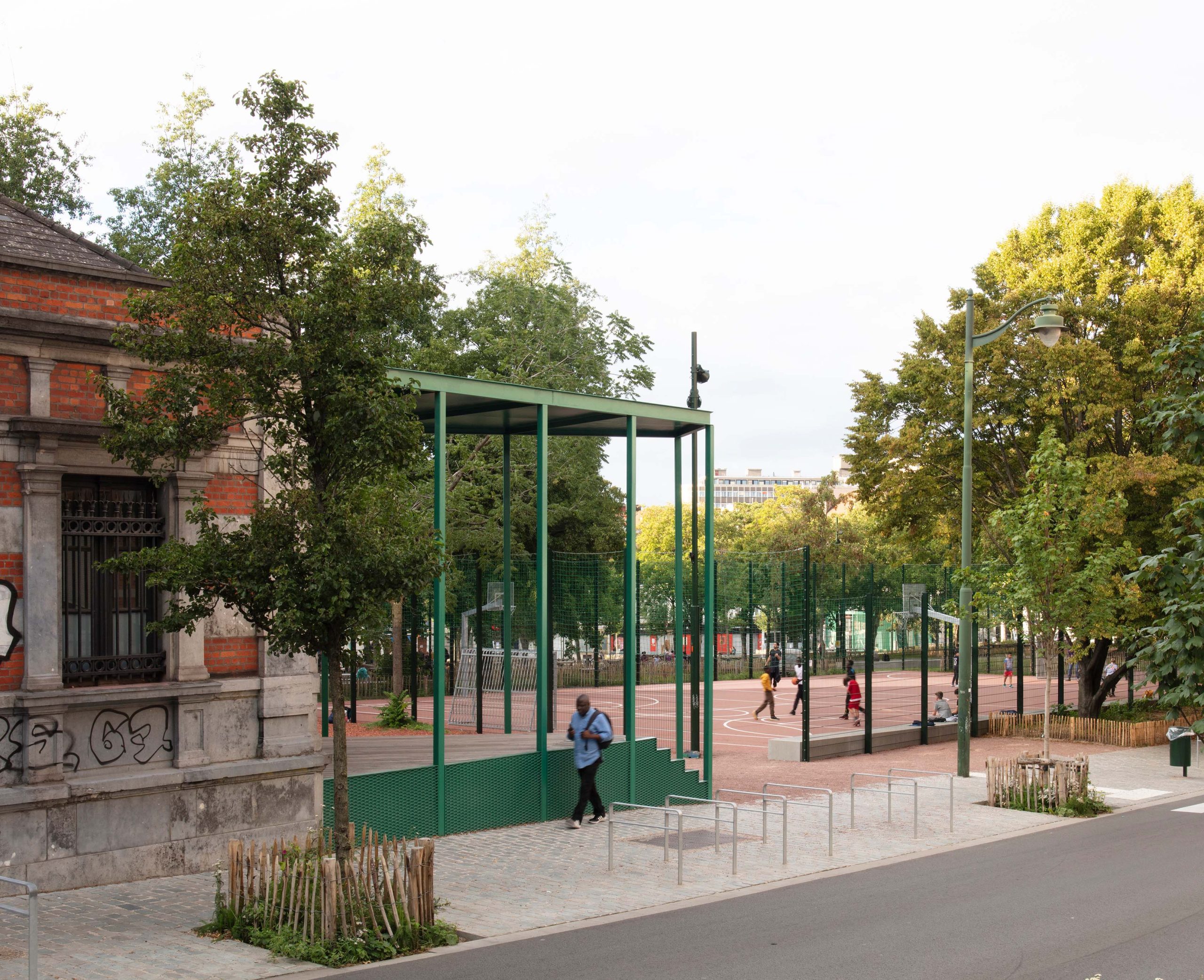
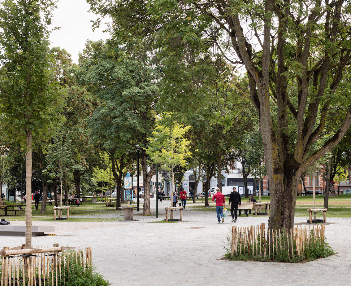
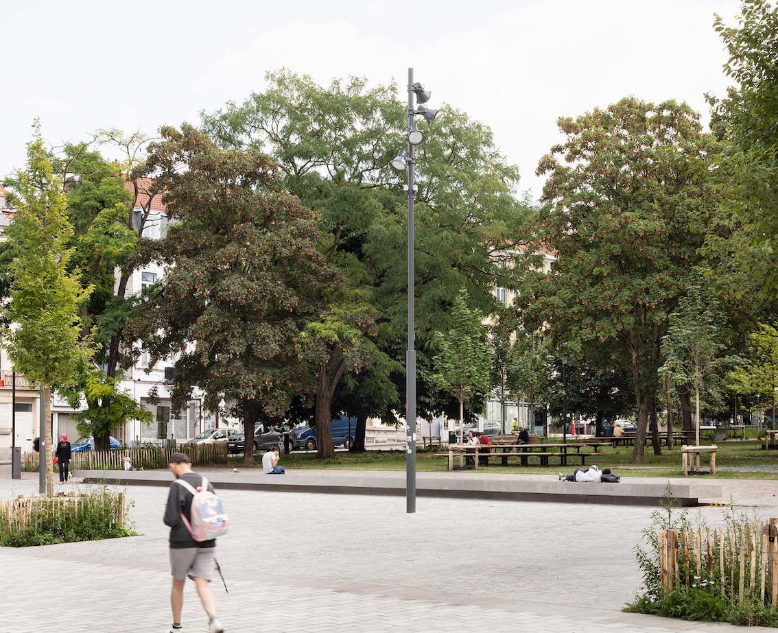
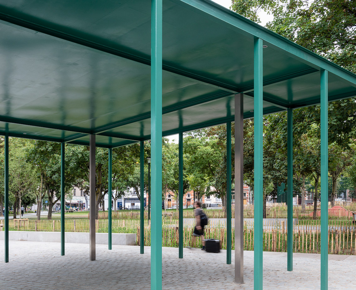
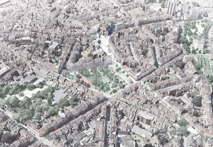
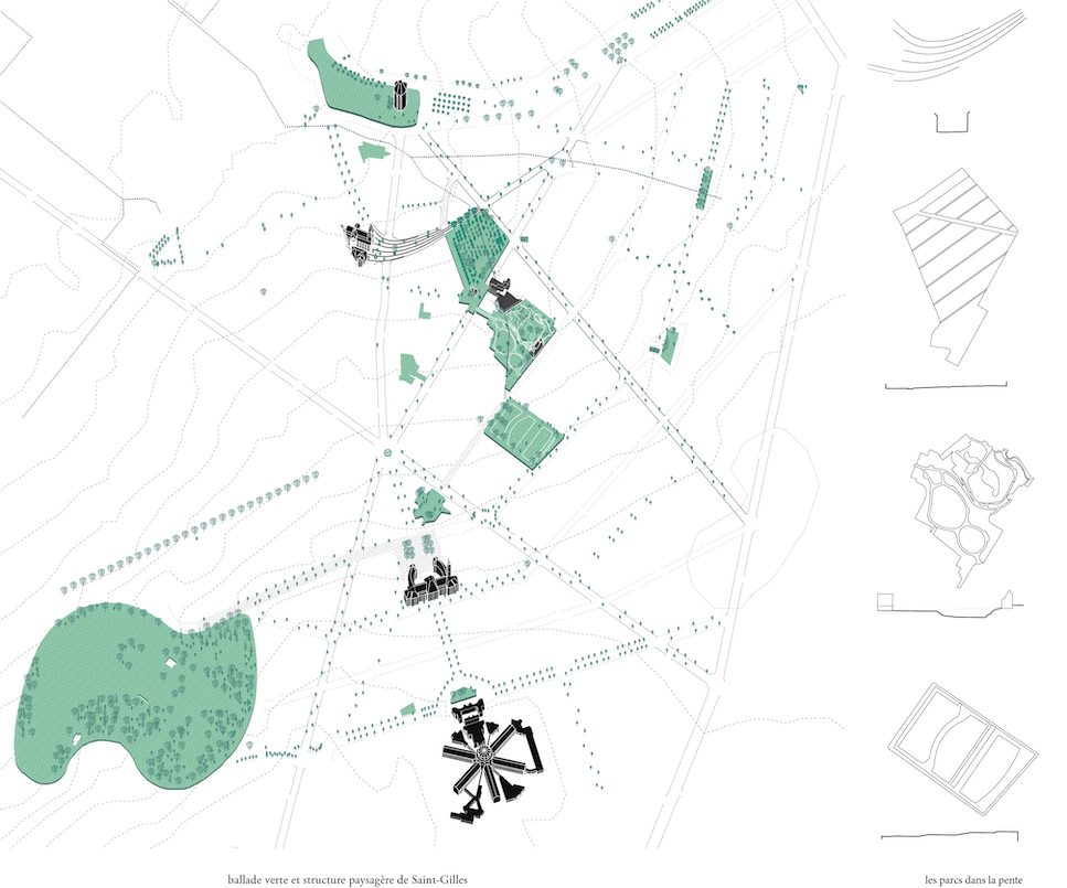
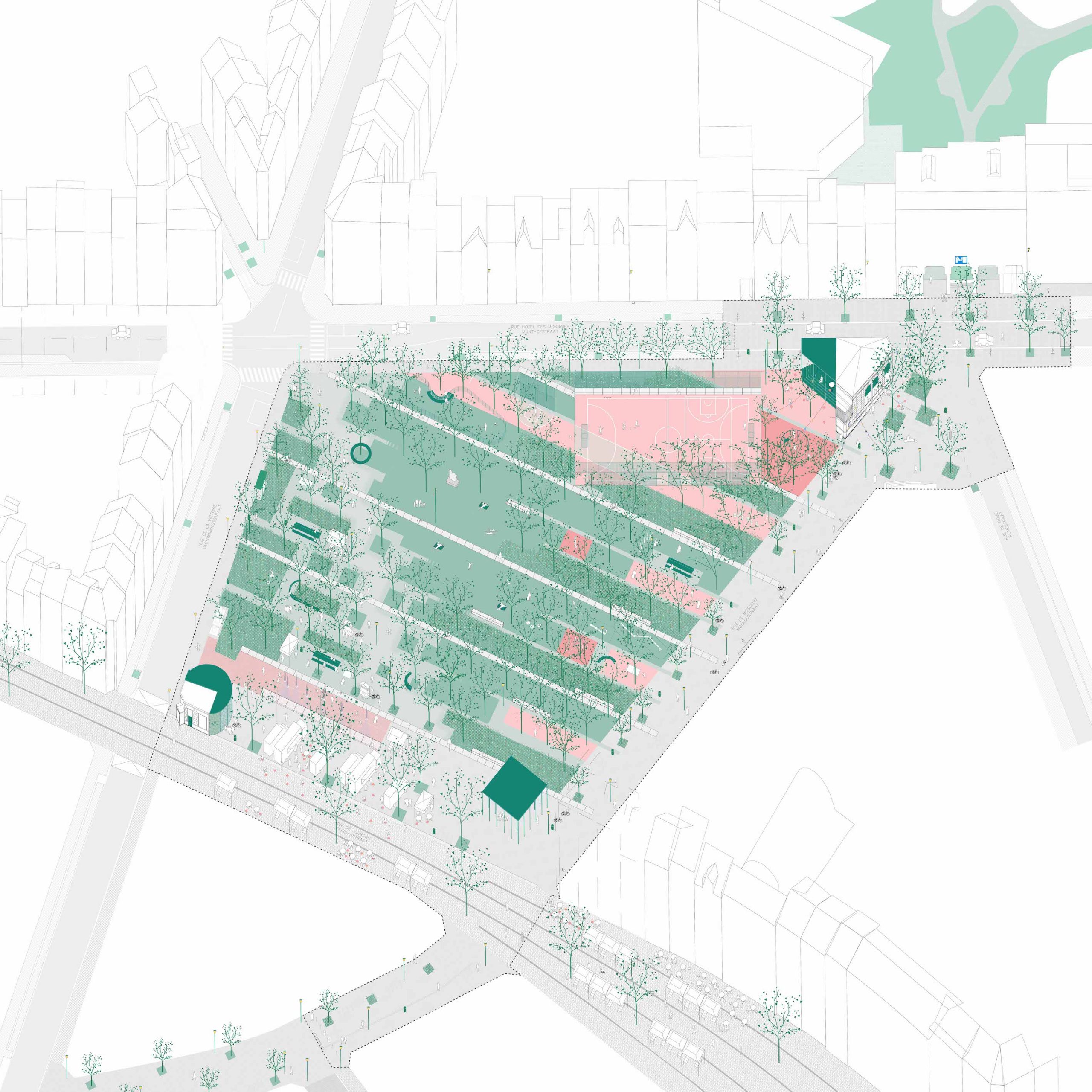
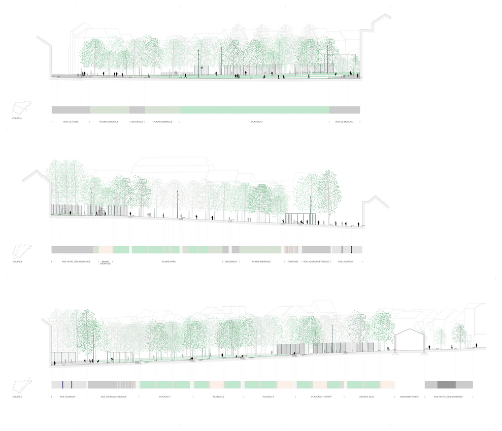
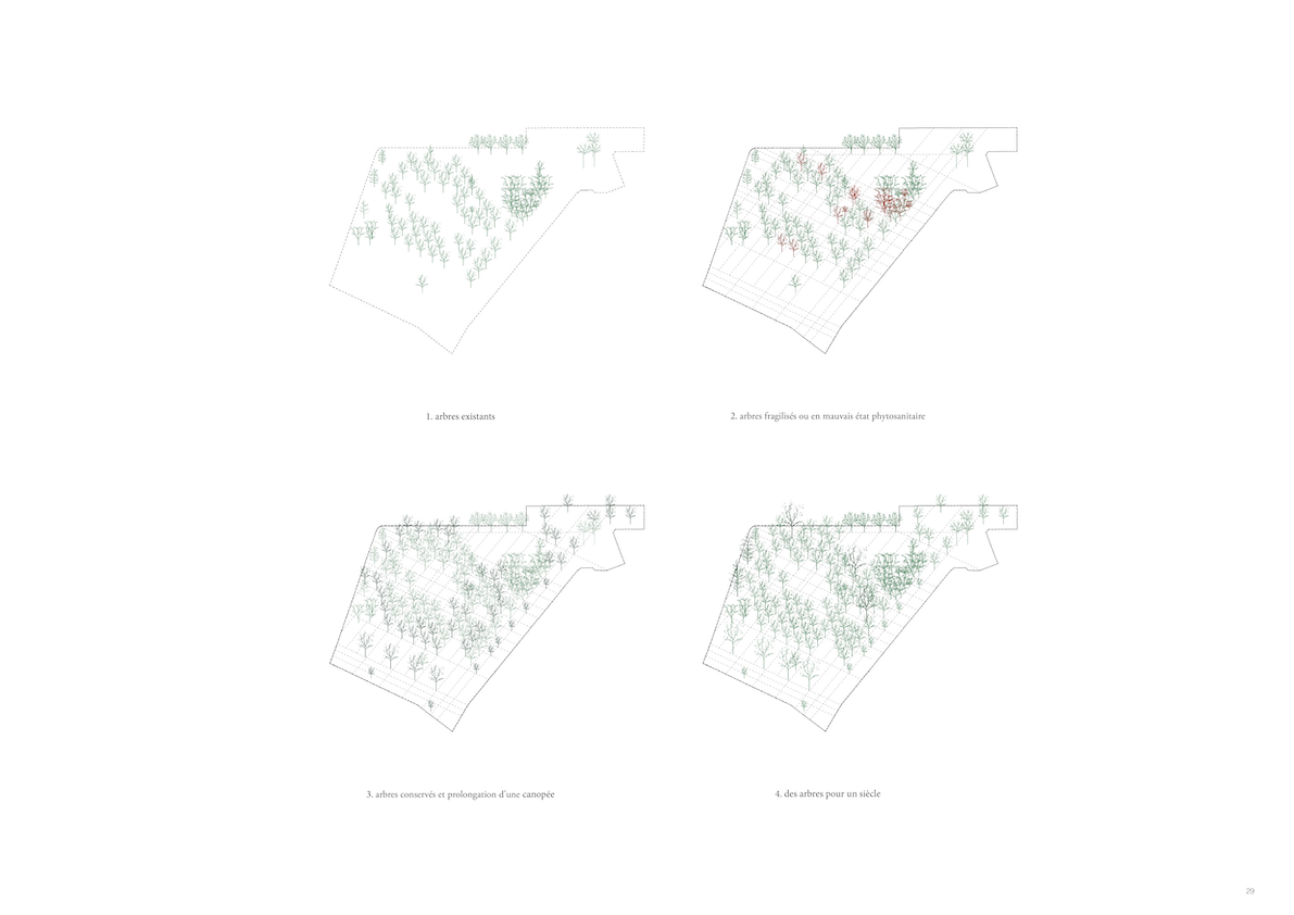
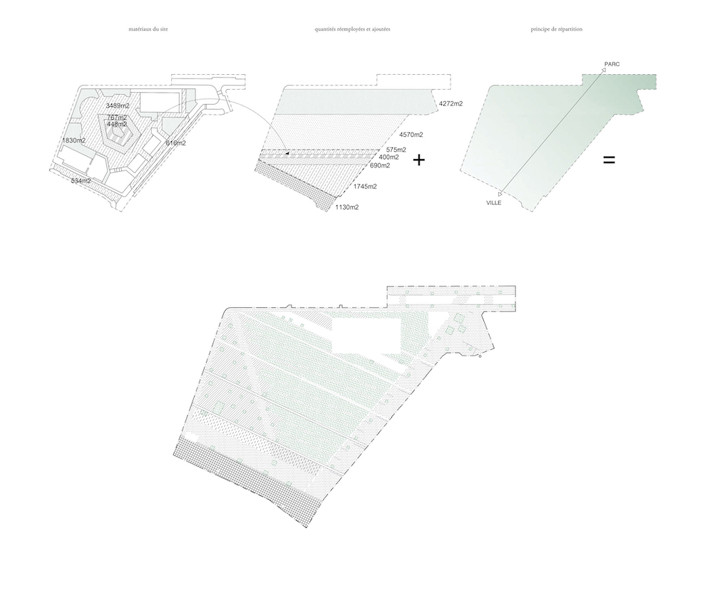
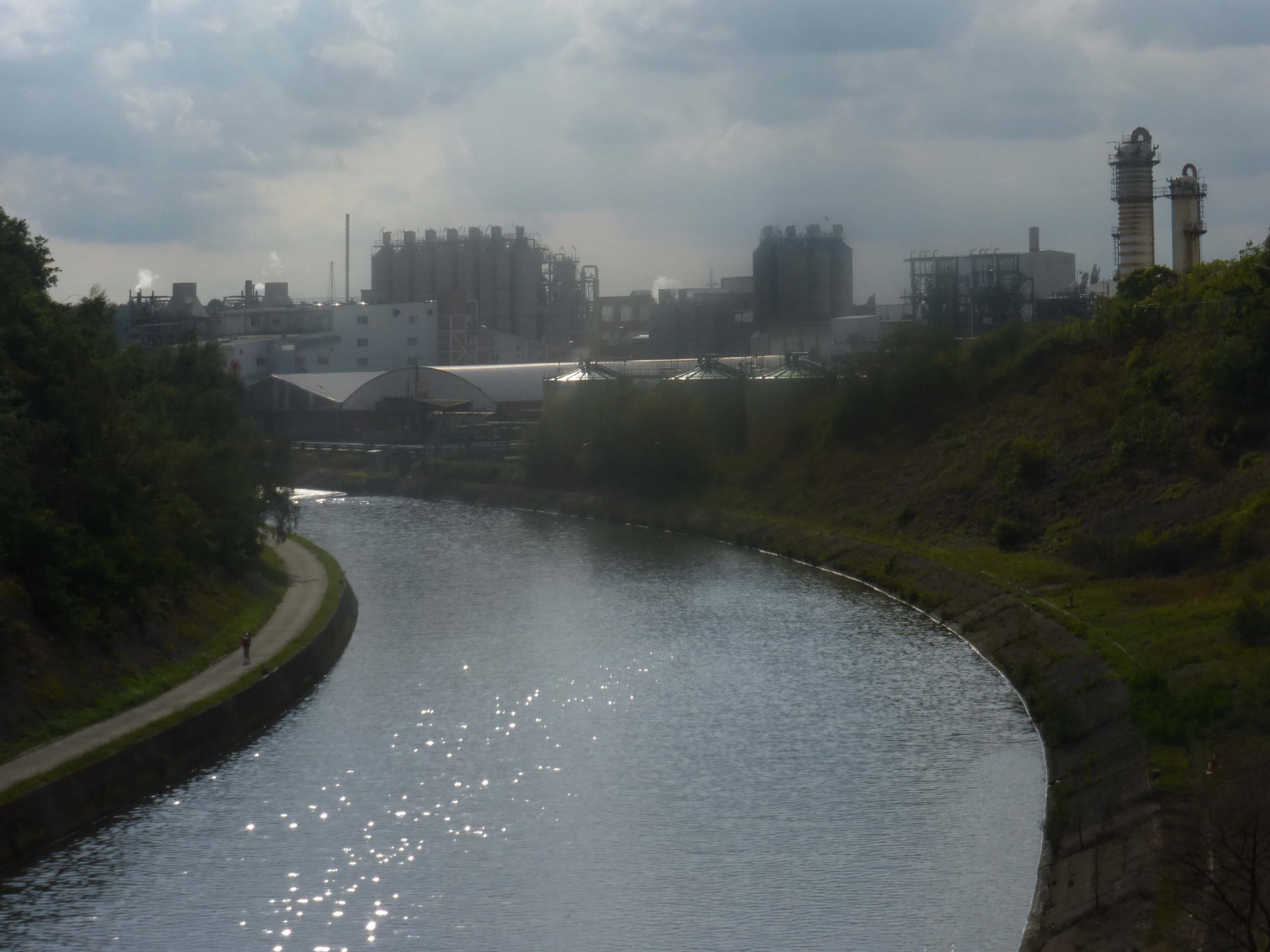
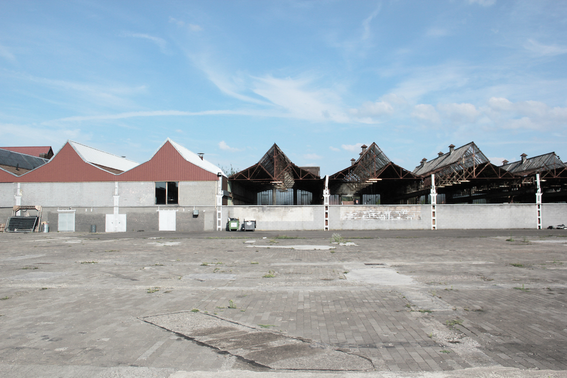
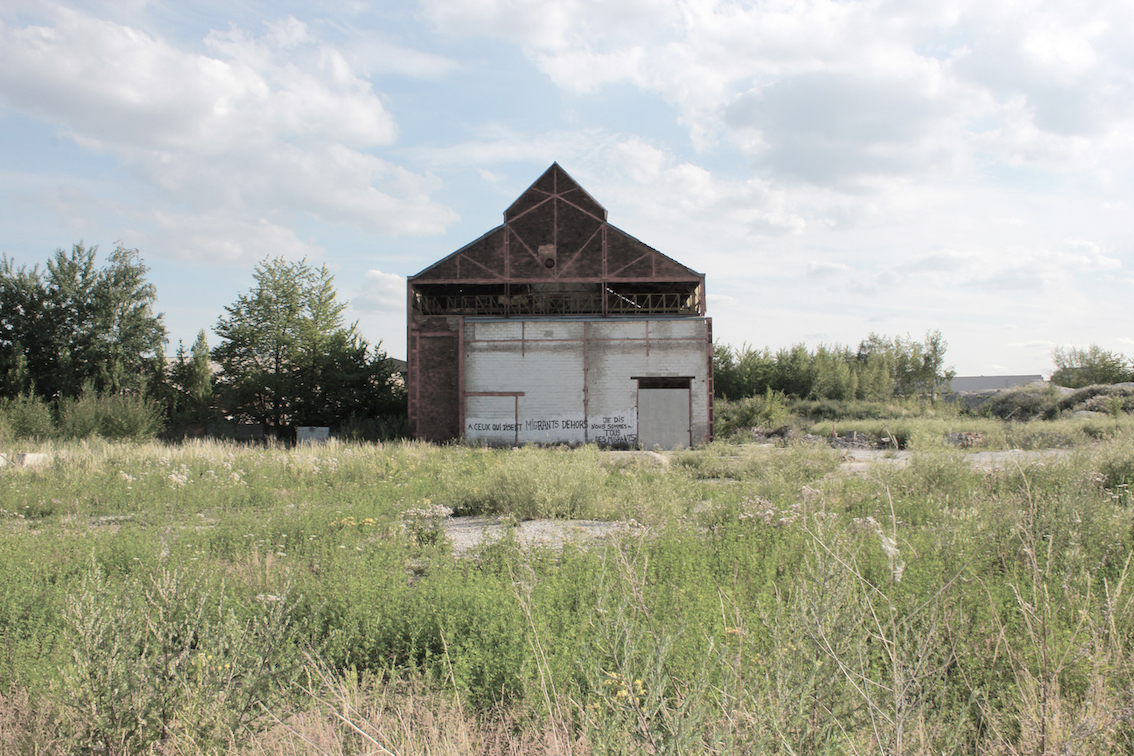
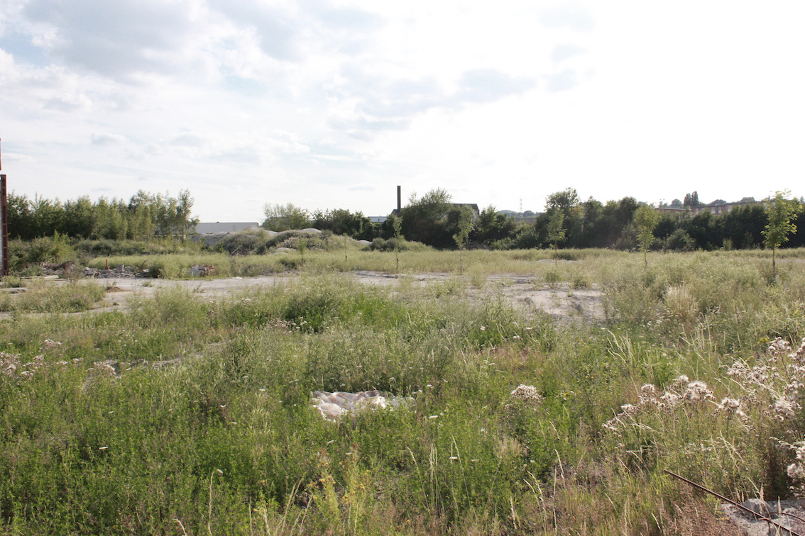
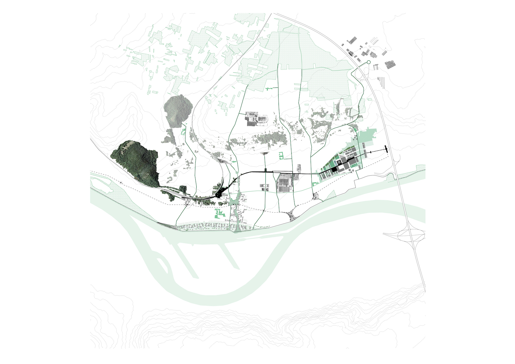
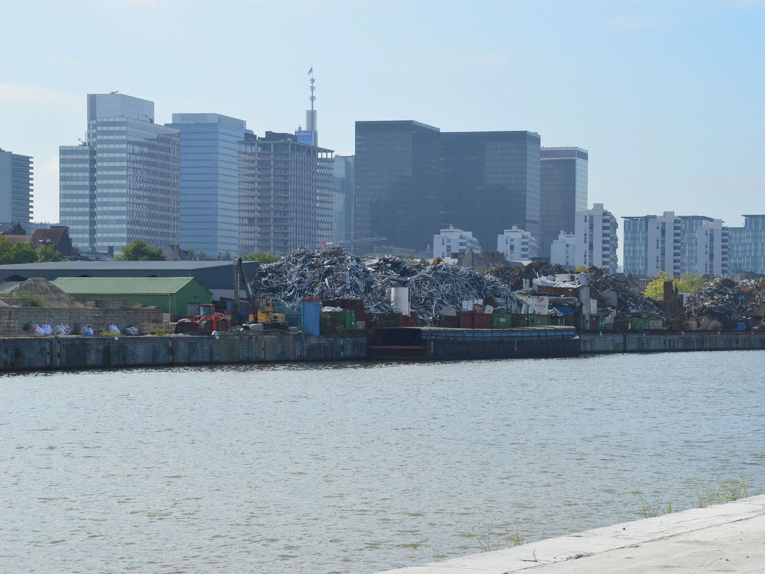
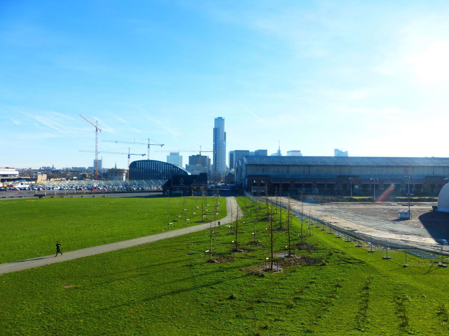
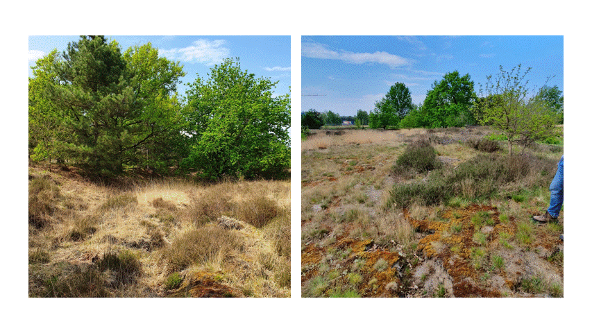
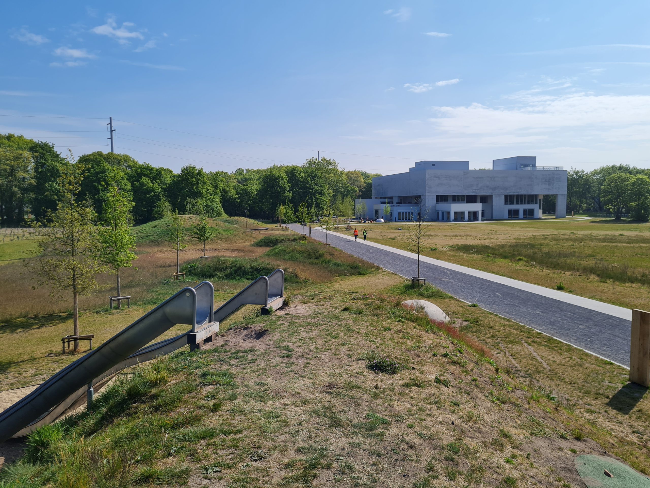
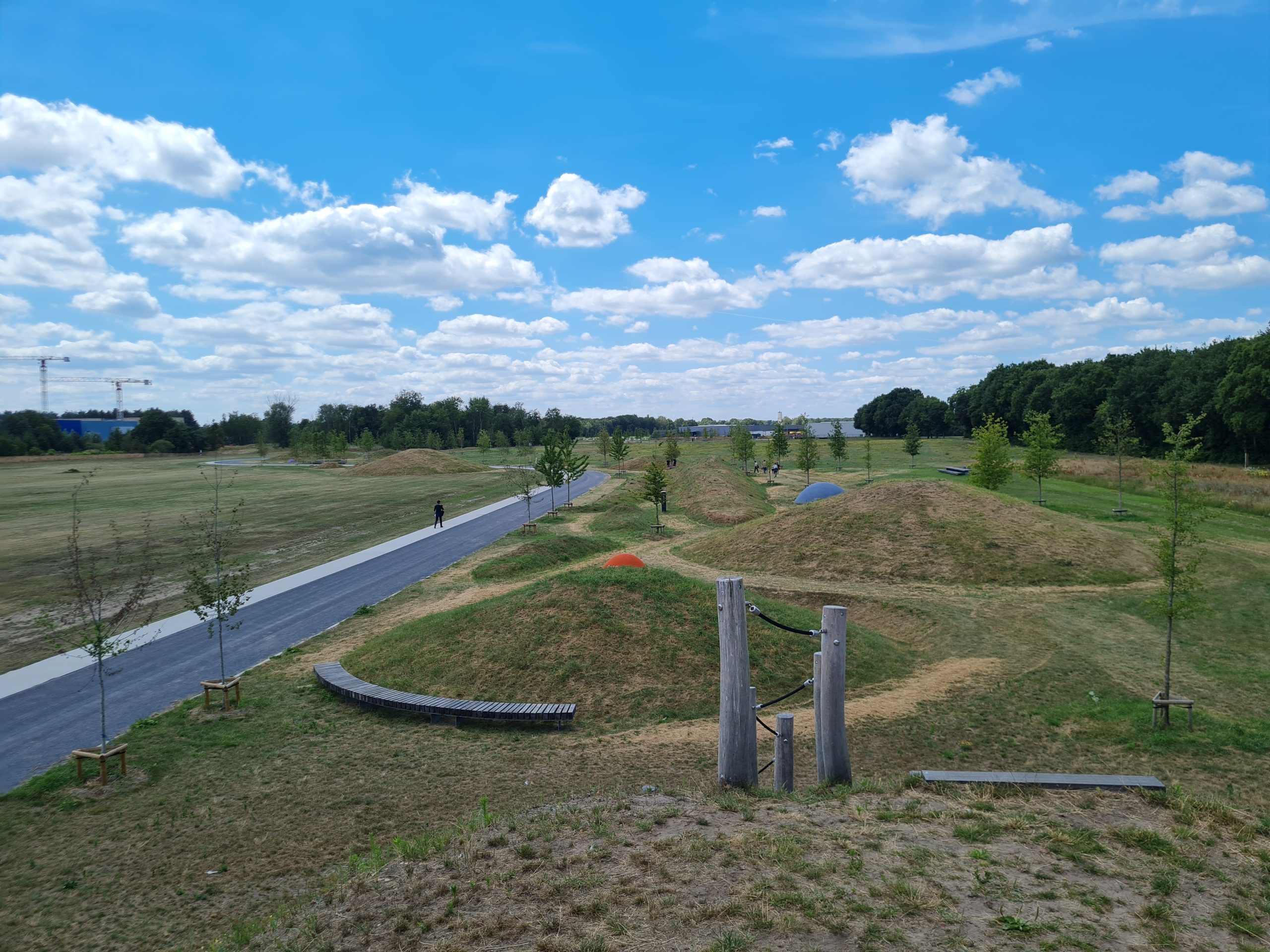
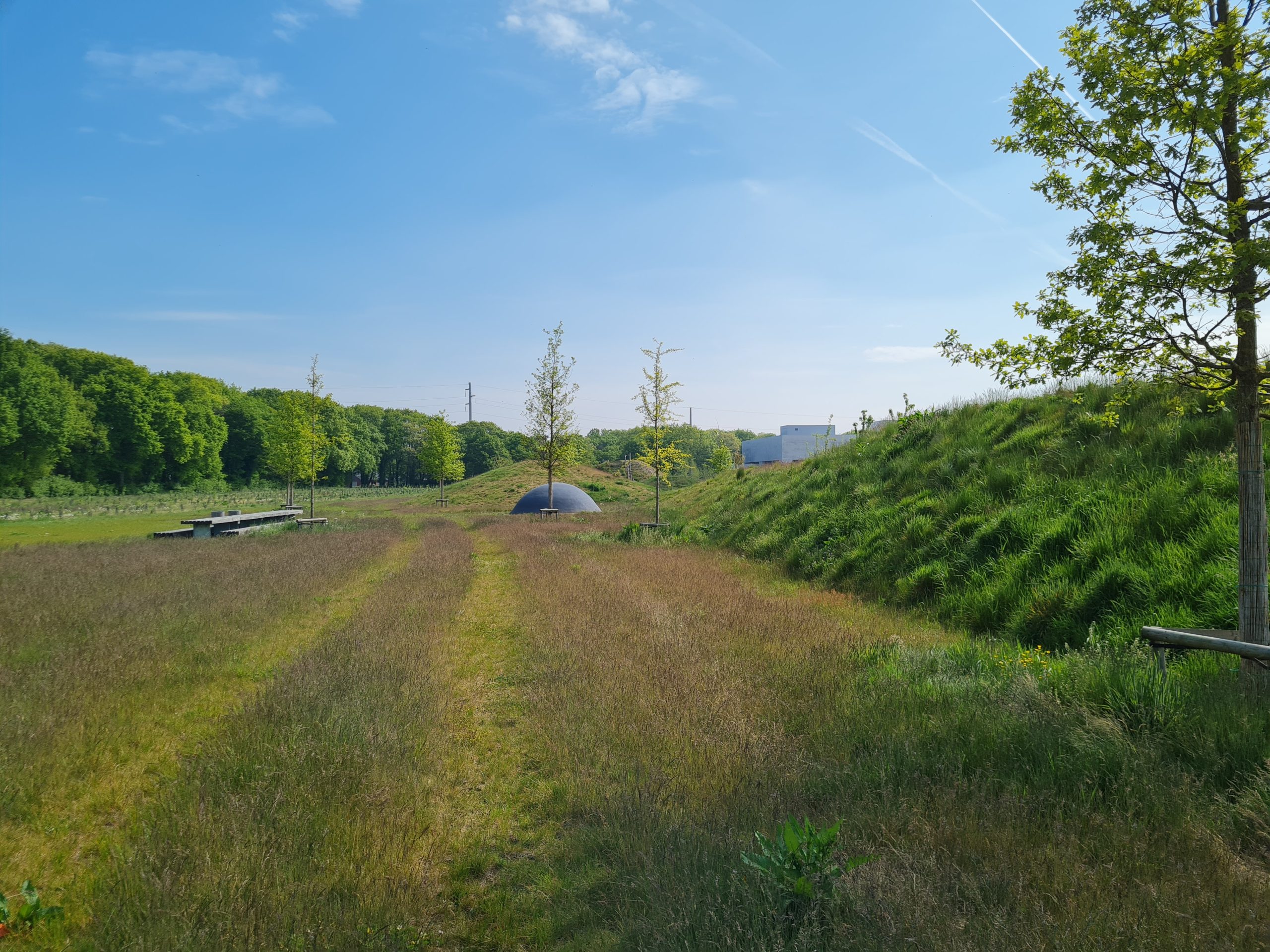
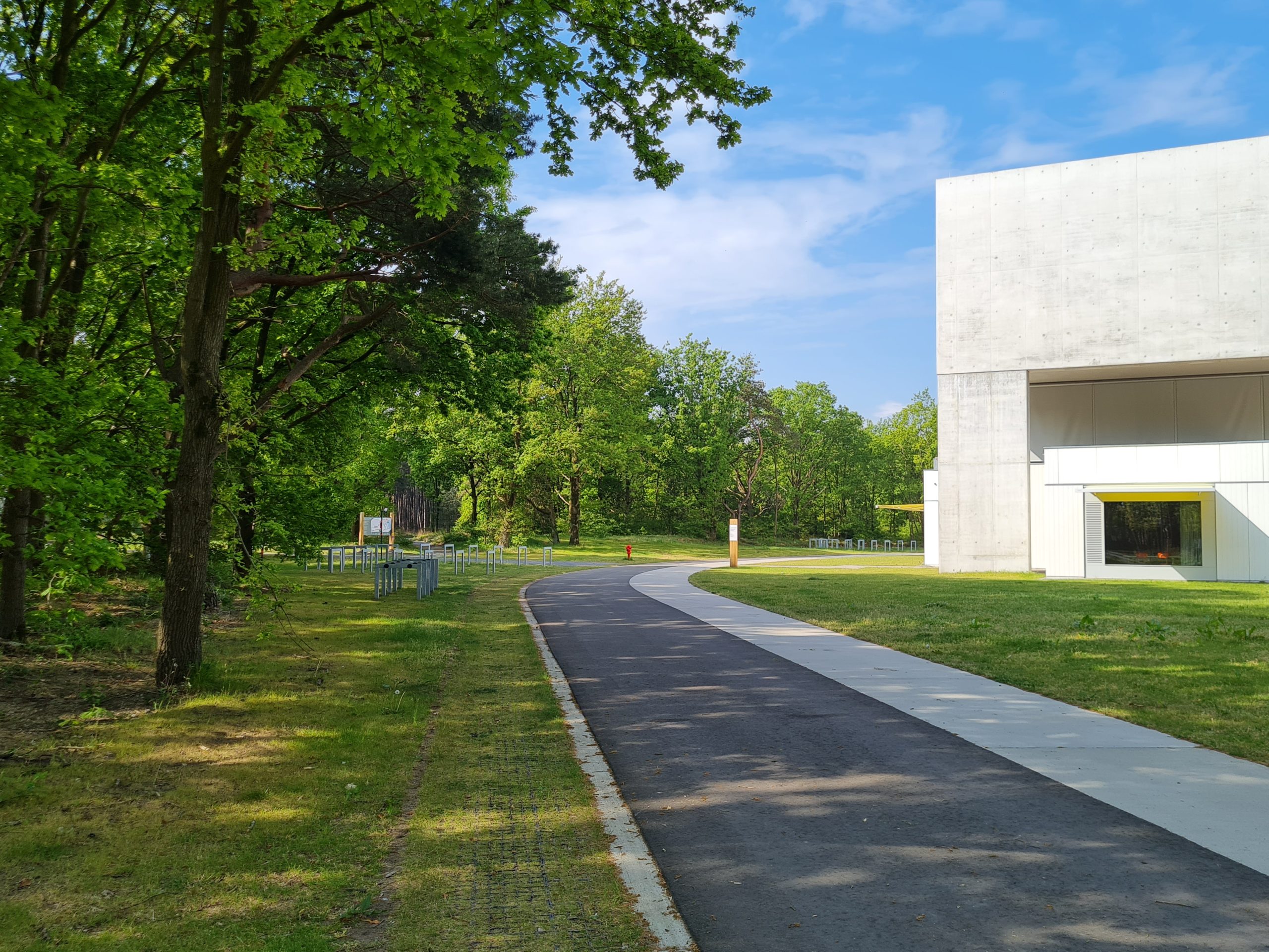
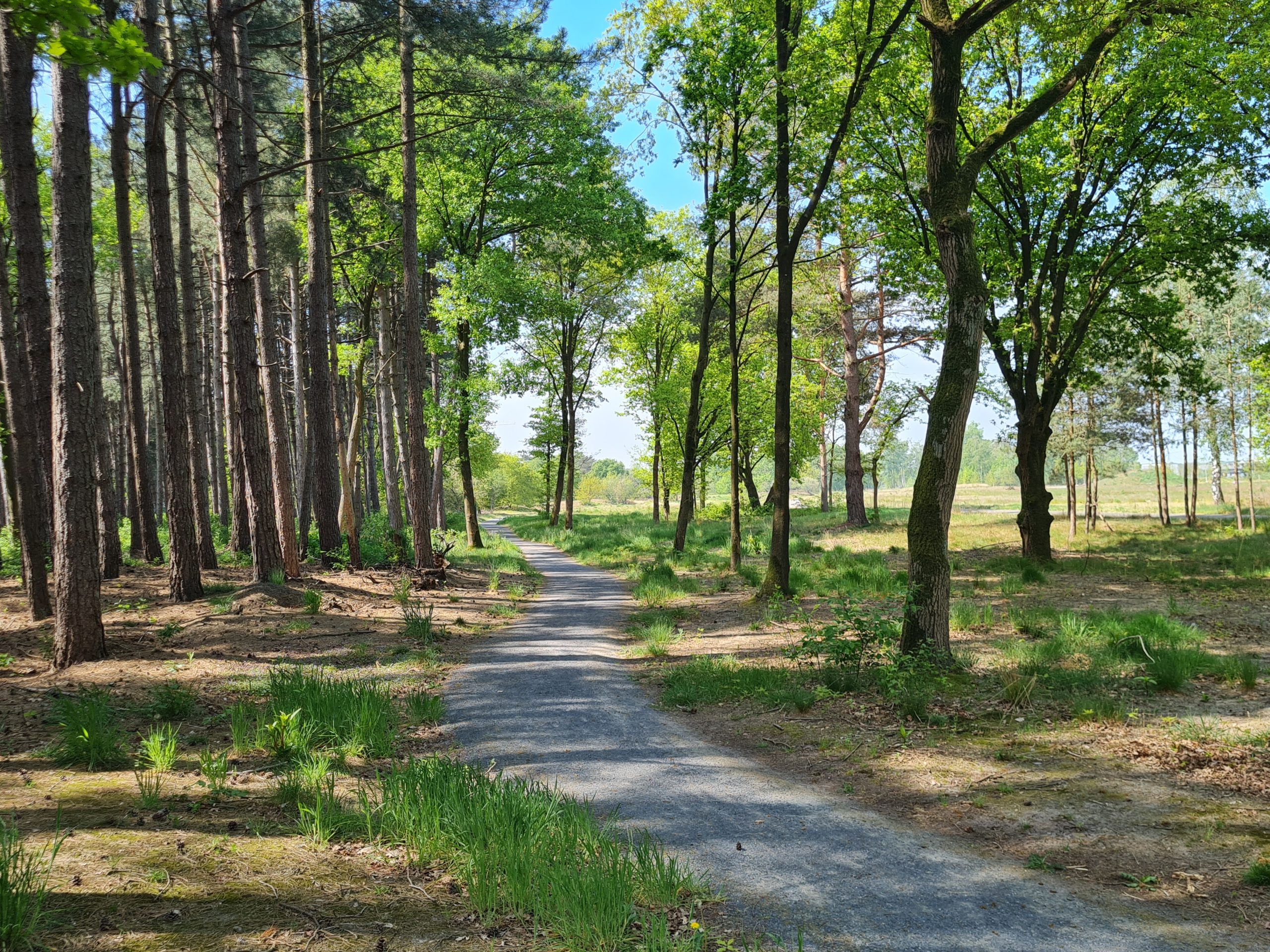
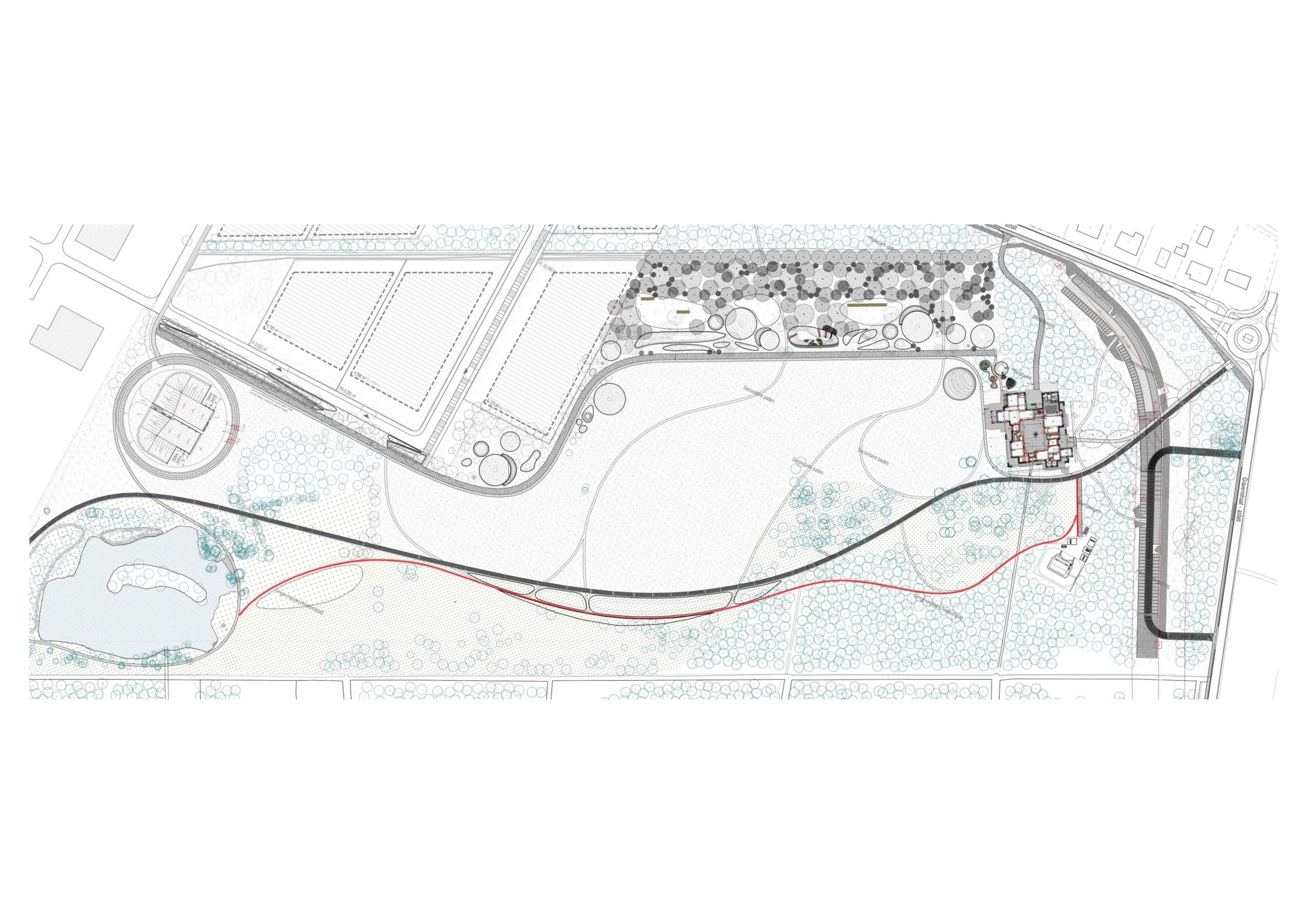
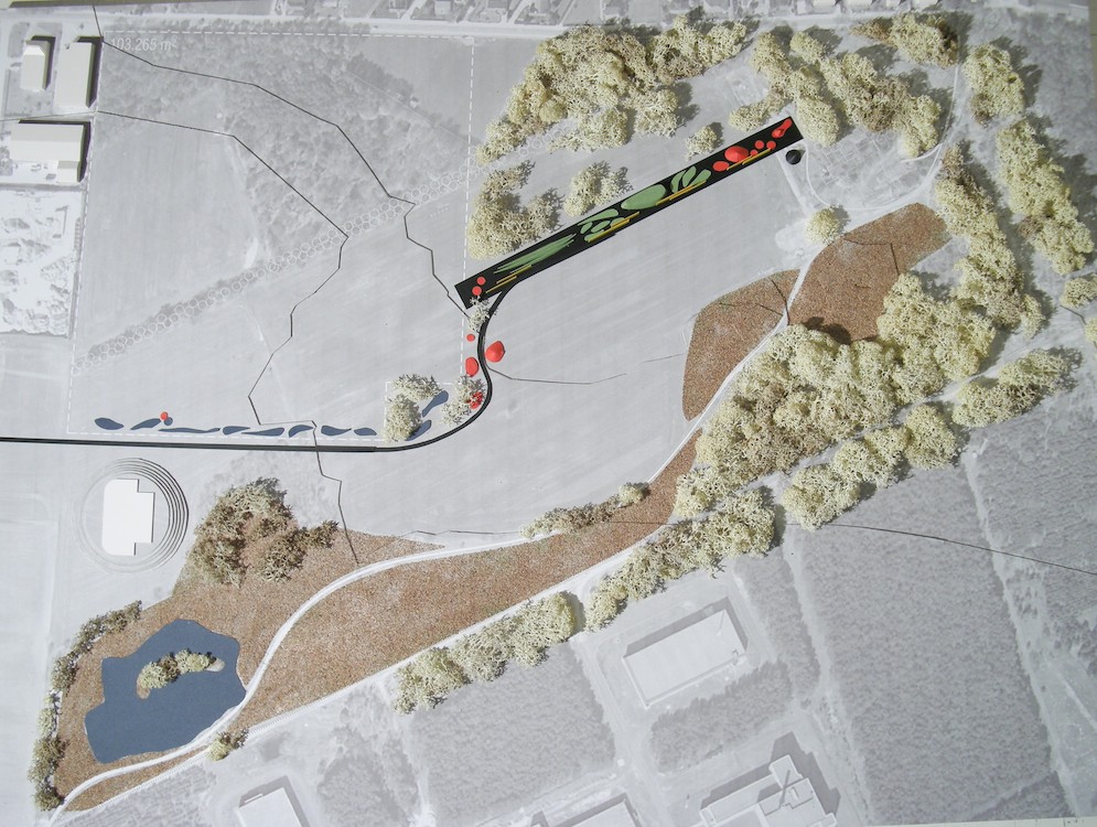
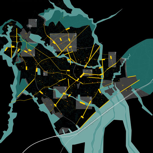
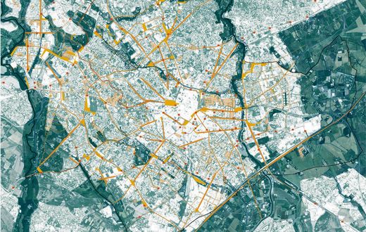
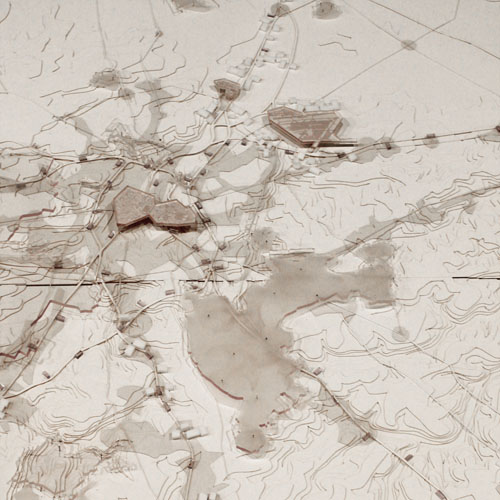
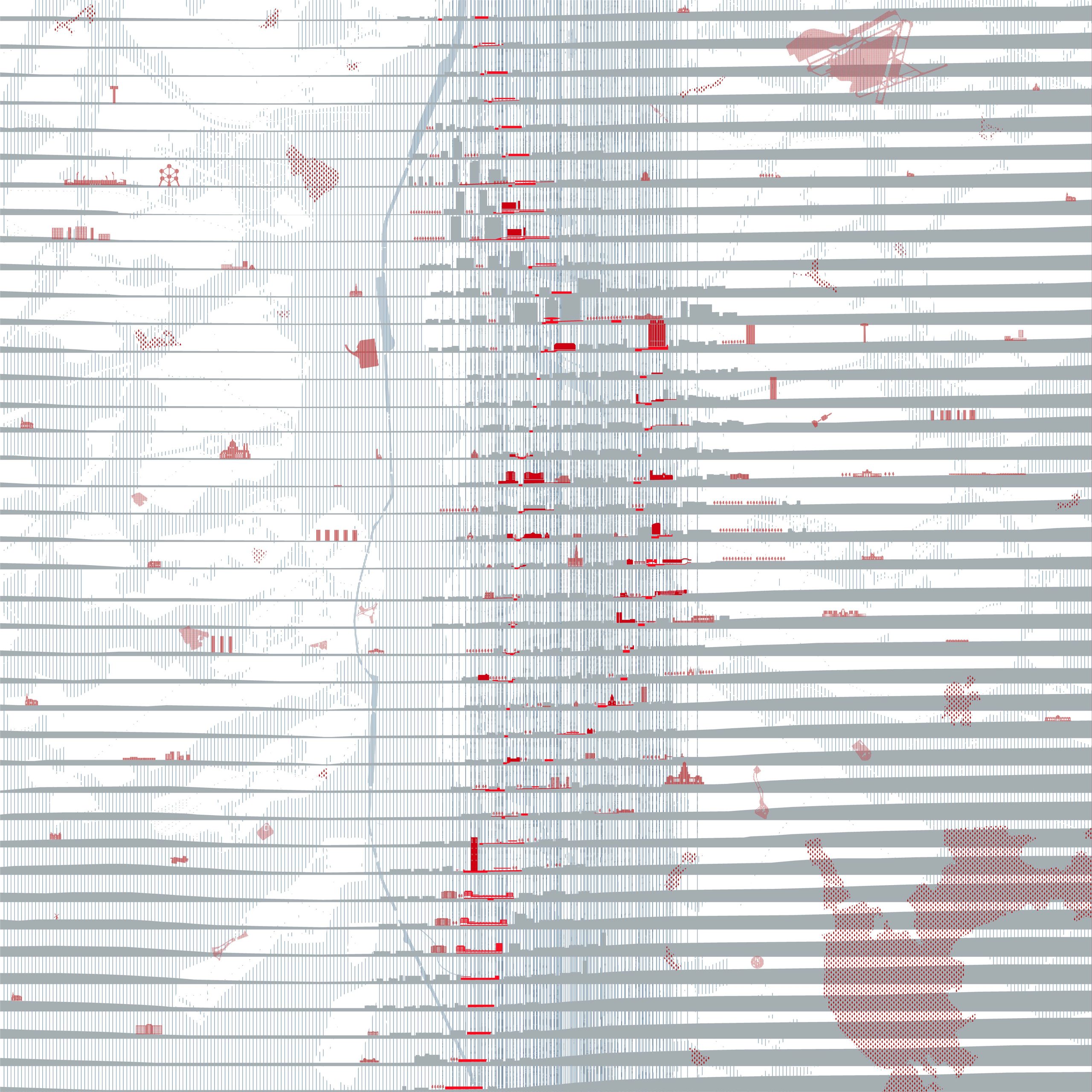
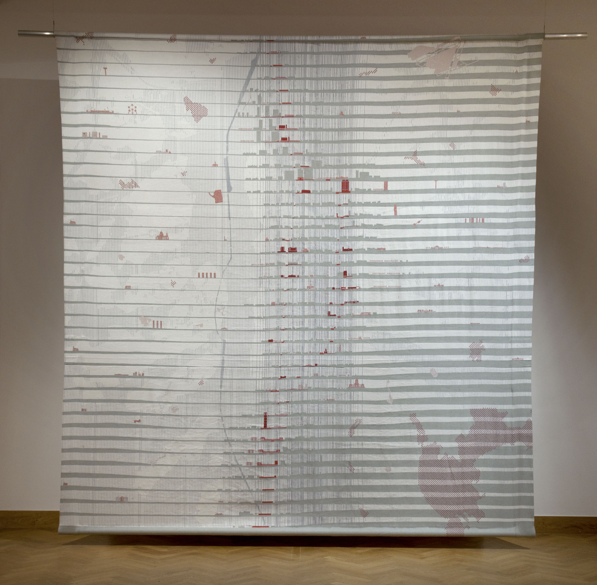
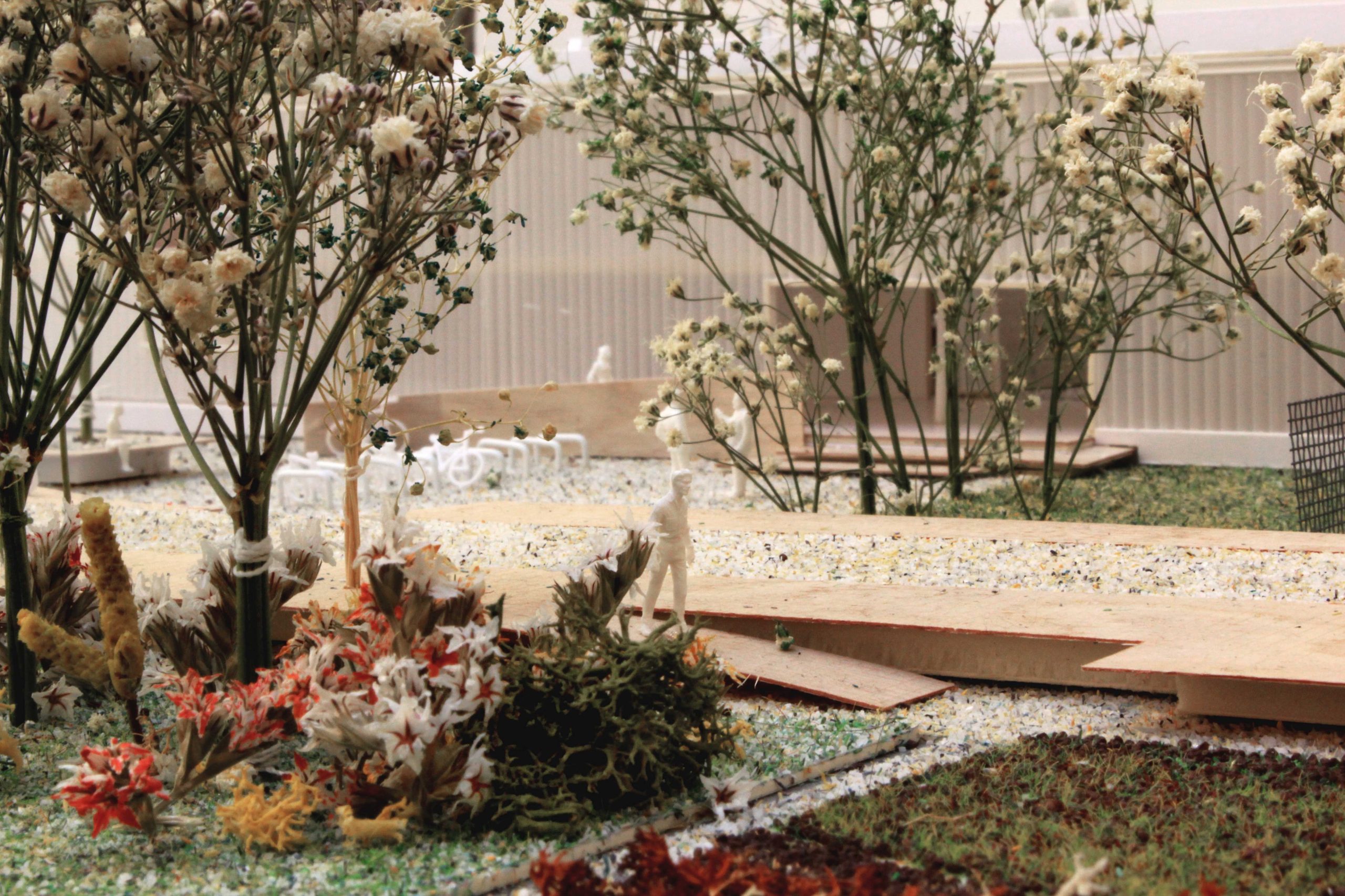
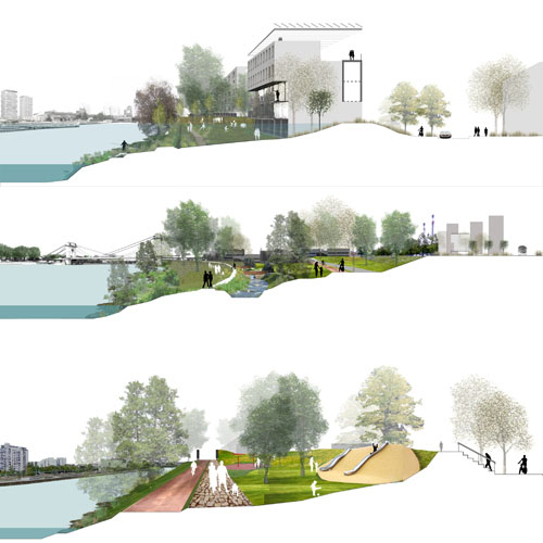
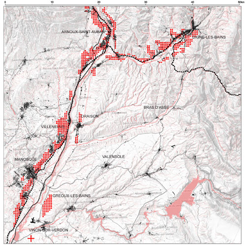
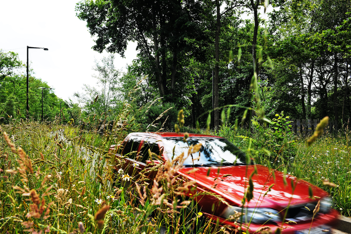
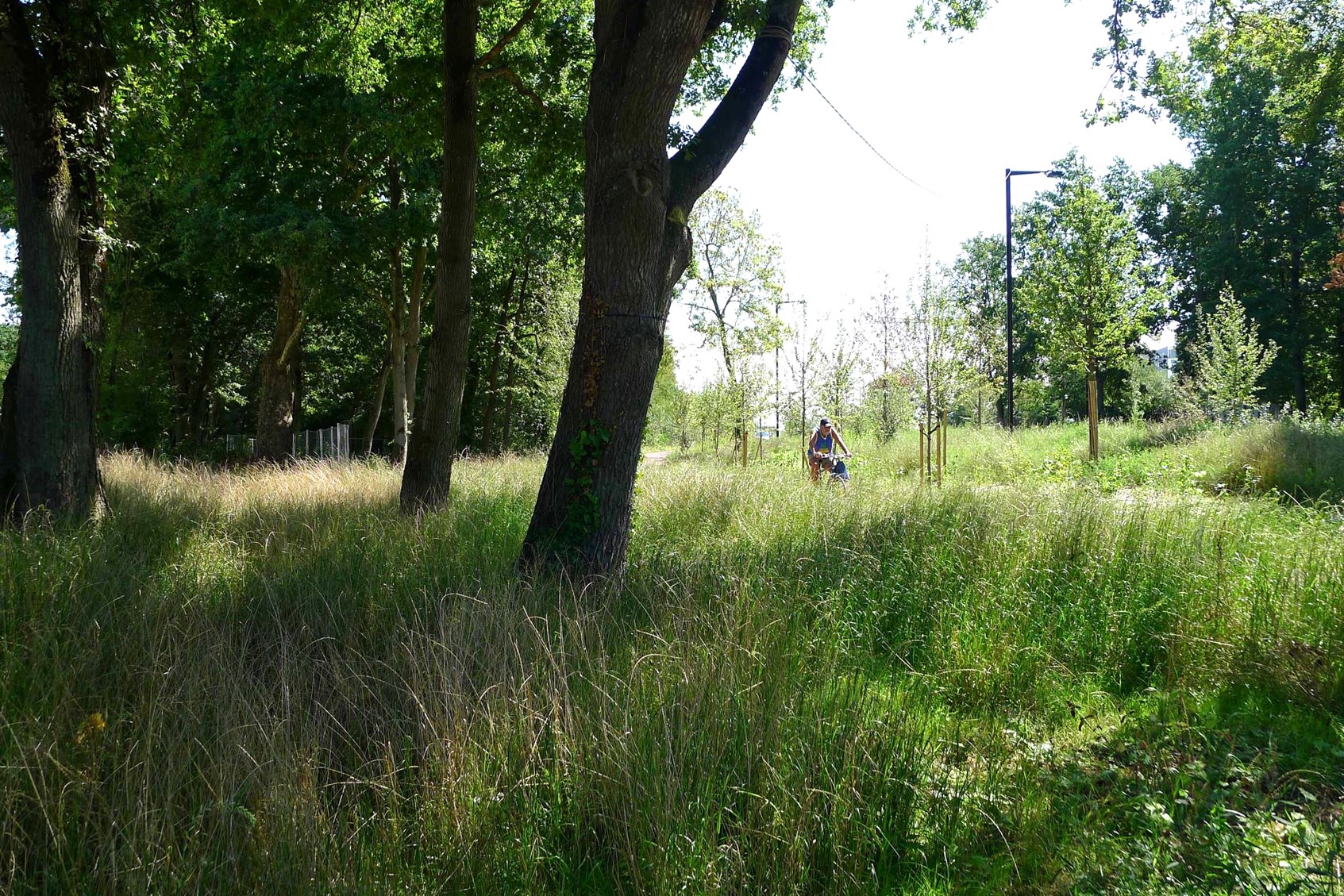
Parc Ouest, located on the former railway barrier that separated upper and lower Molenbeek, forms a long plateau connecting the two banks of the Maelbeek valley, which once ran from Scheutbos to the centre of Brussels. In a context marked by significant socio-economic inequalities and the need to adapt the city to the challenges of transition, the park is becoming a space for emancipation, where people can create, meet and relearn how to live together. The project is part of a system of interconnected parks, in which West Park plays a structuring role: a vast green, productive and cultural space that extends the landscapes of the Pajottenland and its biodiversity and connects the different neighbourhoods. It is designed to support evolving features, covered by a large, continuous, light canopy composed of a mosaic of landscapes: the promenade, the woods, the large meadow, the hills and the equipped slab. The creation of these atmospheres is based on a careful reading of what the site already offers: the landscape of the brownfield, its soil, its topography, its materials and the uses initiated by the Toestand association with the inhabitants. The project aims to co-construct, a park that is exemplary in its resource management: reuse of existing materials, gradual improvement of soils with a minimum of excavation and backfilling, sustainable water management and landscape evolution through a design by maintenance.
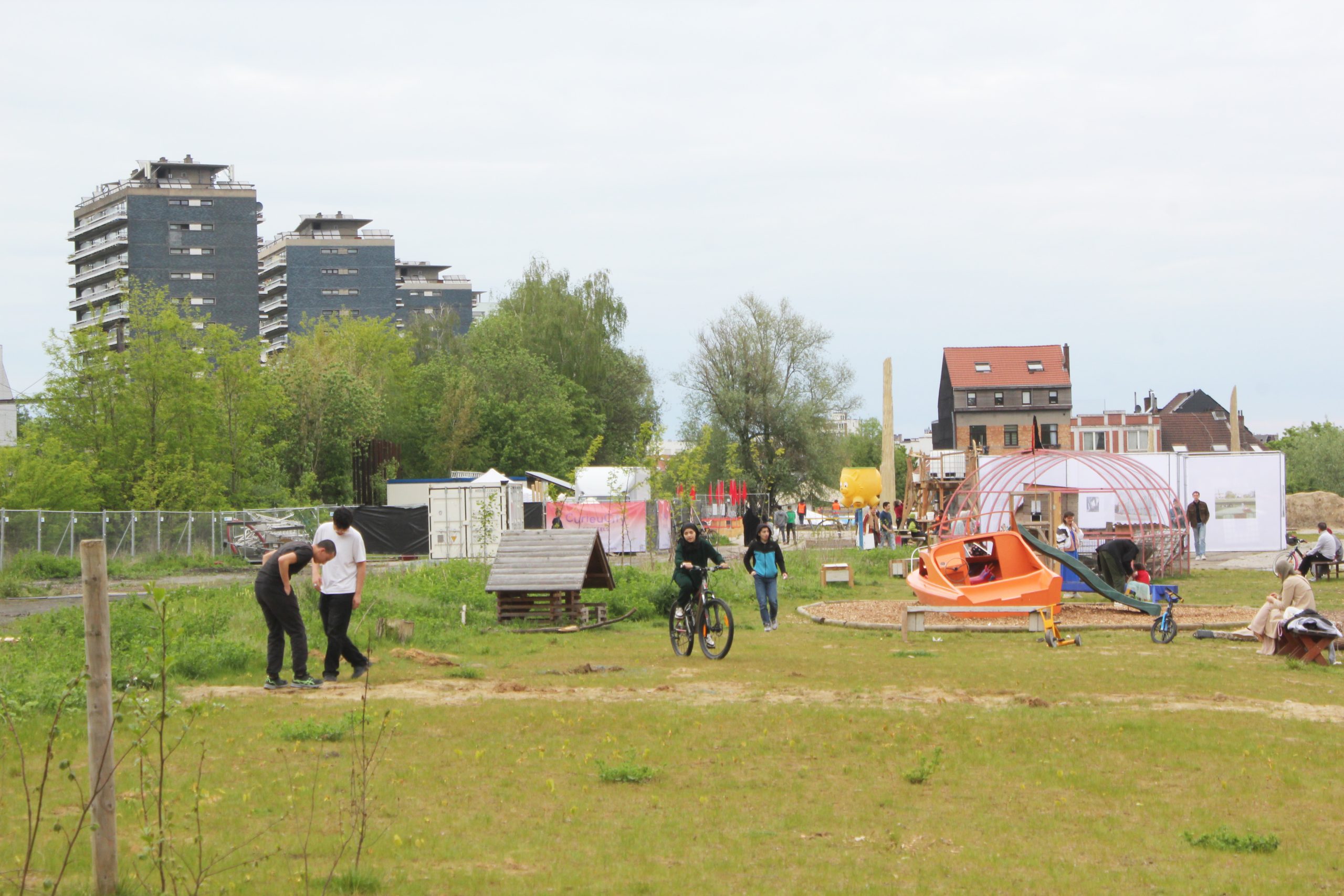
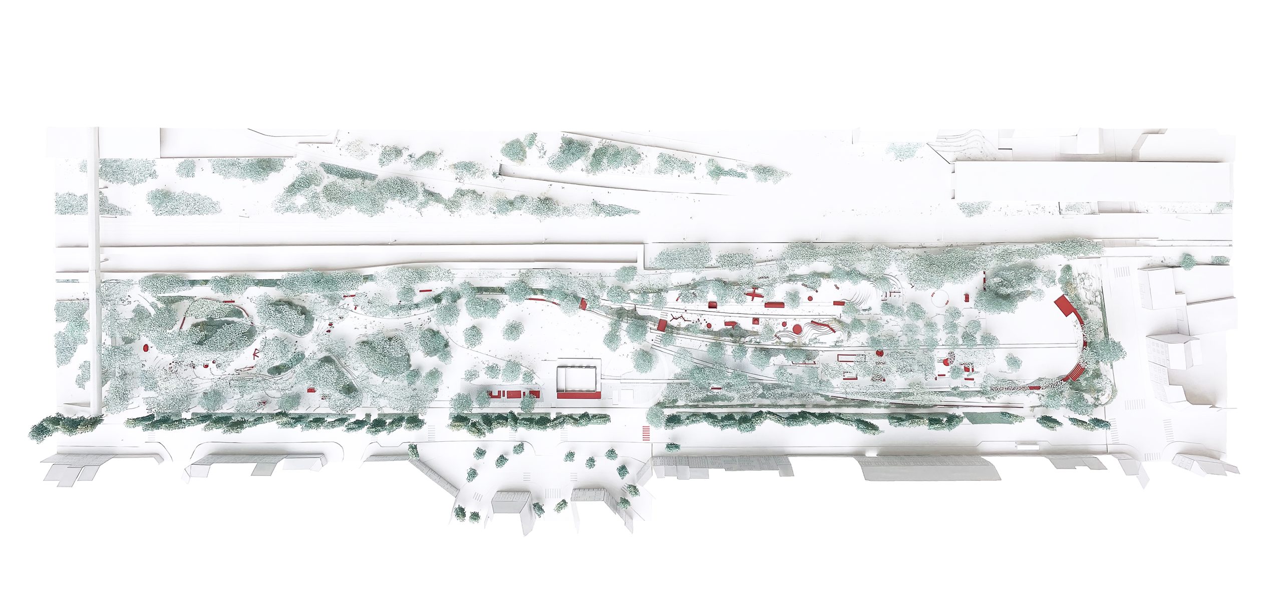
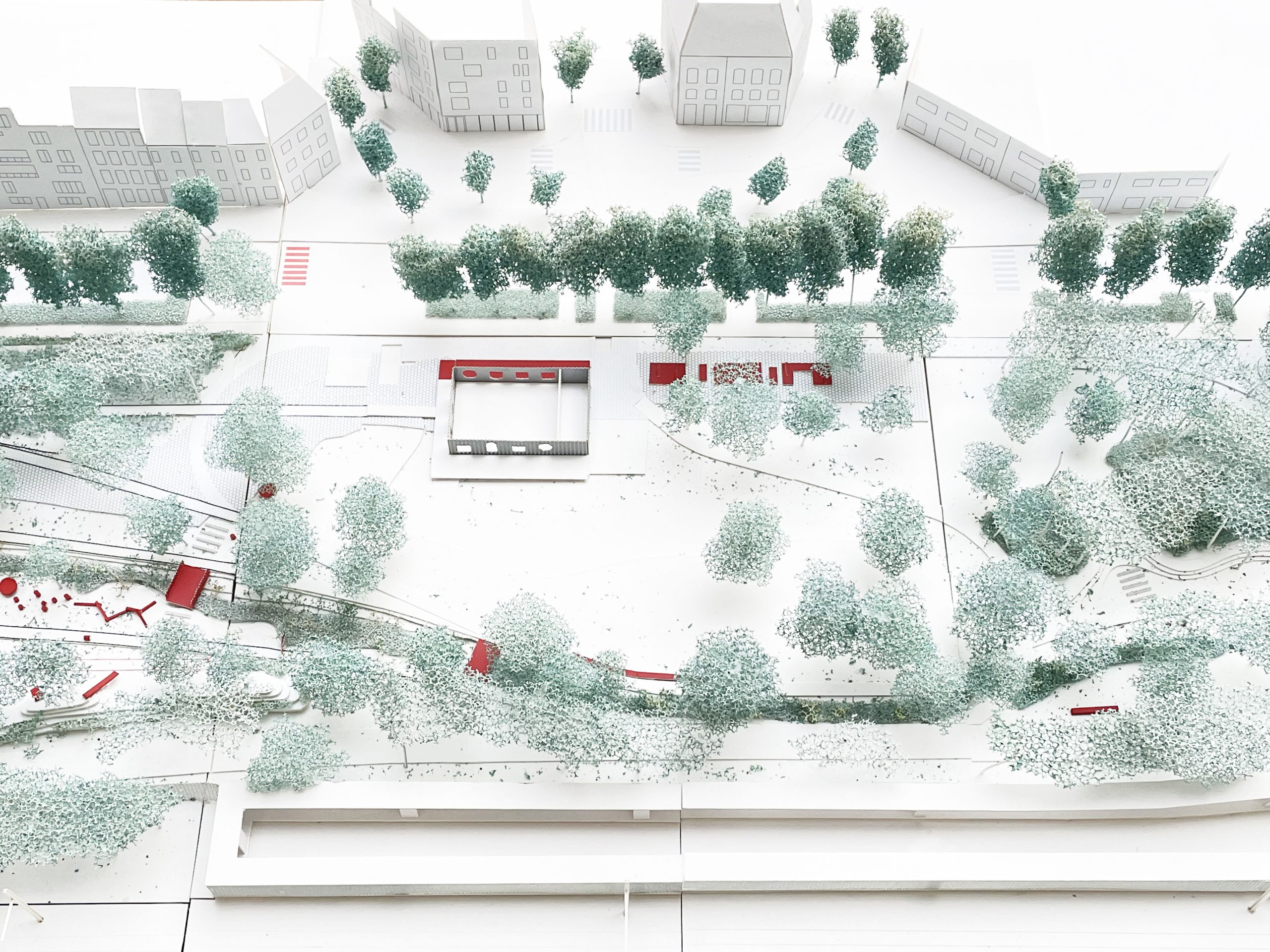
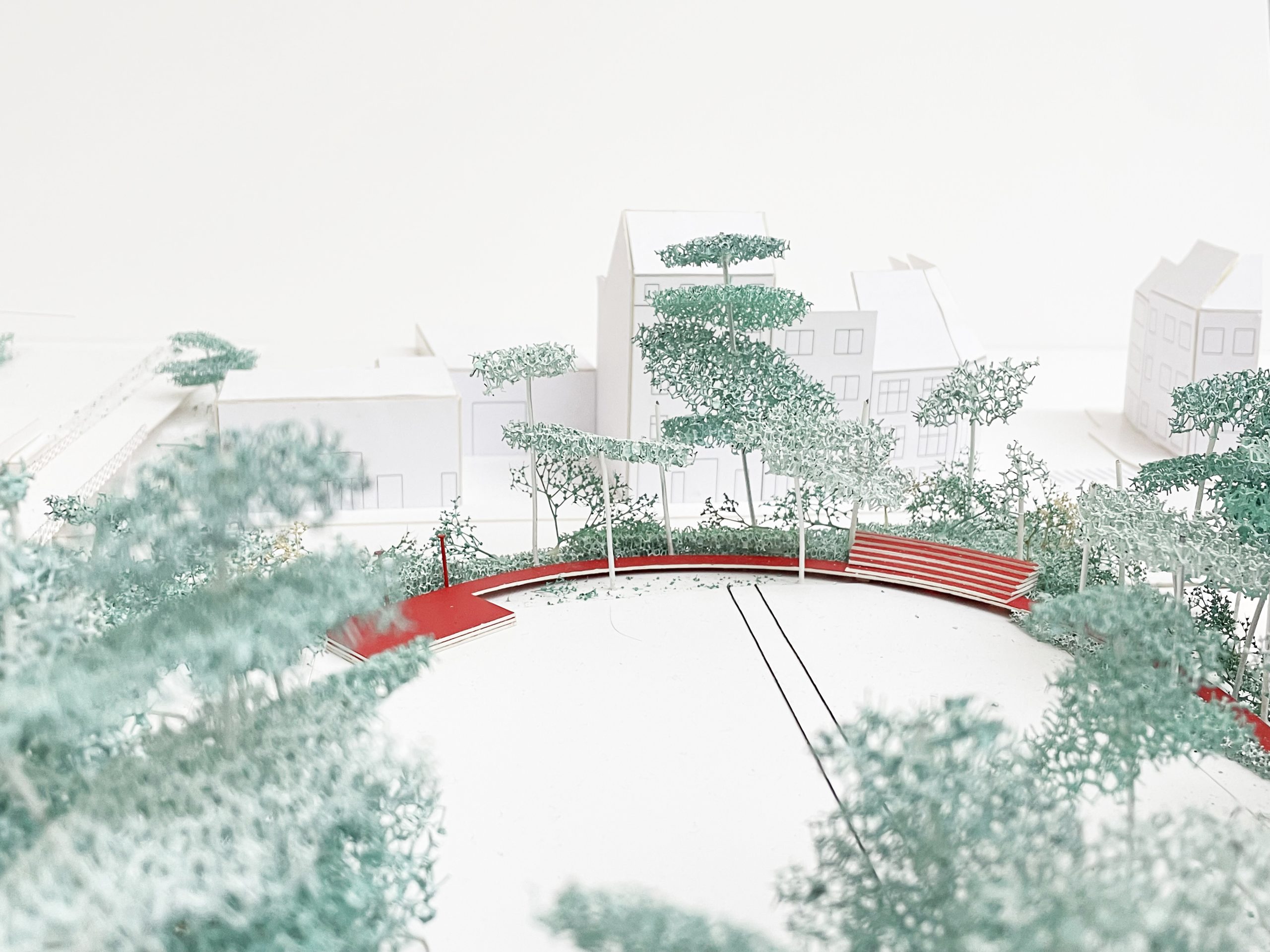
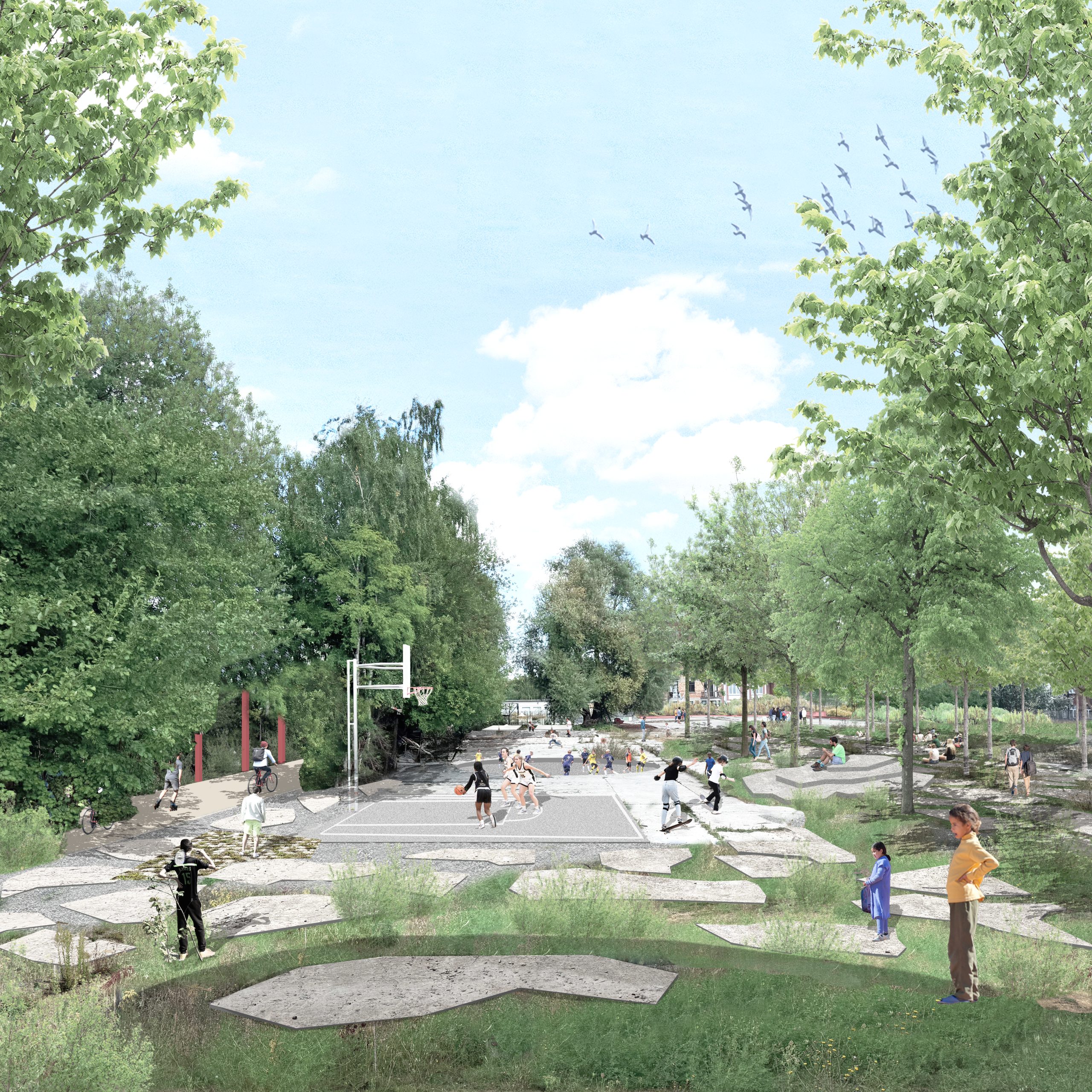
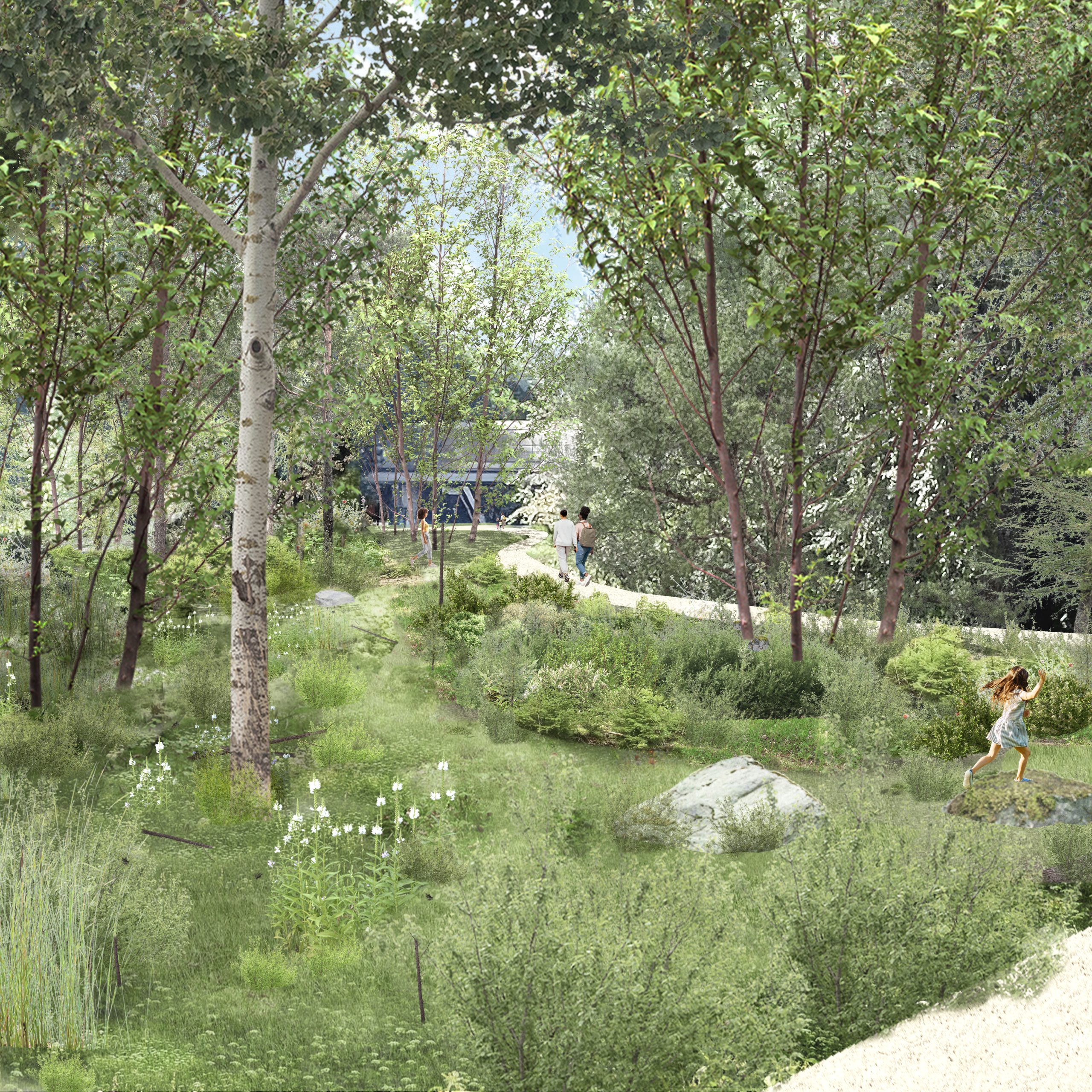
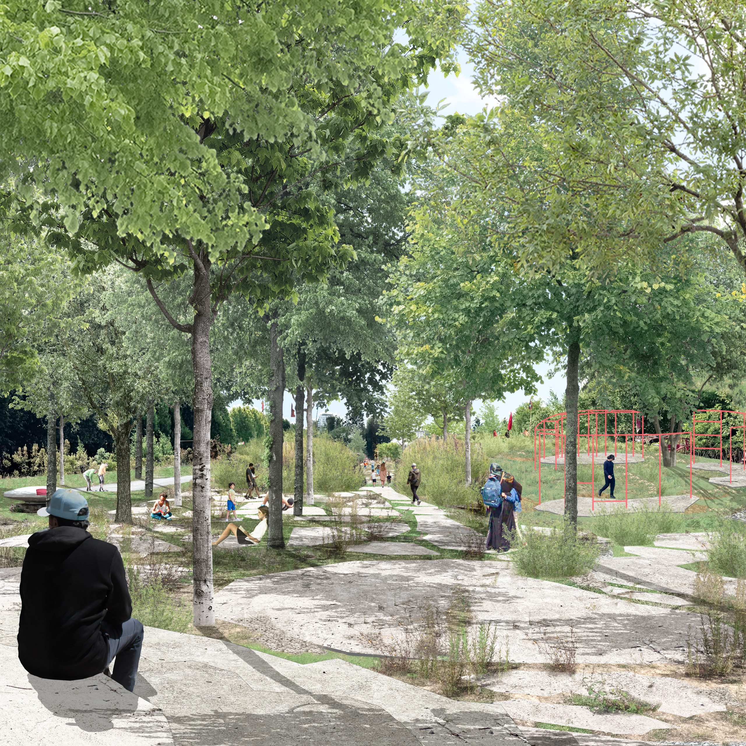
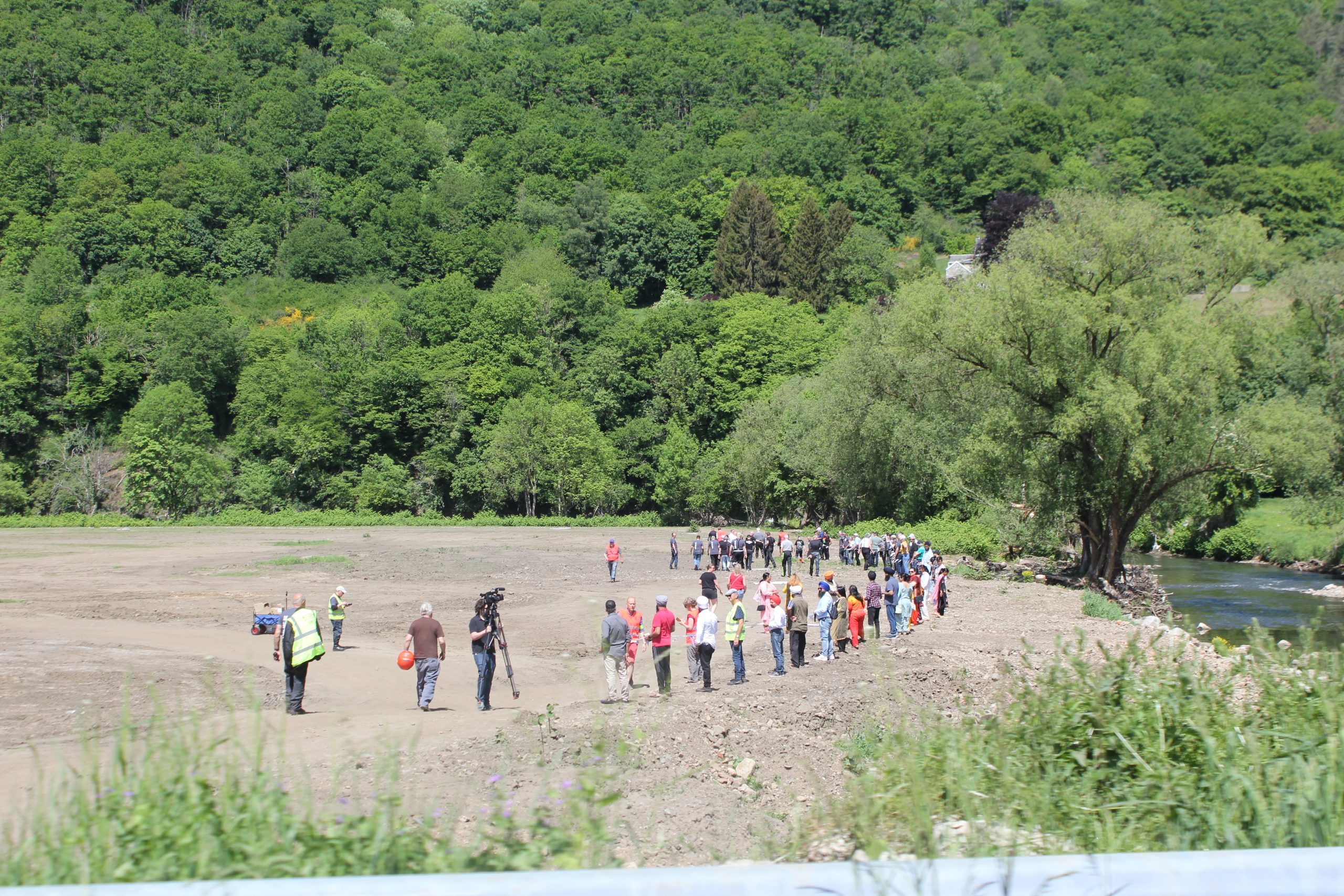
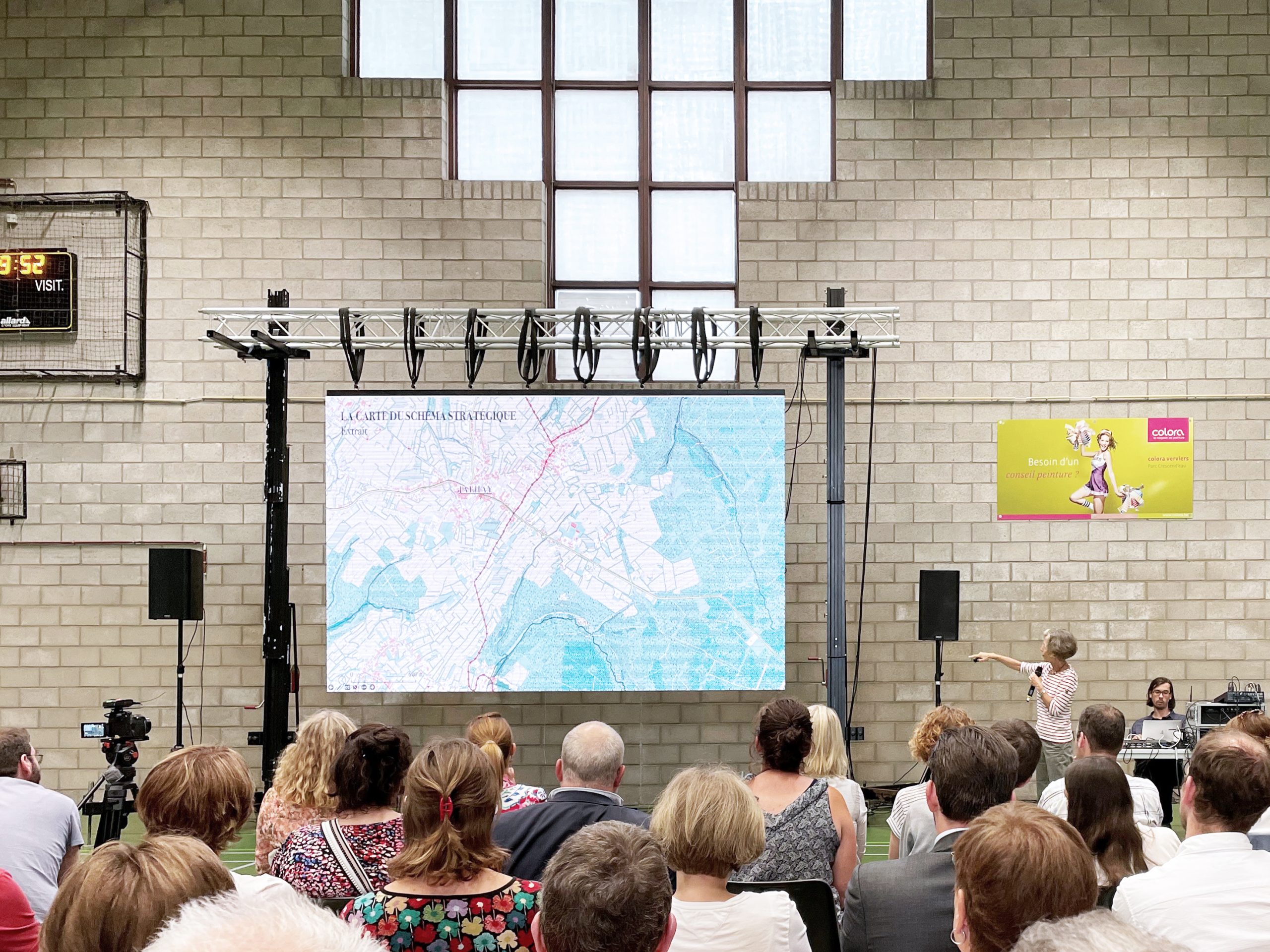
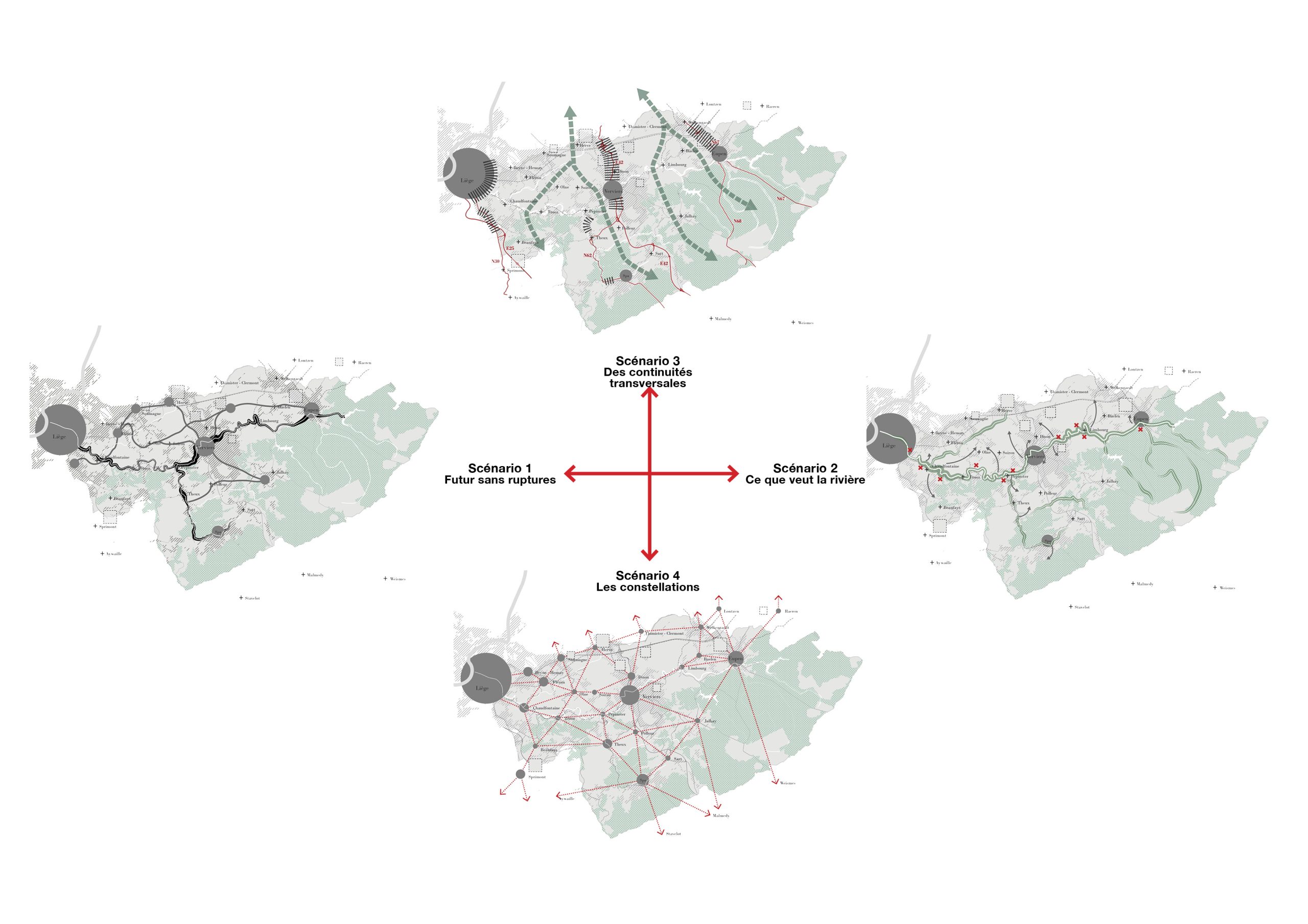
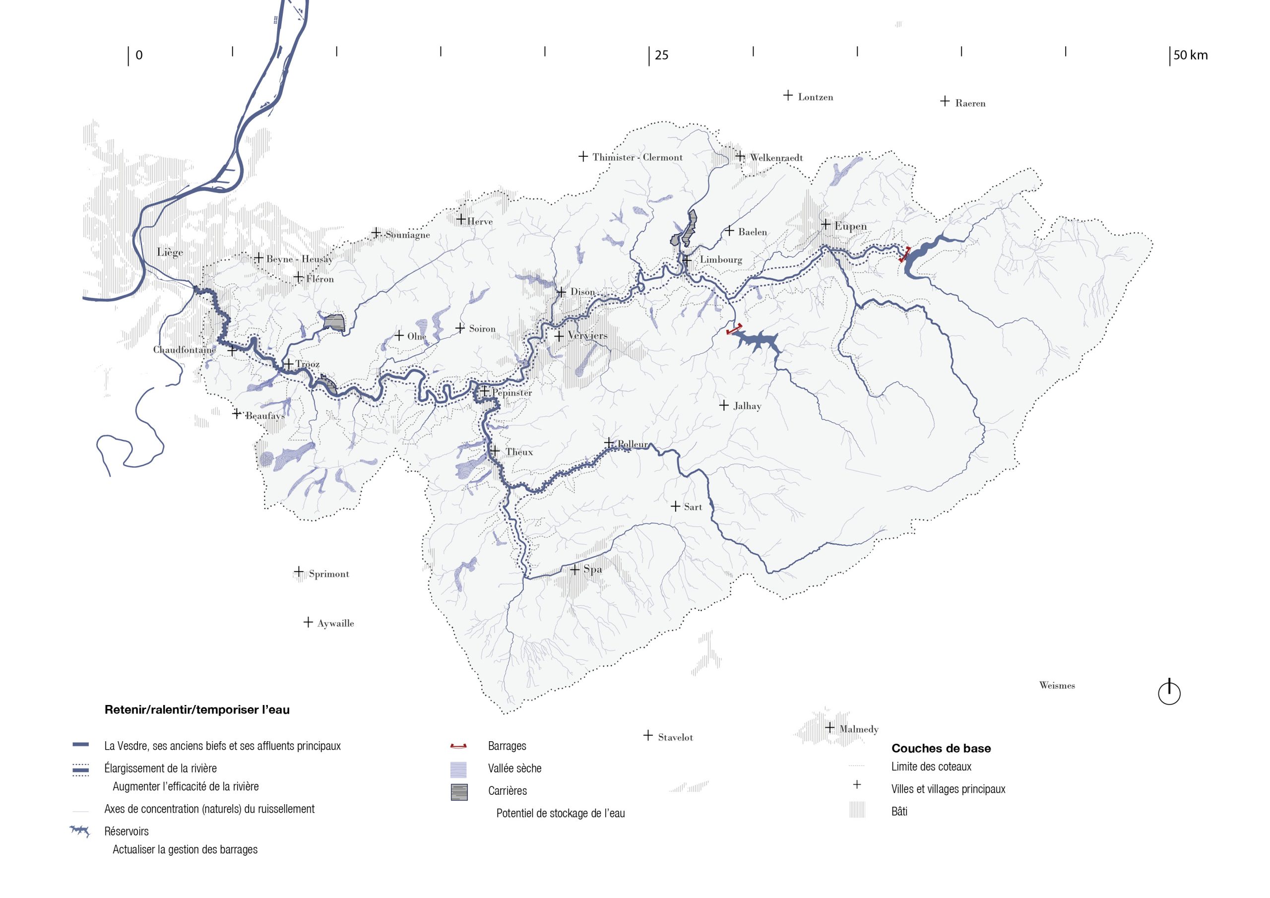
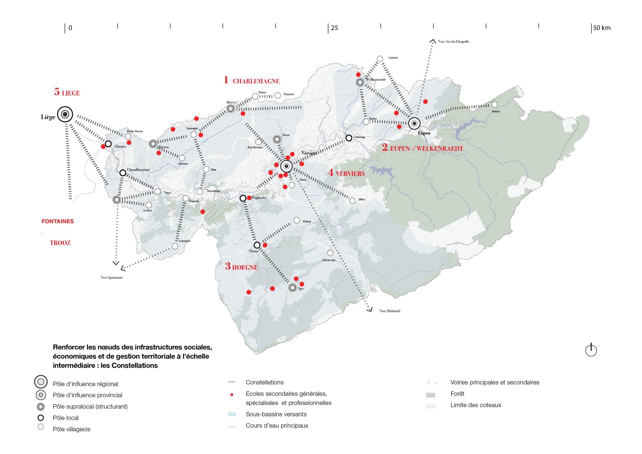
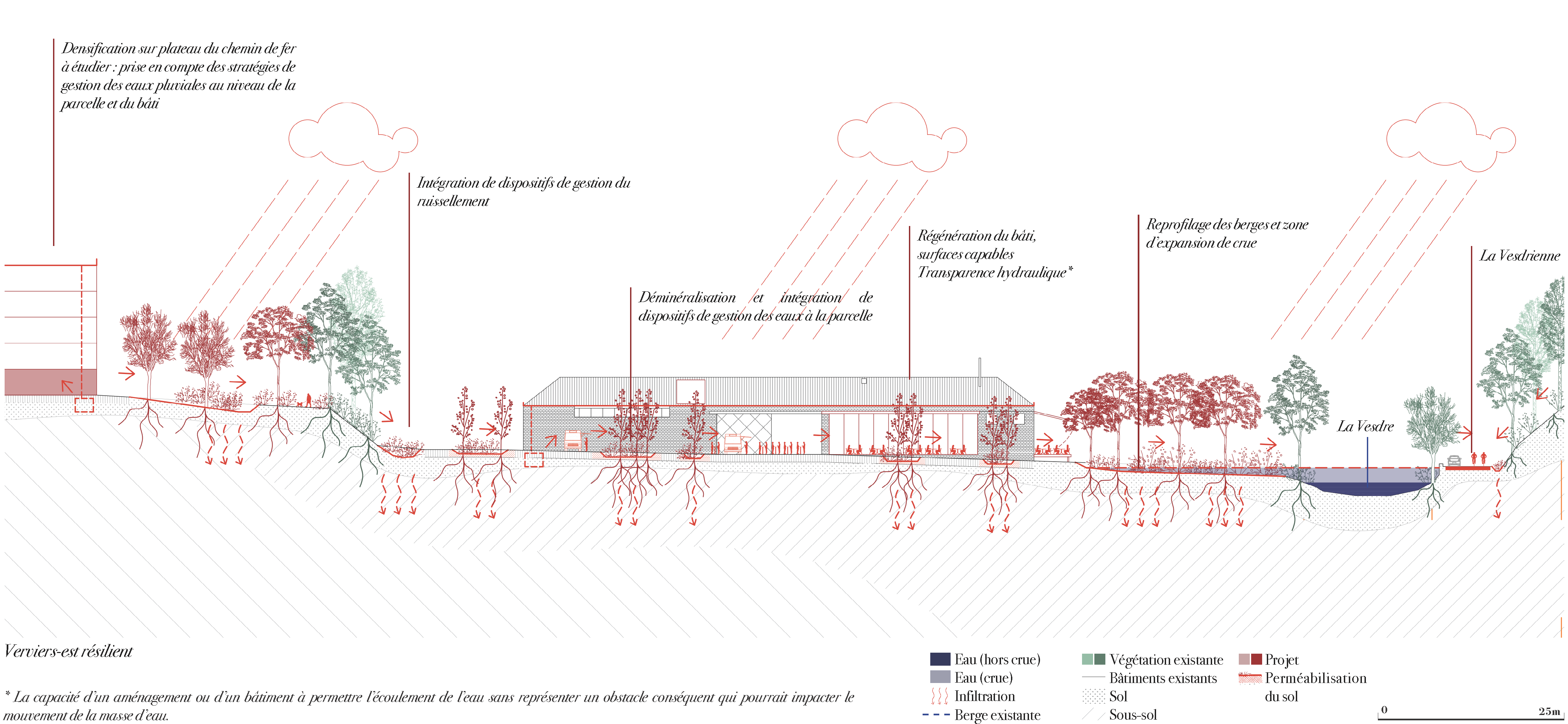
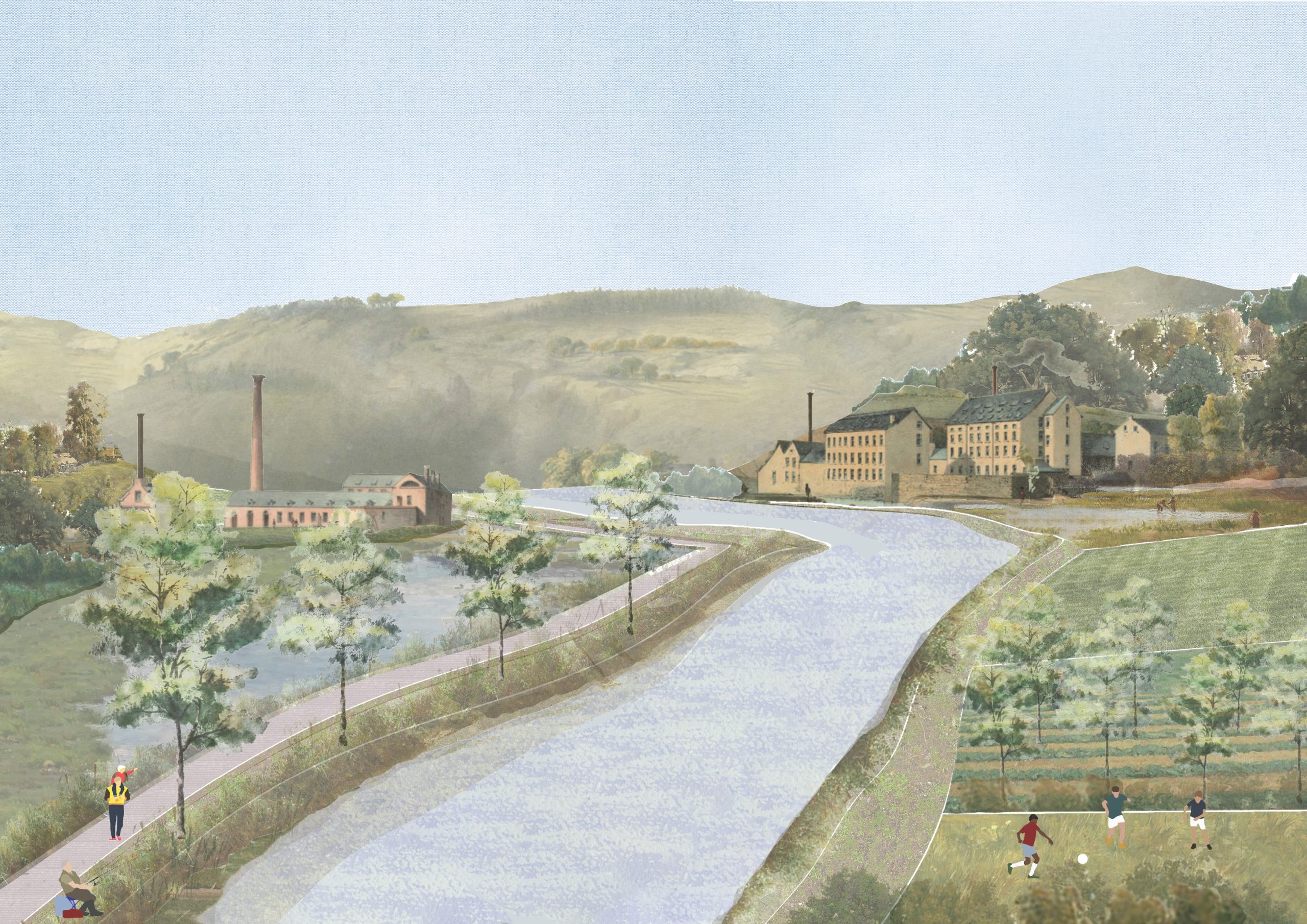
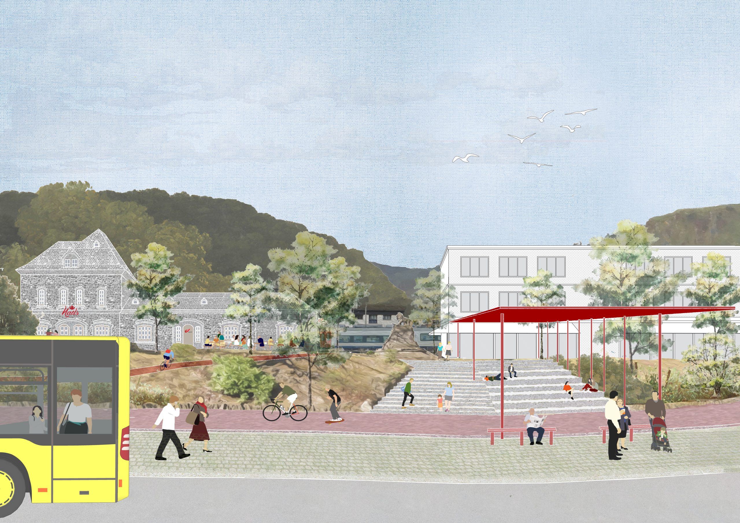
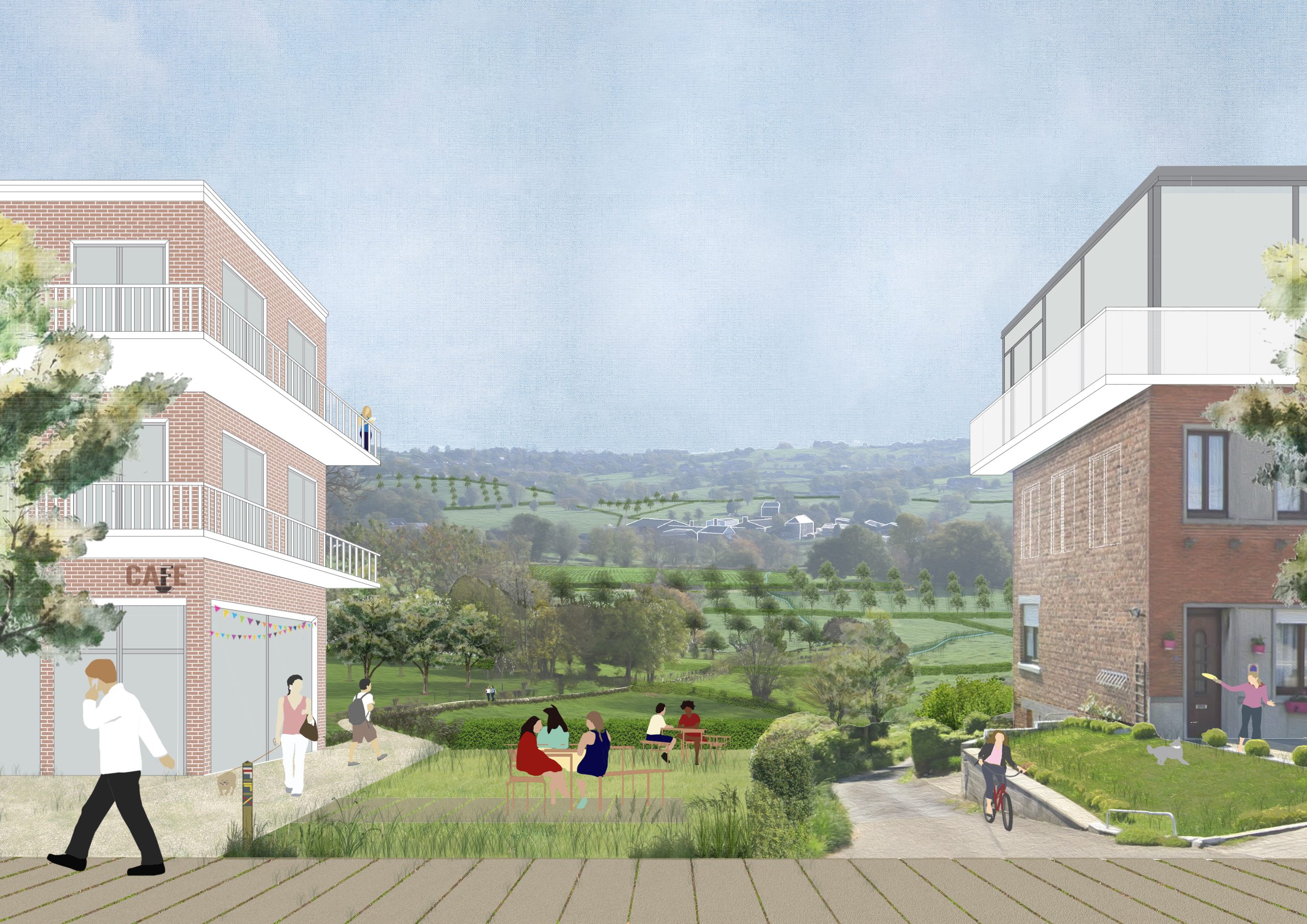
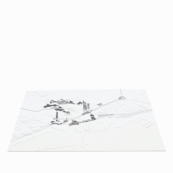
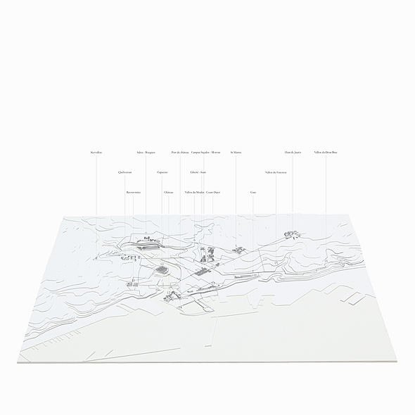
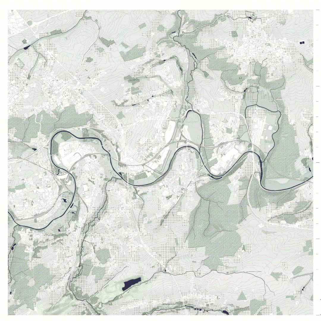
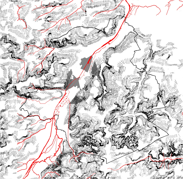
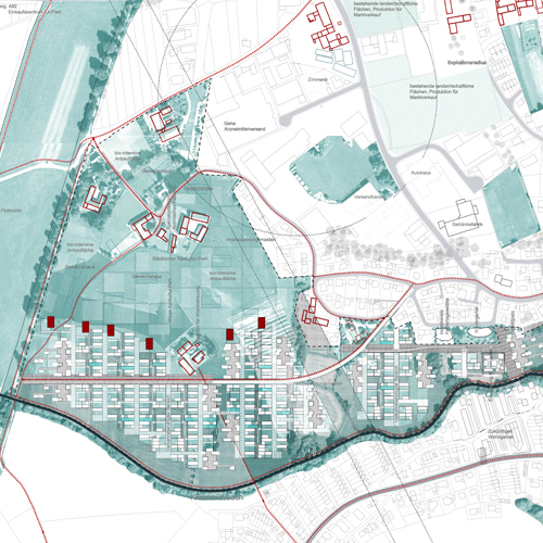
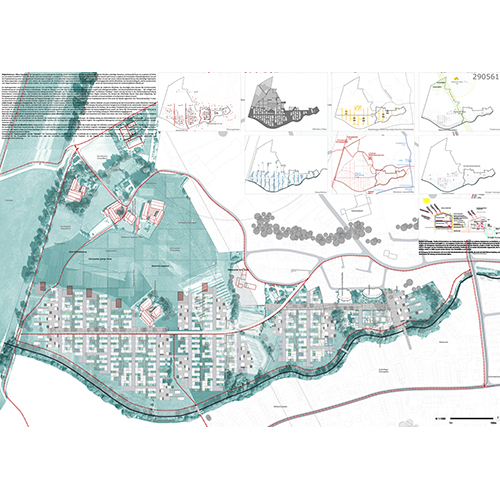
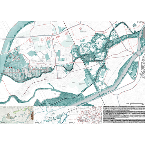
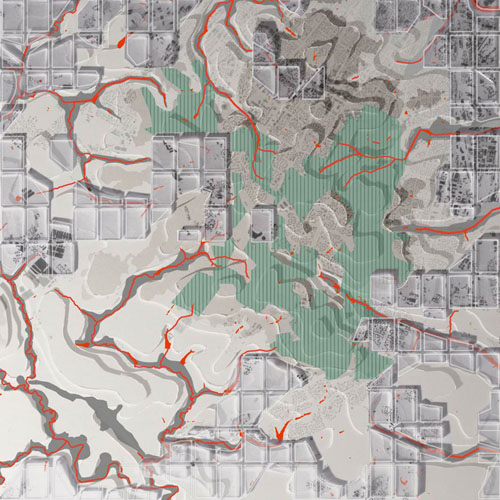
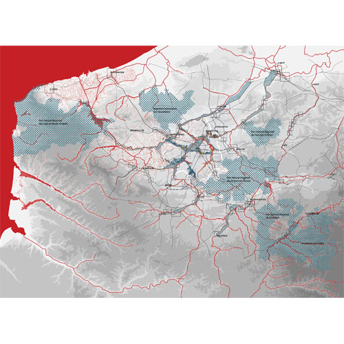
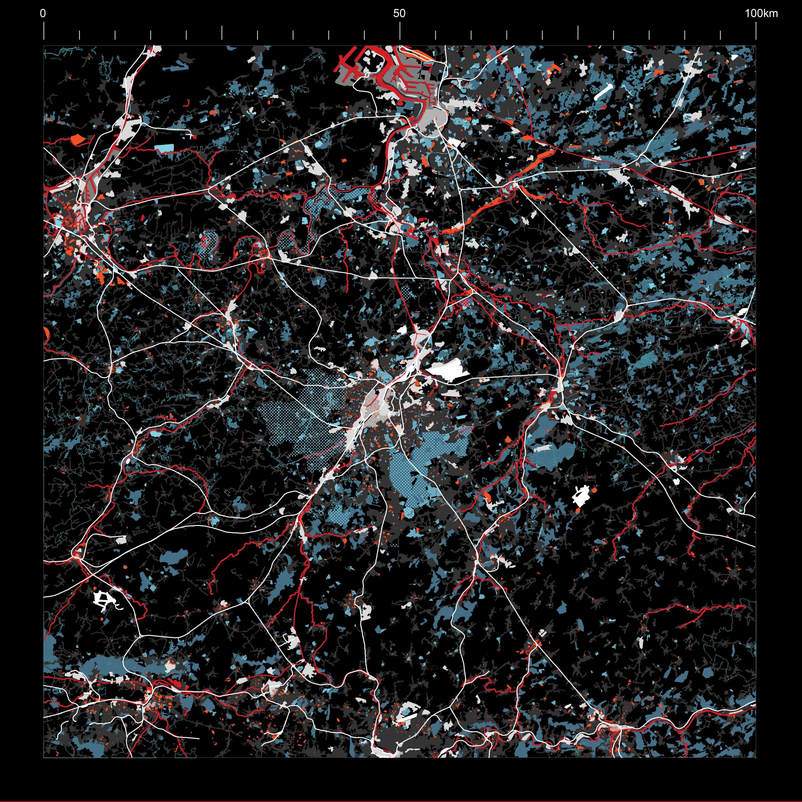
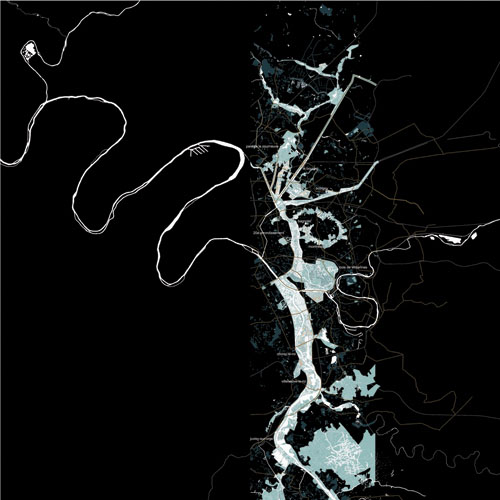
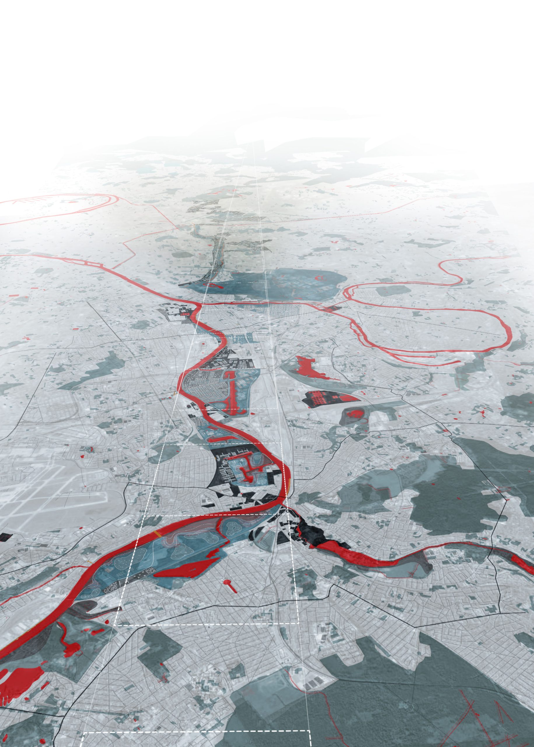
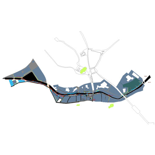
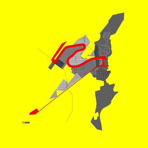
Schéma stratégique Vesdre
Vesdre Watershed, BE
2022/2023 volet 1
Client: La Région wallonne, représentée par Monsieur Willy BORSUS, ministre de l’Économie, de la Recherche extérieure, de l’Innovation, du Numérique, de l’Agriculture, de l’Aménagement du Territoire, de l’IFAPME et des Centres de compétence.
Program: territorial vision to make the vesdre watershed resilient to flooding and climate change.
Team: Etienne Schillers, Matthias Lamberts, Achille Pelletier, Darya Shubenina, Chandelle Cifende, Stefano Gariglio, Yidnekachew Yilma Seleshi.
In collaboration with: University of Liège (partner), Yellow Window (consultant)
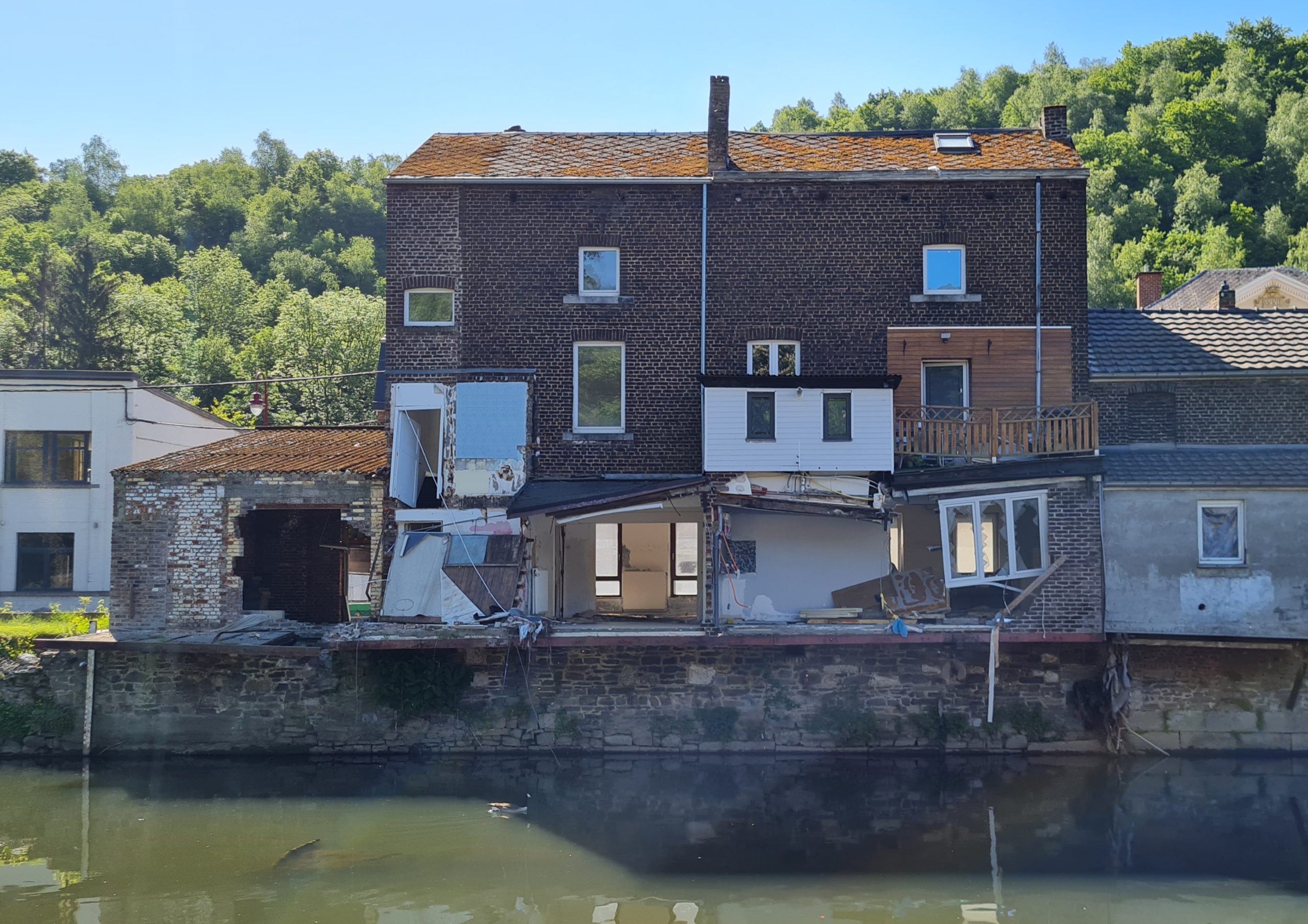
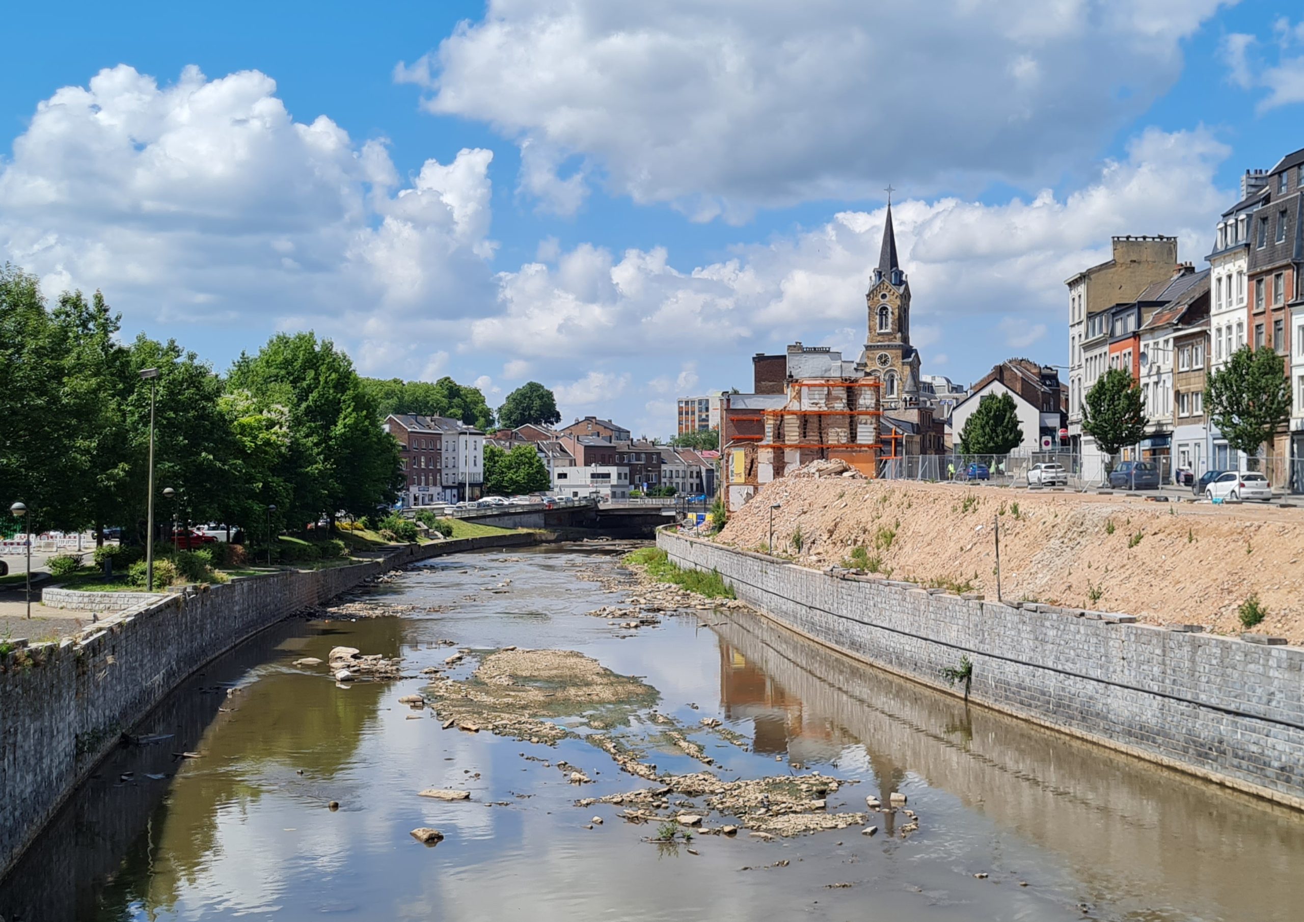
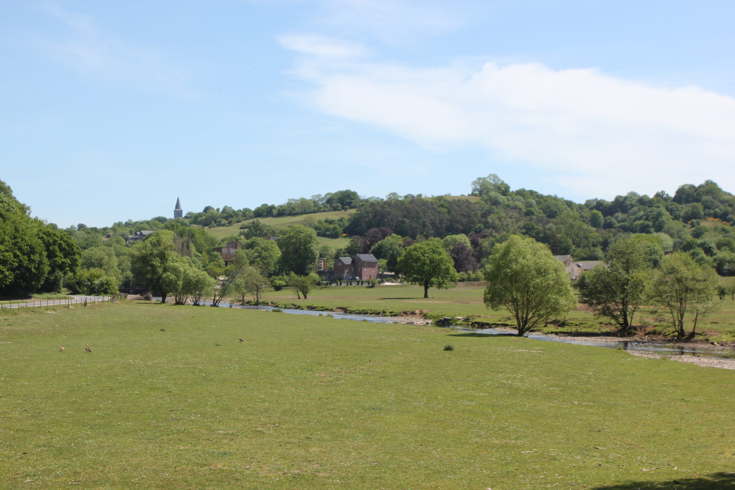
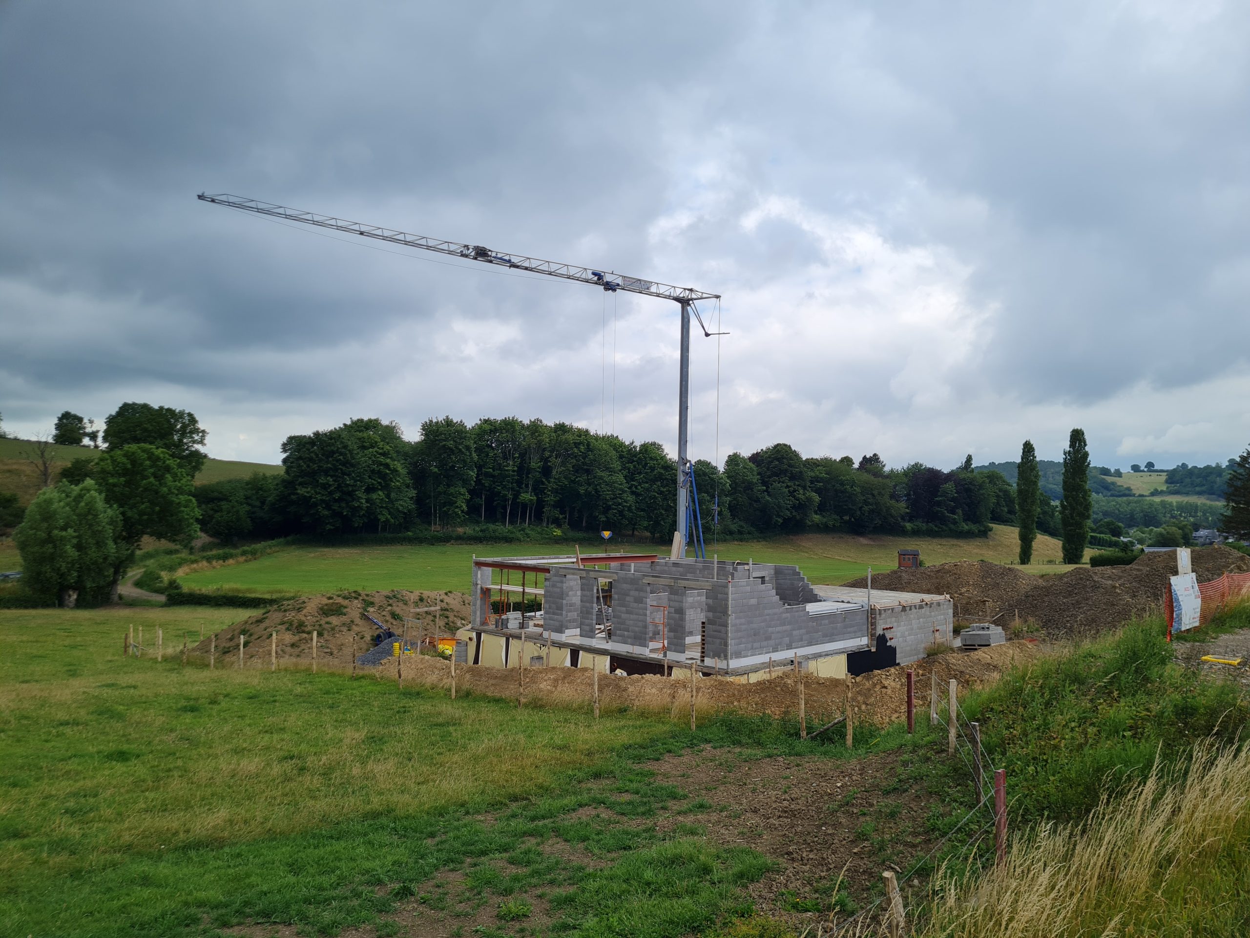
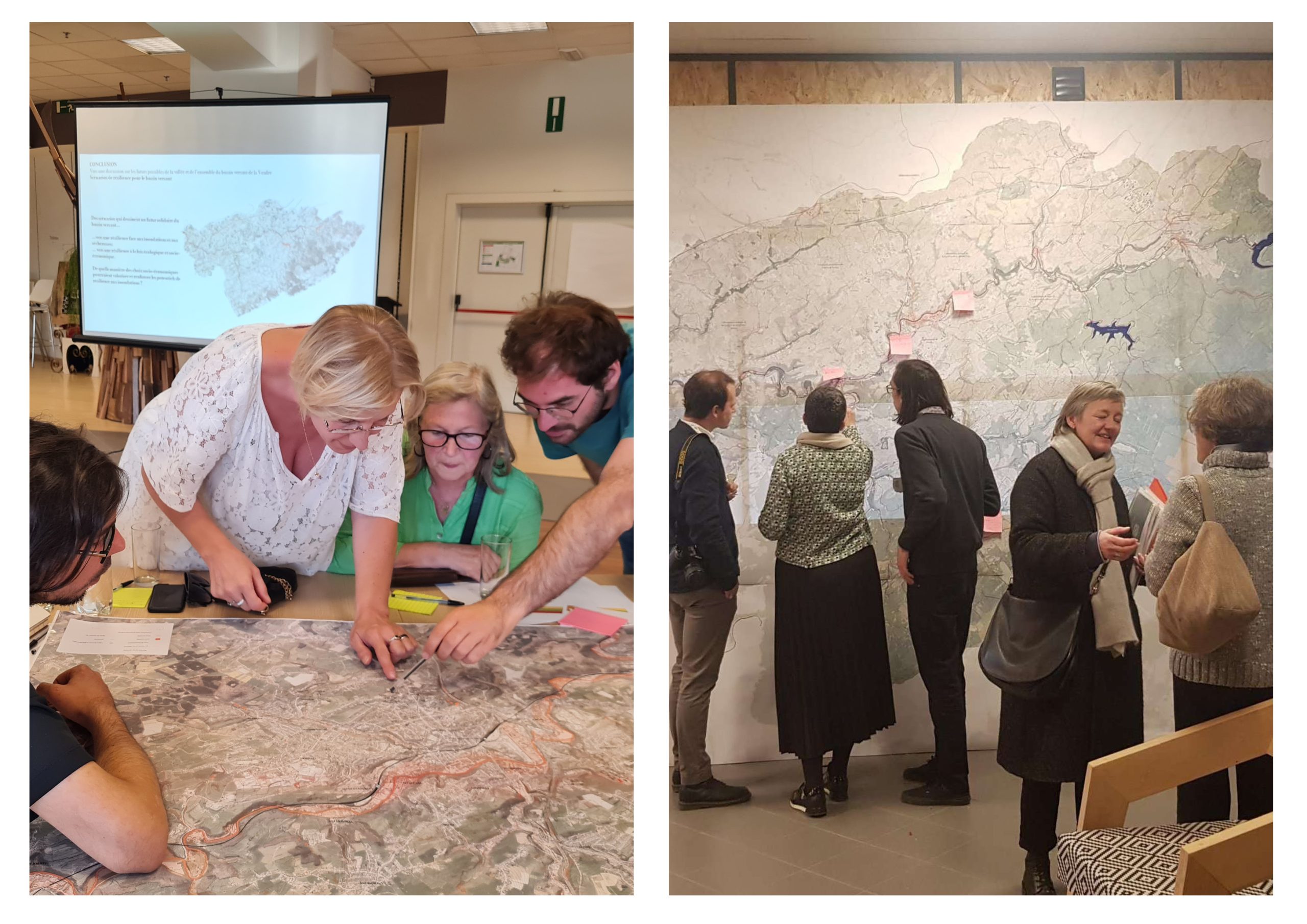
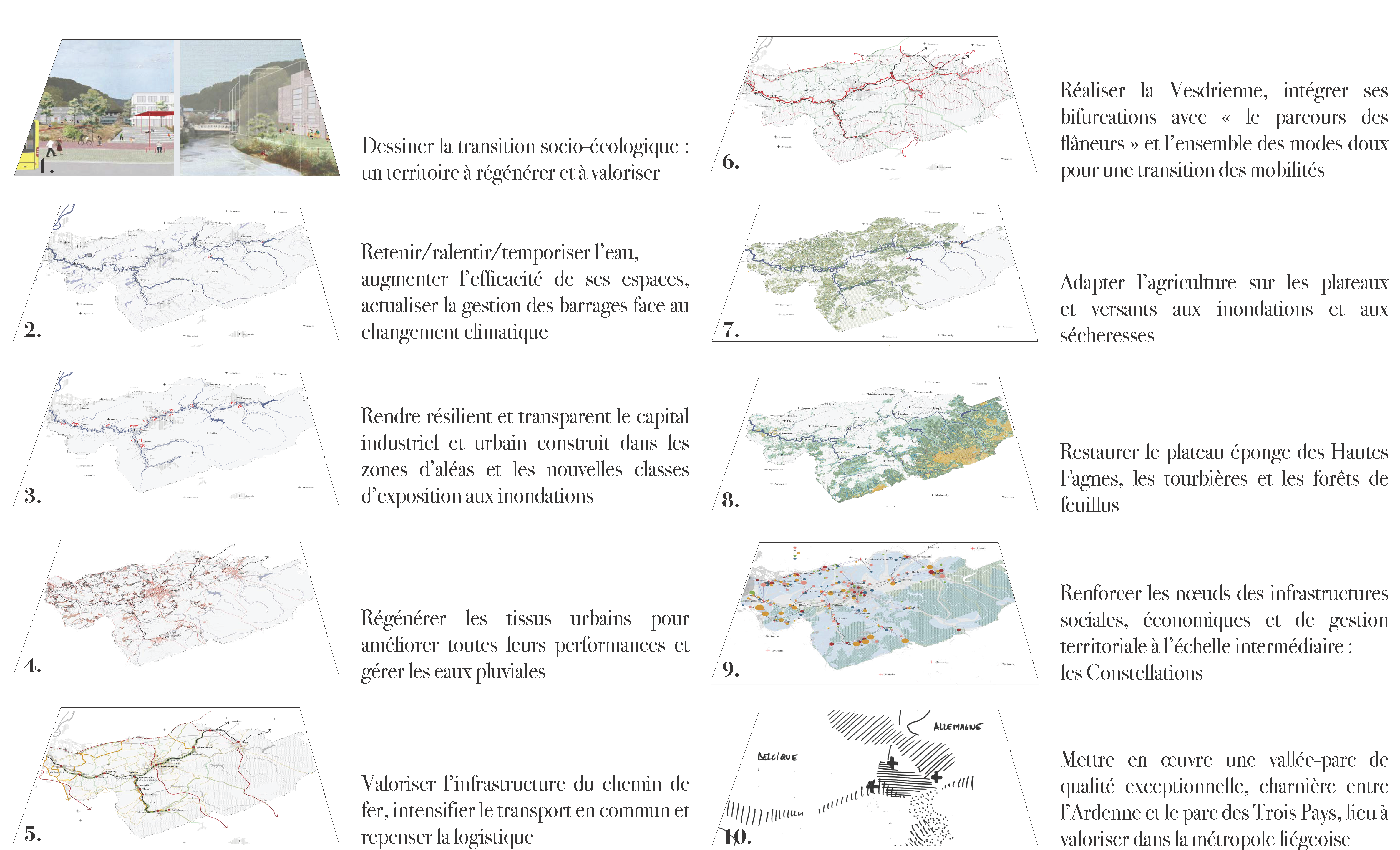
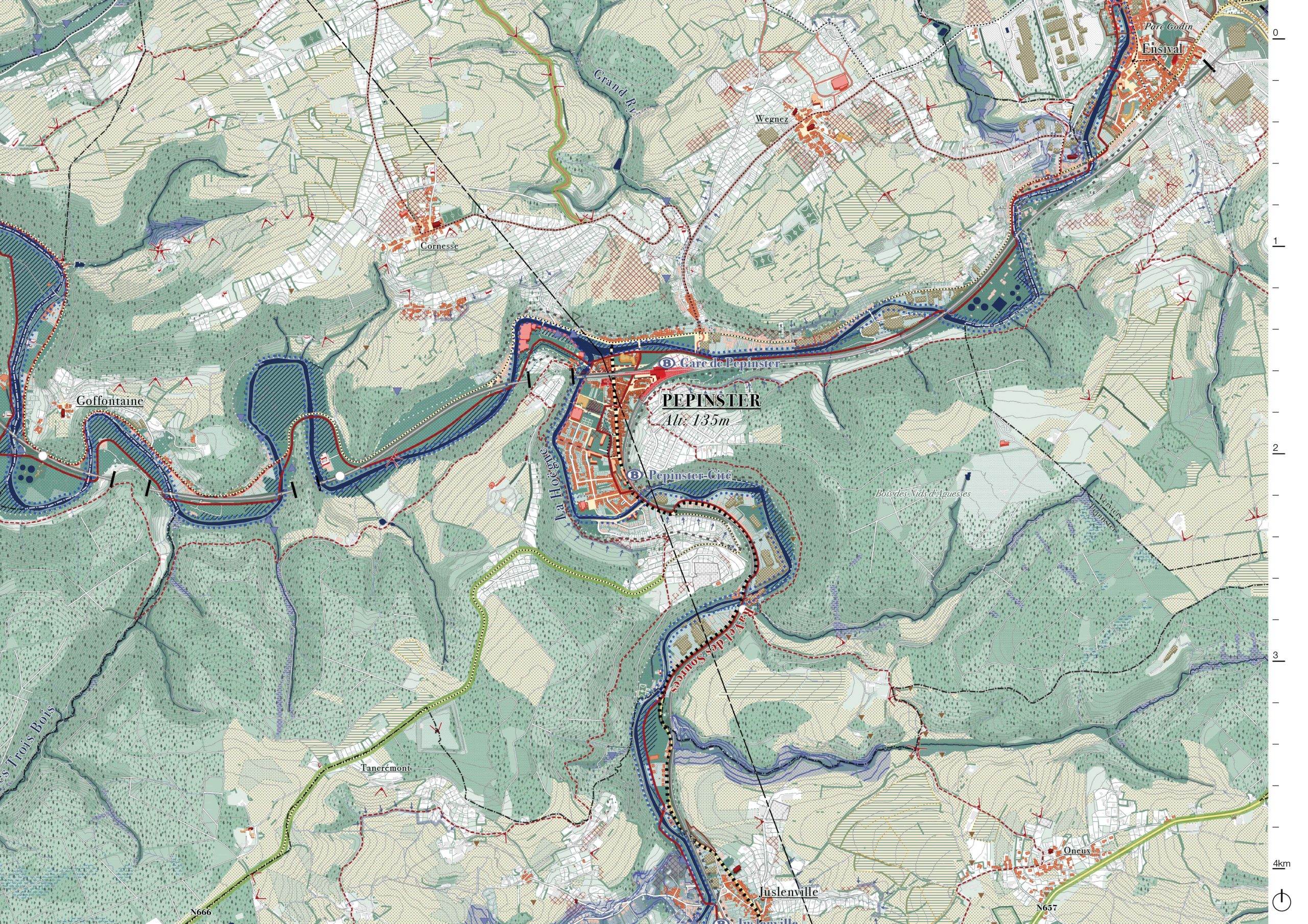
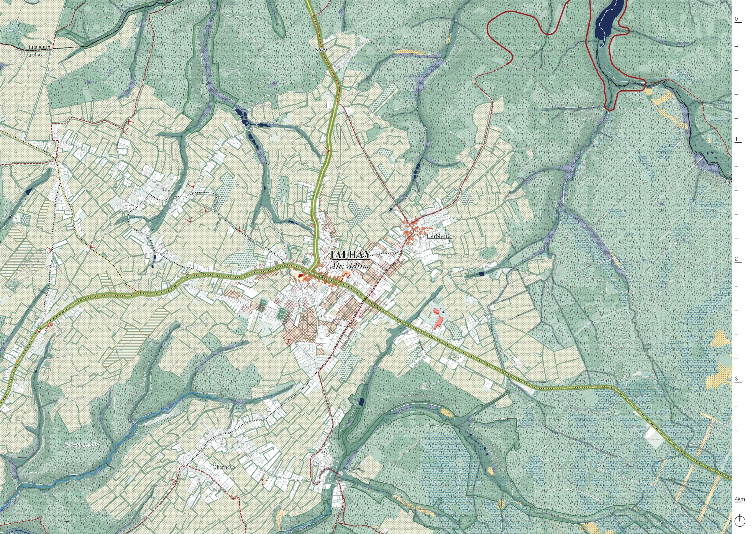
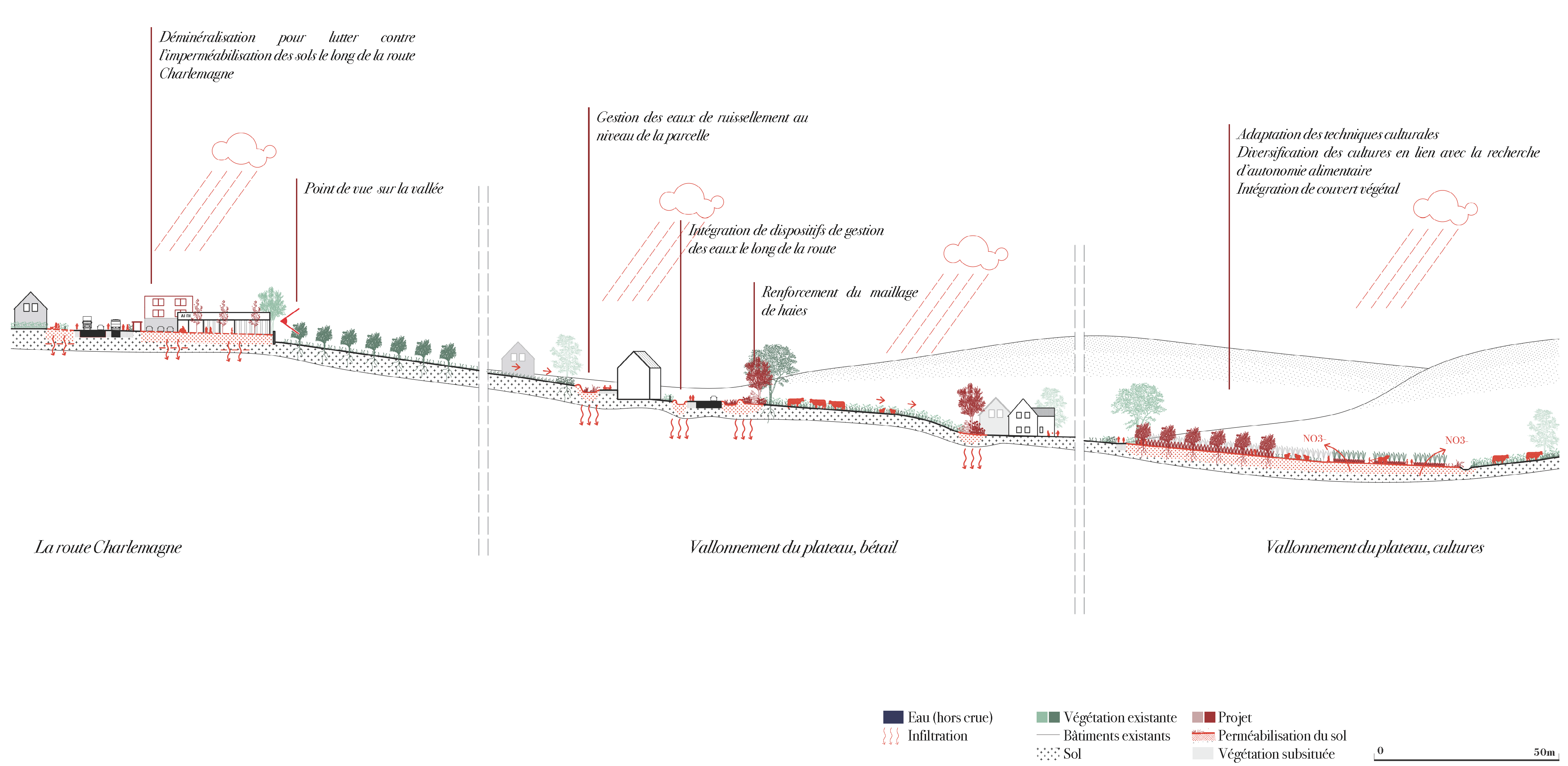
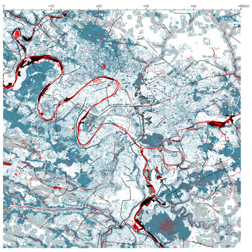
The objectives of the strategic plan are to envisage the future of the watershed composed by 25 municipalities, by 2050 to face floods and the challenges that climate change imposes on us. It also aims to address the future of the watershed in terms of quality of life, biodiversity and living together. The search for opportunities for economic and social redevelopment is also to be integrated to strengthen this territory. The strategic plan is structured according to 10 points that define the vision and mark the priority strategies to achieve the two fundamental objectives: resilience and solidarity of the watershed. They allow for the organization of a wide range of policies in a non-contradictory but coherent way: around climate change, mitigation, and adaptation (both for floods and drought), but also resilience and economic and social solidarity, with an enhancement of the natural and cultural
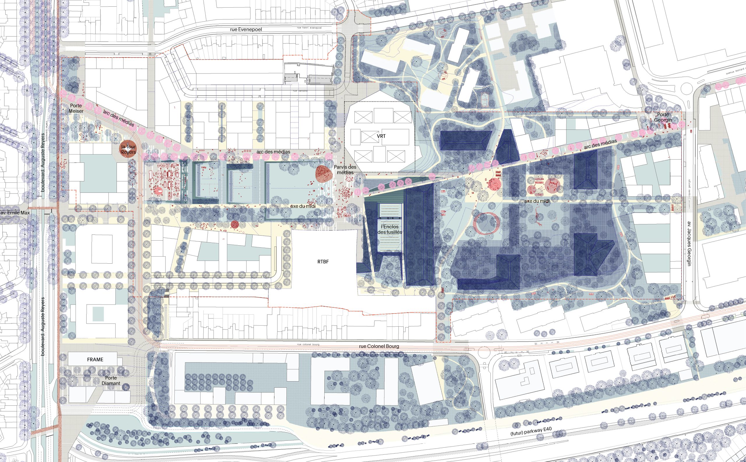
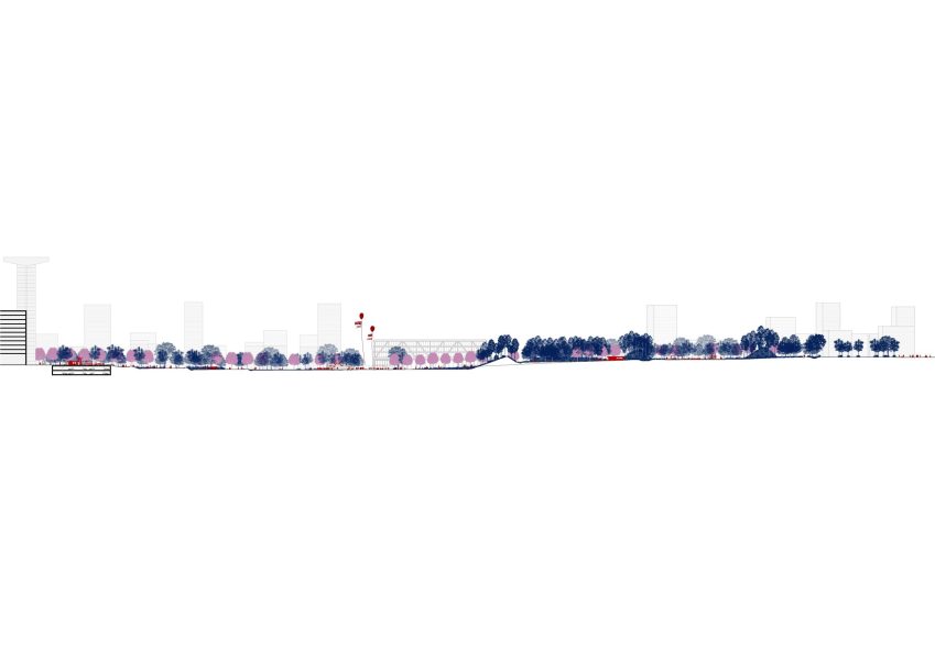
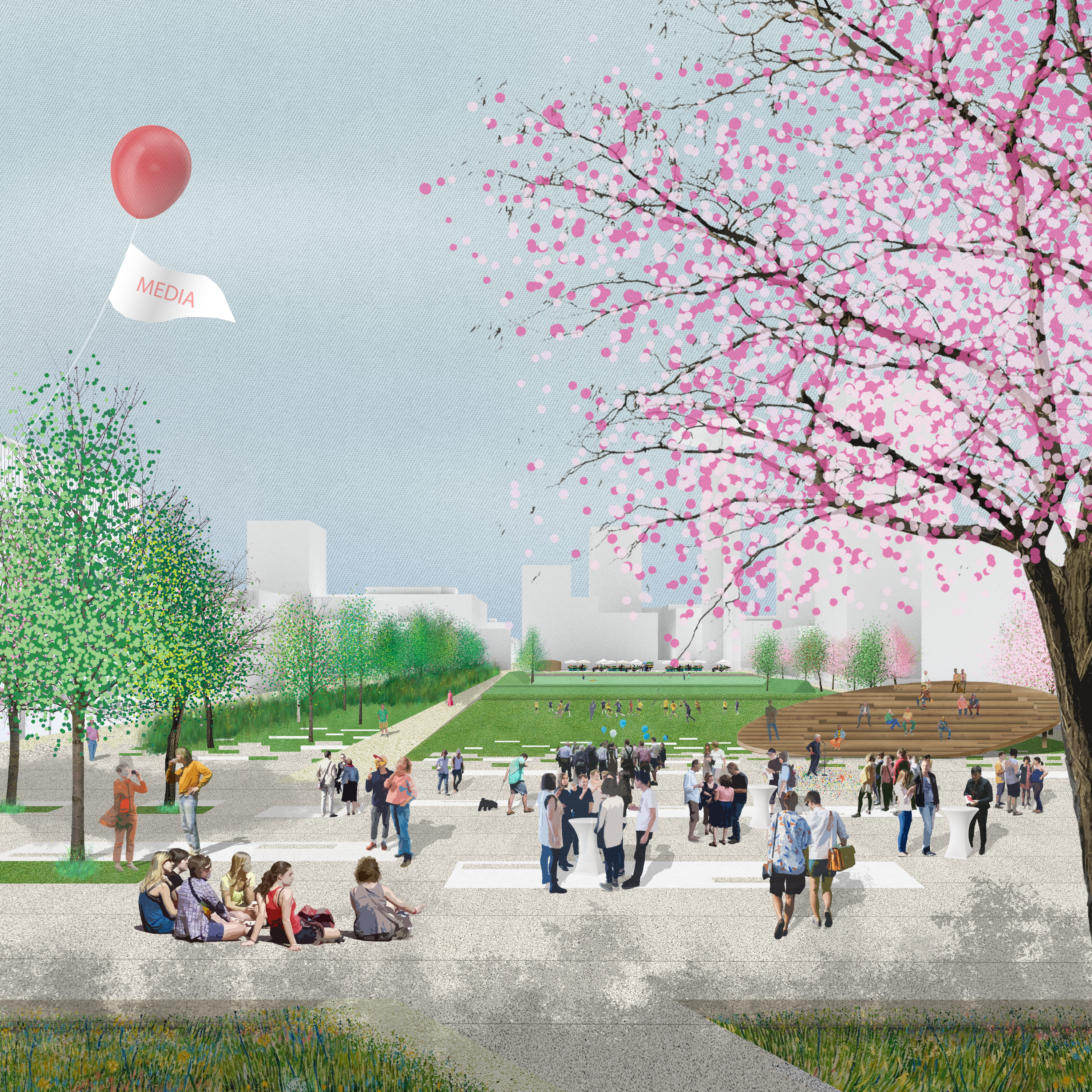
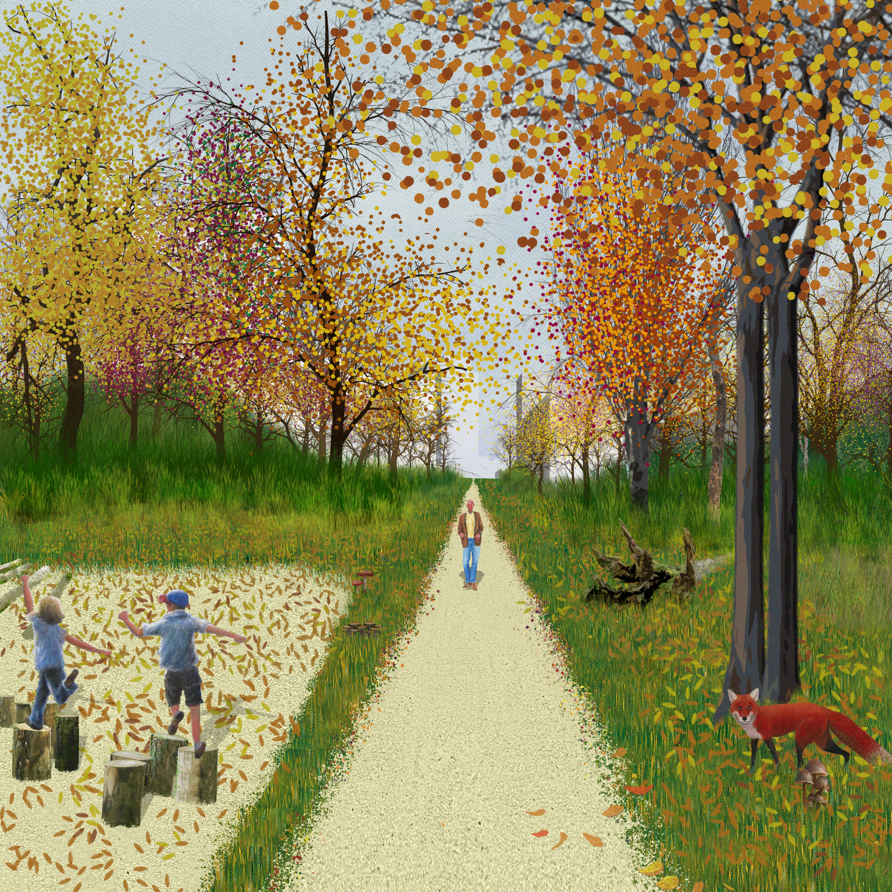
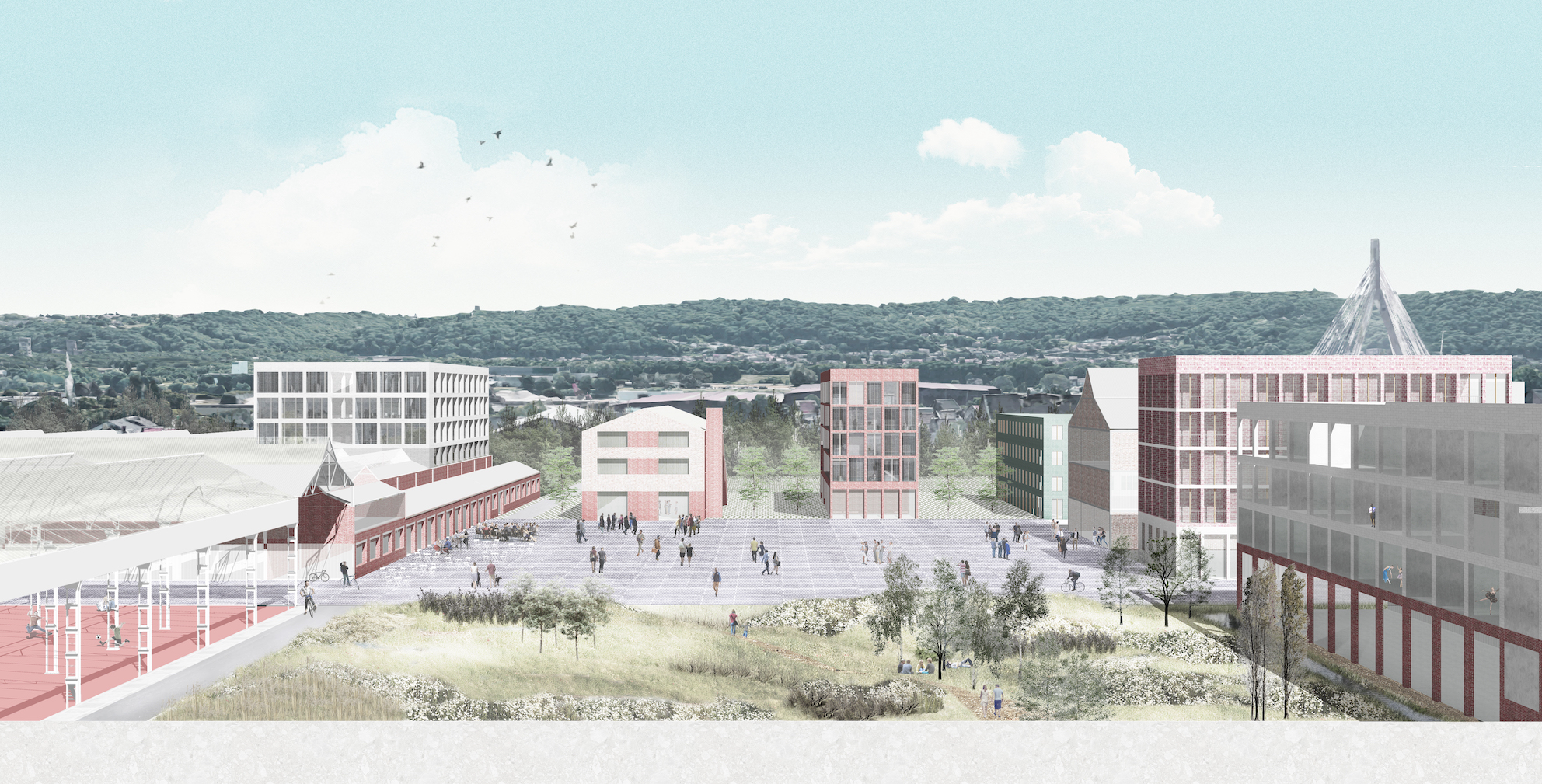
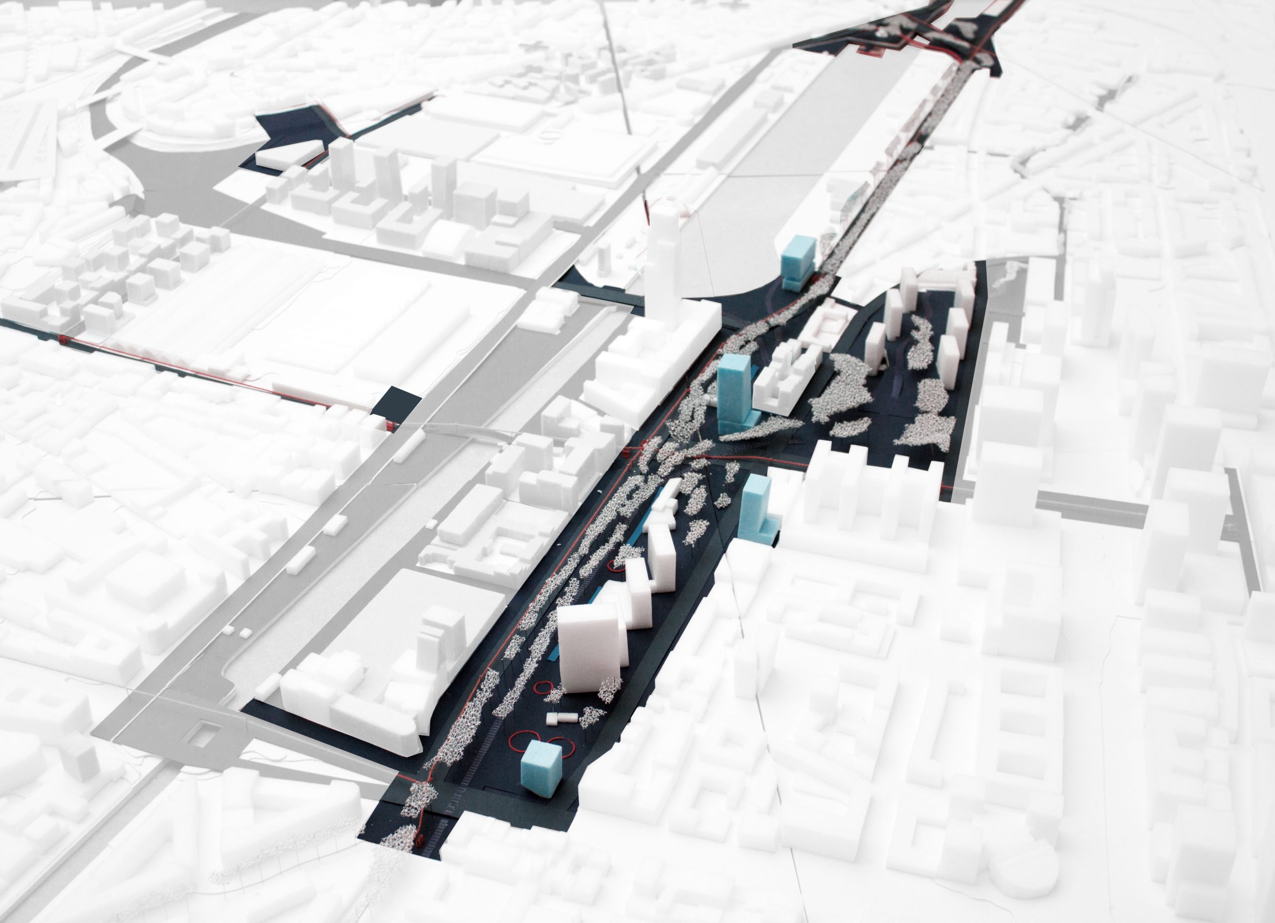
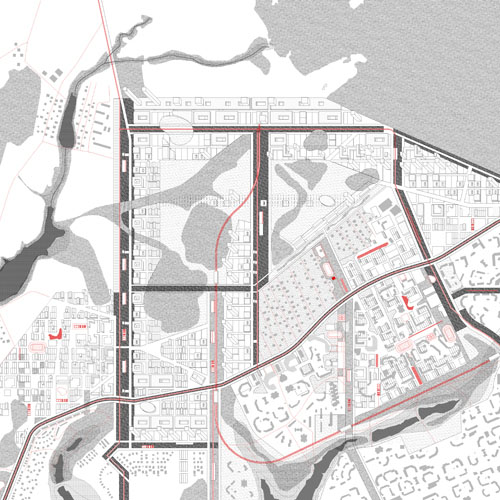
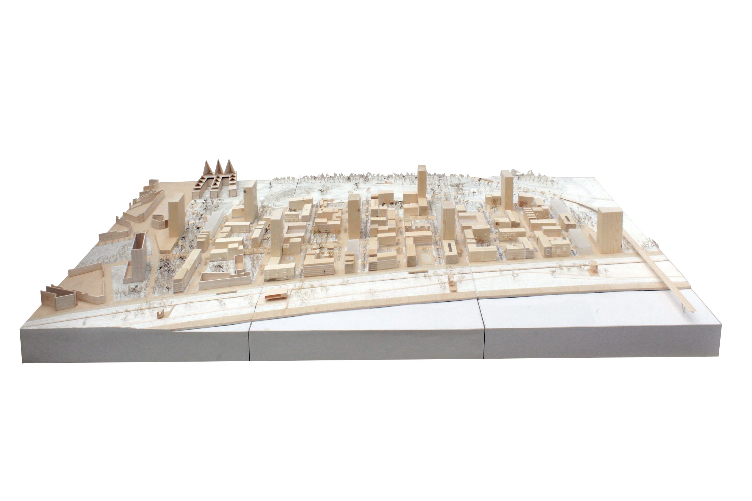
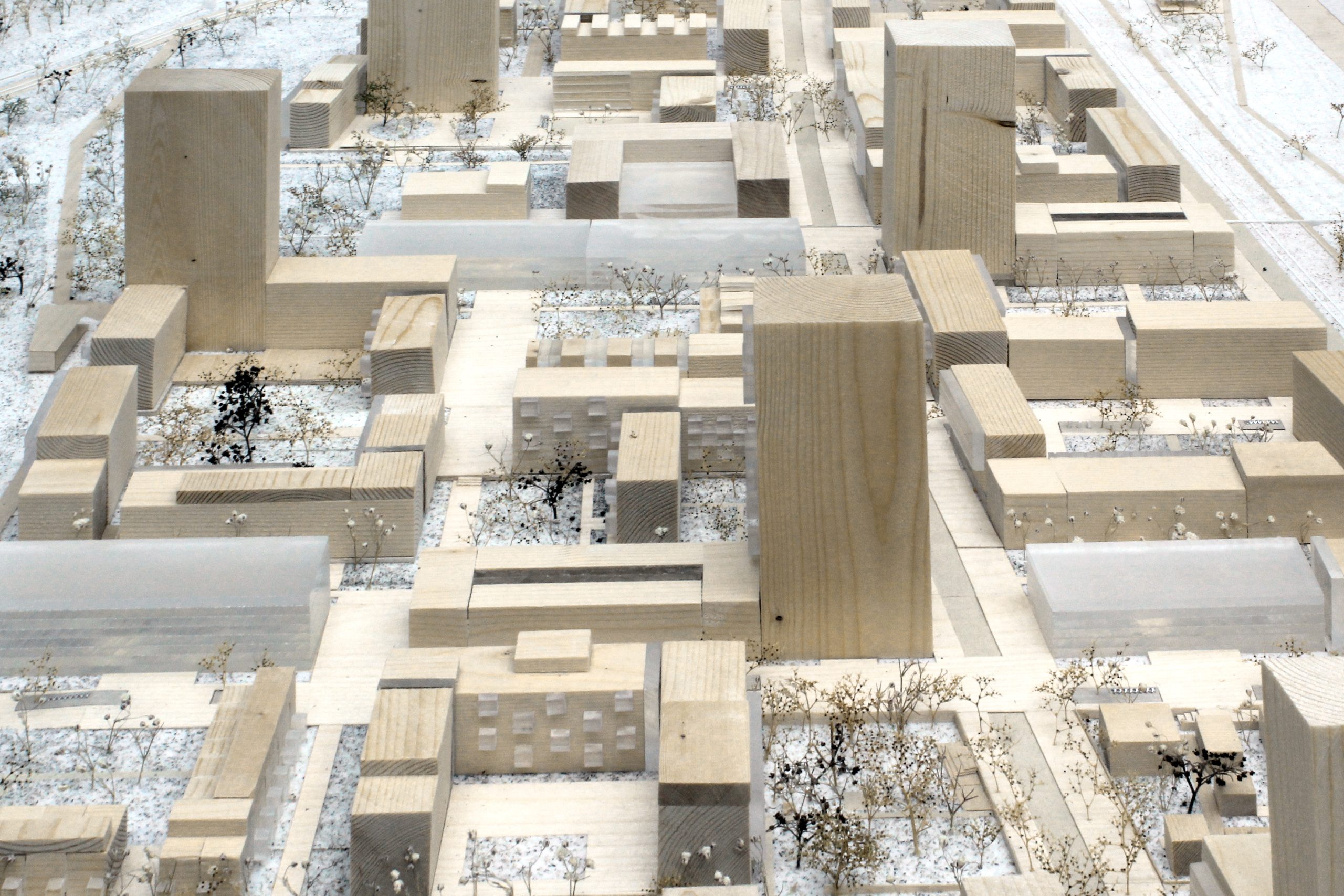
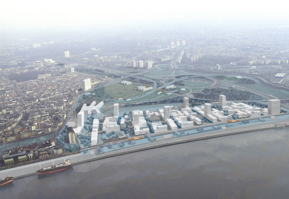
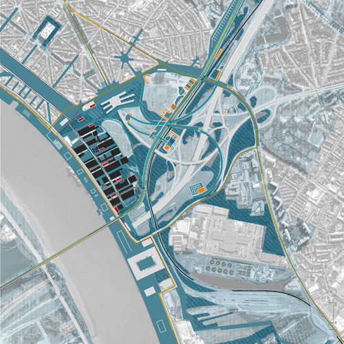
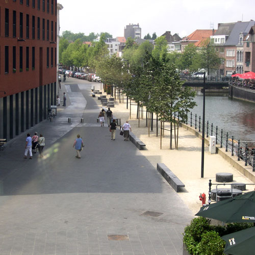
Mediapark
Brussels, BE
2022
Client: Beliris (Federal government and Brussels capital region), SAU (the urban development society of the Brussels capital region)
Program: Landscape design / public space design
Team: StudioPaolaViganò + FALLOW + EGIS
In collaboration with: Plant en Houtgoed, ARA (Atelier Ruimtelijk Advies), a.g Licht, Yellow Window
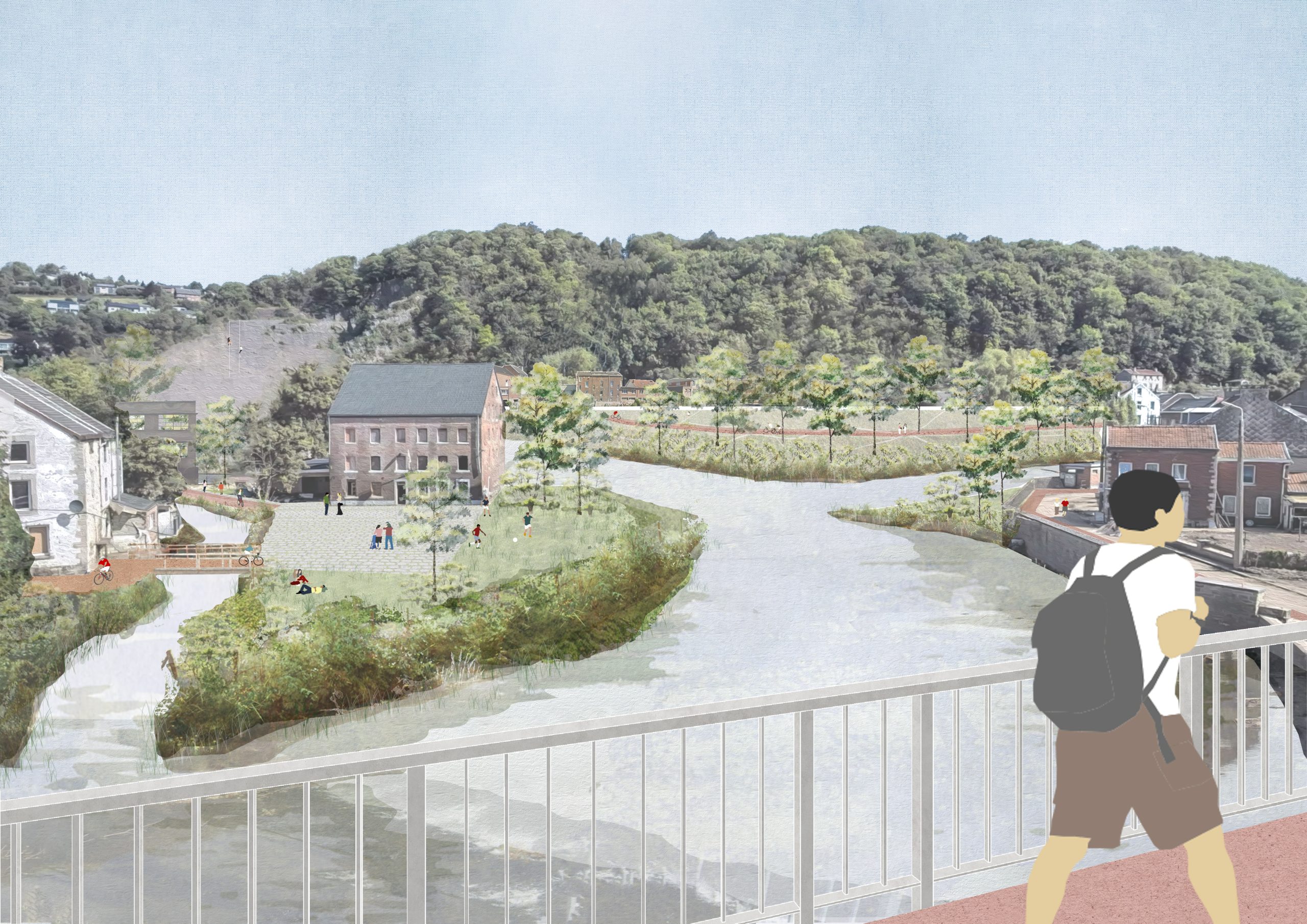
Lying between Chaussée de Louvain, Boulevard Reyers and the Liège motorway (E40) and connected by the public transport hub of Meiser and Diamant, Mediapark is one of the major strategic development of the capital region, where a cluster of some 382,000 m² new program, including 1,600 homes and related services and facilities (shops, schools, nurseries, etc.) and the development of a 30,000 m² site to accommodate 5000 workers from new businesses in the media sector and other measures. After the masterplan (2018), the design team won the design of the public space through a 2-stage international competition in 2022.
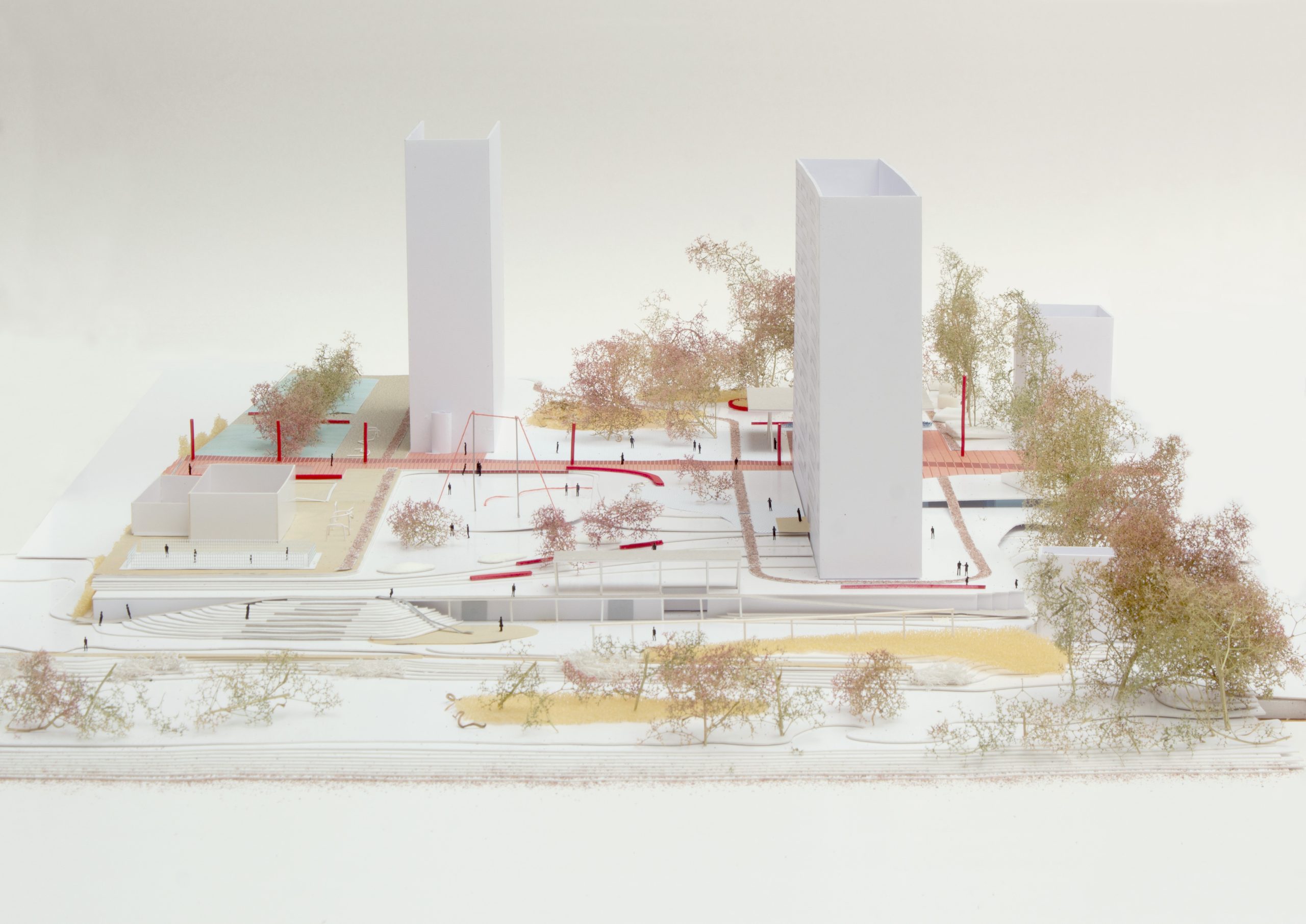
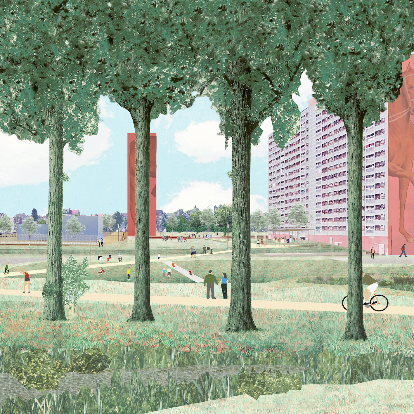
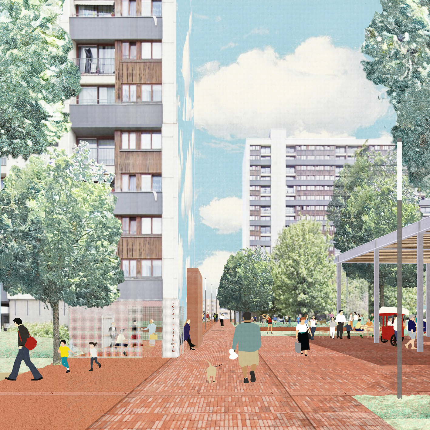
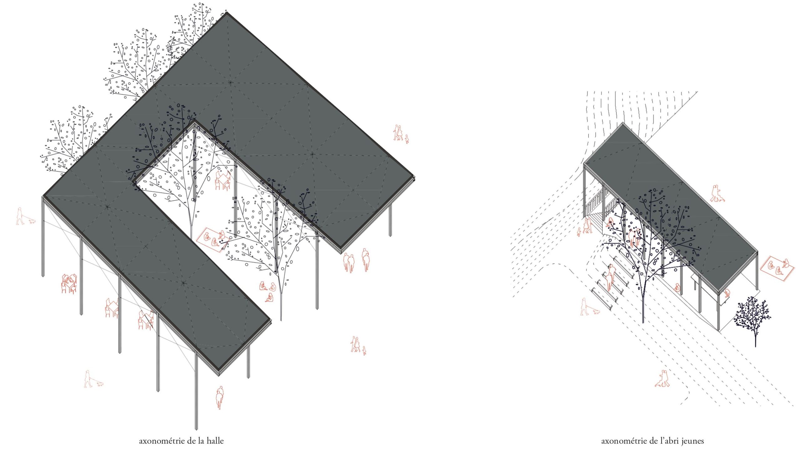
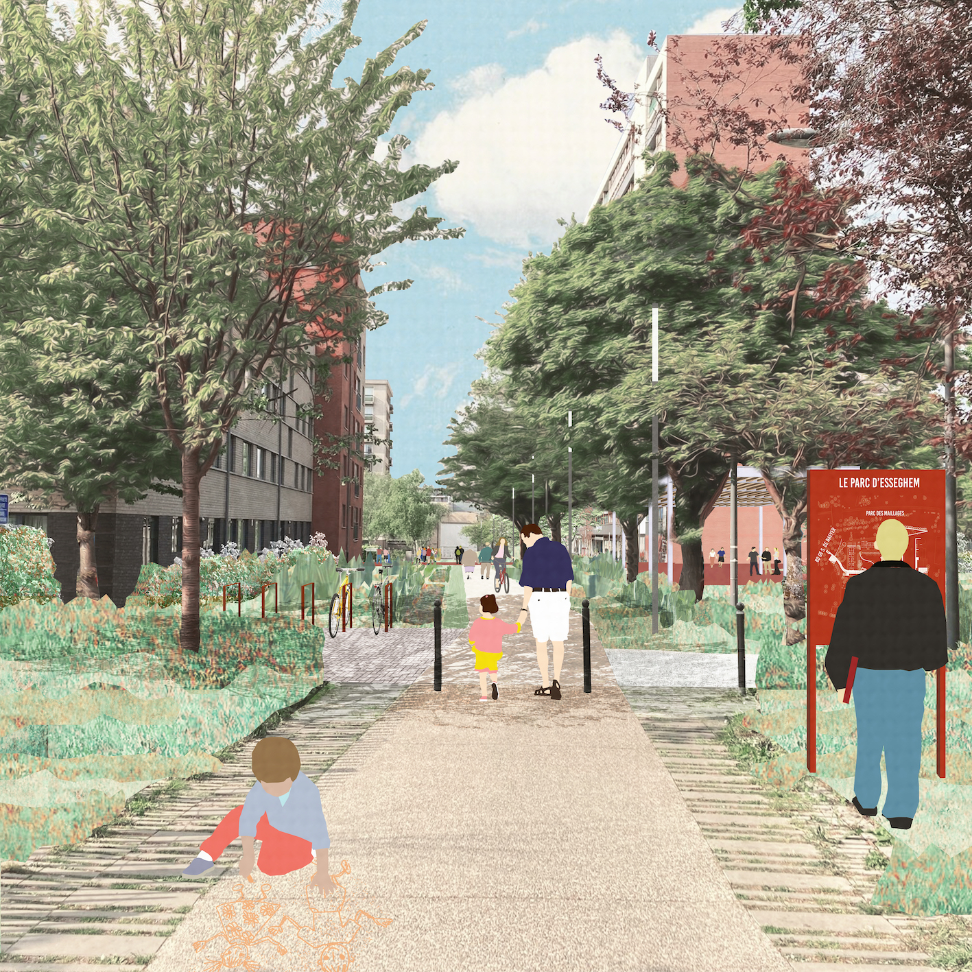
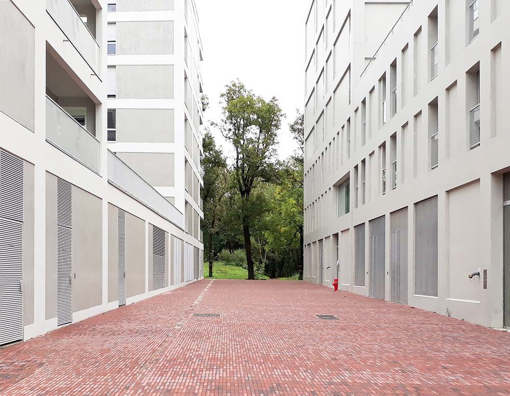
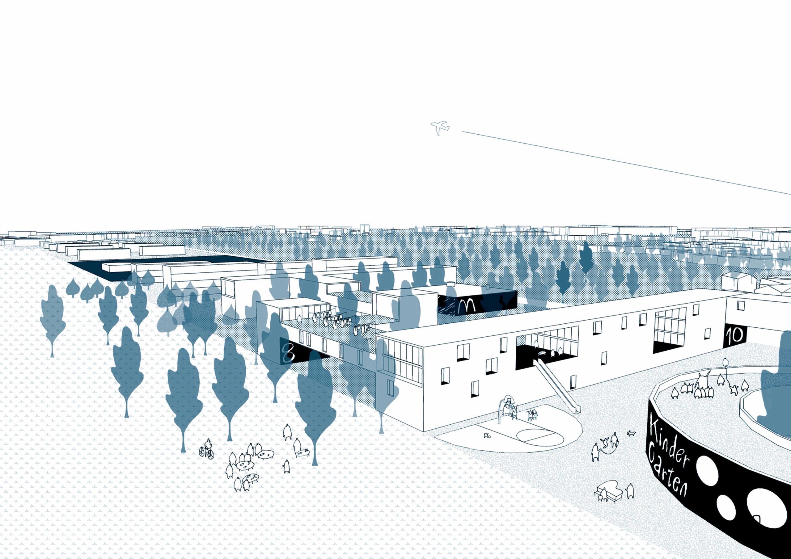
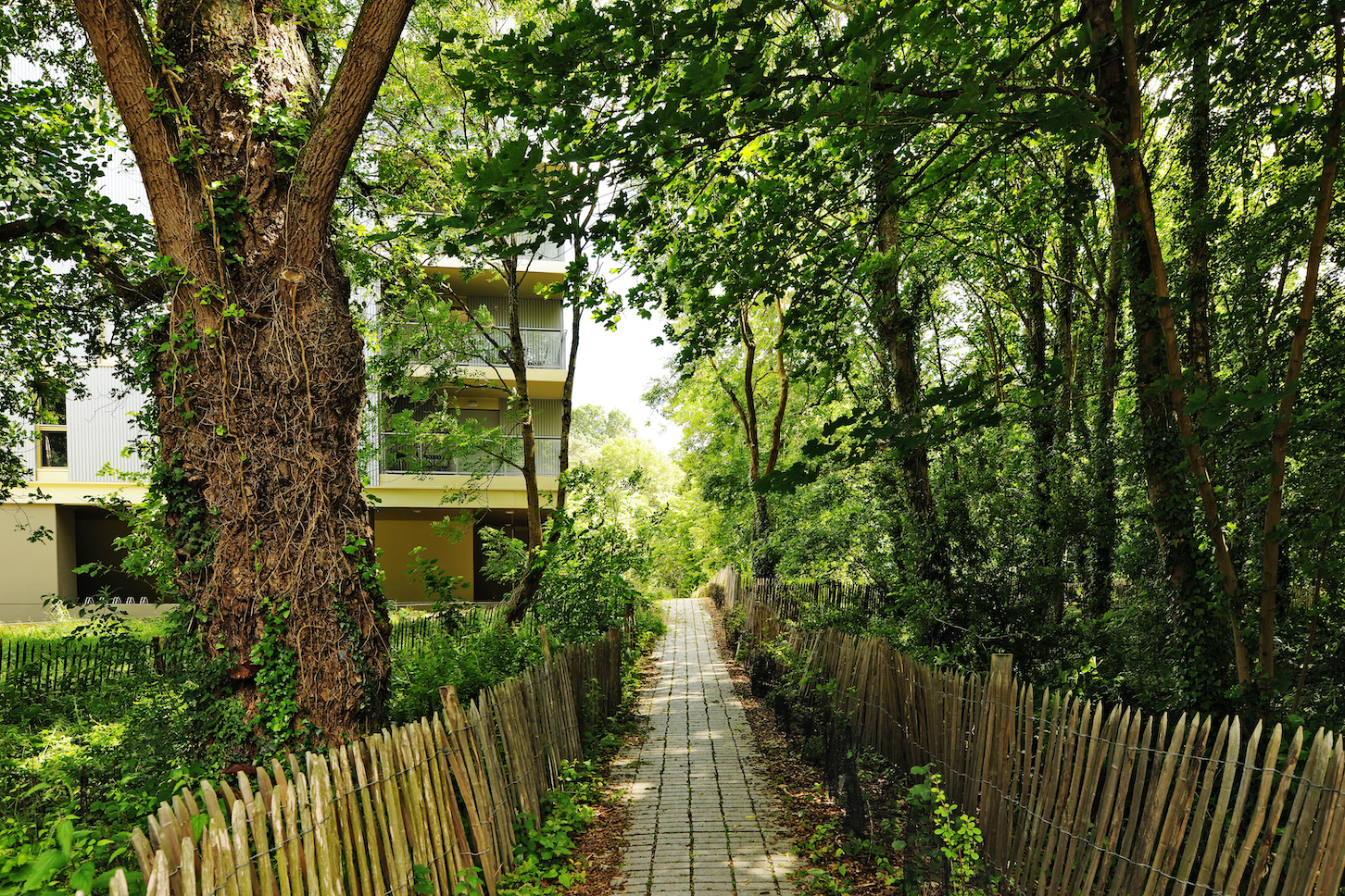
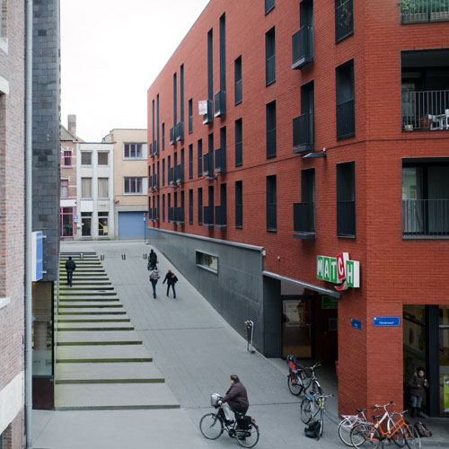
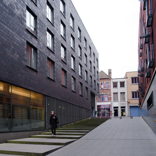
Esseghem
Brussels, BE
2021/…
Client: Commune of Jette, within the framework of the Sustainable Neighbourhood Contract Magritte
Program: Public space
Team: Bertrand Plewinski, Mathilde Meurice, Nathan Fredrick
In collaboration with: EGIS ville et transport, Cluster landschap & stedenbouw, Yellow Win
In the 1960’ and 1970’, modern architects constructed a neighbourhood of 600 dwellings in 4 ‘bars’ in the valley slopes of an old industrial site. The project arose with the generous ambition to become an inhabited park. Nevertheless, it remained a promise, the reality is an enclaved neighbourhood, constricted in its borders, inhabited by cars. Through the gaze of Magritte, after whom the Sustainable neighbourhood contract was named, we intend to surpass this reality, in which reality becomes object of imagination and imagination can soften the harshness of the condition. The project develops along two gestures. The first is an East-West gesture, a red carpet enrols through the site as a promenade linking the neighbourhood to its urban environment. This red axis grafts the site to important infrastructures and forms the structuring element for activity, enlarging into squares at the hearth of the neighbourhood. The second gesture connects the landscape. A North-South path follows the natural slope of the valley bringing human and non-human through the site along it’s prairies towards the future ‘green network park’ along the railway.
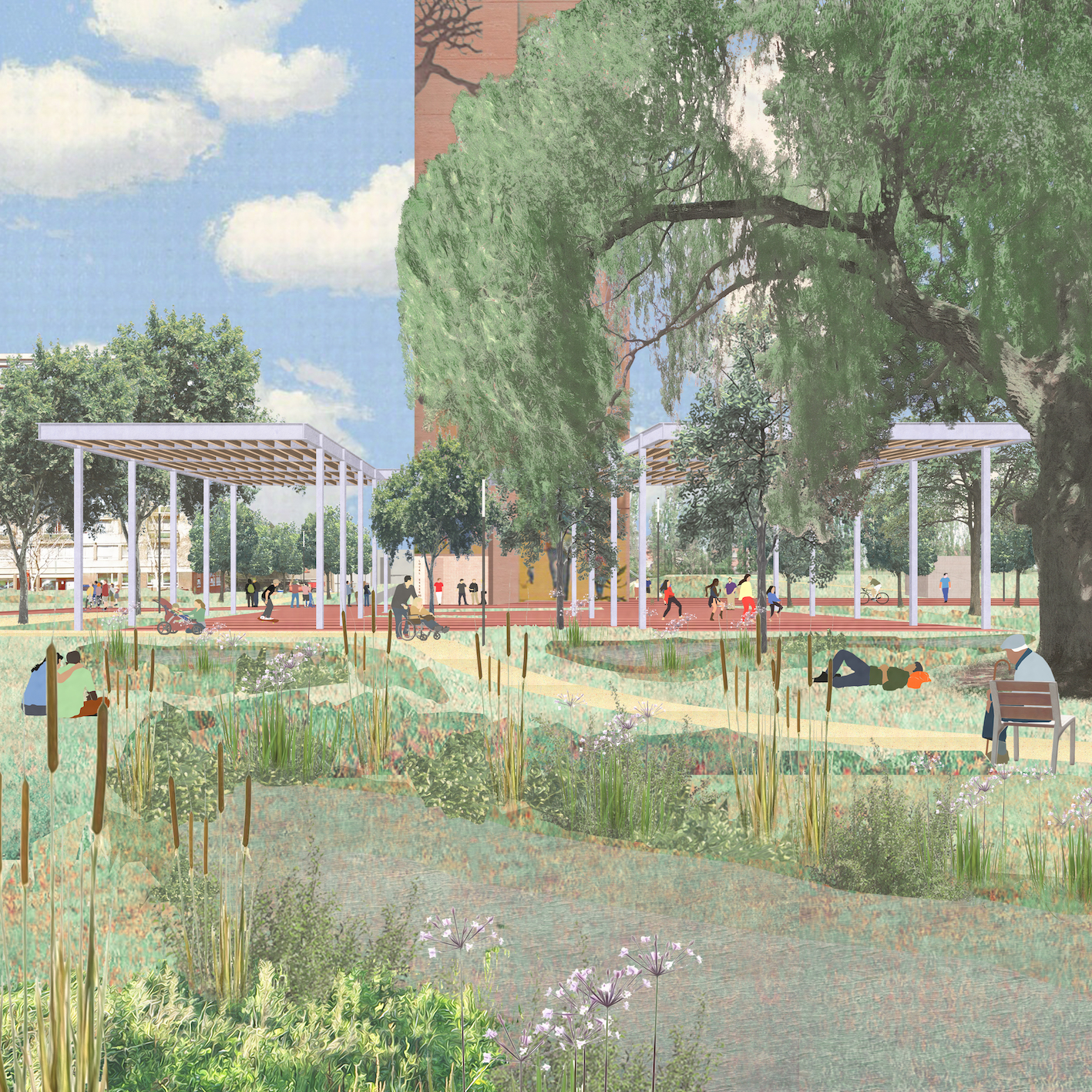
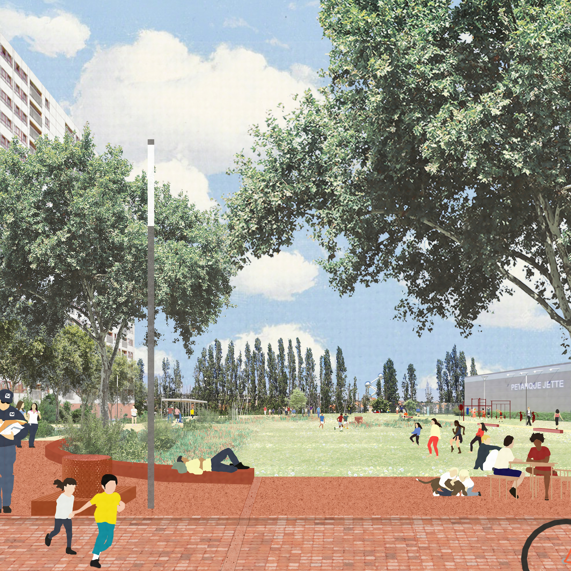
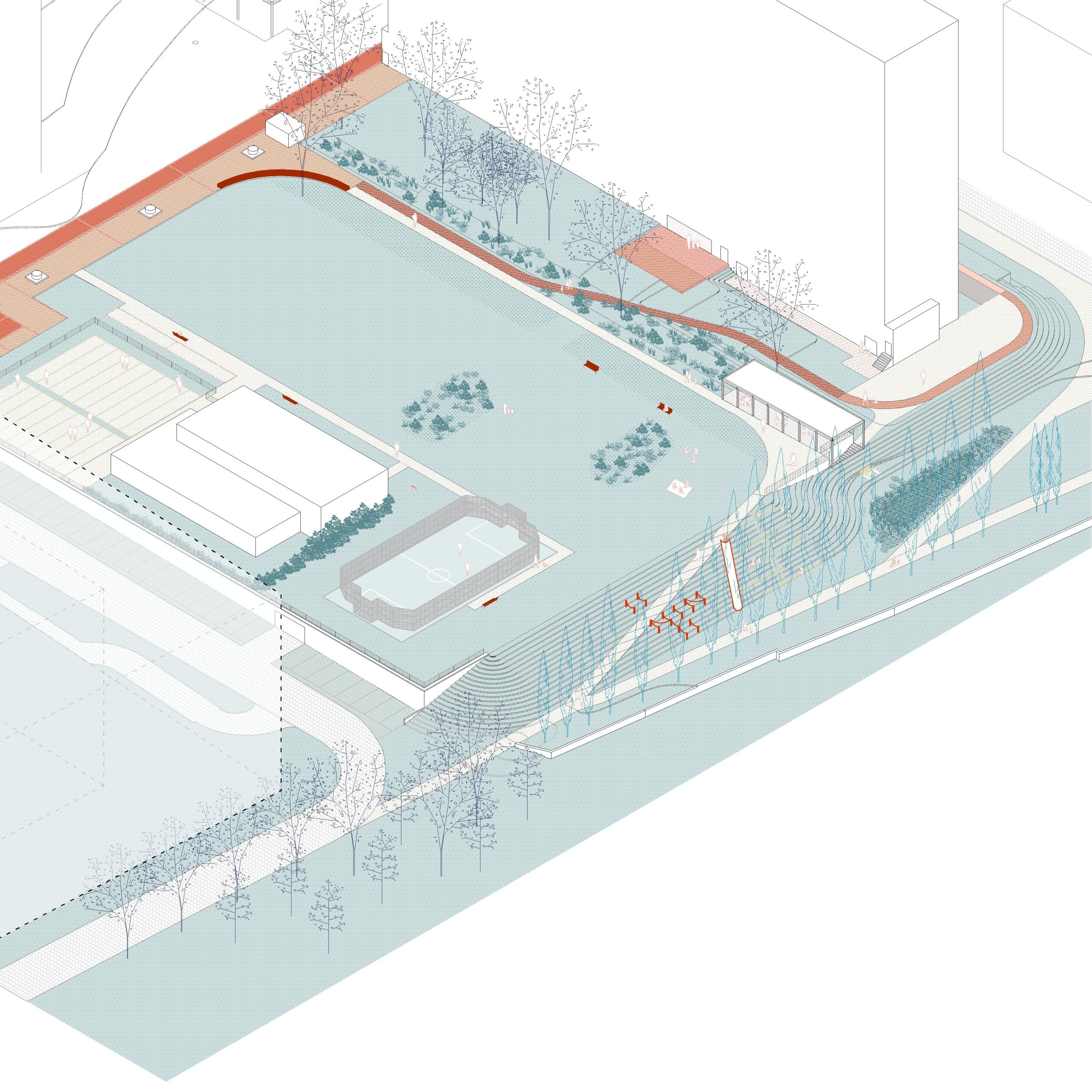
Peterbos
Anderlecht, BE
2020/...
Client: Commune of Anderlecht within the framework of the sustainable district Parvis-Morichar
Program: Public space
Team: Bertrand Plewinski, Manu Vanderveken, Pietro Manaresi, Stefano Gariglio
In collaboration with: vvv architecture, ARA atelier ruimetelijk advies, BRAT
The masterplan describes the vision of the site on horizon 2029, it is intended to guide the coherence of operations carried out in the future in order to connect and open up the park and its inhabitants to the rest of the city. The multiple interventions, in addition to reactivating the plains, aim at giving a strong identity and a better notion of the space for the users It also aims to integrate an exemplary approach in terms of water management and to promote a strong territorial solidarity. Facing the current metropolitan challenges, it rethinks the relief of the Peterbos from its great slope to its microtopography in a systemic and interdependent landscape.
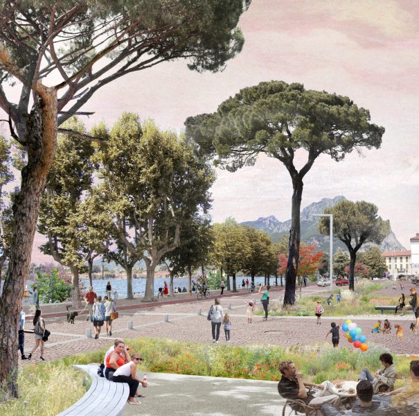
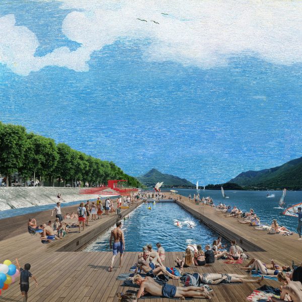
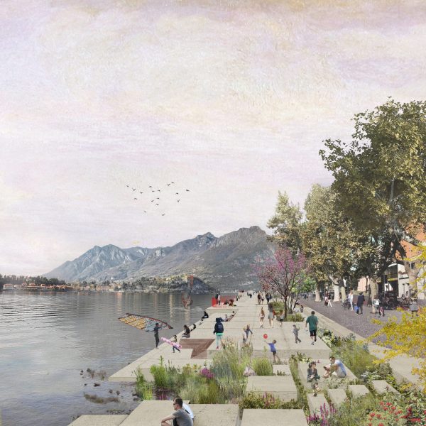
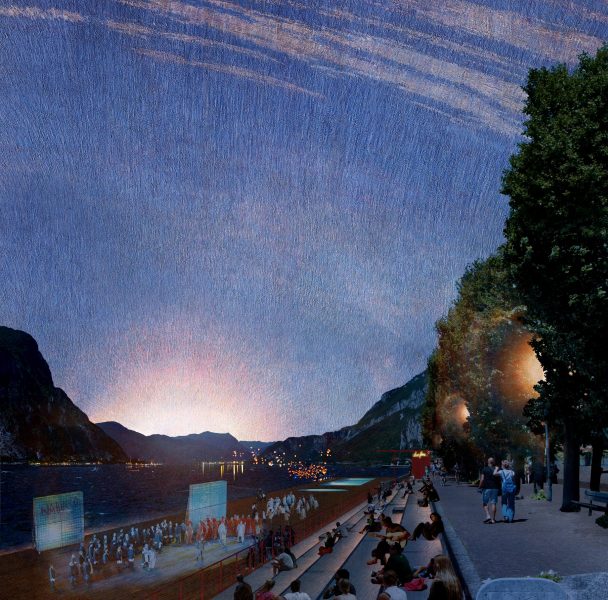
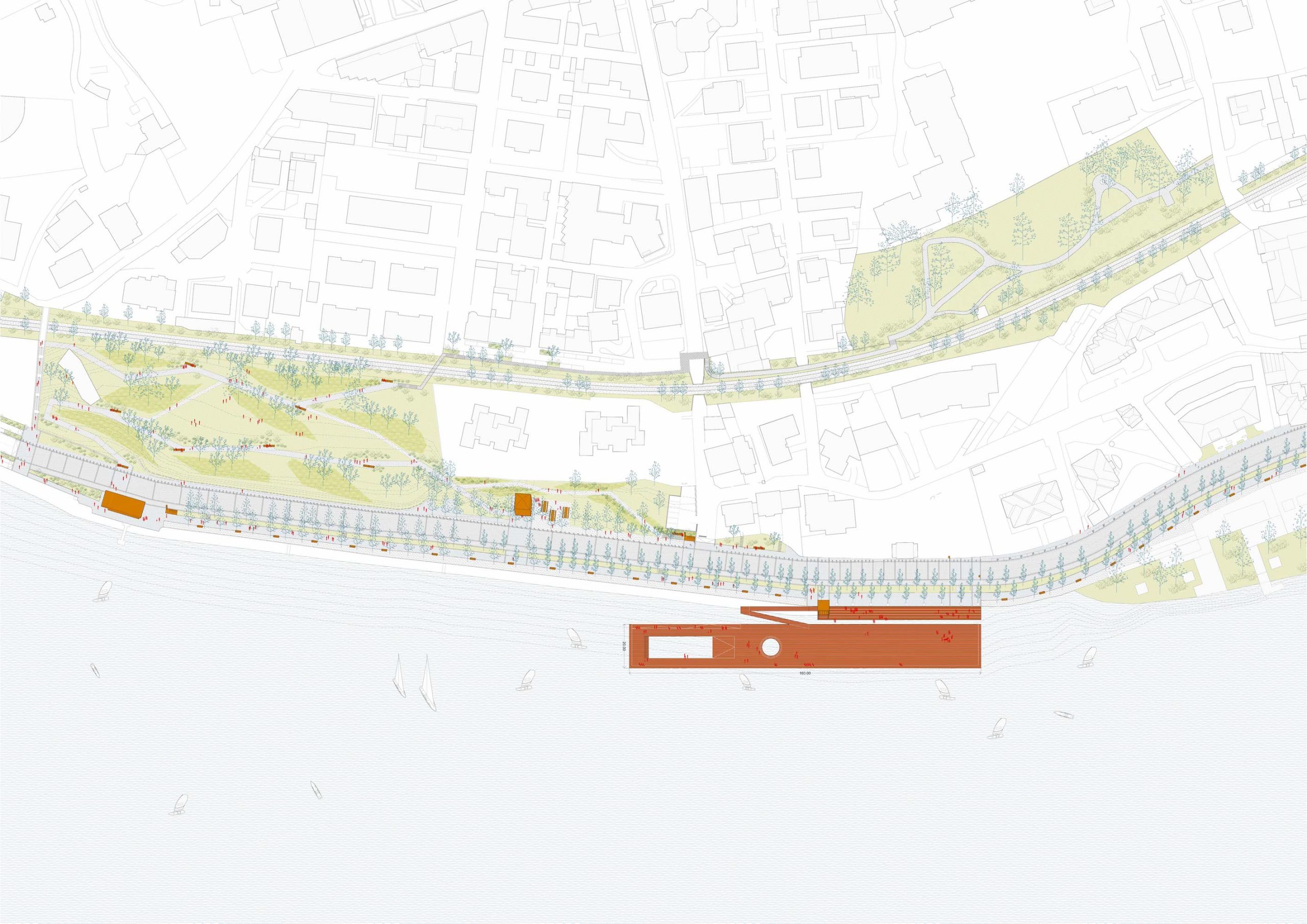
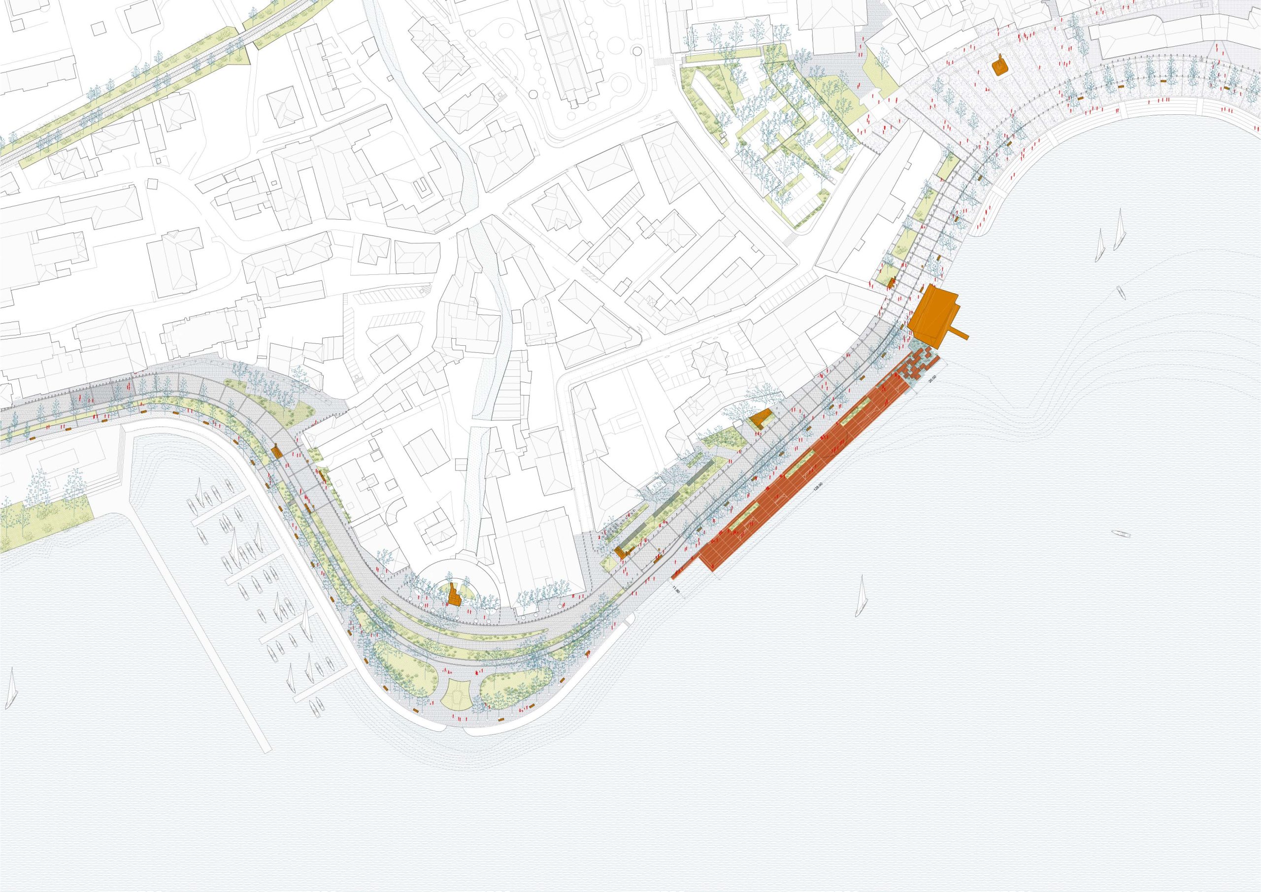
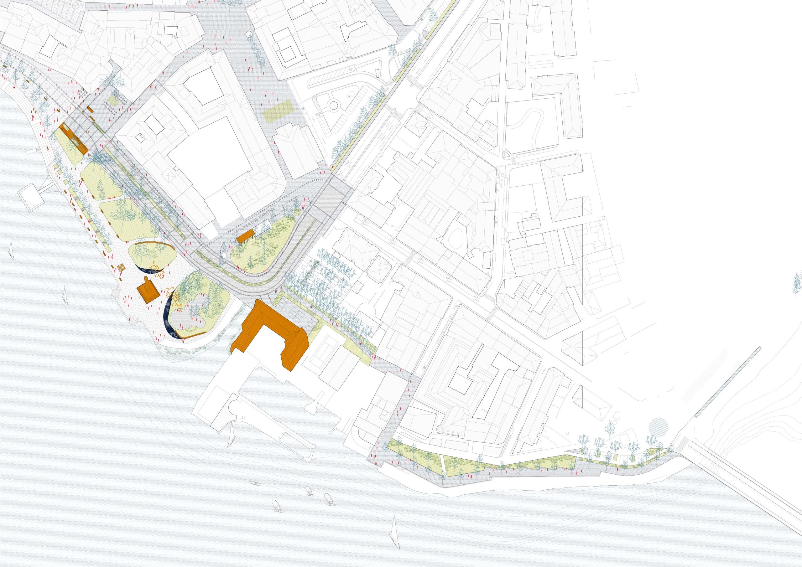
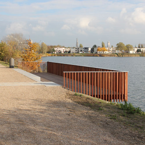
Lecco
Lecco, IT
2019 - 2020 (competition, 1° Prize)
Client: Municipality of Lecco
Program: Preliminary and detailed design, construction
Team: Simona Bodria, Laura Dalla Pietà, Gianluca Masiero, Alessio Tamiazzo, Laura Thierré
In collaboration with: Alpina Spa, Nexteco SRL, Systematica, Ferrara Palladino (lighting design)
The project proposes a new waterfront accessible for everyone, using the ‘thickness’ between the lake and the urban facade and connecting the lake to the city. This is what we call ‘The thickness of the lake’. The task of the project is to rethink this thikness, to enlarge its space, increase its fruibility by citizens and tourists and collect al the differents parts of this space in a coherent urban project. The proposed interventions, arranged within flexible and incremental intervention phases, therefore aim not only to propose new equipment and attractive places on the lake, but to reconfigure the thickness between water and city. The project brings together all the opportunities, including that relating to the progressive revision of car mobility, to rebuild a direct link between the lake and the city and create a new depth on the Waterfront space, extending the attractiveness of its lake to the whole city.
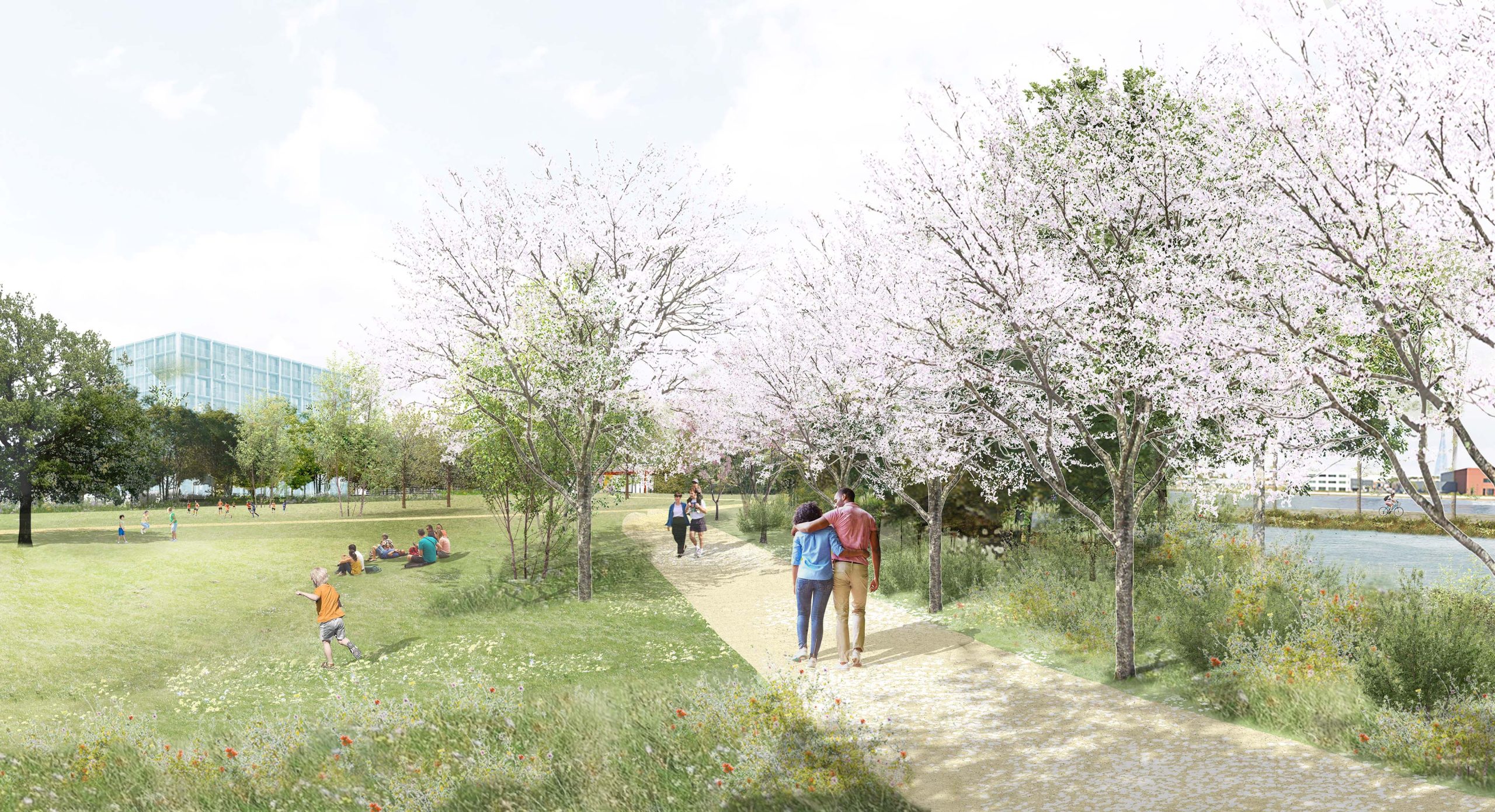
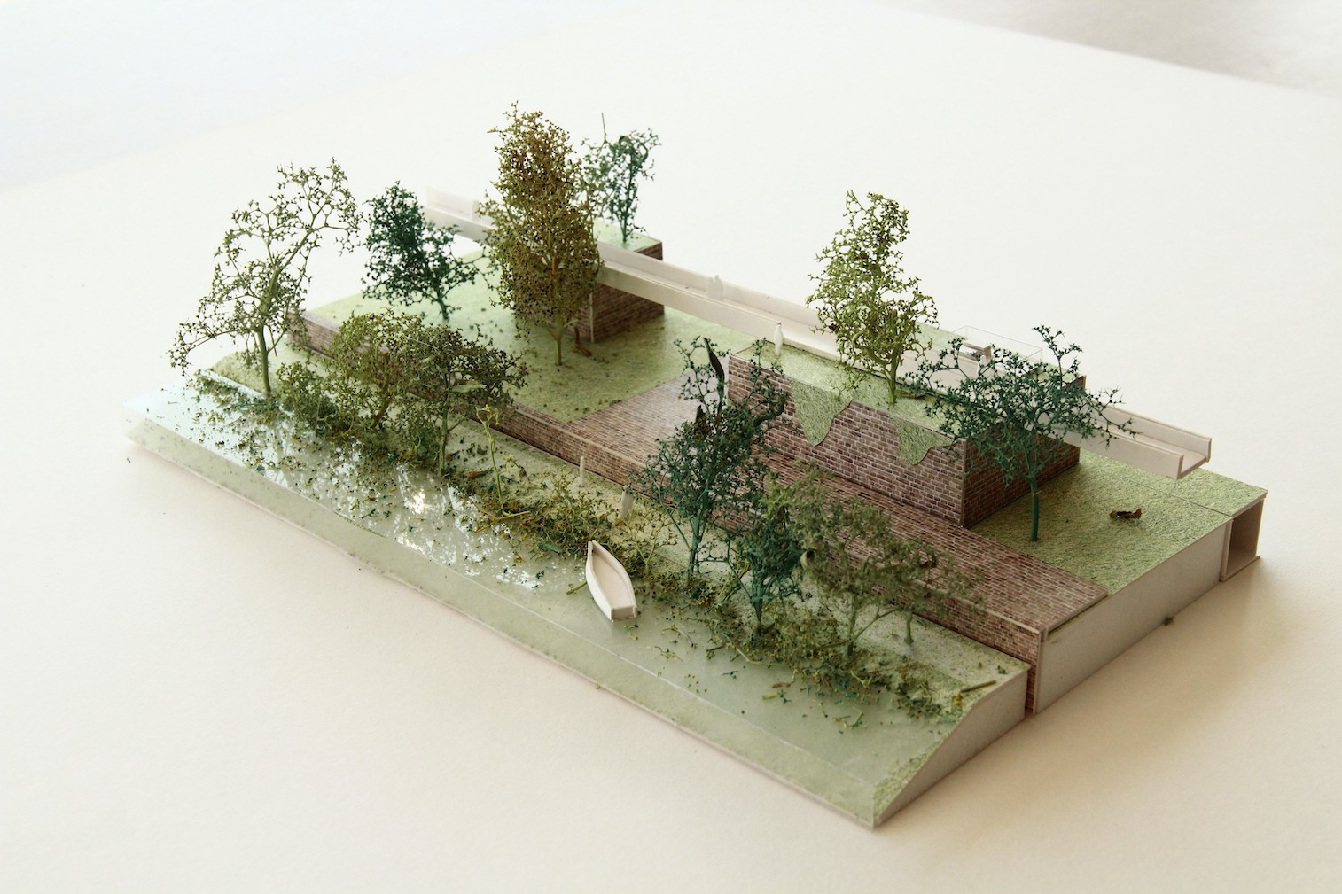
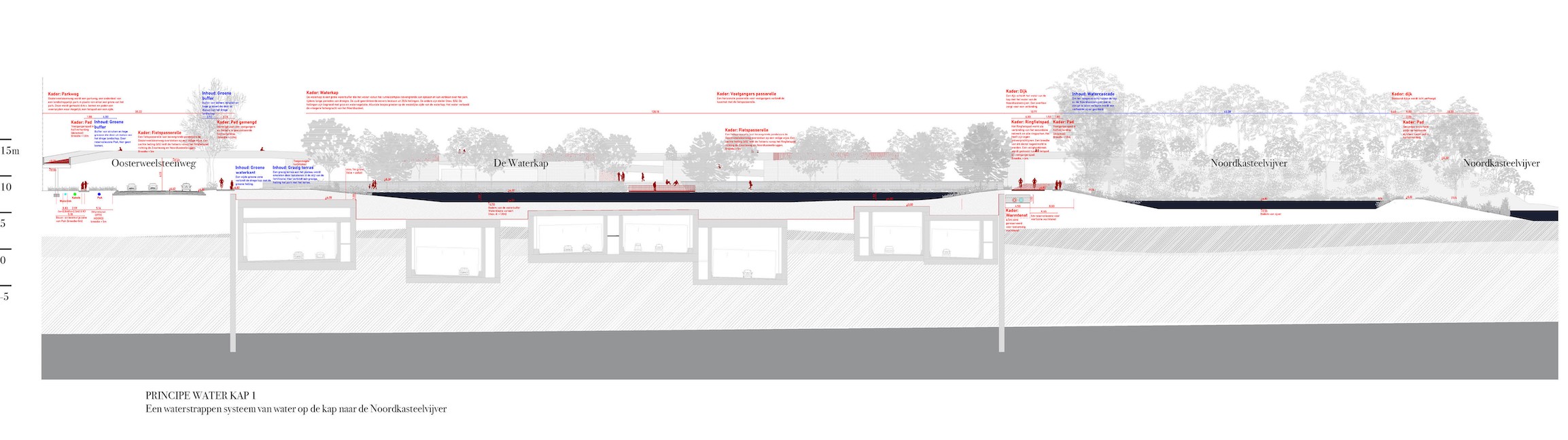
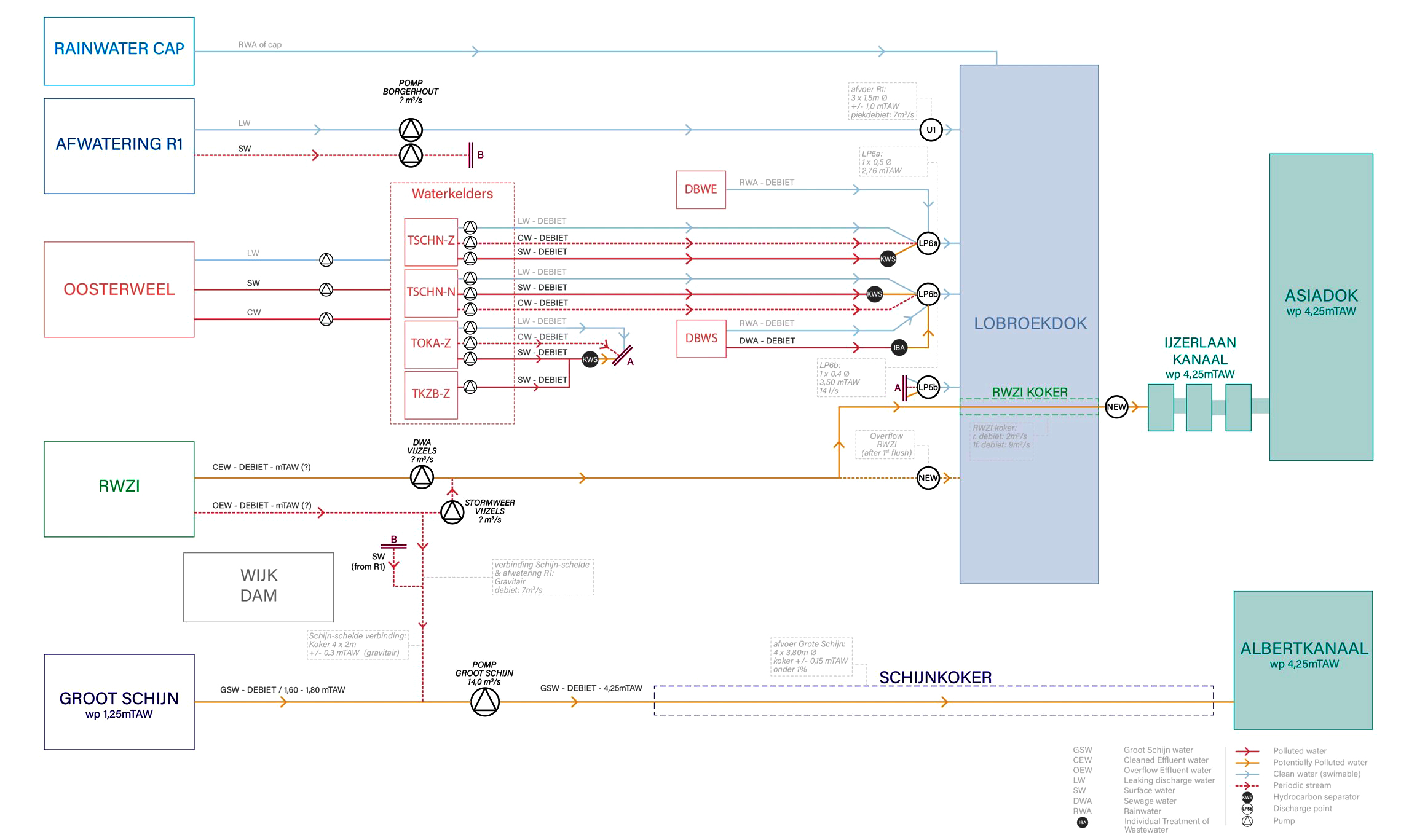
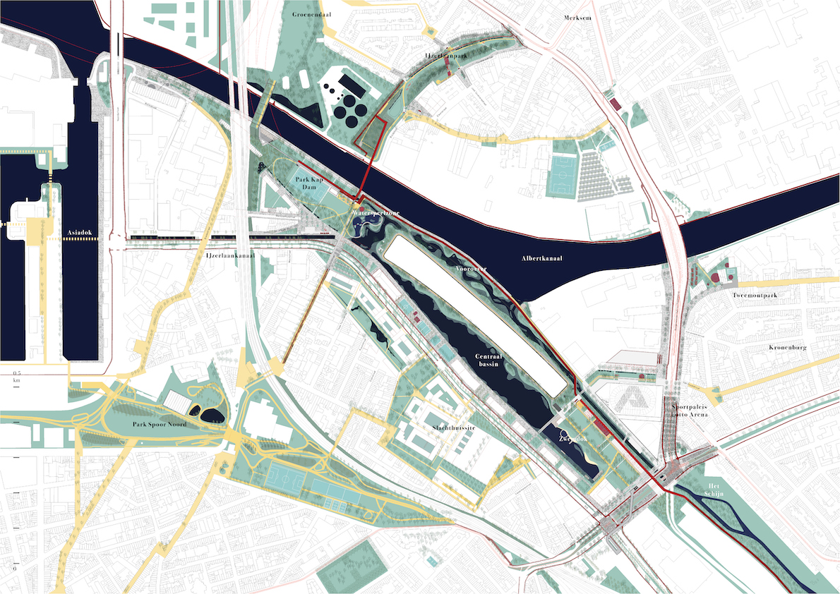
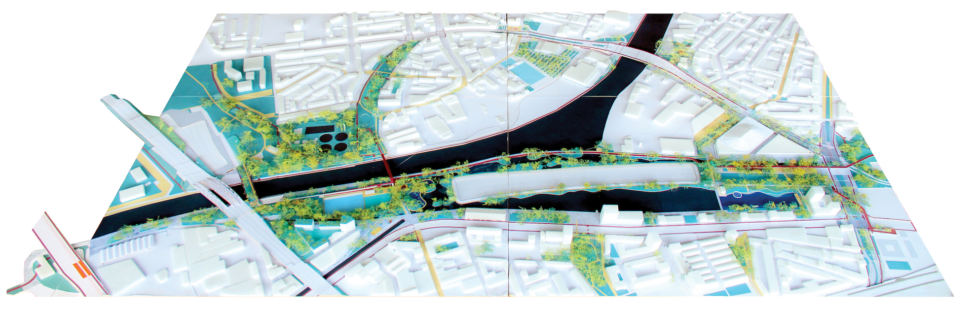
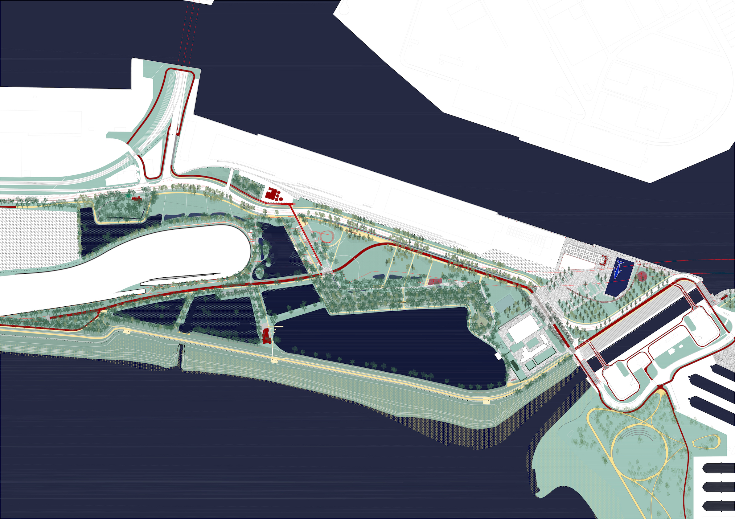
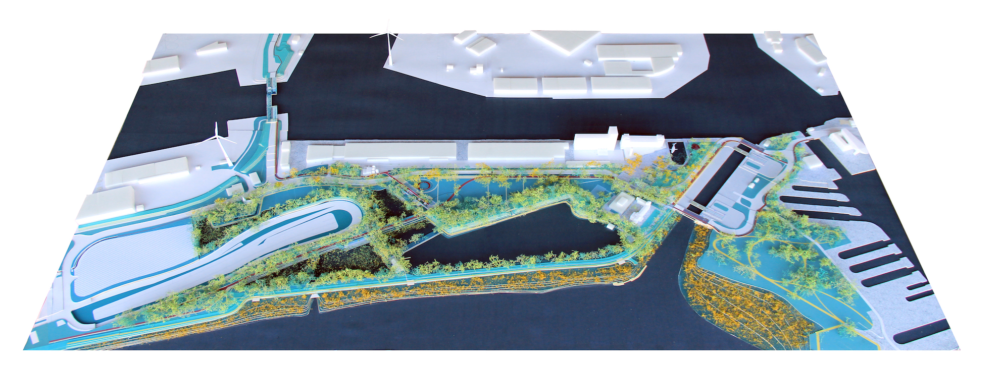
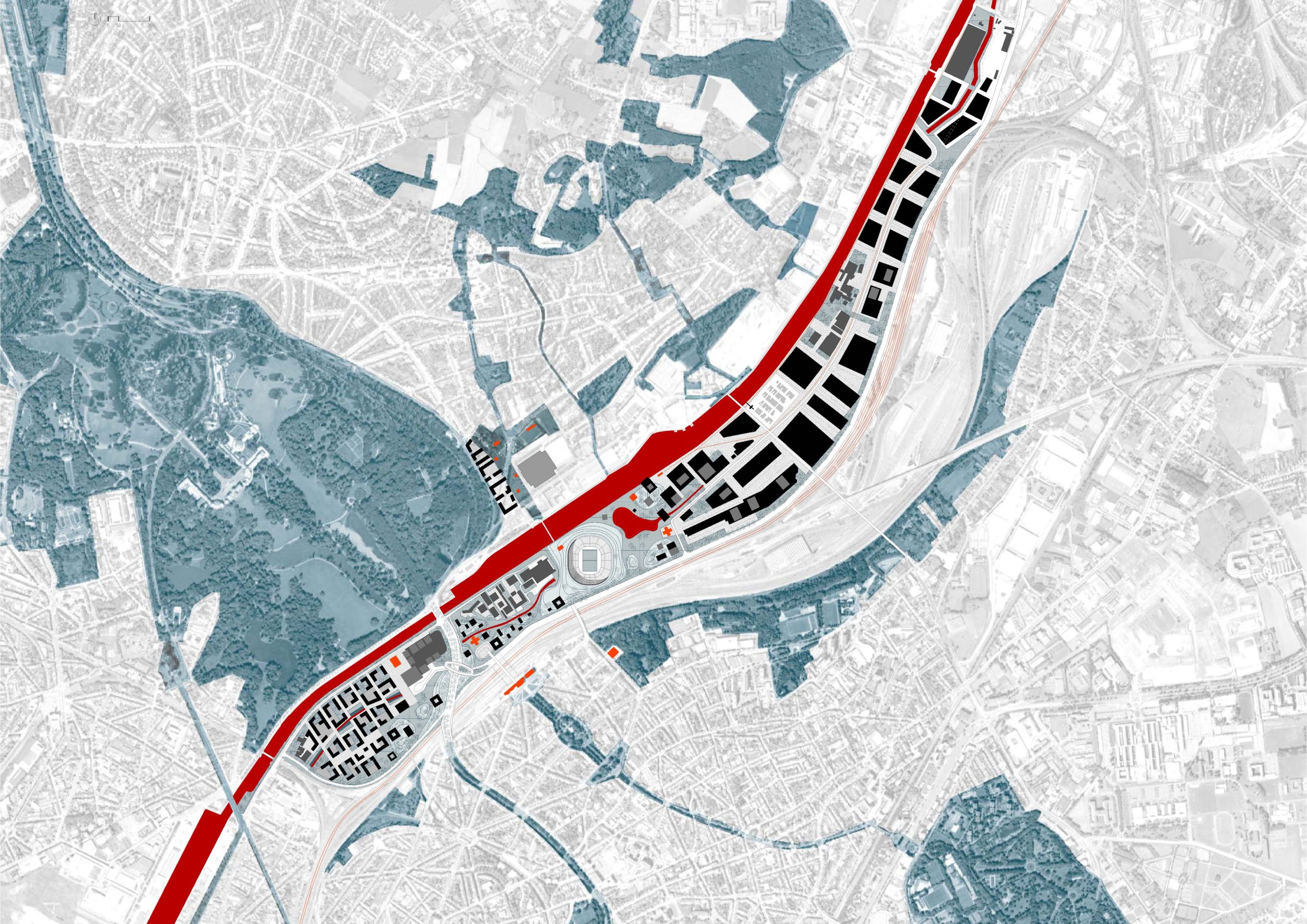
Ringpark
Antwerp, BE
2019-2030
Client: City of Antwerp, AG Vespa, Department of mobility and public works of Flemish Government (MOW).
Program: Masterplan / Urban and landscape design
Team: StudioPaolaViganò + MAARCH + Sweco
In collaboration with: Basil Descheemaeker, Wageningen University & Research, CLUSTER landschap & stedenbouw, Sweco Belgium, Antwerpen Aan’t Woord, Idea Consult, Sertius & D2S international, Grafton Architects Ltd
The Over De Ring project, or the landscape design on/around the capping of the ring of Antwerp, is a historical opportunity in transforming the city/territory and creating a resilient landscape for the social/environmental/urban transitions. After working on the vision of the Southeast segment. the team is selected to design Ringpark Noordkasteel and Ringpark Lobroekdok through competitions, both involves a great complexity, not only in terms of technical issues on the underground/upper ground relations, the long timing of the infrastructure/landscape realization, sustainable mobility, natural and artificial water management, creative energy vision, the creation and maintenance of landscape, but also in terms of establishing a new identity of public space interrupted by large-scale infrastructure, a balance between metropolitan programs and local needs, and a resilient and future-proof spatial framework which can contribute to the transition to a CO2 Zero future and the mobility model-split, through the creation of a “Techno-Nature”. The team works in a strong interdisciplinary character in design and management, both internally and externally.

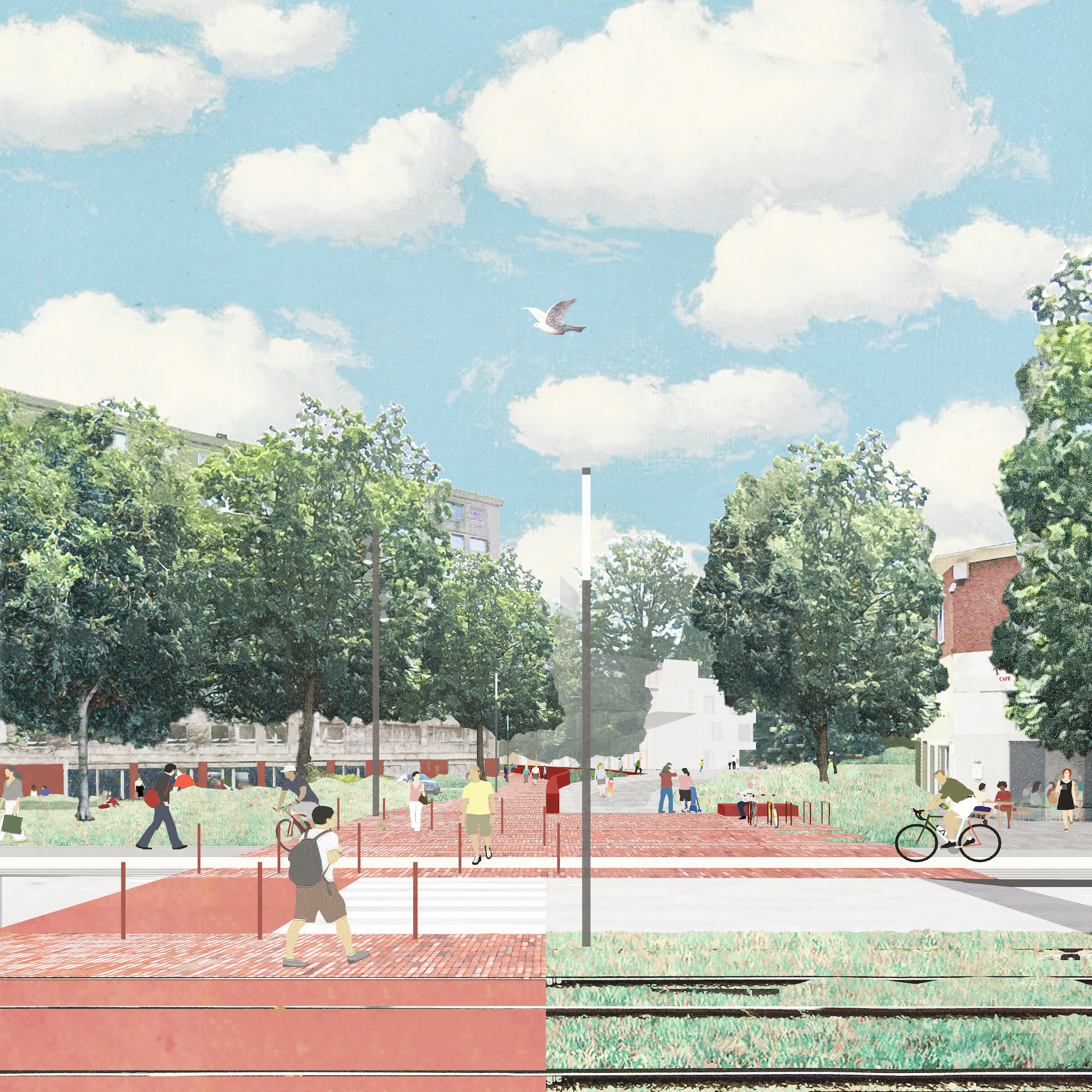
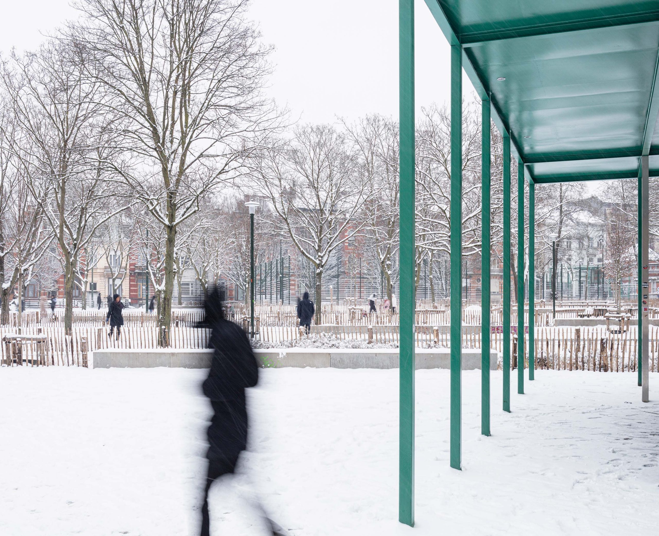
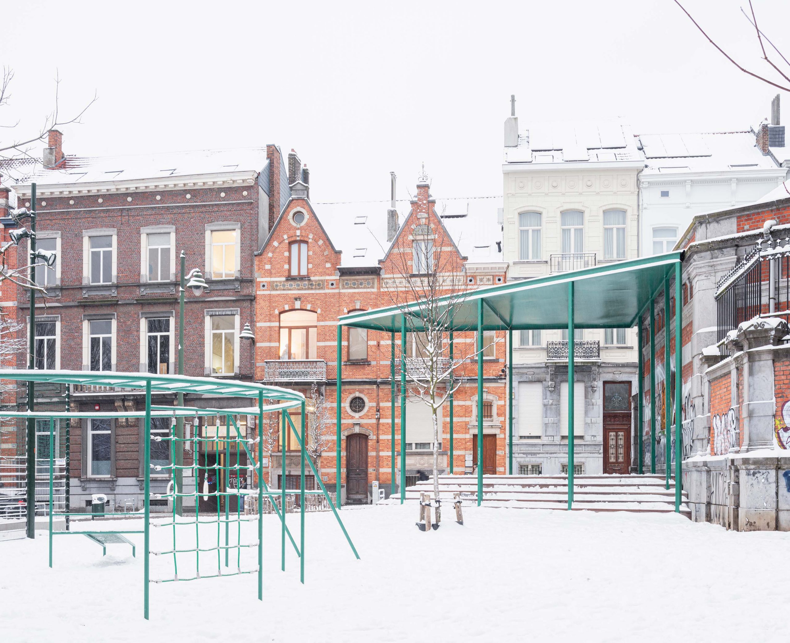
Marie-Janson Square
Saint-Gilles, BE
2019/2023
Client: Commune of Saint-Gilles within the framework of the sustainable district Parvis-Morichar
Program: Public space
Team: Bertrand Plewinski, Stefano Gariglio, Manu Vanderveken
In collaboration with: vvv architecture, ARA atelier ruimetelijk advies, BAS bvba
The Square Marie Janson is part of a sequence of large public spaces on the slope of Saint-Gilles. This project aims to translate from reflections on the soil of the city, the various questions raised by the public space of today and tomorrow, particularly on the aspects of water, pollution, car space, reuse of materials and uses. It is a long-term approach, which has defined this park as being designed for a century, capable of integrating the different evolutions of time.
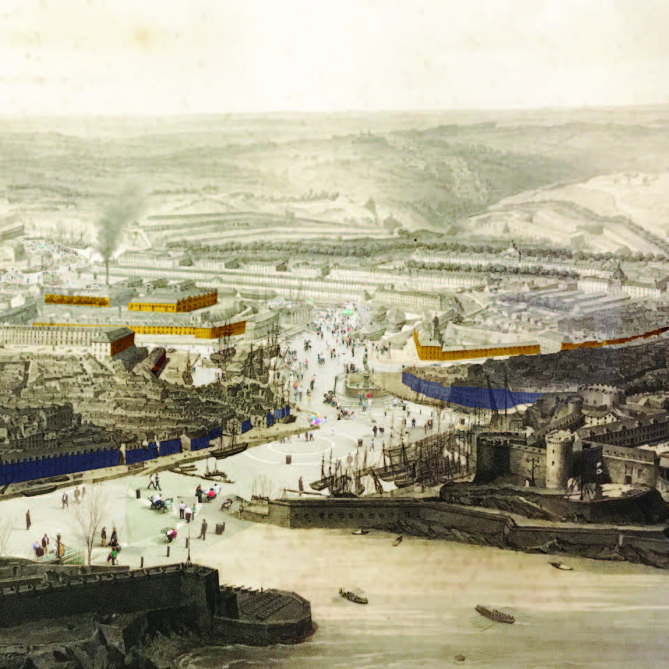
Brest Metropolis
Brest, FR
2018/2023
Client: Brest Métropole
Program: Guide plan – masterplan
Team: Alessia Calò, Morvan Rabin, Bertrand Plewinski, Pietro Manaresi, Stefano Gariglio, Mathilde Meurice
In collaboration with: Idea Consult: programmation, territorial strategy Egis: transportation Scopic: concertation Guam Conseil: economy
Brest creates multiple images: Brest - the city of the navy and submarines due to his strategic geographical position, Brest - the city with port and sailors, Brest Finis Terrae, Brest la Grise after the post-bellic reconstruction... all these images has inspired artists, writers and directors. Like other metropolis, the heart of the city is living a difficult time. Families prefers to live outside in the Breton countryside with bigger houses and a garden, professionals prefer other parts to work. The city centre is shrinking. Brest is also a university city, with an important hospital activity and a developed blue economy: a tram line, the telepherique, old industrial renovations, a campus masterplan, a commercial port plan, etc. The mission is to elaborate a plan guide for the heart of the metropolis: coordinate projects and current dynamics, rethink the urban space, sew up the city with the Penfeld river and the littoral.
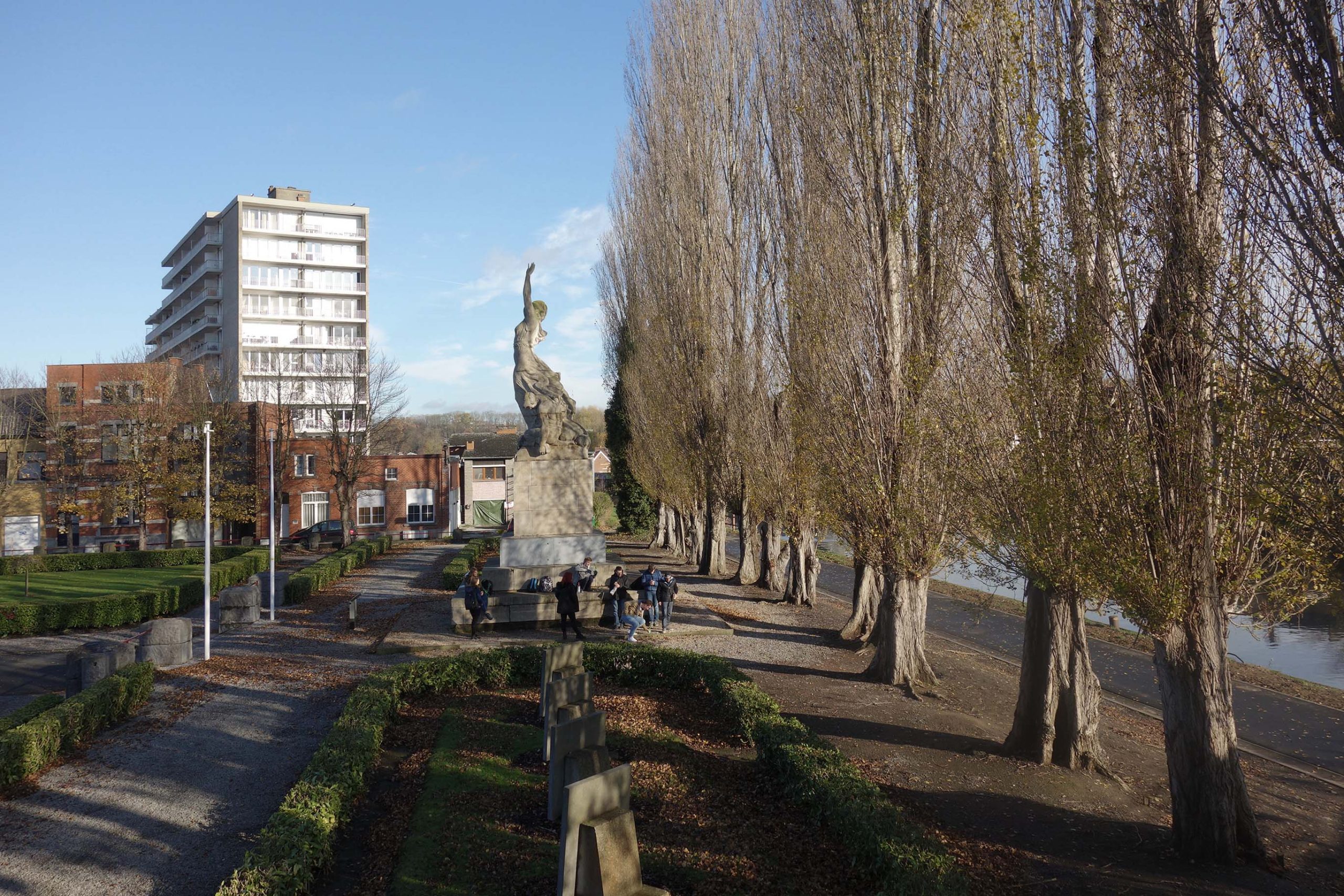
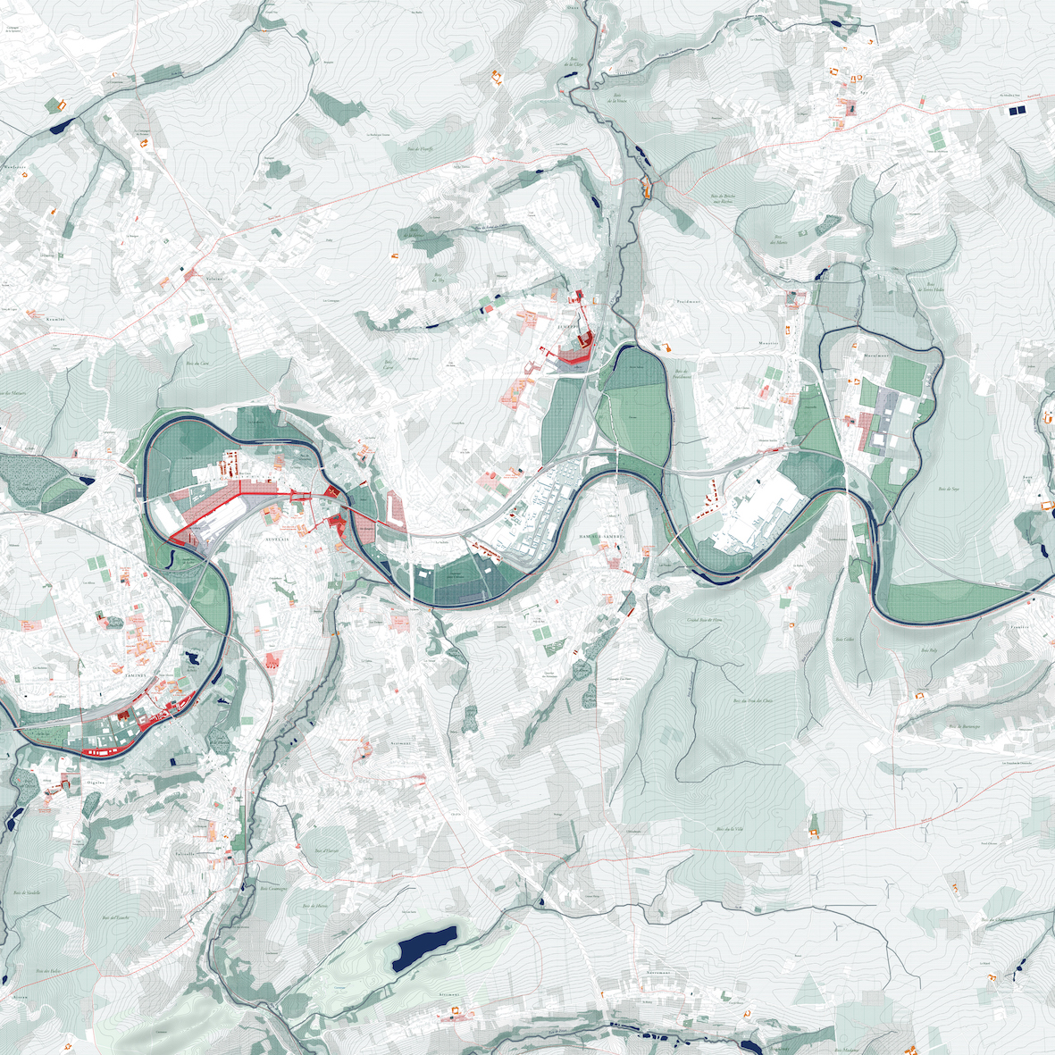
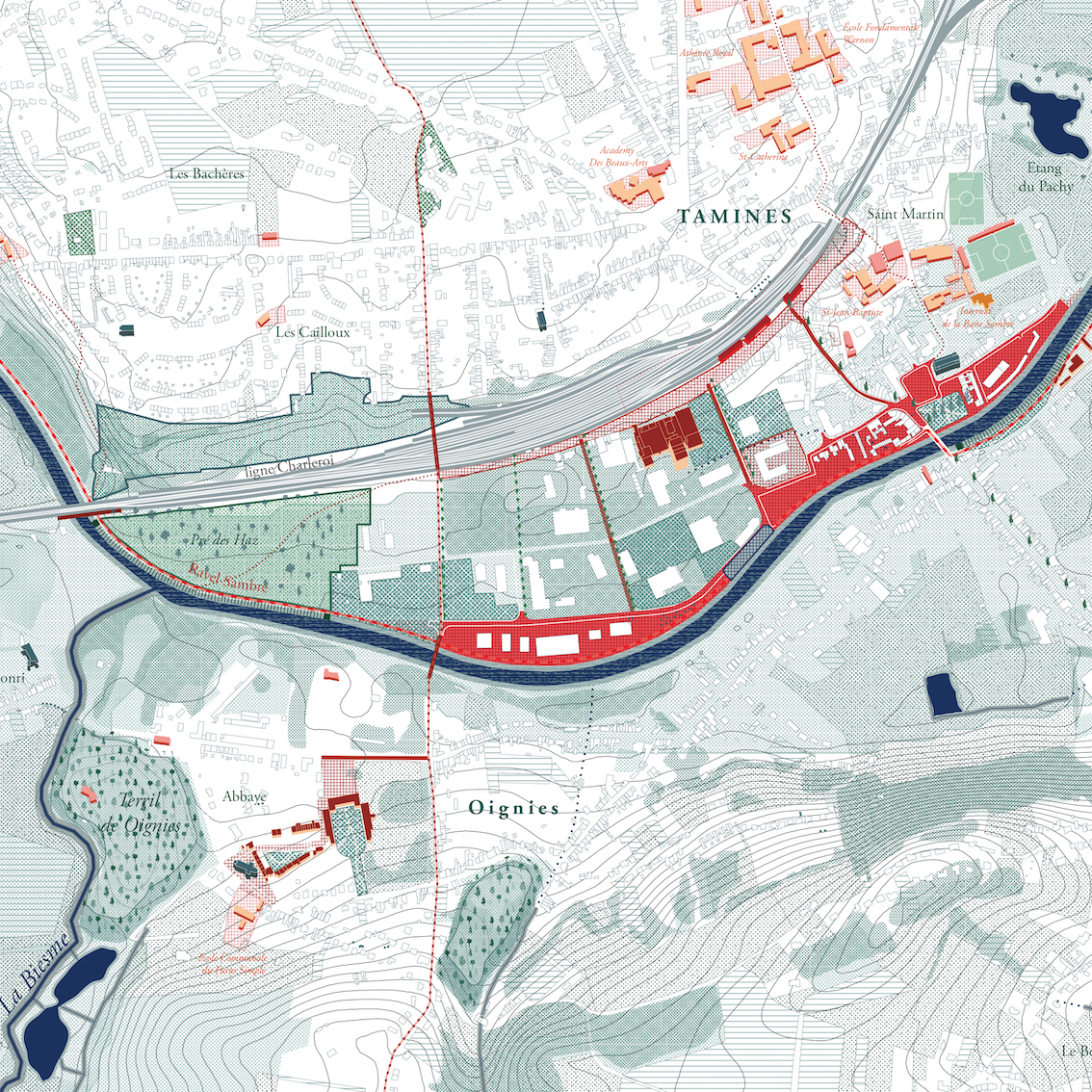
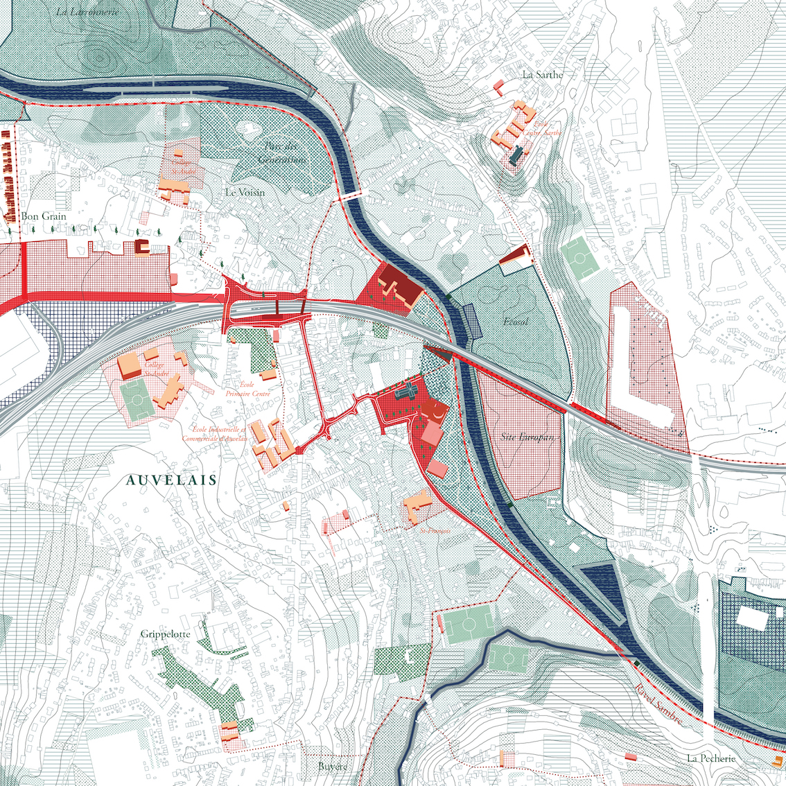
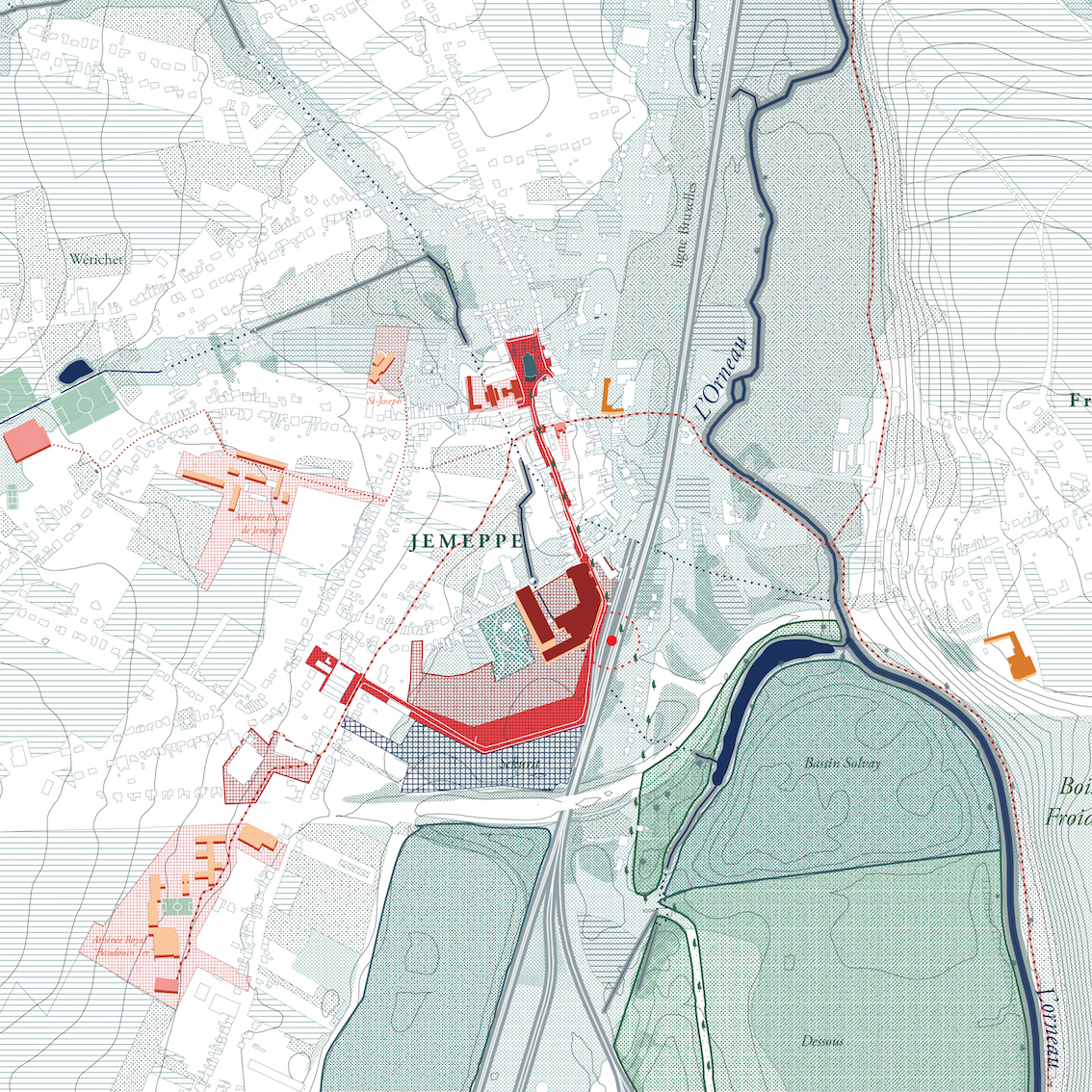
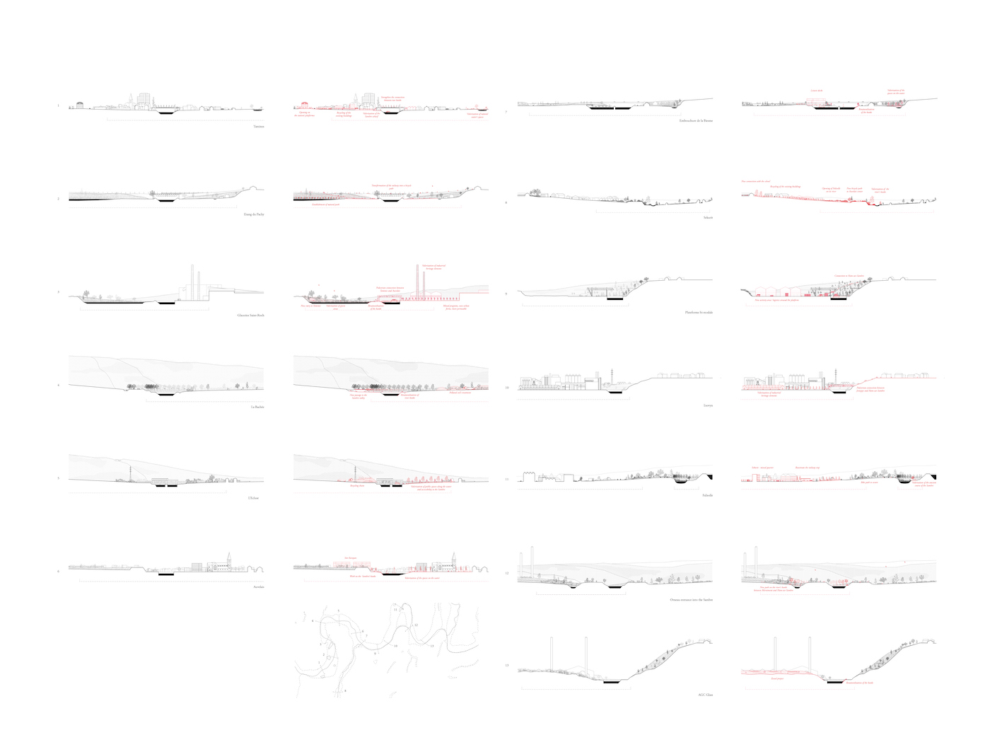
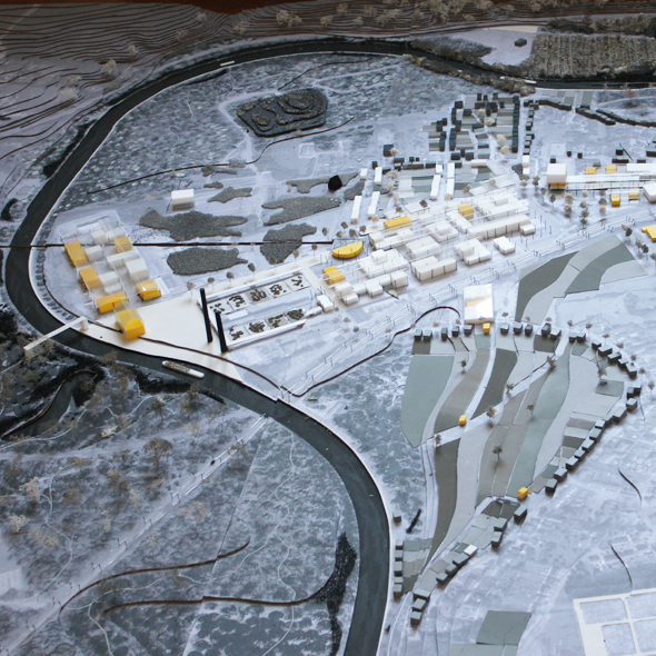
Val de Sambre
Sambreville and Jemeppe-sur-Sambre, BE
2017/2018
Client: Bureau Economique de la Province de Namur
Program: Territorial project - Redevolpment plan
Team: Alessia Calo, Bertrand Plewinski, Morvan Rabin
In collaboration with: Idea Consult: strategies and development, programmation
The Val de Sambre, featured here, comprises the municipalities of Sambreville and Jemeppe-sur-Sambre, a city with a population of 50,000 and a particular form. It is a territory moulded by the glass and chemical industry on the one hand, and by the landscape of the Lower Sambre on the other. Its wealth derives from the connection between the dynamic residential economy of the Namur basin and the long industrial tradition of the Charleroi basin, while playing the role of hinge between the two natural regions of Condroz and Hesbaye. To rework its economic, territorial and social fabrics collectively, the Val de Sambre and its components, linked to the industrial era, must enter into a new life cycle, through a project that adheres to its population and vice versa and that enhances the important spatial and social capital present in the territory. The exceptional landscape of both the main valley and its secondary valley, the quality of the habitat in relation to the landscape, as well as the phenomenon of metropolisation currently in progress in Walloon Brabant, the proximity

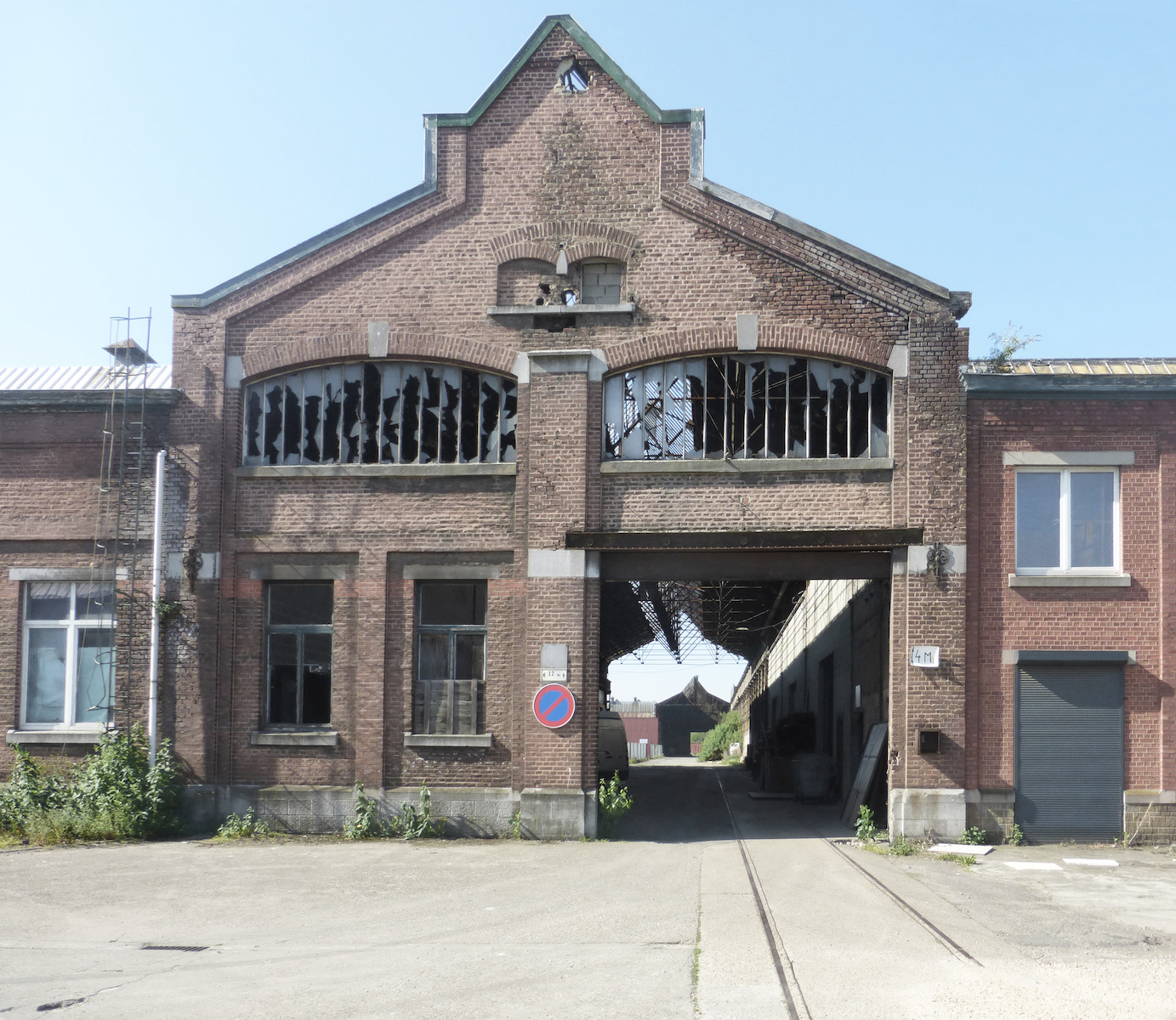
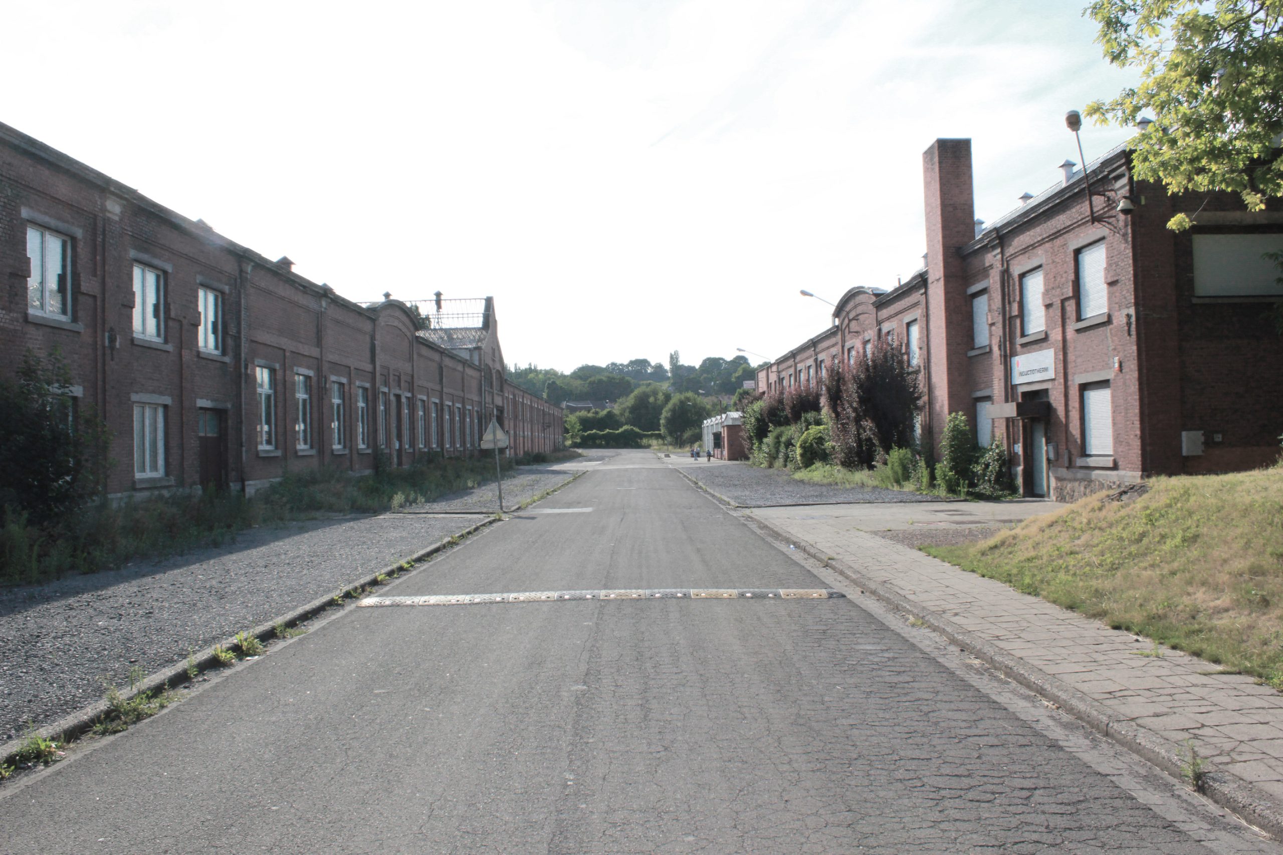
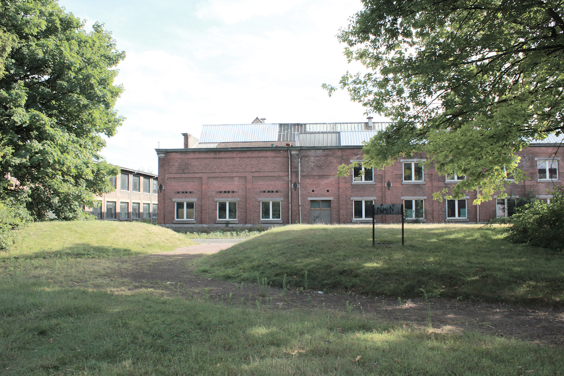
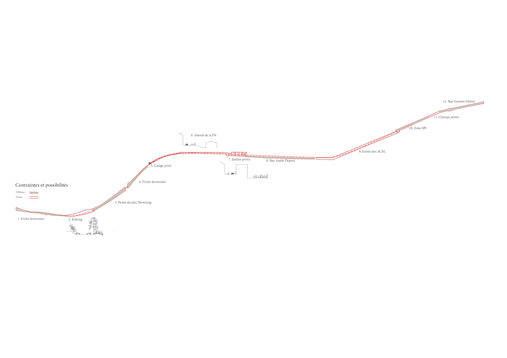
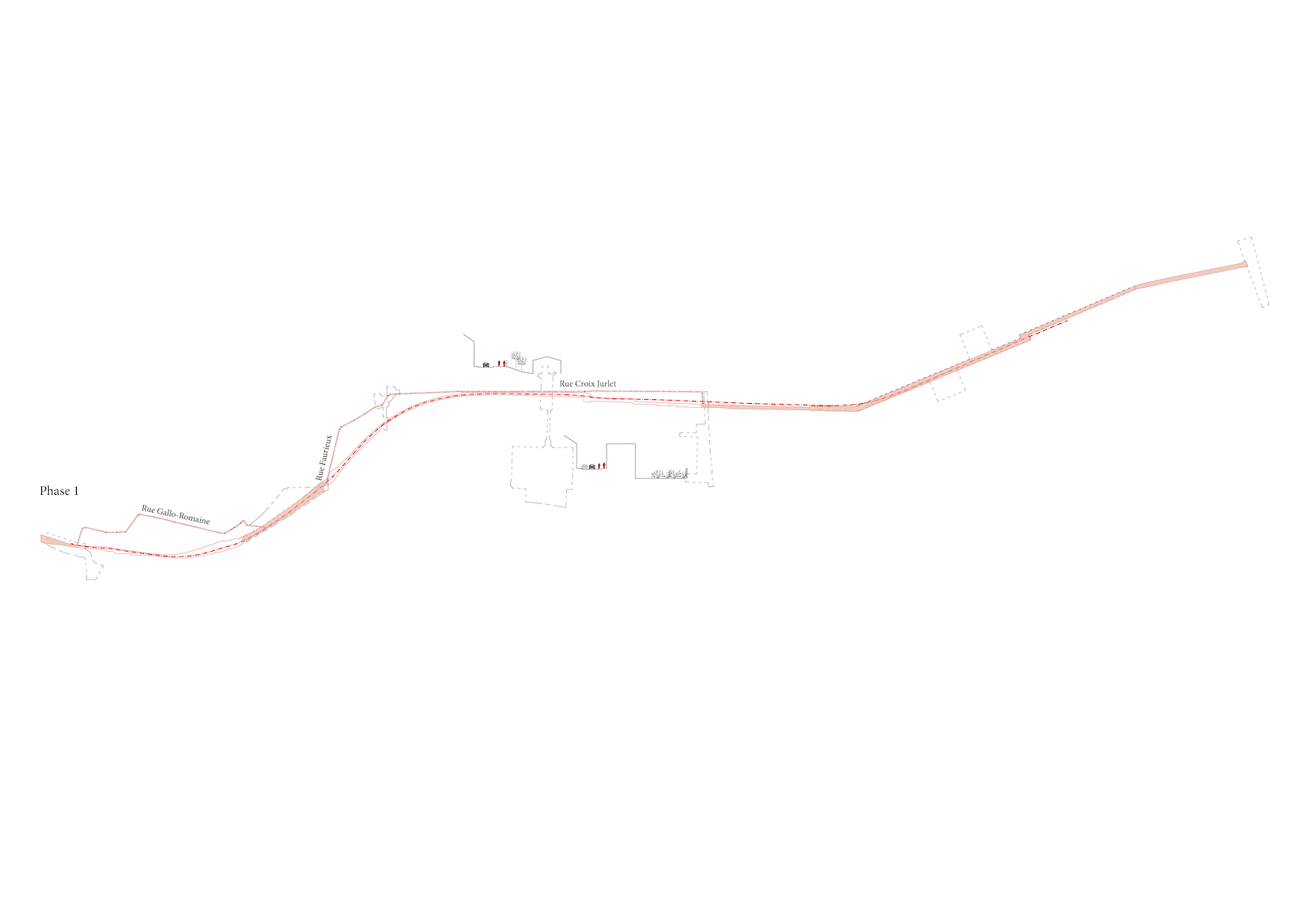
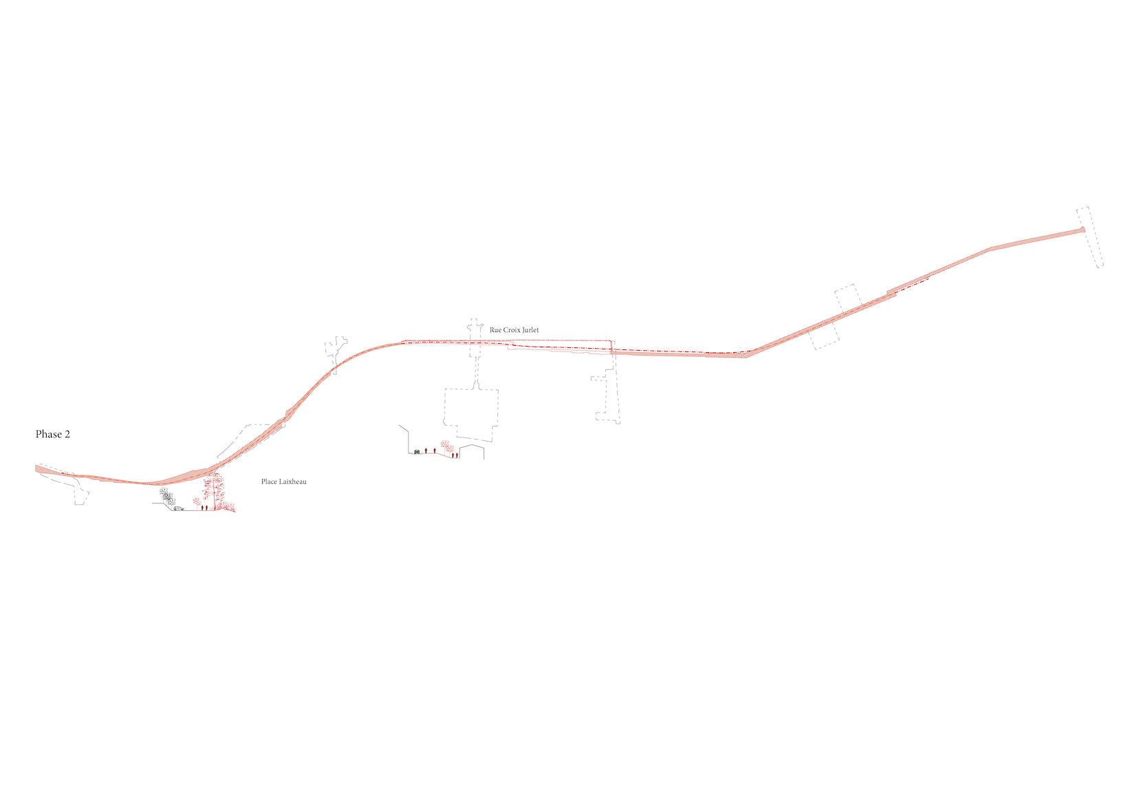
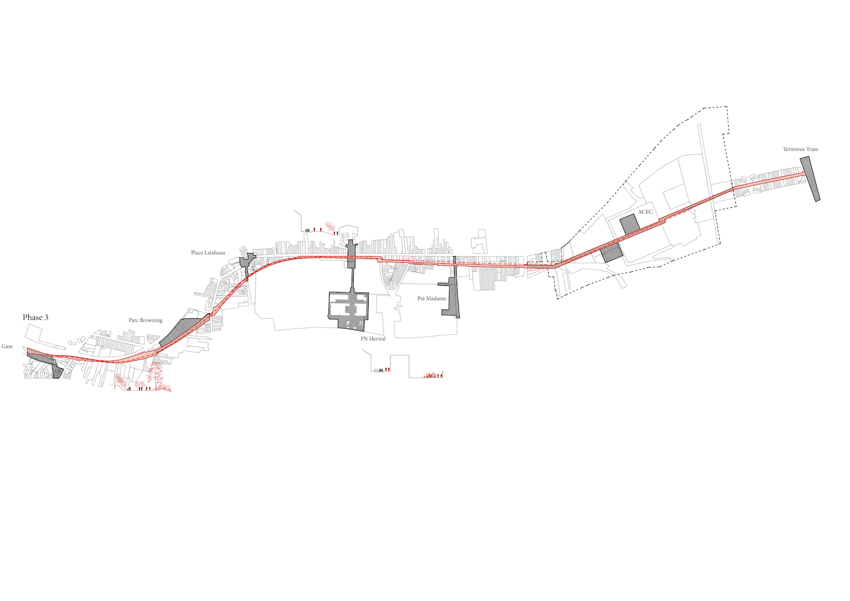
ACEC - Herstal
Herstal, BE
2017/2019
Client: SPI (Agence de developpement pour la province de Liege) and Herstal municipality
Program: Masterplan
Team: Alessia Calo, Bertrand Plewinski, Morvan Rabin
In collaboration with: Idea Consult: strategies and development, programmation Sweco: mobility, landscape engineering, infrastructures Rsk Benelux sprl: pollution Origin Architecture & Engineering: monuments and buildings restoration and renovation
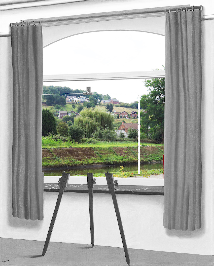
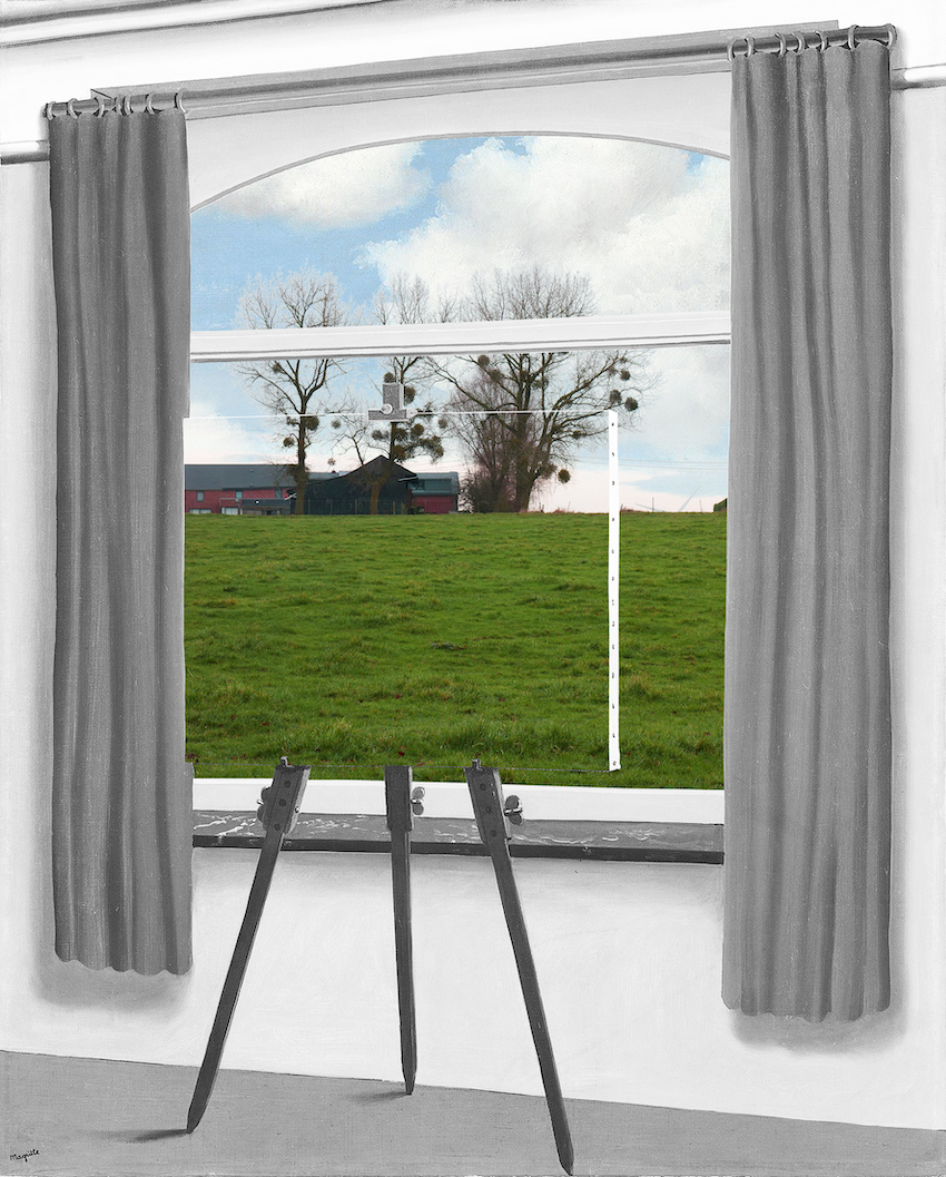
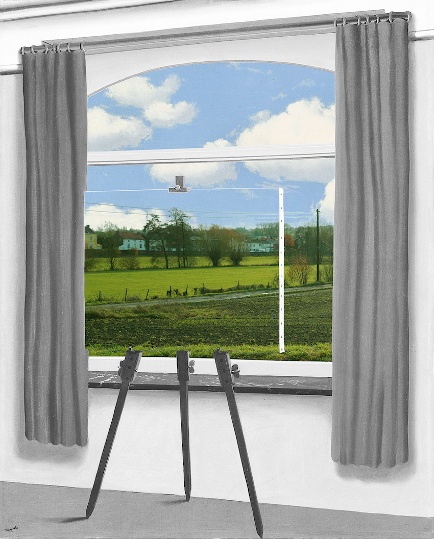
Herstal and the ACEC site are located along the Meuse, in the province of Liège, at the crossroads of the landscapes of the heart of Europe: the Ardennes south, agricultural plains in the north, the landscape of the Meuse and the landscape produced by the European mining belt. These different landscapes can be recognized at the scale of the site: the proximity of productive lands, the presence of the Meuse, the industrial heritage and the remaining trace of an old industrial railway linking the ACEC site to Herstal station, crossing the city. The project is about moving the image from the industrial city to the "green city" by focusing on innovation and inventing a new mix between housing and production. In the north part of the site a new green continuity find place: a “productive garden” is created due to the presence of “Verdir”, a research project developed by the Liege university.
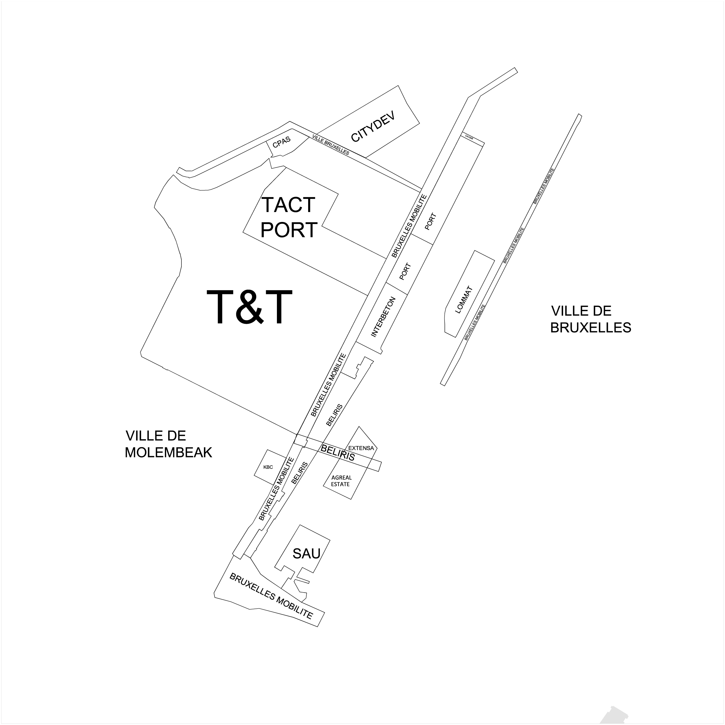
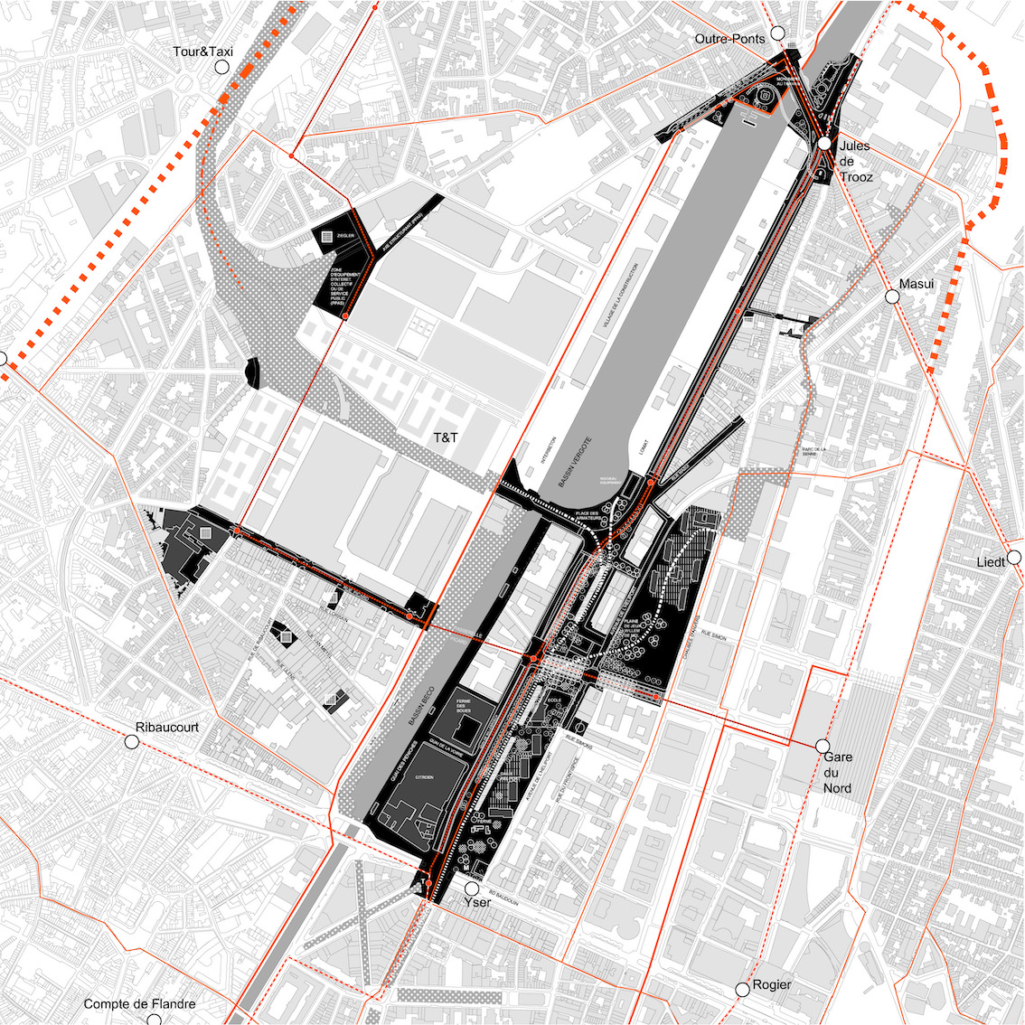
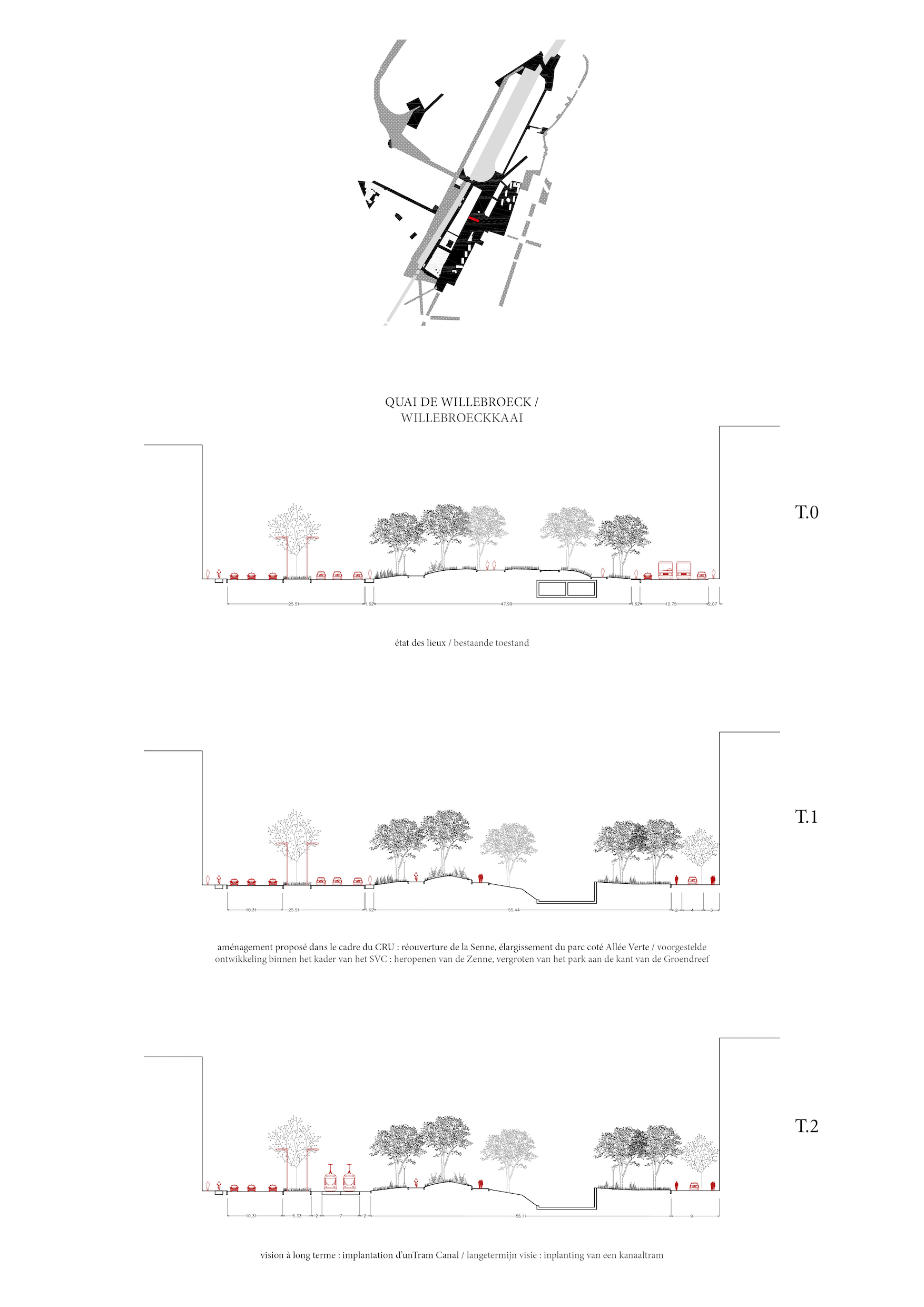
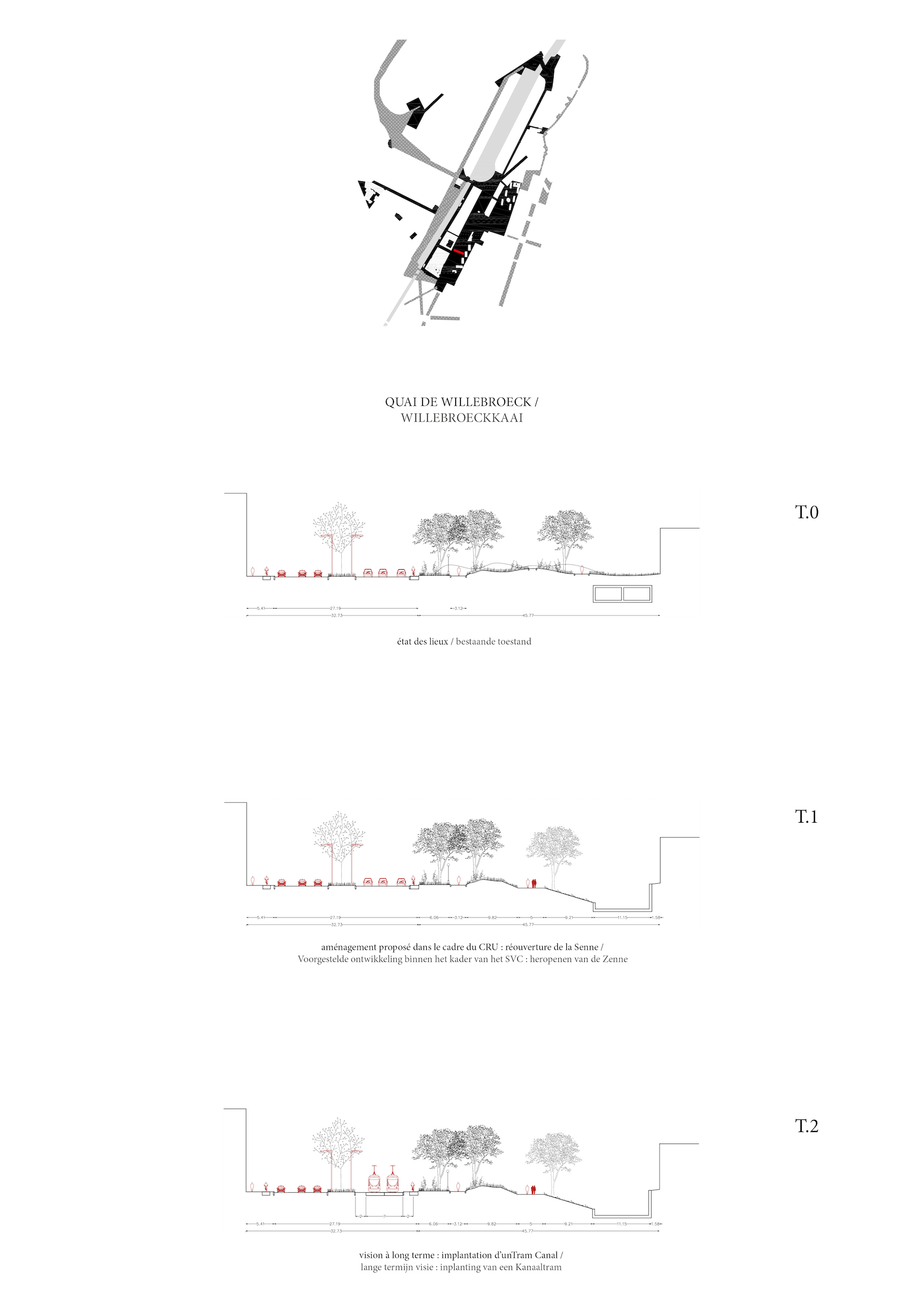
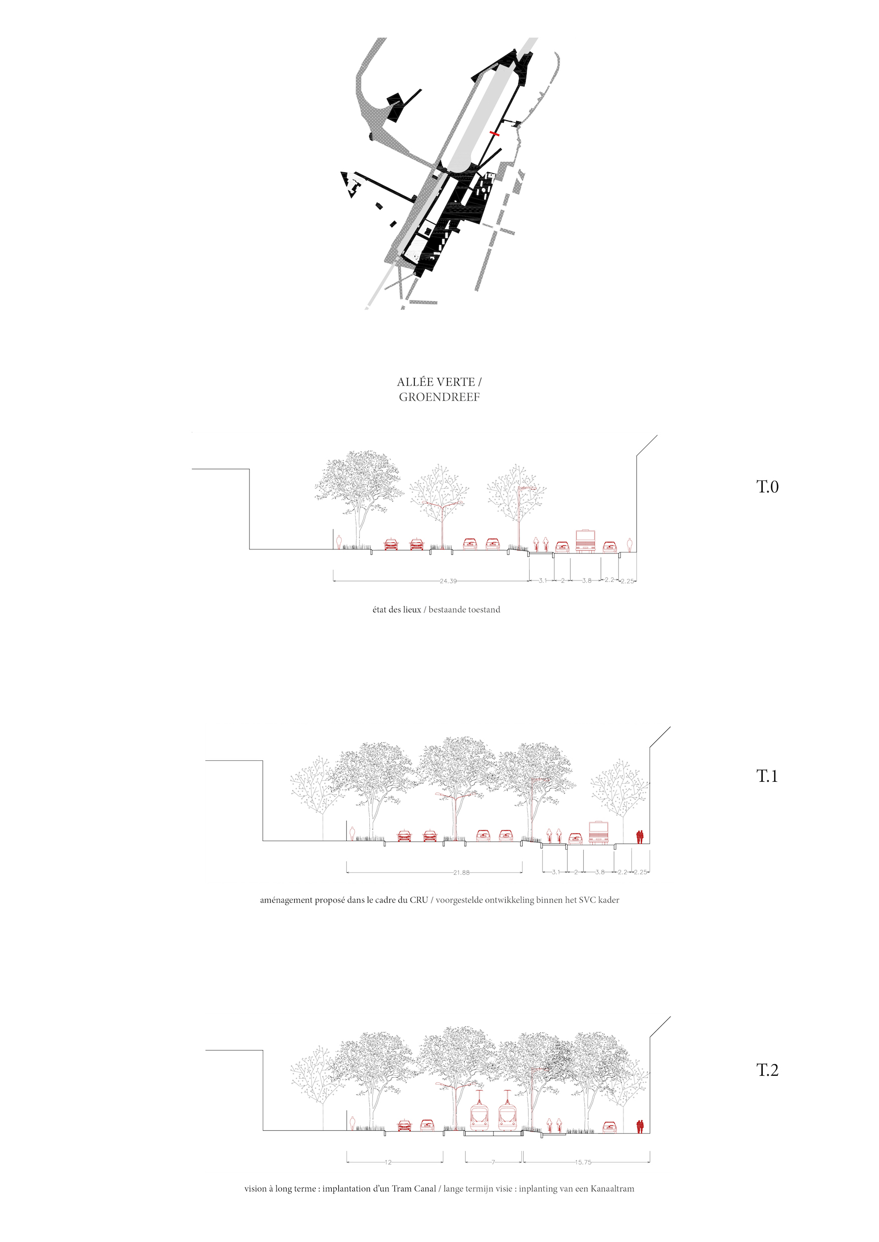
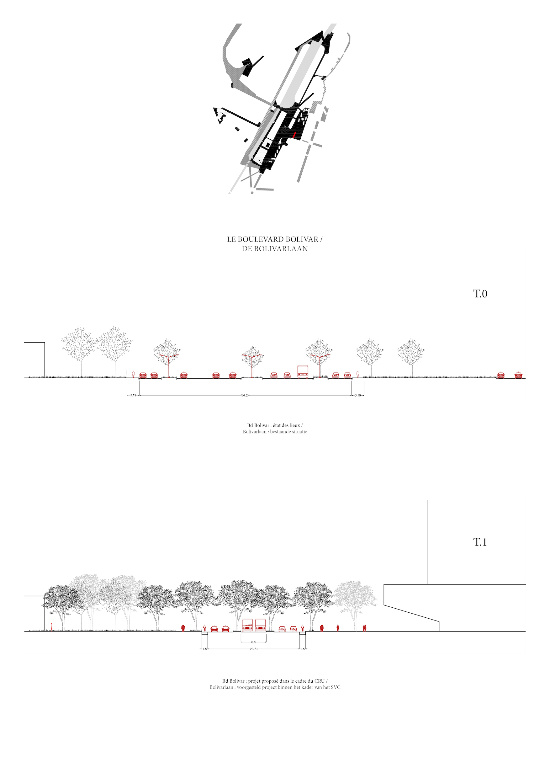
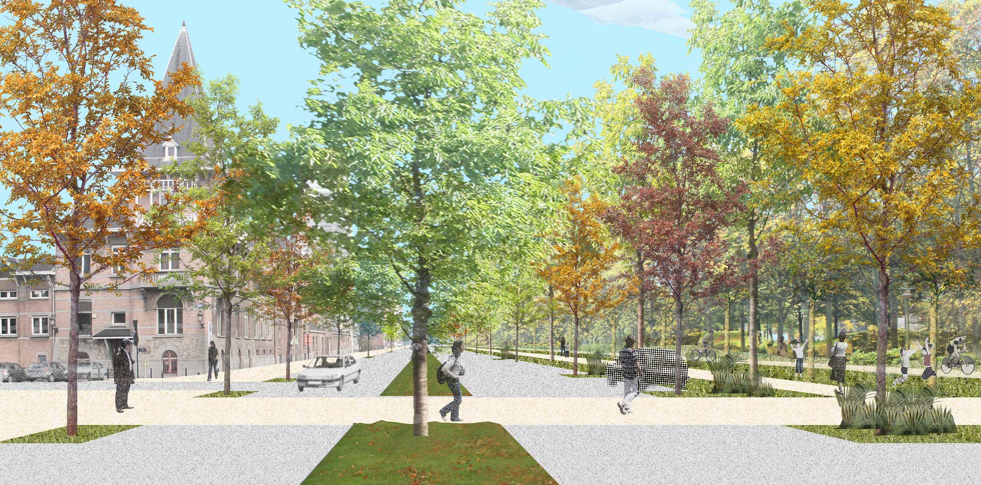
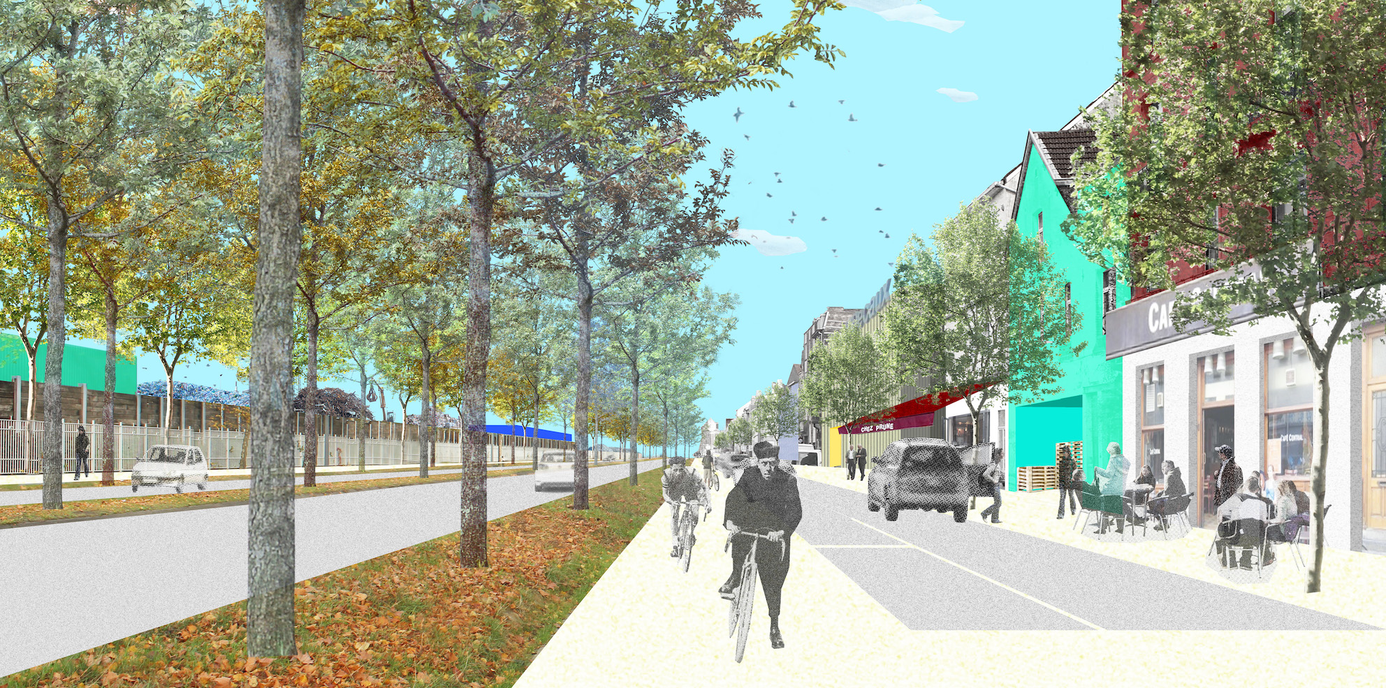
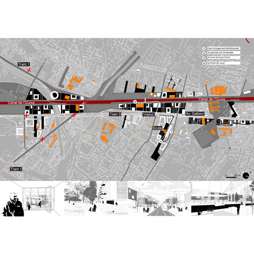
Contrat de Rénovation Urbaine
Brussels, BE
2016
Client: Région Bruxelles-Capitale
Program: Masterplan
Team: Alessia Calò, Etienne Schillers, Bertrand Plewinski
In collaboration with: Arcadis: technical studies Citytools: programmation
The study develops a "Contrats de Rénovation Urbaine" (urban renewal contract) based on a potential operations list within a given perimeter. These perimeters are selected by the Brussels municipality in the poorest areas, and the program seeks to develop the dynamics of social/economic revitalization within the perimeter through decisive actions on public space, heritage, public amenities such as schools, social and training centres, socio-economic actions such as cultural events, training for residents, innovation-related projects and creativity.
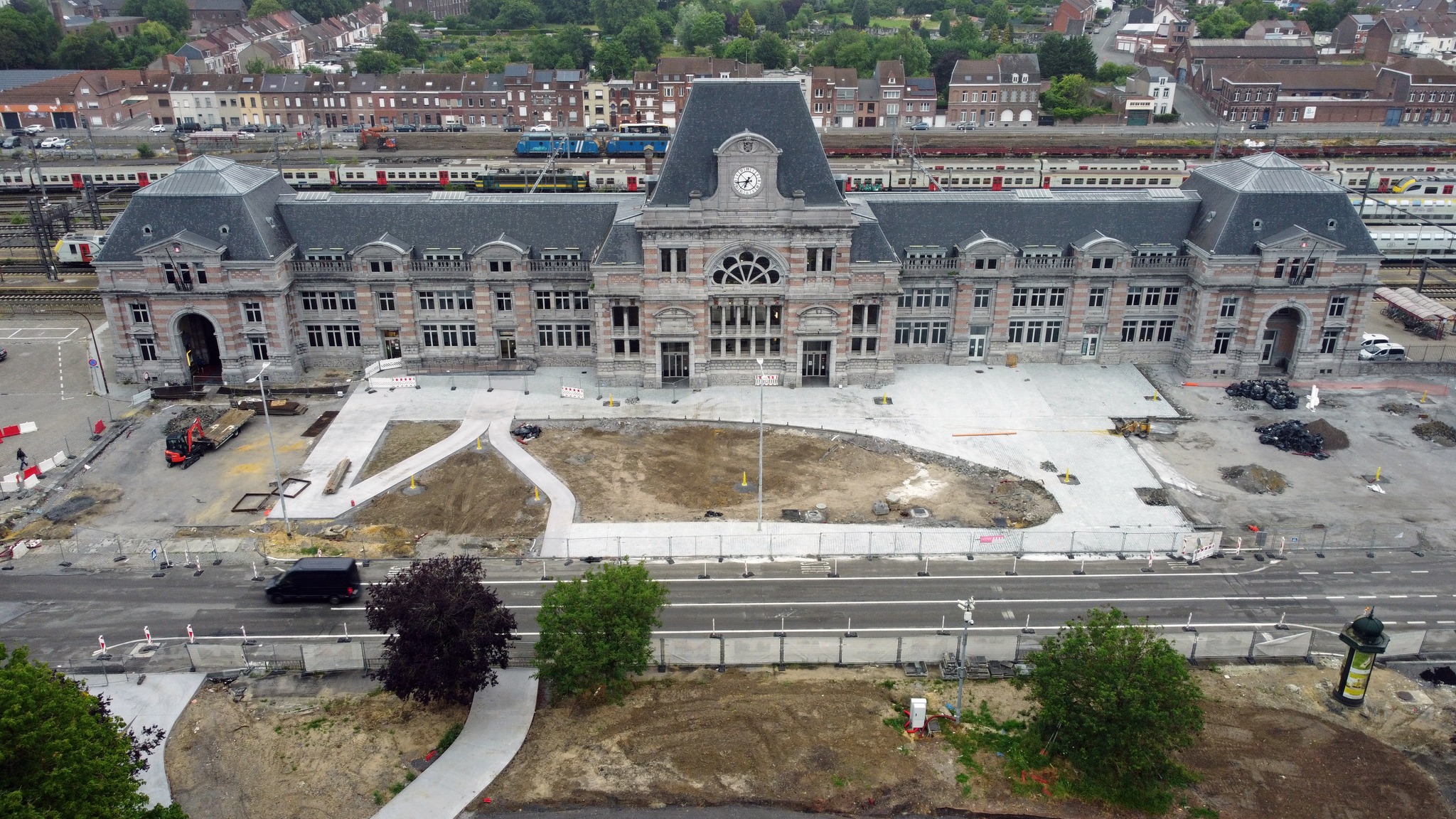
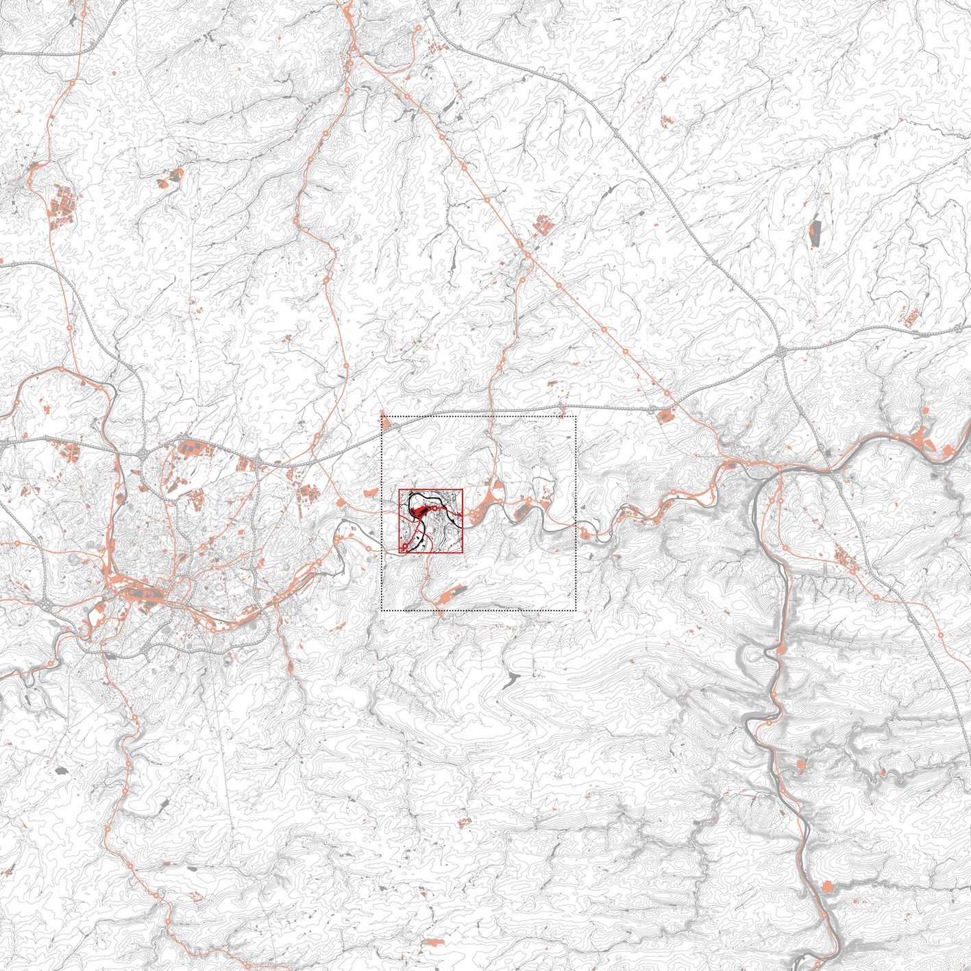
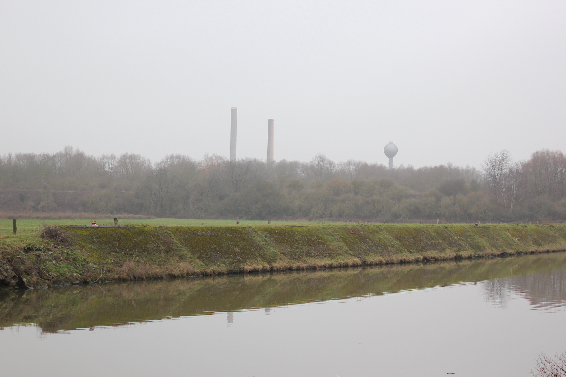
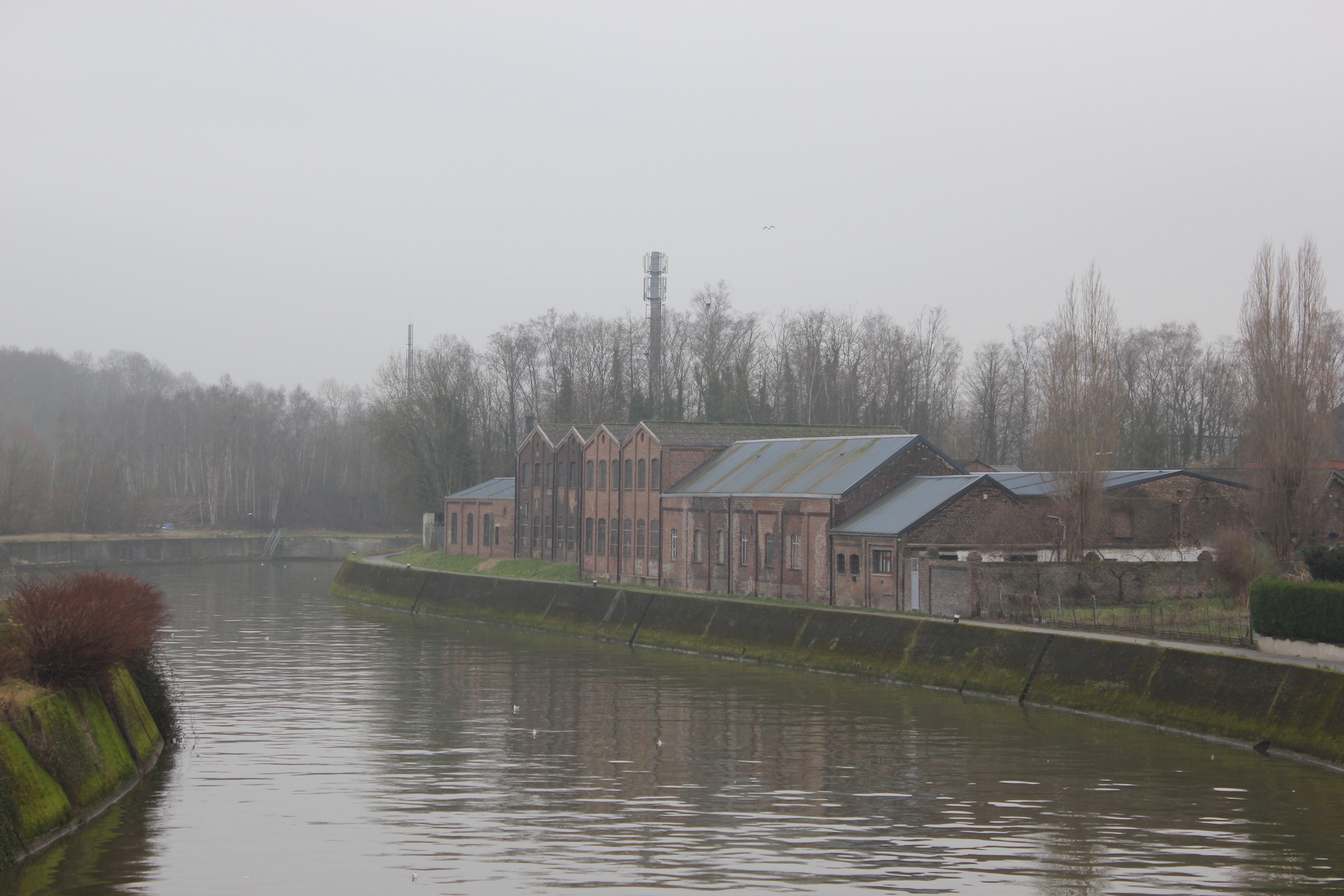
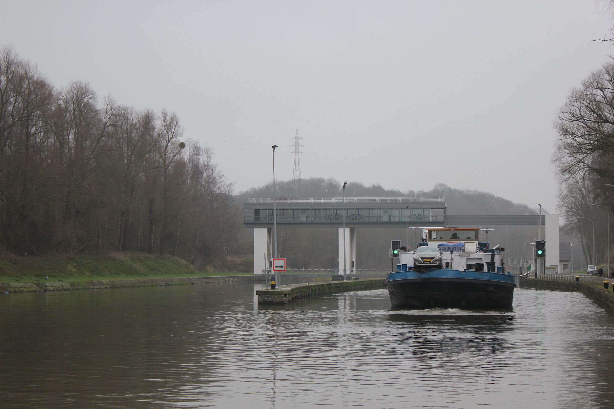
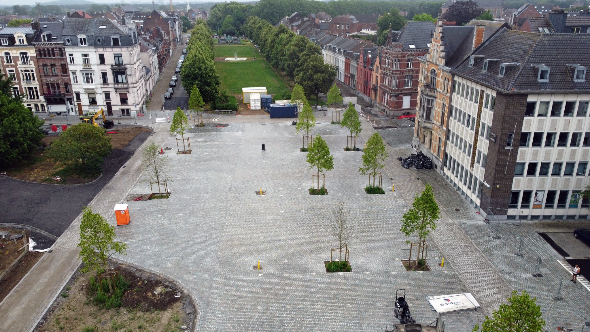
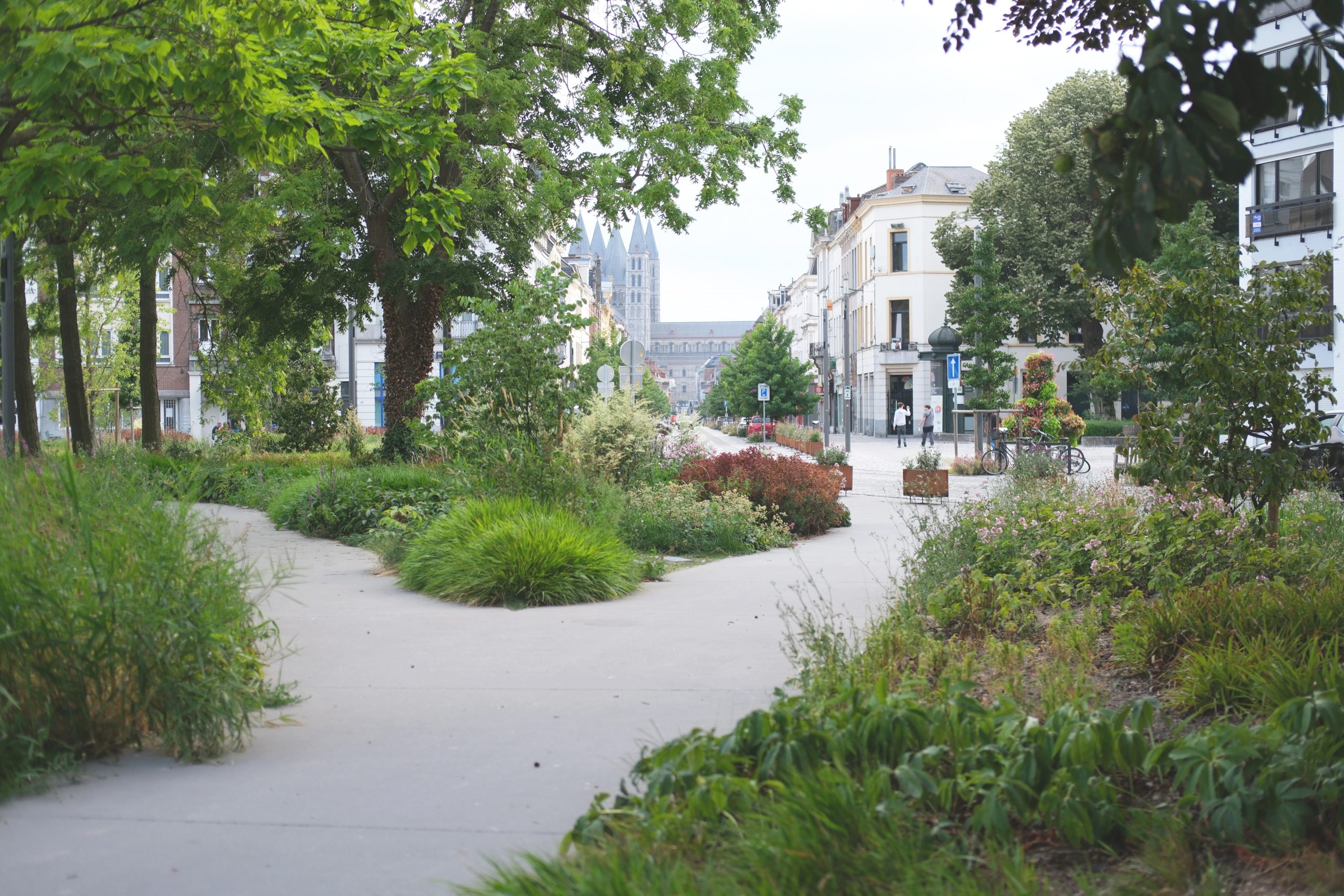
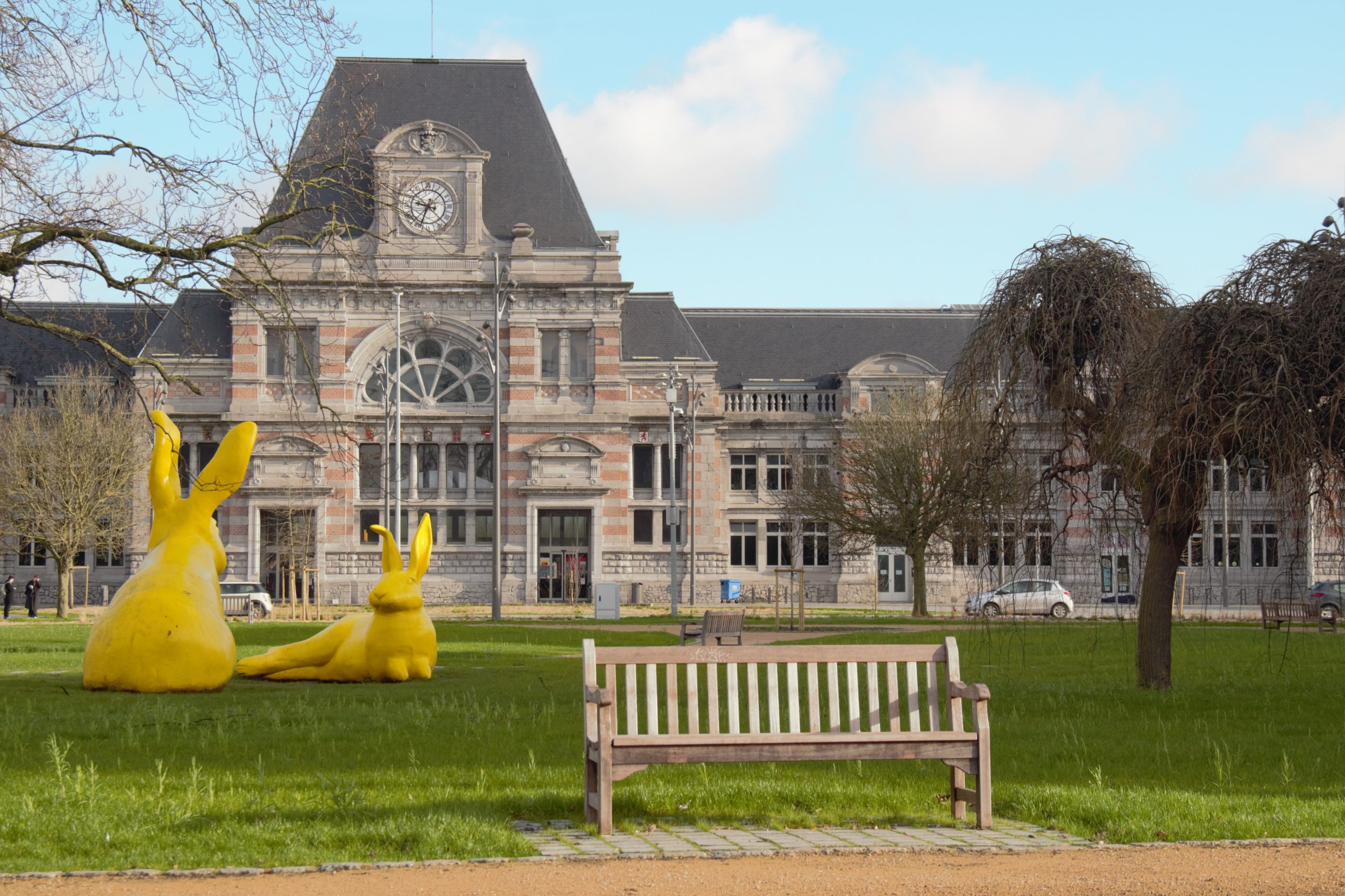
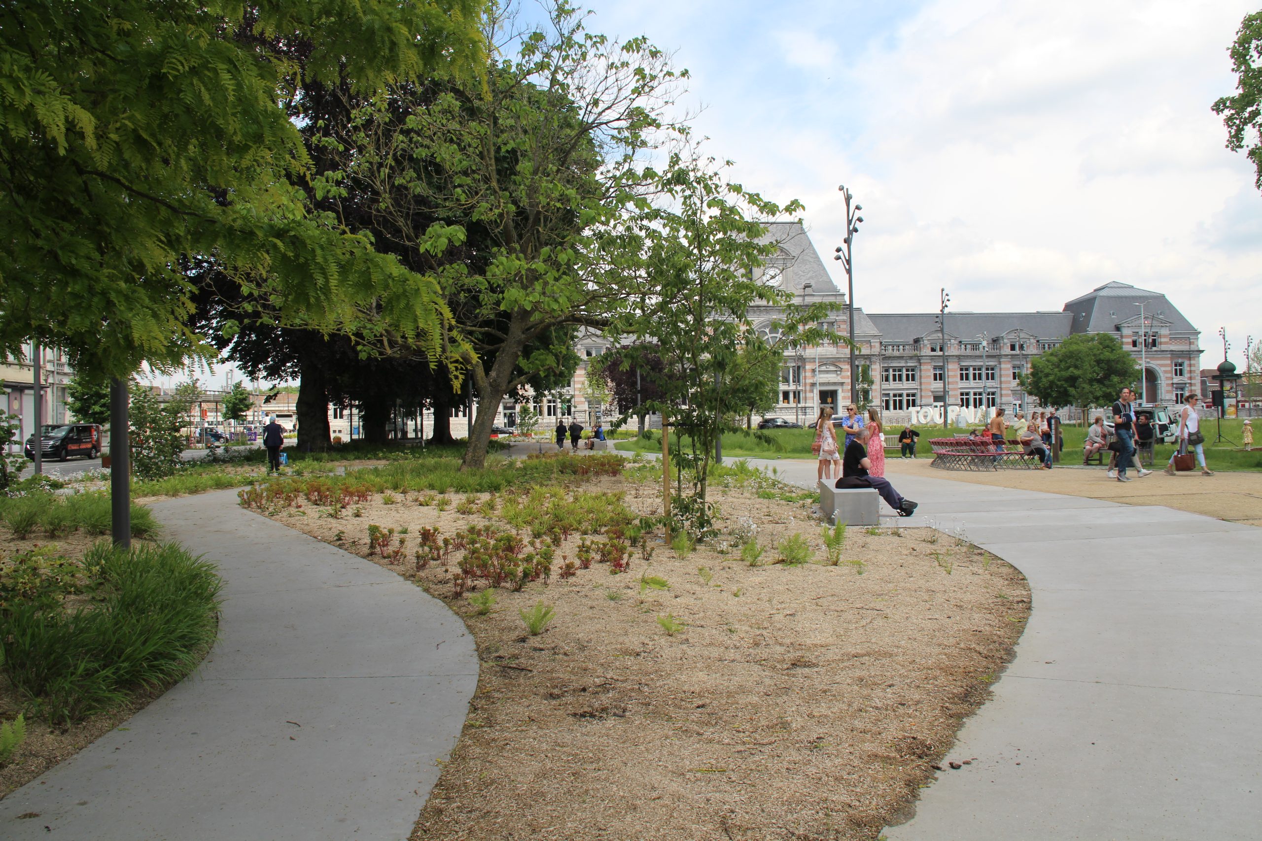
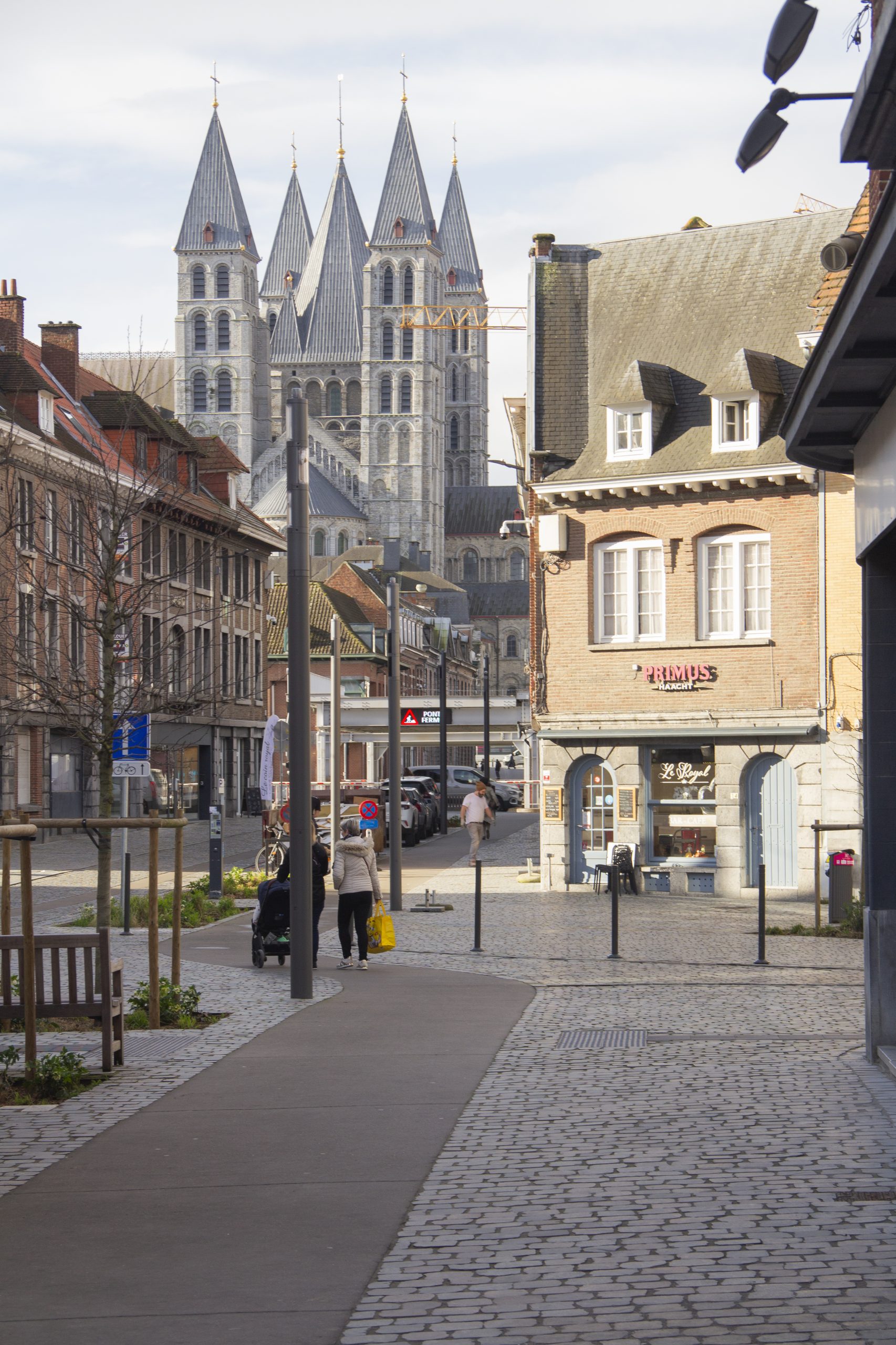
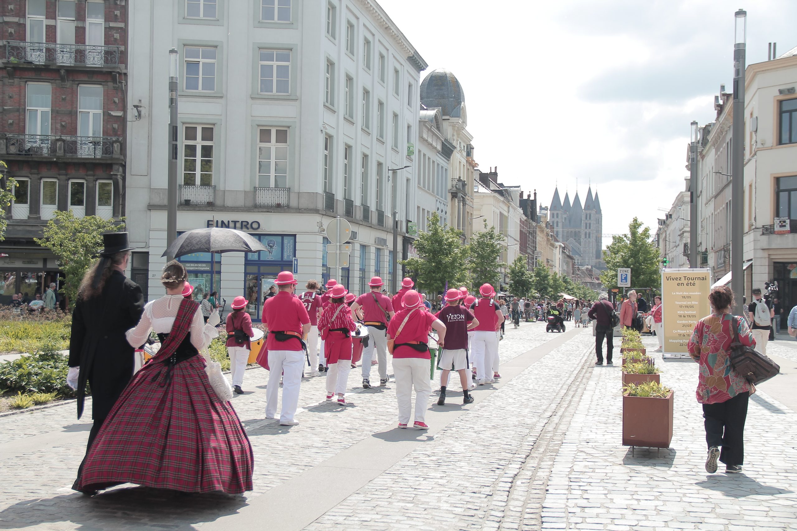
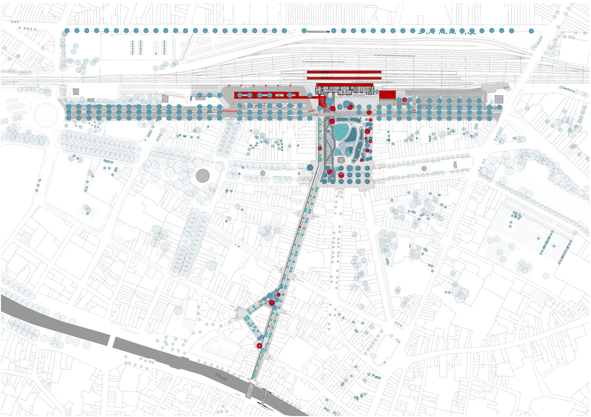
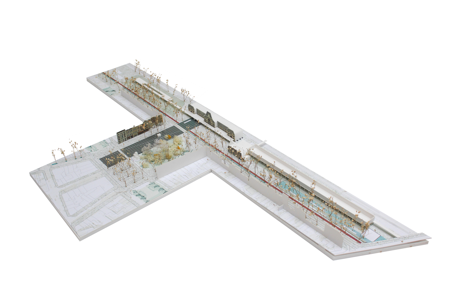
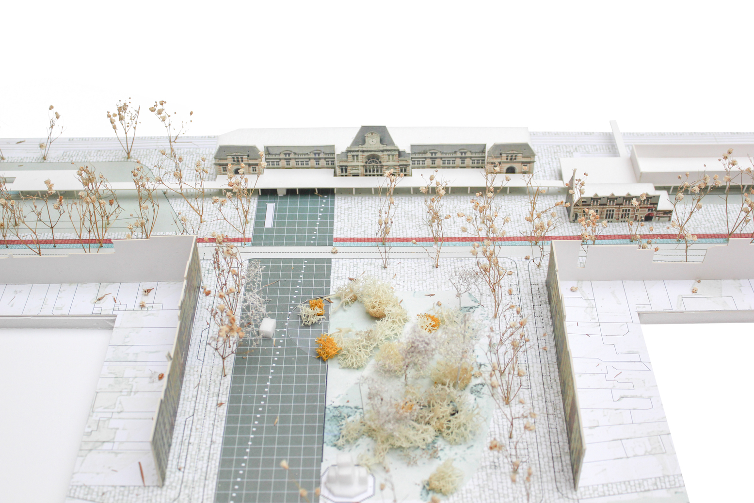
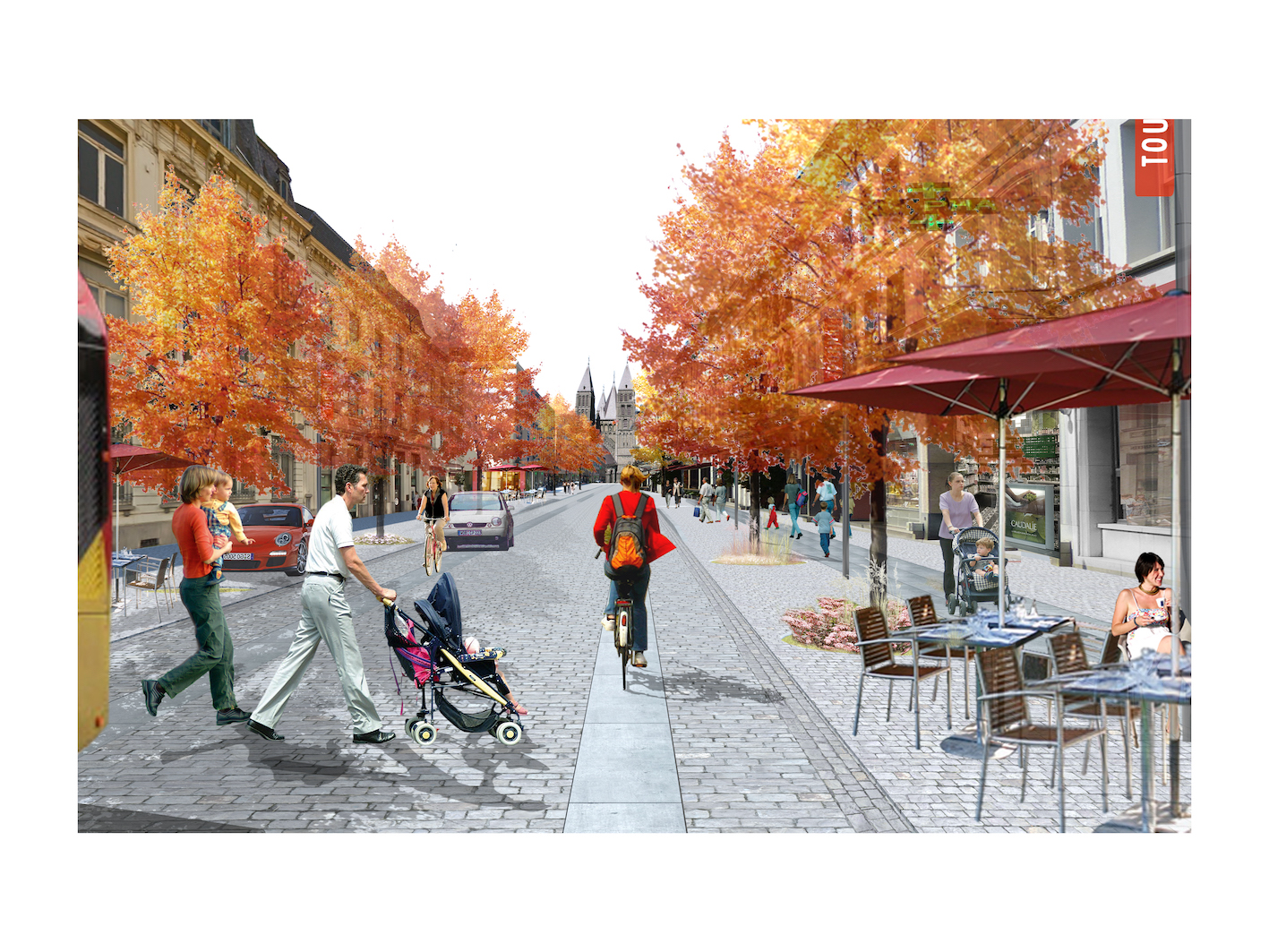
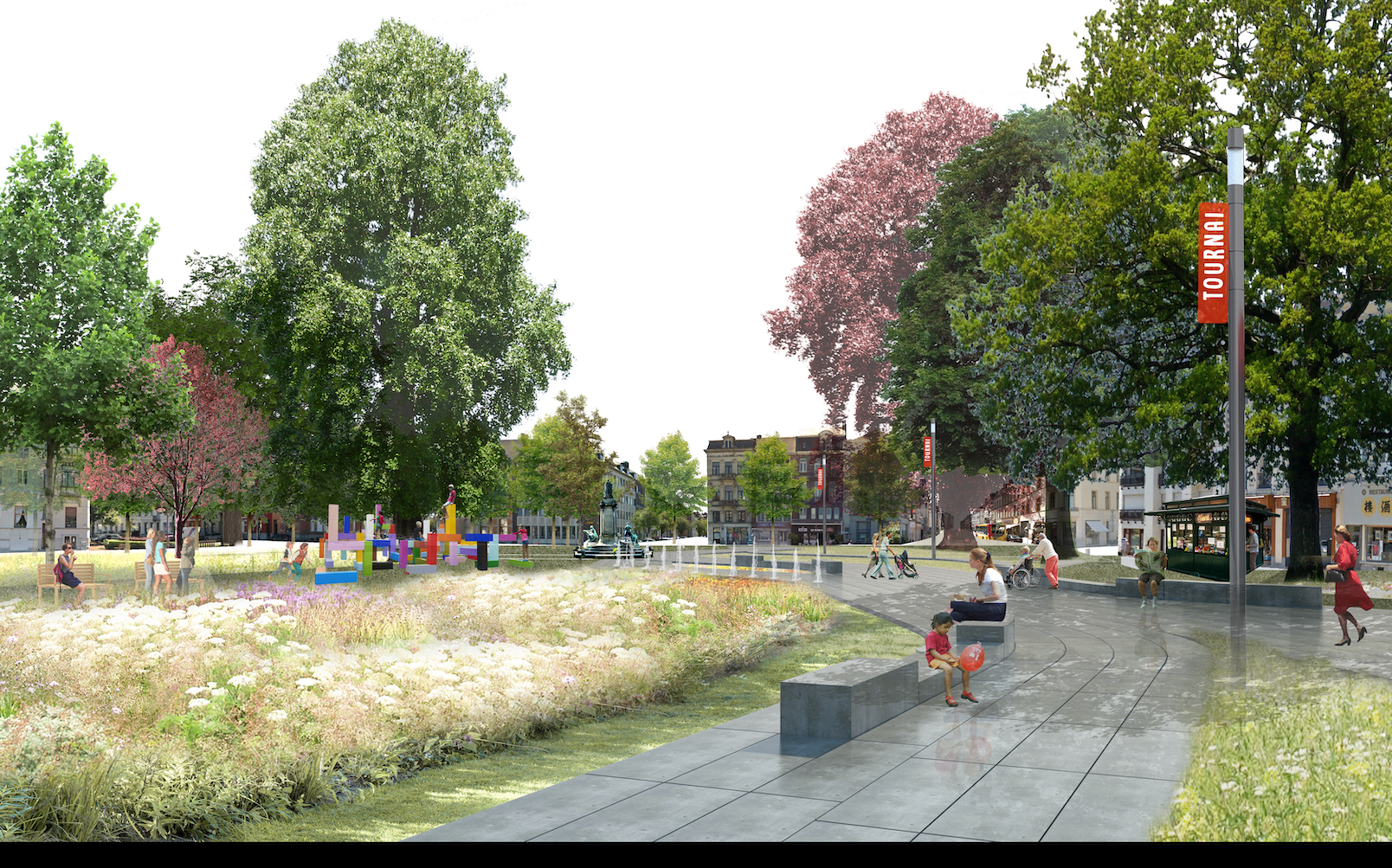
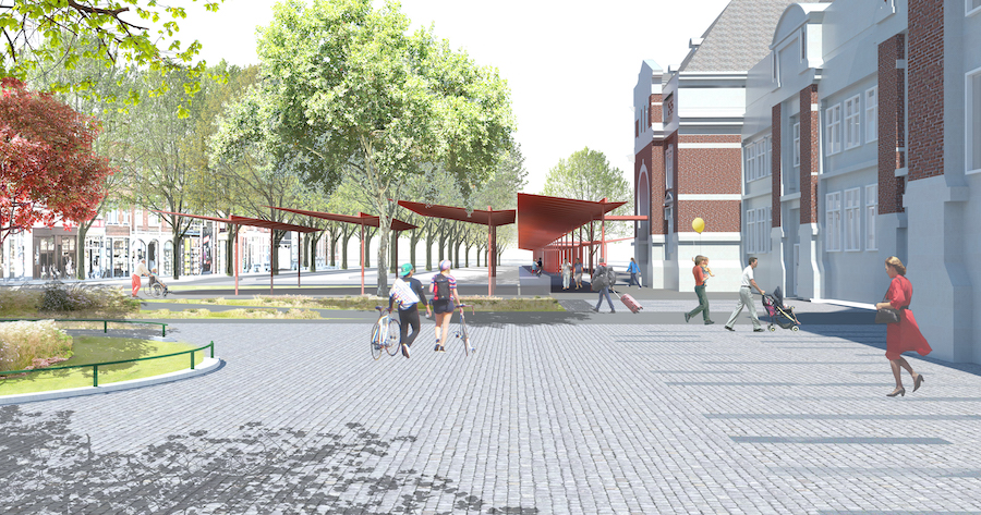
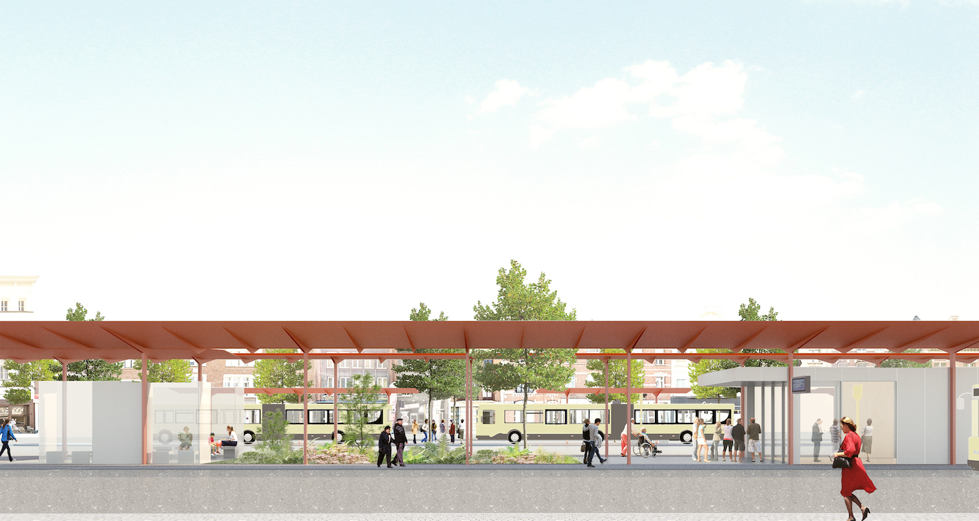
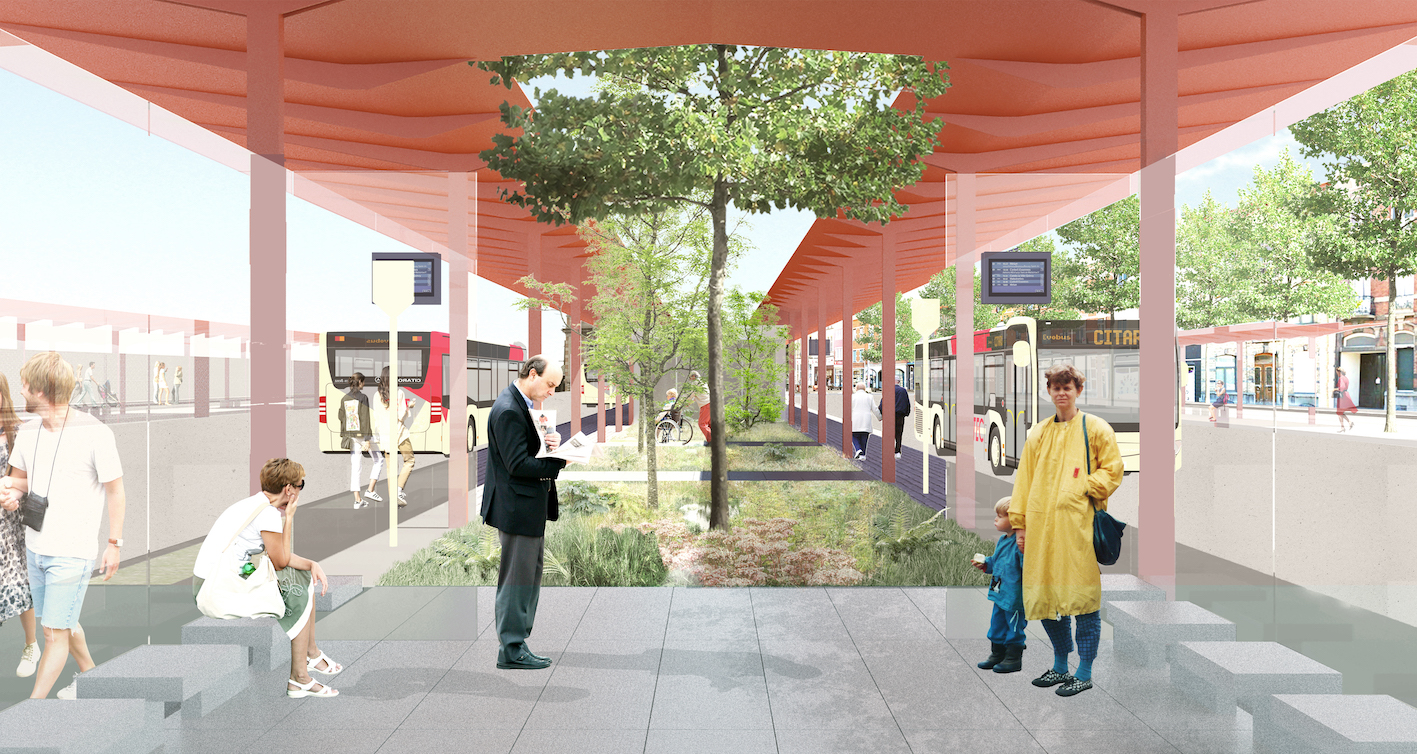
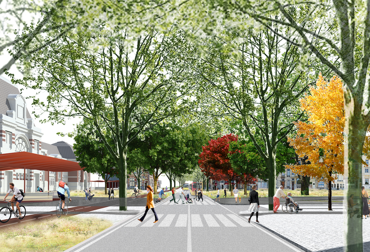
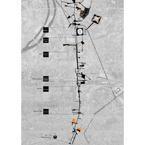
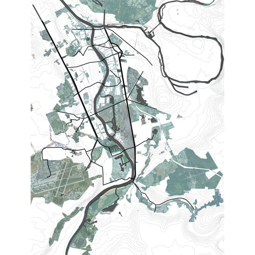
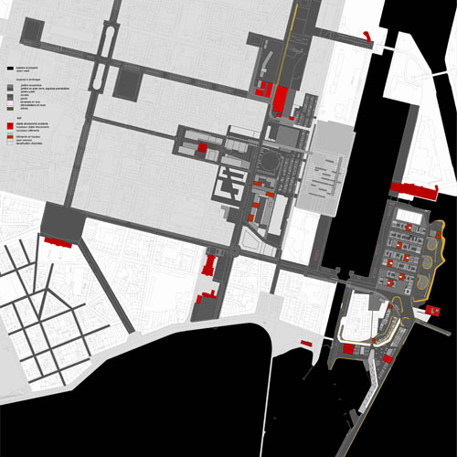
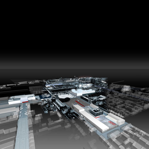
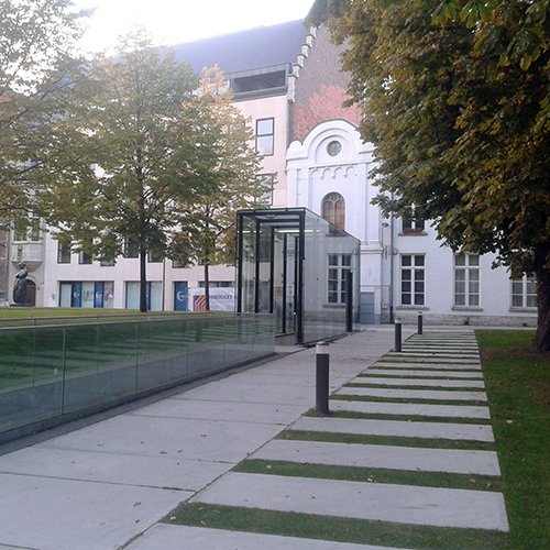
The Tournai Station plateau
Tournai, BE
2016/…
Client: City of Tournai, OTW-TEC, SNCB and SPW
Program: Public space
Team: Etienne Schillers, Qinyi Zhang, Uberto degli Uberti, Thomas Brun, Mathilde Meurice, Christophe Monfort, Rodin Desplechin, Pietro Manaresin
In collaboration with: Studio Sweco consortium, AG Licht, Yellow Window, Aliwen, D2S, Energyconsulting
The Tournai station platform is located on the ring of boulevards in the northern part of Tournai. This intermodal project and public space redevelopment project on the station plateau gives public transport and soft mobility a central role. The urban and landscape quality of the extension of the Crombez Park from façade to façade and the redevelopment of the Rue Royale, which offers a long view of Tournai Cathedral, are also considered.
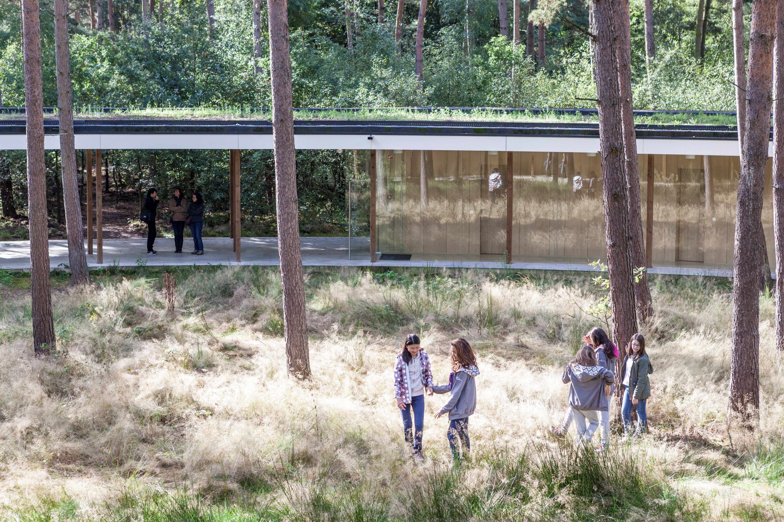
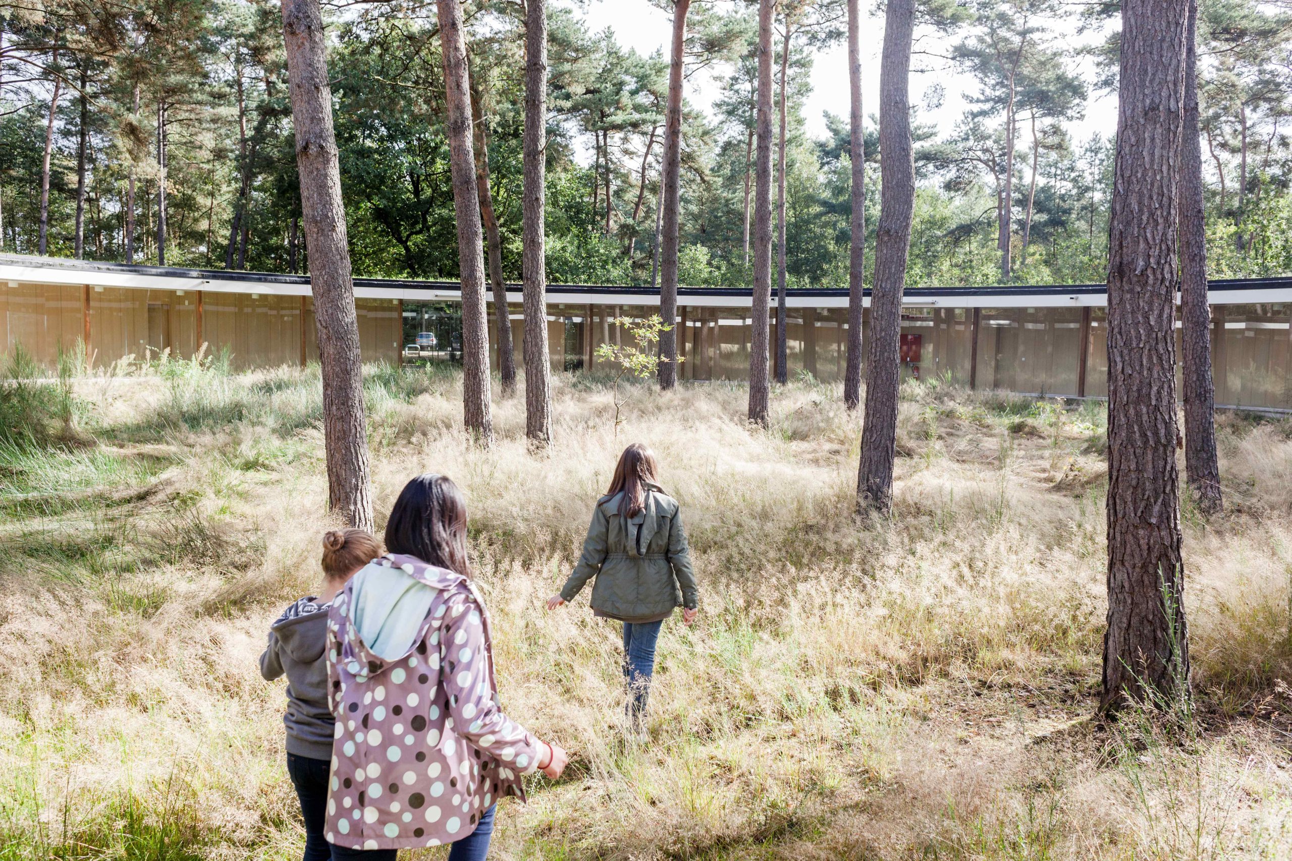
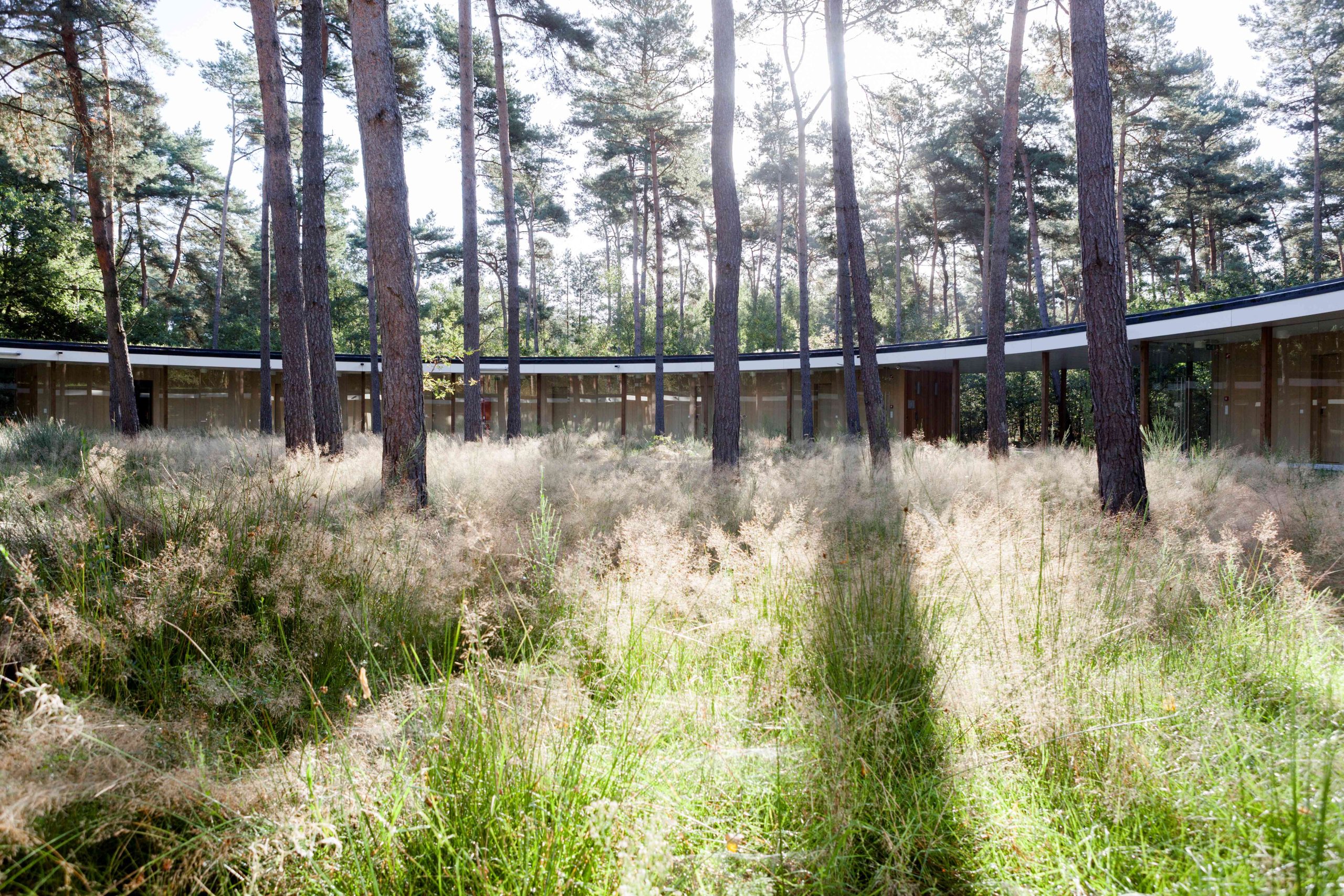
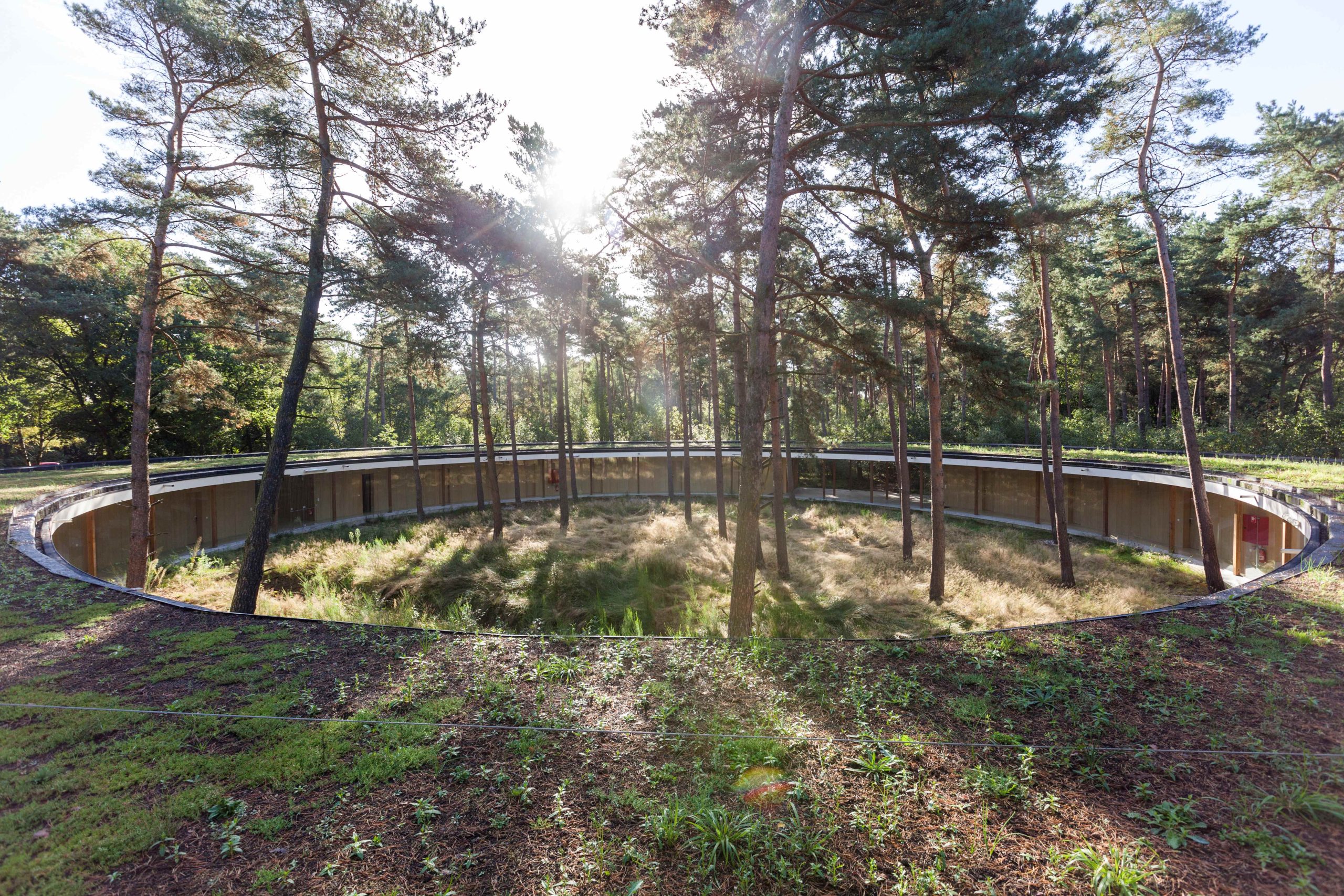
Atom Park
Dessel, BE
2015/2022
Client: Niras
Program: Public space
Team: Matthias Lamberts, Zhang Qinyi, Jordi De Vlam, Veerle Cox, Uberto degli Uberti, Sébastien Declercq, Alessio Tamiazzo, Kasumi Yoshida, Carmen Van Maercke
In collaboration with: ARA/Dries Beys
The landscape park in Dessel is embedded in a very specific context. A highly rich one, where several landscapes co-exist, mosscape, productive pine forests, industrial areas, deciduous forests, etc. the approach of the landscape park related to a communications centre starts with valorising all existing landscapes. To implement this ambition, five lines of landscape are introduced, the productive pine forest (working as a visual spatial screen for the industries), the re-vitalized heath, a natural grassland, an artificial topographical strip and a forest of oak and other deciduous species. Besides this natural sequence, two main paths of circulation guide you through the park. One main path, organized between the heath and grassland, connects the two parts of the park and links up to a wider regional network. The second path runs in a straight line and closely follows the local artificial topography, the so called ‘strip’.
Pole Courrouze
Rennes, FR
Design phases 2014-2016 / réalisation 2017- in progress
Client: Rennes Métropole / Territoires & Développement
Program: Masterplan and Architectural design of central place “Coeur de Courrouze”
Team: Team leader, urban and architectural design: Studio Bernardo Secchi-Paola Viganò / Studio Paola Viganò (Simona Bodria, Adrien Lefèvre, Laura-May Dessagne, Carla Greco, Kasumi Yoshida), Charles Dard Paysagiste (landscape design) , AMCO VRD (engineering and structures)
In collaboration with: Aubépine - Pierre Bazin (ecology), Gwenaël Desnos (water management), Concepto (lighting design)
Almost in the geographic center of Zac Courrouze, the urban project aims to create high density part of the neighborhood, in between of green natural spaces, prior of the project, that realize a strong and amazing contrast with modern architectures that are built. Conceived like a “urban interior”, the Pole Courrouze is hugged by dense wood (oaks, ash trees, pine trees, ..) in both side. Inside him it is realized an open mineral space where shops and weekly market find theirs spaces. The mineral place is covered by a regular pattern of news plane trees that create a “green roof” for the place. Public lightings are also hanging from cables, pulled between the facades of the building. The exceptional big trees existing on the site, are conserved on the place but also but also within the private plots. Localized in a topographic low point, the presence of trees permits also like a water management system: the storm water is stored in the substratum made by a mixture of topsoil and stone. An half of the place is now realized: shops are opened, including a coffee-restaurant.
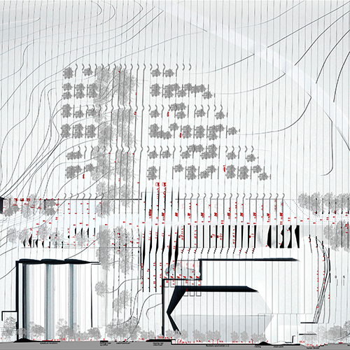
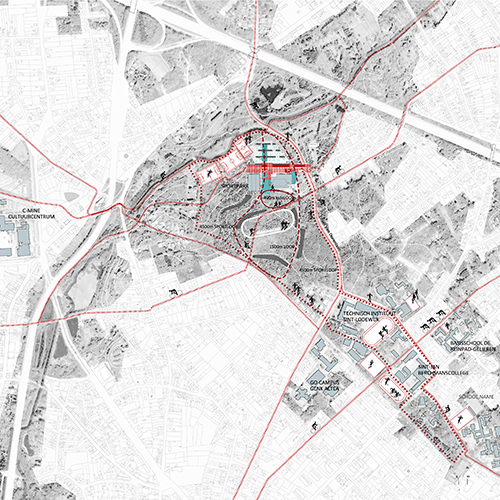
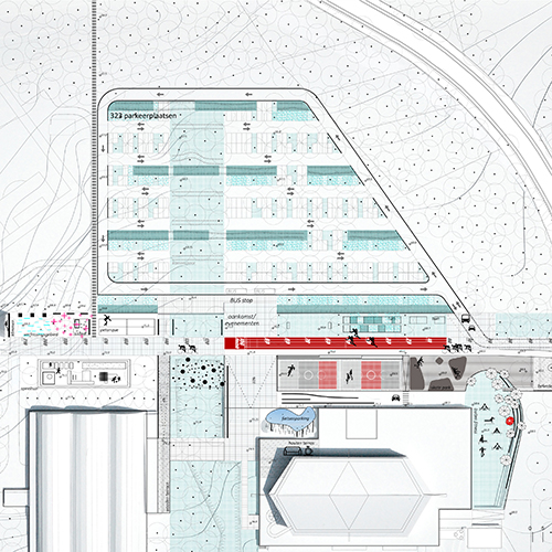
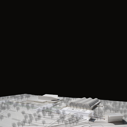
Sportspark in Genk
Genk, BE
2014
Client: City of Genk
Program: Public space/park
Team: /
In collaboration with: Dries Beys (ARA)
The Sportspark is a node to reactivate. Missing links It can be part of a wider park connecting the National Park Hoge Kempen, in the east, to the heather landscape in the west, through the terrils of C-mine and the inhabited agricultural landscape. This east-west connection does not exist today. The Stiemerbeek, part of the blue and green fingers perpendicular to the Albert Canal, intersects the east-west system in the Sportspark. Together, they integrate the Sportspark into a "metapark" running from Antwerp to Maastricht. The project focuses on: 1. mobility and energy saving; 2. green restored habitat; 3 cut and fill balance, water management and water quality. An urban and metropolitan centrality_ Today we consider mono-functional areas a problem: both in the social, economic and ecological sense. The sportspark is at the center of a diffuse urban condition and it needs a different vision. The strength of the urban centrality is not in opposition to the ecological role of the area. On the contrary: it supports a transcalar and flexible project that while designing an enlarged square, suggests new green continuities. The sportsquare between the swimming pool and the sport hall develops into a multifunctional east-west stripe which reorganizes the access and the border between the parking and the buildings as a new open and public space. Together with the green “counter figure” connecting the forest to the Stiemerbeek it enriches the park of a series of flexible spatial episodes.
Landshut in Bayern
Landshut, DE
2014
Client: City of Landshut
Program: Masterplan
Team: U degli Uberti, G.Pusch, M.Rabin, M.Wauters, K.Yoshida, Q.Zhang, L.Thierrée
In collaboration with: /
In Landschut - a pre-alpine context, a part of Greater Munchen Area, an ancient and rich city, a place of flooding risk and of strong agricultural tradition - a contemporary periphery is growing. The characters of this periphery are not exciting: fragmentation of space, lack of urbanity, lack of pedestrian continuity, car oriented design everywhere; erosion of agricultural land. A banal, poorly articulated urban periphery. Our ambition is not only to design an innovative neighborhood, but to contribute to a larger re-qualification of Landschut where the proximity between landscape, residential, employment, services, and to strengthen alternative mobility can enable an ambitious city project. To reach this ambition we propose a strong system of public spaces which are enrooted in the territorial context, in the form of the territory, in its geometry and structure. The proposal valorizes the agricultural context and offers a typological variety which allows flexibility and where different lifestyles are possible. Landschut-West can be requalified starting from the principles stated in the project.
Grand Paris 2
Paris, FR
2012/2013
Client: France Goverment, Conseil scientifique de l'AIGP
Program: Territorial vision
Team: M.Durand, N. Fonty, A. Rafful, R.Sega, G.Vanneste, P.Varloteaux, M.Wauters, Q.Zhang
In collaboration with: PTV France, Tribu Energie, Biodiversité, MOXOX
The vision and strategy we propose is based on the idea that all ongoing major transformations give the occasion to redefine the liveability of Greater Paris, and it is from this that it might be also possible to enhance the territory of the metropolis. Living is a complex practice that is about people and 'city -users ' economic actors pursuing their activities and those arriving to implement others, it is a practice regarding proposed new residents in urban projects and all those who have cultural relations today or memory with the territory. For these practices live must comply places in living spaces, as temporary stable, reduce the current risks, resolve conflicts between the territory of production, territories mobility and habitat rediscover the slopes and channels, large parks on the edge of Grand Paris and the River Seine, and finally restore the ecological relationships at different scales. This is from an open but sufficiently clear in its definitions vision, goals and assumptions, which may raise the question of the meaning and coherence of urban and landscape changes in current and future.
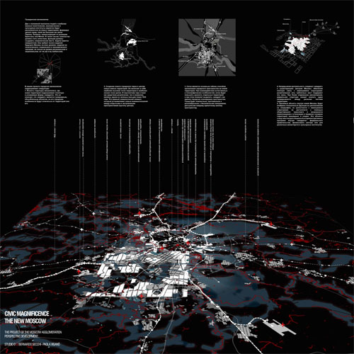
New Moscow
Moscow, RU
2012
Client: City of Moscow
Program: Territorial vision
Team: A.Calò, D.Chang, T.Kadvrov, C.Liang, C.Pisano, A.Rafful, L.Rudko, V.Saddi, R.Sega, A.Tafilica, G.Vanneste, W.Wambecq, Q.Zhang
In collaboration with: ECORYS –NEI, Moscow, Sybrand Tjallingii, Oleg Evseev, Alina Valitova and Yoshiko Miyaguchi
Civic Magnificence The idea of “Magnificenza civile” comes from the neoclassical period and from Italy: there are periods in which society succeeds in representing itself and its main values in a spatial order. In the history of many cities, including Moscow, this has happened several times; marking the city social meaning in the different periods: the aristocratic city, the soviet city and, as our thesis, the Moscow of the XXI century. “Magnificenza Civile” does not concern only architectural icons. It is mainly and more importantly a theme for the whole “architecture of the city”. Two million and half people and important political, financial and cultural institutions will probably be hosted in the new south-west expansion forming as a part of the city as big as Paris intra-muros, or London city. Quantities must become qualities, functions should become symbols. The challenge is enormous. It needs a clear “vision” of the future Moscow and of its political, social and economic meaning at the regional, national and global level. In our proposal “Civic Magnificence” concerns: 1. The readability of the metropolis. The expansion assumes a clear and recognizable figure of a city in-between the existing Moscow inside MKAD and the New Territories (the “square”). The urban rules inside will be different from those outside. 2. The realization of a new metropolitan park at the centre of the new southern expansion includes the highest hills of the region and the lowest points of the valleys. The park is in continuity with one of the green finger of 1935 plans. It is an important symbolical element that establishes a new relation among open and built spaces. 3. A strategy of continuous centrality will connect the «square» to the existing centre of Moscow. The «western and the eastern bundles» along railways and rivers structure, together with the radials contribute to a new spatial structure. 4. The grid is the main flexible device organizing the urban space in the new south-west expansion. In the encounter with natural and topographical features the grid will valorise the different sites. The city is compact, continuous and varied. Every single living space can have a panorama. 5. Important collective functions inside the New Moscow will profit of relevant sites selected for their visibility and position in the landscape, in continuity with the existing tissue, easily accessible in particular by public transport. They offer the possibility to re-qualify and re-cycle in depth the existing degraded areas nearby.
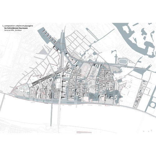
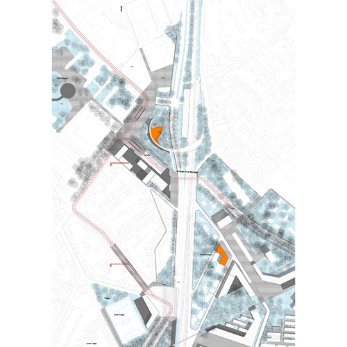
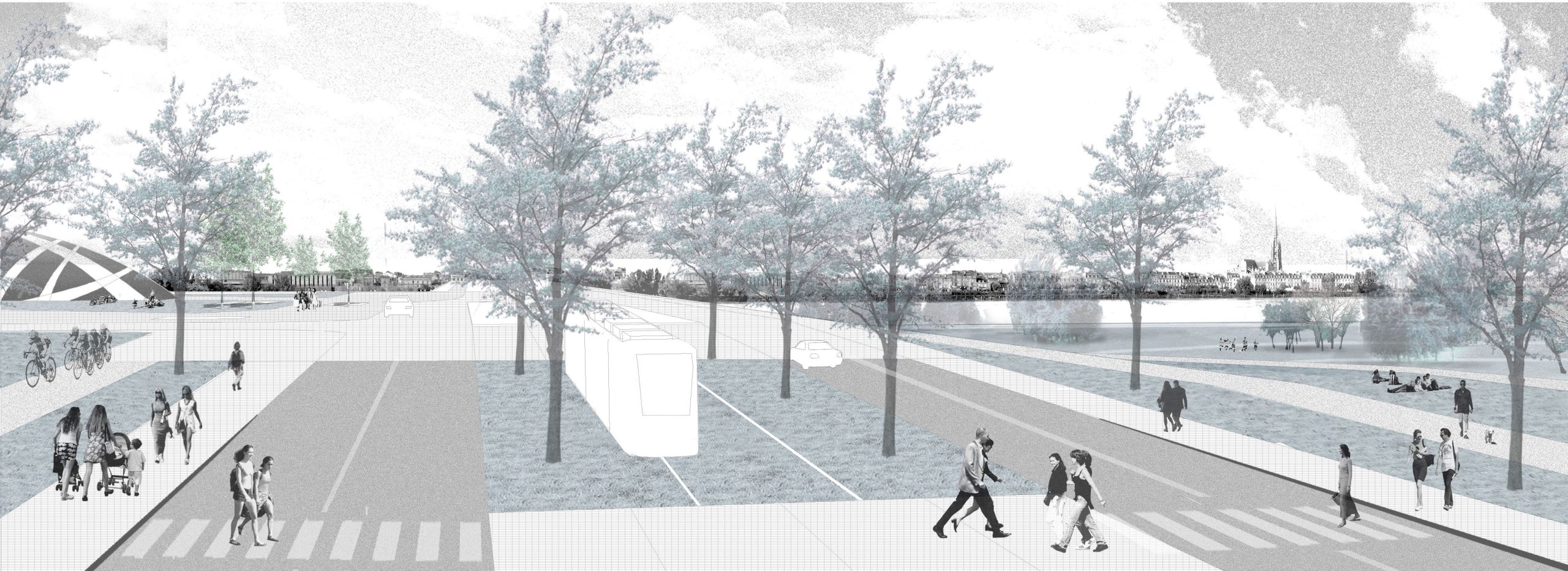
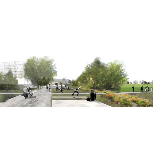
Garonne Eiffel
Bordeaux, FR
2011
Client: Établissement Public d'Aménagement Bordeaux Euratlantique
Program: Masterplan
Team: U.degli Uberti, M.Durand, S.Urbano, K.Yoshida
In collaboration with: Orgeco, ARCADIS, 2EI, CoCo
Bordeaux has emerged as a clear success in terms of reputation, image, residential attractiveness and renewed economic dynamism. This success, which included the Cubs in the accelerated growth of any " Atlantic Arc " should be extended with the arrival of the TGV in 2017 to strengthen economic development and ensure the continuation of a virtuous circle facing the goal of " millionaire city." That is the purpose of the ISO on 738 which extended on both banks of the Garonne ha is a building volume of 2.5 million square meters of floor area in 2024. In this ambitious and proactive perspective various projects related to river are added in recent years, and the Garonne Eiffel operation is clearly part of the ambition to make Bordeaux and agglomeration in the next 15 to 20 years a city European dimension in strengthening its centrality and international attractiveness of both sides of the Garonne in which the city turned its back to the late 90s. Imagine a large project to transform the city from the town itself, we seem inevitable in the case of the Garonne Eiffel sector. It is not starting from scratch, but to use a recycling strategy accompanied by an incremental attitude. Our, proposes new cycles of life in this part of the Bordeaux territory that has already gone through several: territory marshes, rural business and pleasure houses, industries and infrastructure. Our project focuses on structural biases that allow a gradual and progressive urban transformation: First with a large green space, large metropolitan public space, which outlines a monumental reminder plant on the left bank and enhances the great river view as well as the use of pragmatic hydraulic stress and the contribution amenity necessary for the attractiveness of the new district. Followed by the construction of a bridge over the railway barrier and roadways to restore the continuity of pedestrian routes between the north and south of the district and for access to the park for a living buildings more base high offices and housing to be built in the axis of the bridge. The project is thus a compromise between Bordeaux culture of Lower Town and the need to comply with the programming of 870,000 m² of floor area.
Nieuw Zuid in Antwerp
Antwerp, BE
2011/2012
Client: City of Antwerp, development Neiuw Zuid
Program: Masterplan / housing development / public space
Team: A.Calò, D.Chang, U degli Uberti, C.Liang, E. Giannotti, I.Mancini, L.Rudko, R.Sega, W.Wambecq, Q.Zhang
In collaboration with: 3E, ARA, BAS, Citec, IDEA consult, Yves Hermot
The total plot is about 70 hectares, while the new neighbourhood cover an area of 29 hectares, in which the public space is about 20 hectares and the construction area is 9 hectares. The construction area is 400.000 sqm, including 261.000 sqm of new residential units, 64.000 sqm of office space, 21.000 sqm of public facilities and 18.000 sqm of services, and 34.000 sqm of urban functions. The project for a new part of the city is always a complex and layered operation. In the case of New South it deals with the force of settling new rules on top of an already urbanized area; with the re-interpretation of an existing context through the gaze of a new functional program; with the time variable that needs flexibility, inside a clear spatial structure; with the coexistence of a plurality of projects and actors that will animate the new urban space, without producing a banalised catalogue of spaces and buildings. Three themes The competition brief asked to develop ideas on three different perimeters: a bigger one including the South Station and the Spaghetti Node; the second, the area between the Kaaien and the Leien crossing the Tribunal; and the third selecting an area where to focus and detail the project. This is not simply a way, a trajectory going from a bigger scale to a smaller one, but it is, in our opinion, the opportunity to use the design project to investigate three different themes, each one developed at different scales. 1 the park ‘à pois’ The first theme is the construction of an important metropolitan space, a park connected to the south to Nachtergalen, and to the north to the Kaaien, through a bundle of infrastructures today occupying and fragmenting the space. 2 a concept for an urban structure: the ‘striga’ The concept that organize the new settlement is the result of the understanding of the site narratives, it is a concept able to structure the design of an habitat for about 2500 dwellings, it is also a concept of minimal rationality, that follow the rhythm of traces almost perpendicular to the Scheldt river, to design a system of streets and public spaces giving accessibility, but also connecting the park to the river. 3 theme: ‘bigger and cheaper’, innovative housing Five main themes guided the reflection on typologies and their mix: the good orientation of all apartments, with a special attention to the shadow brought by other buildings (‘ombres portées’); the presence of a panorama for all dwellings; an open room, an exterior space for all units; the attention to the construction cost and of the energy consumption. Each building clearly distinguishes a compact core, well isolated, and a lighter structure that hosts all the external or semi external spaces. This can produce some economies in the realization of the housing that could be advantageous also for new inhabitants. Finally a variety of sizes and types are the result of an attention to the previous themes and of an attention to the different types of populations and of lifestyles that might choose New South as their home.
Montpellier 2040
Montpellier, FR
2011/2013
Client: City of Montpellier
Program: Territorial vision
Team: A.Calò, L.Dessagne, M.Durand, C.Greco, L.Péan, E. Pietrobon, A.Rafful, A.Tafilica, L.Thierrée
In collaboration with: Mensia Conseil, Tribu Energie
The first phase of the work helped to define trajectories and images, strategies and projects that were lately put into perspective in the urban project for the city of Montpellier. Trajectories: The development model of Montpellier is based on massive migration which has increased the demographic growth of the city, an important engine for the augmentation of the city and its vast territory. From there, several questions arise as many trajectories and challenges for the territory by looking at how the model reacts or resists towards different possible situations. Therefore, it is required that the territory is able to produce in its interior the necessary wealth to finance its operations, something that it is not enough today. Images: The good life, the place to be, the humanist. We imagine that large images, used in the past for Montpellier, could be further enriched from new contents to be able to give directions and to motivate projects to lead Montpellier in the future. Strategy: The three images inspired concrete projects and reflections at different scales. The space has an important role in the social, economic and institutional behaviour. Giving it a clear and readable structure contributes greatly also to how all these different levels of reality work together and interact. Our hypothesis is tested by two scales: the scale in which the continuity between the different parts of the city and the territory and landscape that characterize it, have been established. At the local scale: the neighbourhoods, it is about working on the fine network of public space by transforming them into places of sociability, seeking an "open" city.
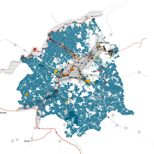
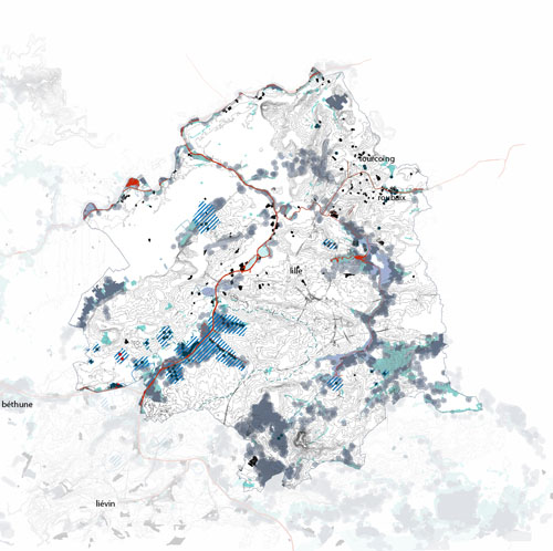
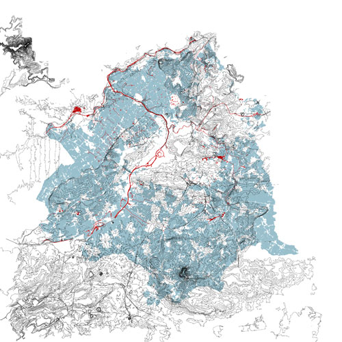
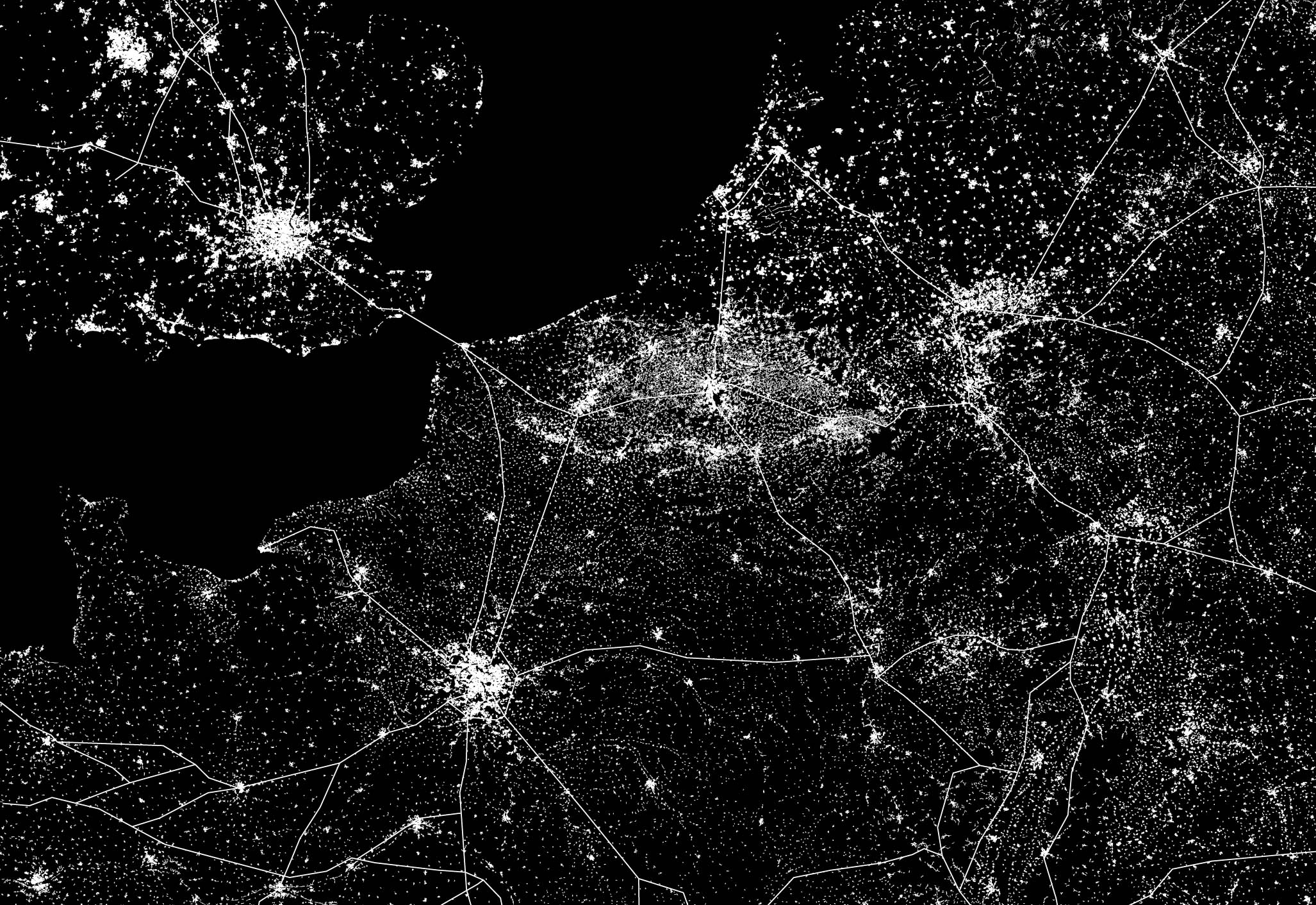
Lille metropolis 2030
Lille, FR
2011/2013
Client: Lille Métropole
Program: Territorial vision
Team: M.Durand, A.Tafilica, V. Saddi, A.Tafilica, P.Varloteaux
In collaboration with: Orgéco, Egis, Pattou-Tendem
The presented and discussed analysis of SCOT in 2010 concerns the communes and intercommunity’s of the arrondissement of Lille. Our reflections are thus inscribed in a strongly deepened process and methodology of elaborating the SCOT around the challenges of practising urbanism in the territory more eloquently named ‘Lille Metropolis’. Strengthened by its various works, converging analysis, reflections of LMCU and our field visits, we bring our insight on the questions and hypotheses of a new attractiveness for Lille and propose a new vision for the agglomeration on the horizon of 2030. The exploration of the territory has suggested us some strategic themes: recycling, attention for life span of materials, pieces of the city and the territory; the importance of the valleys and the biodiversity for the interpretation and spatial structure of the Metropolis; the hybridization between the spaces of the compact city and the diffuse city, the rhetoric submission to the dramatization of their relations which will lead to a new reflection on the new forms of the Metropolis and its different parts; finally the infrastructural support of the Metropolis, the water and the rail in their past and future role.
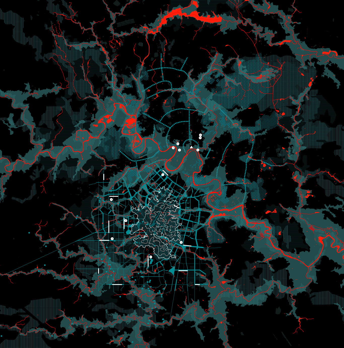
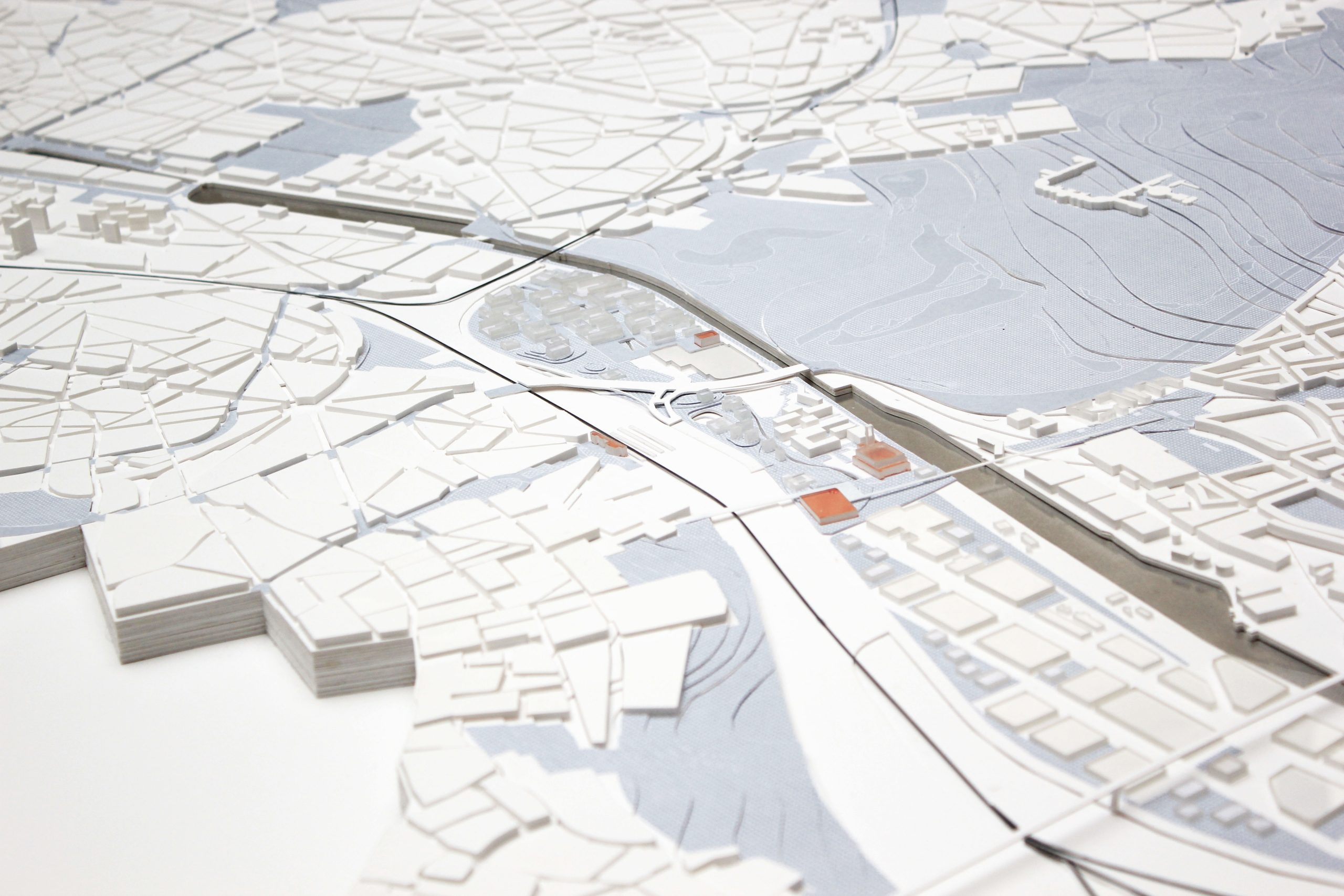
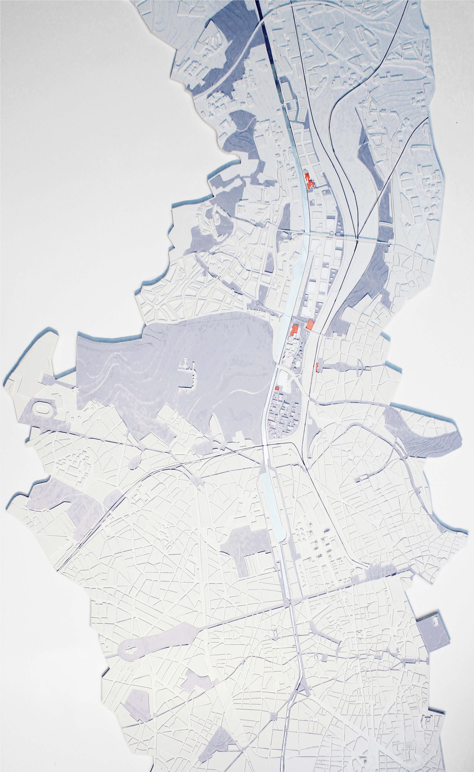
Brussels 2040
Brussels, BE
2010/2012
Client: Brussels-Capital Region
Program: Territorial vision
Team: Myron Devolder, Emmanuel Giannotti, Michele Girelli, Chunxiao Liang, Carlo Pisano, Ana Rafful, Veronica Saddi, Wim Wambecq, Qinyi Zhang
In collaboration with: CREAT- Centre d’Études en Aménagement du Territoire, Egis Mobilité, TU München (Department of Building Climatology and Building Services) and Ingenieurbüro Hausladen GMBH, Karbon’, IDEA Consult
Launched by the Minister-President of Brussels Capital Region Charles Picqué, three design teams of international relevance are invited in order to study the sustainable development of a metropolitan area served by regional public transportation in Brussels. The growing population, the relationship between the centre and the suburbs, the internationalization, and changes in transportation were all themes developed in the vision. Horizontal Metropolis Brussels needs an innovative and radical project The challenges for the future, de demographic, work, formation, education, environmental, social inequalities, internationalisation require a completely new frame: a spatial vision, a structure of mobility, a way to practise urbanism that leaves behind de ideas of the past, but learns from what has happened in the last decades. Our project presents a city model of the 21st century: the Horizontal Metropolis, located in the heart of the North Western Metropolitan Area. It is a city of which the limits are vague and uncertain that in this case is structured by the three valleys of Dender, Senne, Dijle. A definition of the Horizontal Metropolis: an enlarged urban condition, typologically diverse and well equipped, structured by three valleys and by a dense and branched network of public transport; articulated by a series of urban and territorial figures that form the reference points. Inside the Horizontal Metropolis, Brussels is an intensification of this condition. The elaboration of these elements forms a new vision for the city of Brussels and radically redesigns it. Three strategic spaces can be identified in which these aspects build up a specific relation. The Garden of the West, the Lively Canal and Metropolitan Space of the Woluwe. A fourth space crossing the others is the requalified public space in relation to the mesh, the intensified network of public transport. The Garden of the West is based on the extension of the fertile landscape of the Pajottenland inside Brussels. A new culture of equipment’s in a seemingly untouched landscape strongly improves the image of the west of the city, often marginalised. The Lively Canal deals with the requalification of the public space along the canal and recuperation of the built mass. The canal, for centuries the populist industrial centre, regains its liveability. the Metropolitan Space of the Woluwe is the continuation of an extremely well-equipped valley that forms an important ecological continuity between the Sonian forest and the airport in the north (with the forest Floordambos). Again, the relation between services of the city and the ecological landscape is the frame of an amazing metropolitan life.
Woluwe valley
Brussels, BE
2010
Client: VLM (Flemish Land Agency)
Program: Territorial vision
Team: A. Rafful, V.Saddi, W.Wambecq
In collaboration with: ECOREM
This vision is in the result of the work developed between 2010 and 2012 in Brussels in 2040, looking vision sponsored by the Brussels -Capital RER area. In this context, the valley of the Woluwe is one of the strategic areas for future metropolitan Brussels. It has fantastic landscape features, urbanity magnifying the capital, between contrasting rustic areas and build infrastructure and equipment of local and supra- local scales. The valley of the Woluwe is a very important tributary of the Seine and has a double character which is directly related to its location on the border between two regions. Indeed, years the Brussels-Capital, where the Woluwe its source, it flows into a fairly authentic landscape transformed into a rich green spaces and open structure determinant in this part of the city. In contrast, the Woluwe valley is much more constrained in its most remote part of the city, in the Flemish Region. This is an incredibly dense immediate infrastructure presence causes: the airport, R0, Boulevard de la Woluwe, etc. Furthermore, additional infrastructure is provided, which clearly reveals the urgent need for a comprehensive vision for the whole valley. Since this valley is in fact partly loss (sometimes literally) and within the scope of a development by accumulation of small process. This means that ongoing projects and existing operations are increasingly under the influence of physical conditions in an artificial environment, such as floods and lack of quality open spaces. The landscape of agricultural areas is threatened by the tendency to fill these open areas by new developments. The strategy to be adopted is however not that filling. We must consider how these areas are critical to the landscape and liveability of this part of the valley of the Woluwe. However, these areas must be better integrated into the metropolitan life and the banks of the Woluwe. This can be done through agricultural transverse structures related to structural features of the river. Often, these areas face a monofunctional planning business lands that may yet become permeable through the introduction of a common structure. Around the structures, ' patches ' can be densified. The strategy followed here is that of the dune setting common structure for the valley and activities that develop, allowing percolation and strengthening ecological continuity while describing a valley landscape fighting against his artificial environment.

Crossing the Grand Paris (North-South)
Paris, FR
2010/2012
Client: Établissement public d'Aménagement Orly-Rungis - Seine Amont
Program: Territorial vision
Team: A.Calò, I.Mancini, A.Pagnacco, R.Sega
In collaboration with: Biodiversita, MAGEO
The character of the mission is a process accompanying a system of actors, as a design module, led and fed by Studio. Upstream Seine is located in strategic areas of the Grand Paris and was an opportunity to remind the strategies of " porous city" developed by our team during the consultation on the future of the Paris area and "the city of XXI century Kyoto. " Production area for over a century, the future of the valley of the Seine will be built with its historic features, unlike the Parisian model who has pushed to the periphery these productive vocations. Territory to inhabit, it assumes all the social and functional complexity of a metropolitan area, while retaining its unique identity. Active territory and instead of connections, Seine Upstream will firstly find ways to reconcile these different functions but also face risks, including flooding, while finding a link to the river and its banks. These themes announce Exploring a vision and a local project that we called the project the " green passage ". Minor Seine bed, bank to bank, is the starting point of an investigation that extends confluence (with the Marne and the Yerres). The issue of flood risk finally scored the debate, with in-depth reflection on the concepts of resilience and resistance and the difficulties and ambiguities associated with their implementation. We propose to detail our assumptions through places: the confluence Seine- Marne and the relationship with the Bois de Vincennes, the " island of Choisy " area and the Carelle Athis-Mons. Each of these areas involves different project themes: from North to South, the respiration of the river, forming a large metropolitan area connected by bike paths, activities and centralities the river; recovery arm side of the Seine and the opening of the regional park of the city of Choisy, between the gondolas and Villeneuve Triage; restructuring of the productive and renewal of the urban fabric along the Seine
Crossing the Grand Paris (East-West)
Paris, FR
2010/2012
Client: Établissement public d'Aménagement Orly-Rungis - Seine Amont
Program: Territorial vision
Team: A.Calò, I.Mancini, A.Pgnacco, R.Sega
In collaboration with: Biodiversita, MAGEO
The territory of Seine Upstream is a prototypical territory of contemporary urban fragmentation, formed by specialized enclaves, closed plates and fragments of nature that is changing radically in its entirety. The coming years may be an opportunity to reopen the discussion on the current characteristics of the territory in addressing environmental issues as a catalyst that produces innovation project of the city and the country, which produces new relationships between natural ecologies and artificial. The challenge is to make it habitable territory today very specialized and hard in several of its parts. To make it more habitable territory, the proposed overall strategy involves the reconstruction of ecological and functional connections between the plateaus, hills and valleys, which requires work on both the biological, ecological and programmatic aspects in the broad sense. Elements that could be carriers and carriers of a porous city project are numerous: they act at different scales and with specific terms. The study proposes to reflect on all the possibilities of expansion of existing naturalness, the naturalness of infiltration along preferred directions, its percolation through more or less permeable materials according to their density and. These arrangements movement can also guide us in the programmatic reflection must know and understand leverage existing practices, identify and take into account, as well as devise new. Developed strategic projects take place in three sequences. Indeed, between the Seine and Seals we recognize three main sequences project, each defined by a theme and a specific territorial condition. The three sequences are connected by efficient TC and appropriate spaces waves infrastructure environment. Strategic projects and new rules of territorial construction will define a new space and permeable structure, but also the percolation processing in tissues, activity areas along the infrastructure beams. The three sequences suggest three themes in urban and metropolitan scale: Sceaux sources Ru Rungis, the first and the Plateau with the new urban park (the " Boomerang " and " Lambda ") the second; arrival the Seine and through the third. Together, they define a new territorial public space, support the transformation.
Lille metropolitan area
Lille, FR
2009/2011
Client: DREAL Nord pas de Calais
Program: Territorial vision
Team: M.Devolder, A.Rafful
In collaboration with: Orgeco, Citec
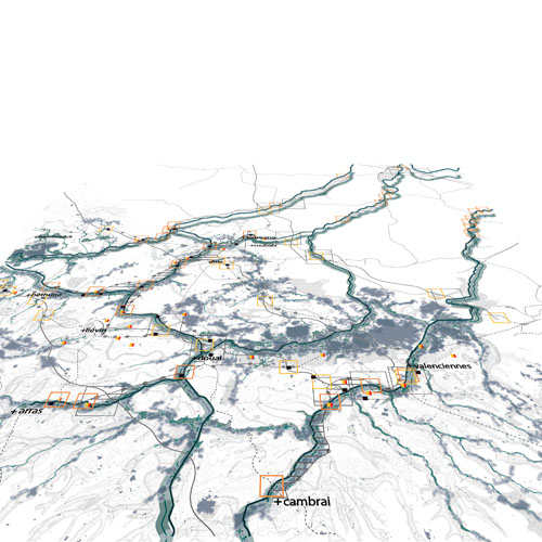
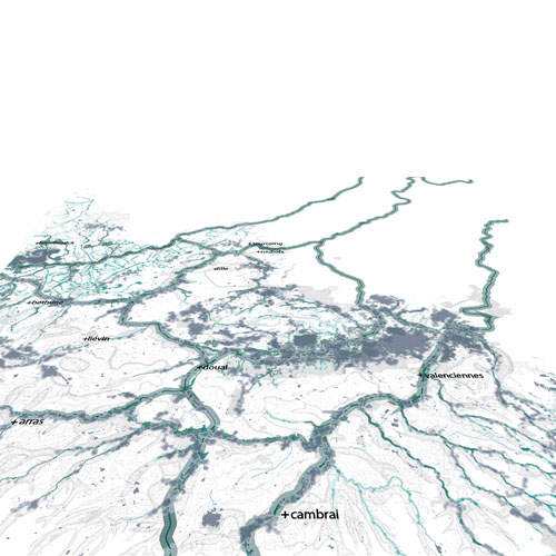
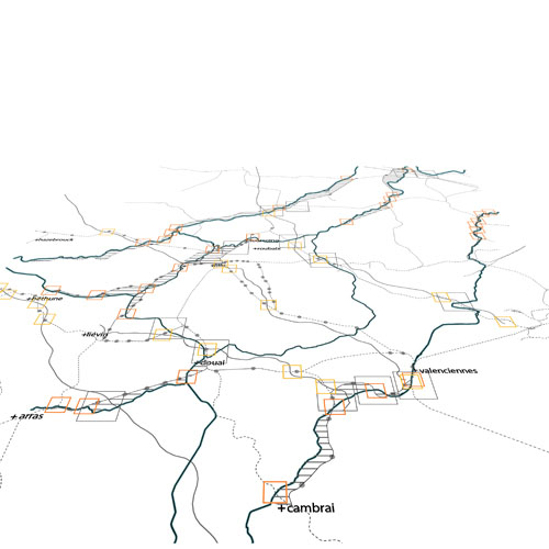
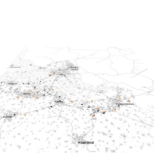
The work, of nine months with the DREAL Lille Nord-Pas-de-Calais, was organized together with the support of three working groups; each one dedicated to different themes:’ the green and blue network”, “the urban fabric” and finally “the transport network”; enabled us to establish a coherent framework for the planning and transport for the metropolitan area of Lille. The project inventory done by each one of the working groups, allowed us to represent the territory in a more conceptually way. Something that presented the same paradoxes that a description can bring which would not be the reproduction of reality and which forced us to choose what seems most important and relevant. We often tried to resolve this paradox limiting ourselves by what is "structuring," as if the concept of structure was very clear and obvious. Usually, confusion takes place considering as structuring what is larger, more massive, more expensive or which is proposed by the administration of a higher level. By comparing the information gathered with the "form" of the territory and its history, it has been questioned how the proposed projects would eventually change the shape of the metropolitan area and the relationships they could establish with its long history. But the metropolitan area of Lille can be designed in different ways: as part of a vast metropolis that many researchers call the North Western Metropolitan Area, a metropolis that goes from Lille and extends it to Brussels, Antwerp , Rotterdam, Amsterdam and Cologne, or a smaller as a metropolitan area that has its main centres in the cities of Lille, Tournai and Kortrijk, or as an even smaller but highly articulated territory in which we can identify different parts with its own physical and social morphology: the mining area, the heart of the metropolitan area, areas of urban sprawl, the historic cities on its borders, etc. It is likely that the only way to think seriously about coherence is to confront, as we did, the involved dynamics, the undergoing or planned projects, with scenarios that explore the impact that these projects can have in the future. The conclusions of this work do not seem clear, it is not white either black, coherent or incoherent. It is much more complex, but it seems to be useful enough to start a debate at the metropolitan scale and to indicate some project management guidelines. The methodology was based on the animation of meetings and crossing analysis of the data provided by the DREAL with our own ideas and research information.
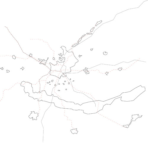
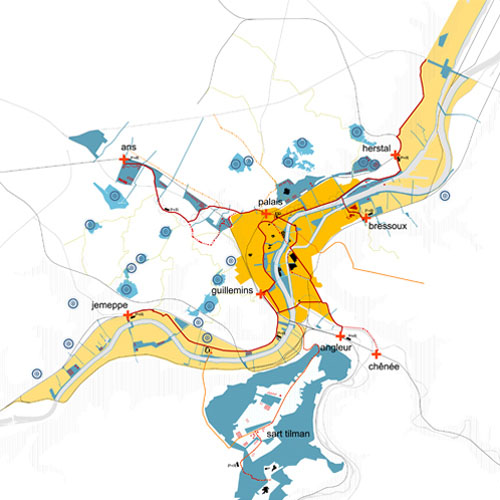
Transurbaine Liege
Liège, BE
2009/2012
Client: City of Liège
Program: Infrastructure
Team: M.Devolder, A.Rafful, G.Vanneste, Q.Zhang
In collaboration with: Creat, Egis, Haumont-Scholasse and partners, Doublepage
Liège is changing, from and in response to the decline and eventual disappearance of the industry in the mining area. One problem is the apparent lack of attractiveness and another one the degradation of the city centre. This has led to a polarization of the urban fabric between rich and poor where workers are still not integrated or interact with the rest of the city. The topography of the valley of the Meuse reinforces the fragmentation of the urban fabric, but also represents a strength of this territory. These elements led us to the definition of four different urban models, or simply four types of cities: 1. The dense city: old and compact, localized between the Meuse River and the hills. 2. The mining city: the mining landscape on the hillside which consists on mining housing tissues and abandoned mining activities sites and heaps. 3. The steel city: the landscape of the industrial valley that has played a leading role and is now the place where major changes might come. Industries are mainly located along the Meuse River, which implies an enormous potential for the valley. 4. The emerging city (or the 'edge city'): the contemporary city, on the plateau developed a long road and transport infrastructures and large objects agglomerations: university, business parks, shopping centres, etc. The first objective was to assess the implementation of the tram and the structured and sustainable development regarding these four types of cities in Liege. This was a great opportunity to be able to reflect on the future of a territory based on the installation of a public transport infrastructure through its various social and urban morphologies.
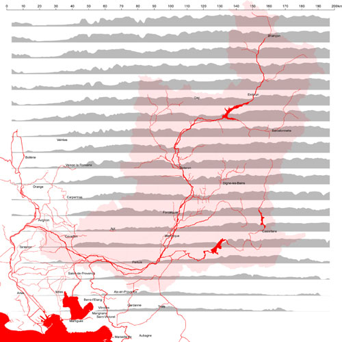
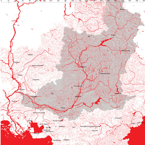
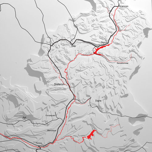
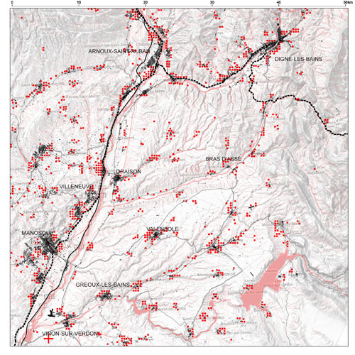
Val de Durance
Provence-Alpes-Côte d'Azur, FR
2009/2011
Client: Region of Provence-Alpes-Côte d'Azur
Program: Territorial vision
Team: S.Bodria, D.Chang, I.Cogliano, L.Rudko, L.Thierrée
In collaboration with: ORGECO, Citec, Gioacchino Garofoli, Fondation pour la recherche sur la Biodiversité
Build a territorial project is a great opportunity to question our idea of future, to apply the test under different scenarios and to propose such a vision that aspires to become collective. The idea of a new modernity, specific and not generic, we find appears in the image of Val de Durance as reservoir, wider than that of the valley scale, a point of strength and leverage project. Thus, the hypothesis of Val de Durance as water tank at the regional level, renewable energy at the national level, biodiversity at European level, scientific innovation on a global scale is an image project. It directs and may guide the selection of places and strategic actions. If the issue of agriculture is taken as an example in an " agropolitain " territory we can already begin to imagine actions inspired by Cassini hypothesis and strengthen several aspects of the "reservoir " as take advantage of the diversity of dry areas and irrigated and distribute new acreage consistently sectors maintain and develop agro-ecological structures, hedges, open spaces, the meadows, the vegetation of "water" etc. The strategy for the development of this spatial vision involves constructing an image of the project, which is here the tank, and the implementation of scenario. The image of the reservoir is a critical picture. Perspective, a perspective that allows us to cross territorial thickness of critical and reflective way. While the scenarios are more like a collection of assumptions, the possible consequences are explored. So, we have not developed a " run of river " scenario in the traditional sense. Instead, we started thinking on the basis of the establishment of a "zero scenario". One that starts from the consideration of projects: this is, in our view, the base of one possible future, one that is already in assumptions change and change in progress or offered on this territory. Besides the zero scenario we developed two other tracks: The hypothesis radically strengthens transit and territorial consequences of the ITER project. Large external projects, such as ITER, the effect is not a fundamentally new phenomenon in so far as the valley grows and changes, today as in the past, through a series of shocks externally driven. However, the scenario of urbanization along the valley raises important questions with respect to agriculture and biodiversity therefore need to be thought together with the integration of the infrastructure.
Grand Paris
Paris, FR
2008/2009
Client: French Government, Public Institution for Business and Cultural Works
Program: Territorial vision
Team: A.Calò, D.Chang, T.Cos, N.Fonty, A.Pagnacco
In collaboration with: EMU (students of fall semester 2008-2009 of the European Master in Urbanism), IUAV, Doctoral students in Urbanism (Lorenzo Fabian, Emmanuel Giannotti, Paola Pellegrini), PTV France, MOX, MIT and P-REX (Alan Berger and Case Brown), TU München (Department of Building Climatology and Building Services) and Ingenieurbüro Hausladen GMBH
The study on Great Paris Region ‘’the porous city’’ is divided in three parts. The first part, a knowledge strategy for XXI century -the after Kyoto age- metropolis, makes clear our approach to figure out contemporary metropolis situations complexity and depict a possible future. Studio followed here this pattern: Paris, as others metropolis, will have to face, in the future, some important issues. This drives to the need of considering and build different ‘scenarios. We made a comparison with other metropolis through common criteria, specifying Paris diversity; not drawn only on long time fixed icons. Great Paris is neither only a main tourist venue, nor the mental images Paris inhabitants have of their city. A trial for a new approach study was our guideline. The second part illustrates three different scenarios we consider fundamental for the XXI century -the after Kyoto - metropolis and its future. The 1st scenario took as a model a future of 100% durable energy situation; the 2nd scenario envisages the creation of a new great wetlands system in the metropolitan area, aiming at a composed ecological and recreational system starting from the ‘dross’ biotic system, and how this system could deal with metropolitan risks which includes environmental, social and economic crisis; and, at last, the shift from a hierarchical vertical system to a horizontal isotropic mass transportation system. During the scenario construction, we have been collaborating with experts, artists and EMU students. A large number of interviews, micro-stories, photographs, analysis and design have been done in Paris to root the scenarios deeply in this vast territory and its inhabitants. In the third part, finally, Studio proposed strategic projects, interacting with the three scenarios.
Schaerbeek Formation
Brussels, BE
2008/2013
Client: Brussels-Capital Region
Program: Masterplan
Team: D.Chang, L.Domenichini, S. Dussin, S.Geeraert, T.Fait, S.Peluso, W.Wambecq, Q.Zhang, G. Vanneste
In collaboration with: IDEA consult, ECOREM, Mint, 3E
The competition deals with an old railway area at the northern side of the city of Brussels. Relatively close to the center, the Schaerbeek Formation area is surrounded by a thick infrastructural bundle. The accessibility to the area is obstructed by regional - national and international railway lines and high traffic streets. Moreover, the area is historically been used as train storage, this feature has implied a high pollution of the grounds. Above all: coal and heavy metals. The proximity to the Brussels north-haven, to the Schaerbeek train station and to the international airport (Zaventem) clarify the potential of this area. Due to the accessibility high complexity, to the problems of depollution and to the high number of economic and social players involved in the project; we opted for two different strategies instead of one solution. The strategies have been built on a base made by four different scenarios.
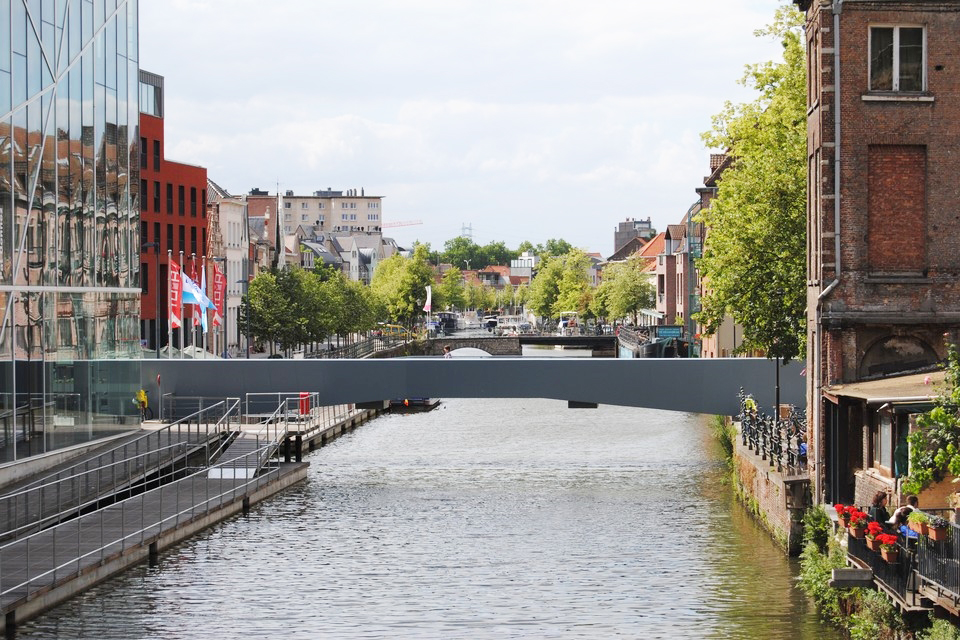
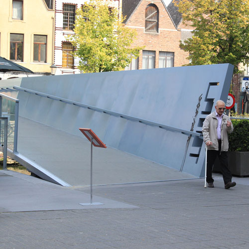
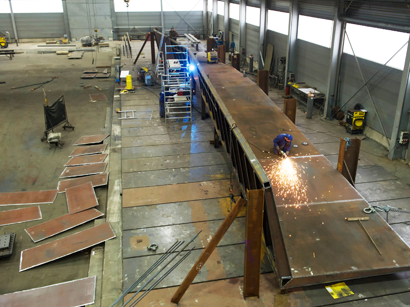
Pedstrian bridge
Mechelen, BE
2007/2012
Client: Waterwegen en Zeekanaal NV
Program: Infrastructure
Team: E. GIannotti, S.Geeraert, G.Pusch
In collaboration with: Dirk Jaspeart, Marc De Kooning (BAS)
The project Lamot bridge is not considered a simple connection between the two banks of the Dyle, but as part of the wider strategy for renovation of Mechelen. In this sense and also from a symbolic point of view, the bridge is part of an important link between the Lamot site and the historic centre. These reflections on a large scale are joined by others, explicitly related to the configuration of the site. The project of public space has created a connection in a heterogeneous area is characterized not only by a multitude of features and social practices, but also by a strong fragmentation. In particular, the need to design with the goal of creating such an open space and readable as possible, led to a series of compromises, like in the first place the need down the level of the place that hindered the possible relationship with the Dyle. the Lamot site and the fish market are perceived in other words, if two extensions of the Dyle, rather than two different places: the deck and pavilion providing centrality to space and back to the water. Both objects are designed as two terraces cantilevered over the water, as two homes. Strong heterogeneity in terms of shape, colour and style of existing buildings brings us to the use of a very discreet architectural language. The soil is a little bent, black concrete surface. Similarly, the bridge and the pavilion are two surfaces of folded steel. The bridge is an extension of the road Stoofstraat, where a slight crease directs it to the space instead.
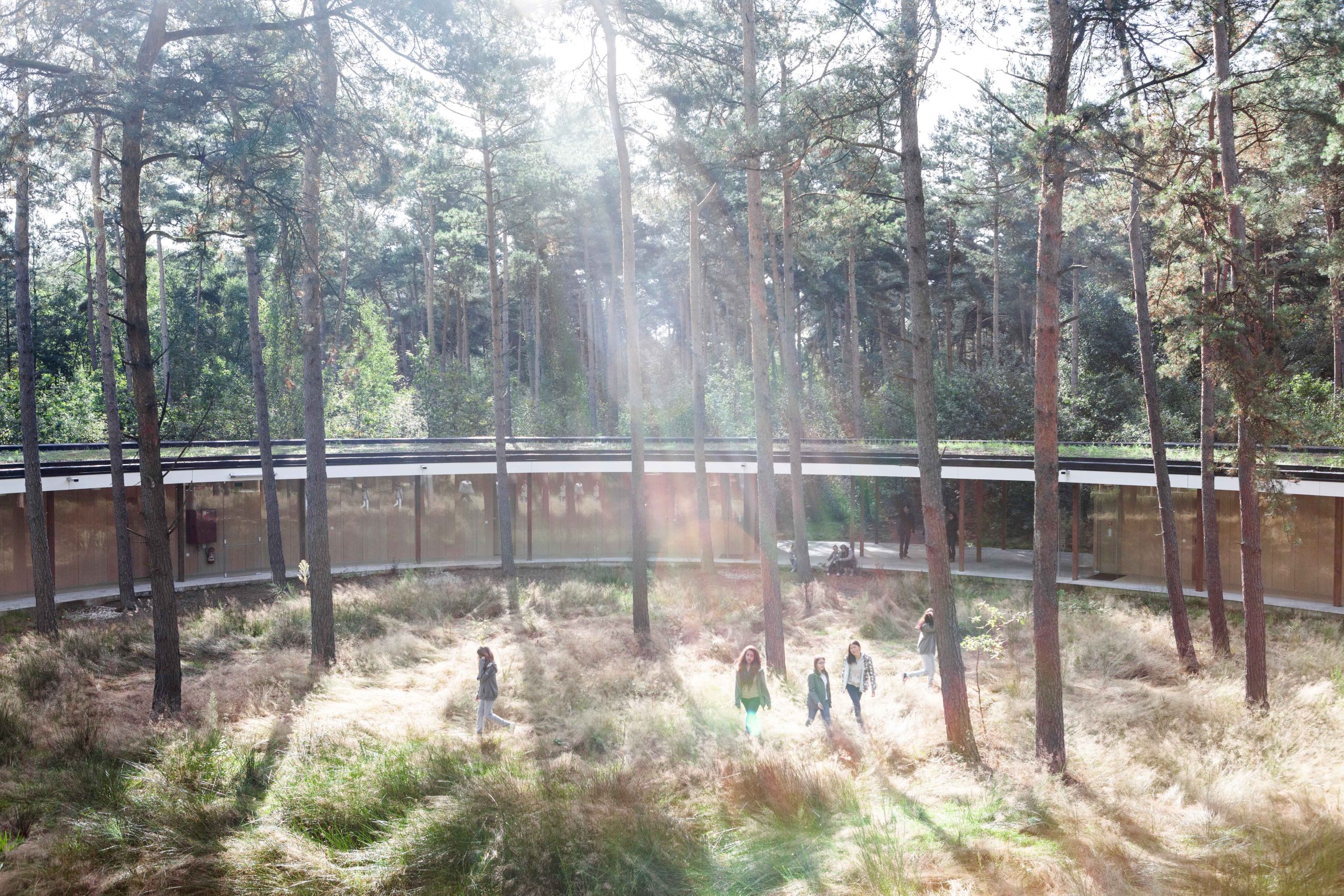
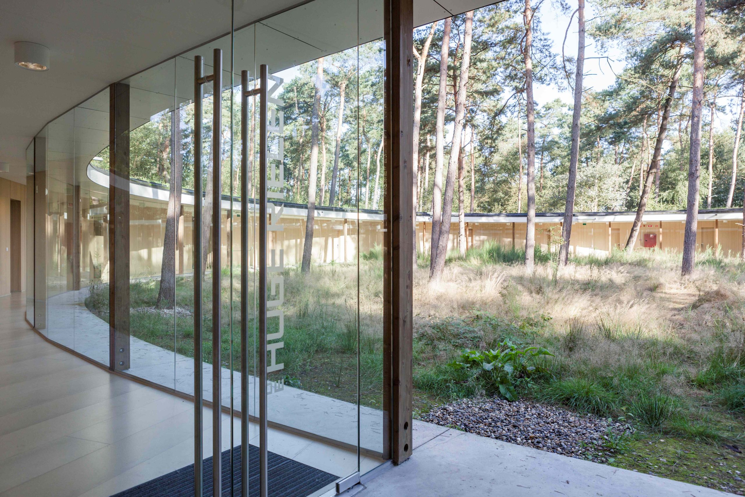
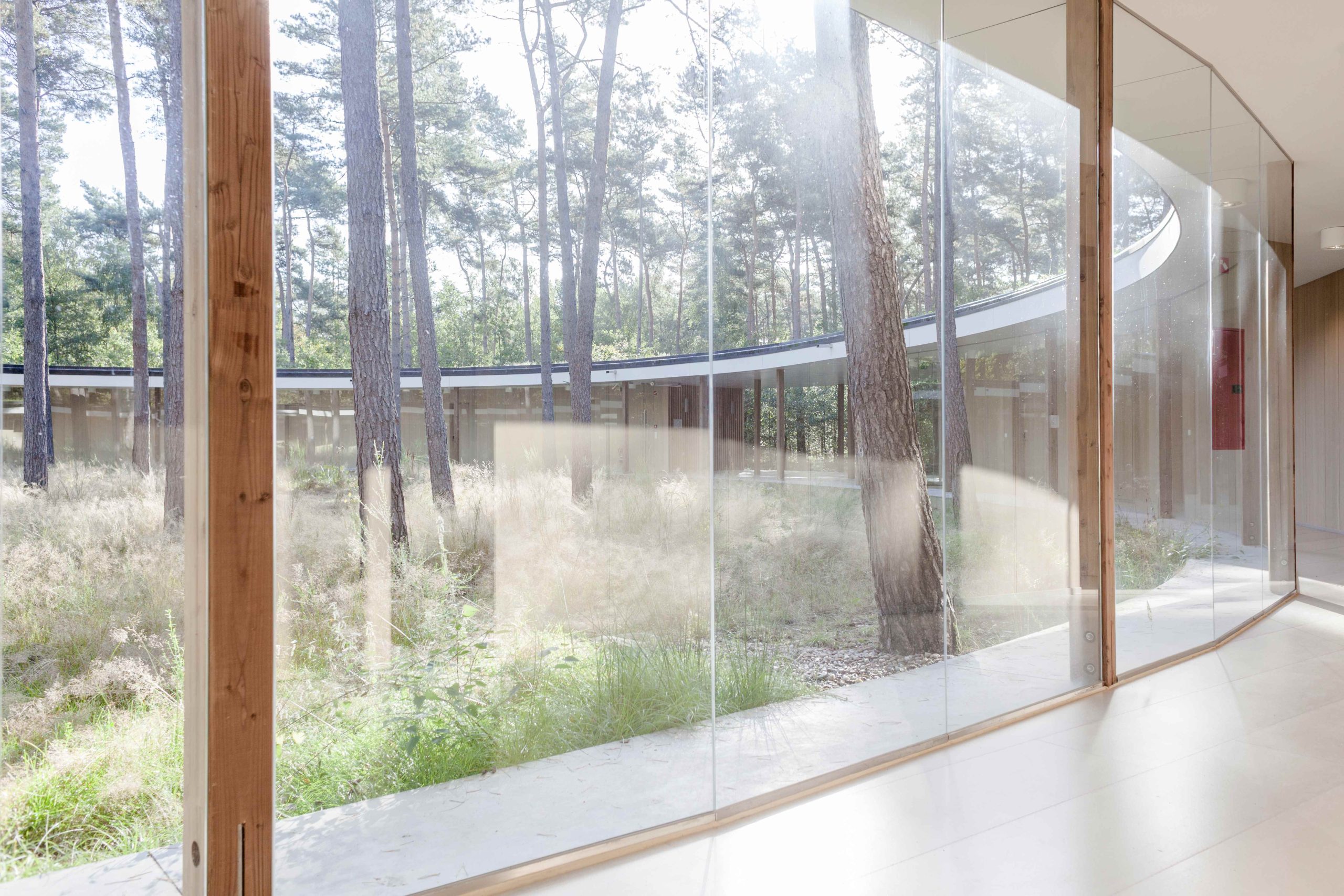
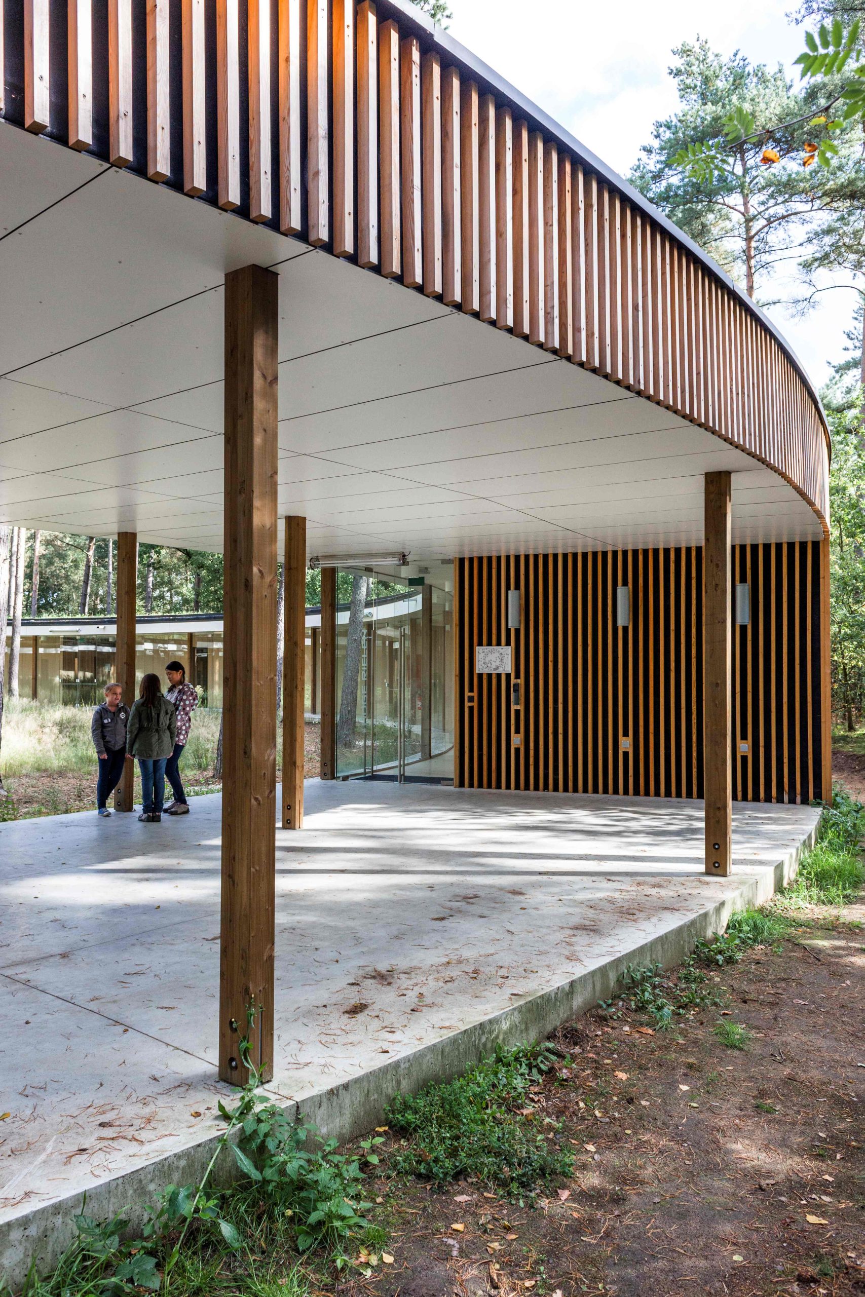
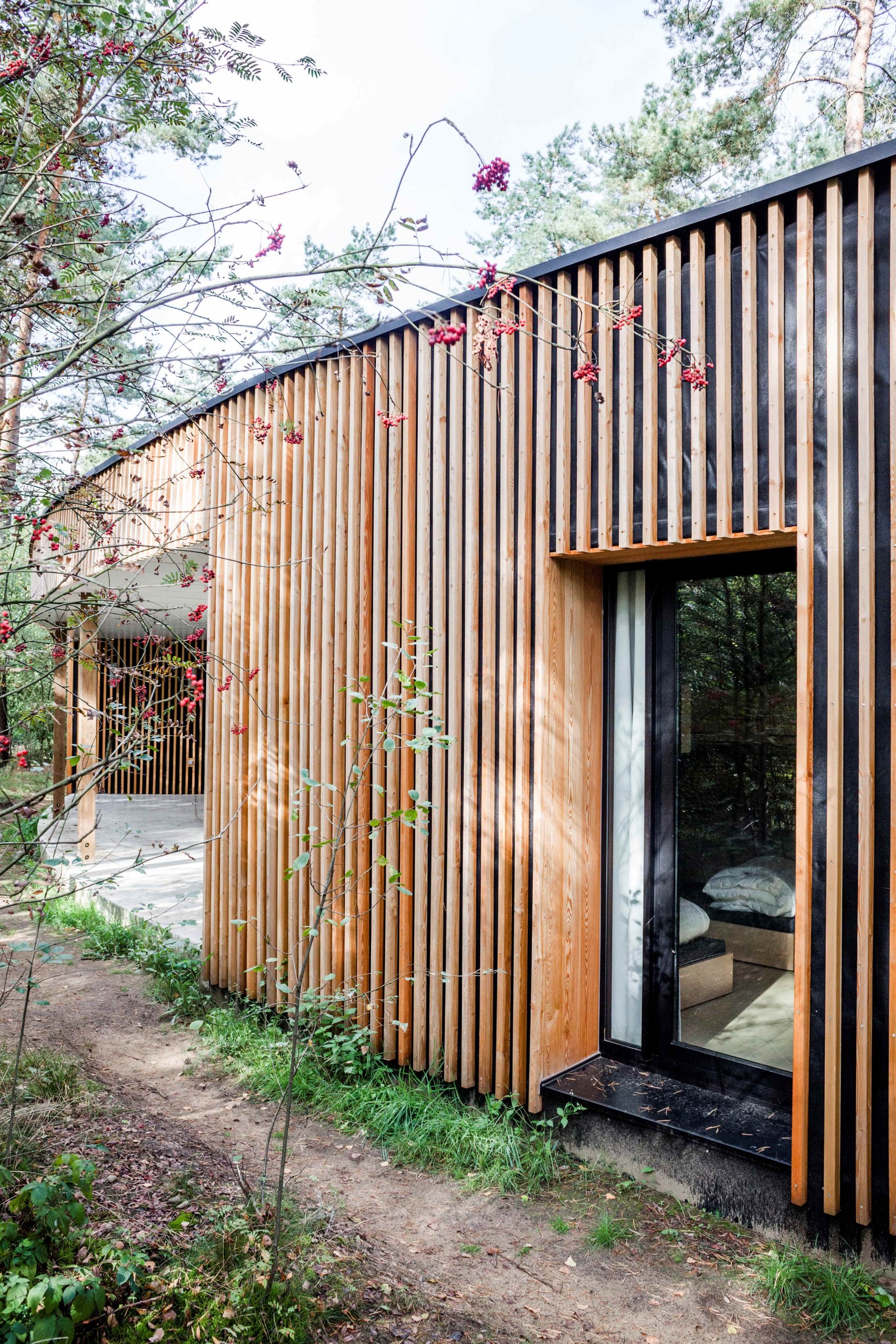
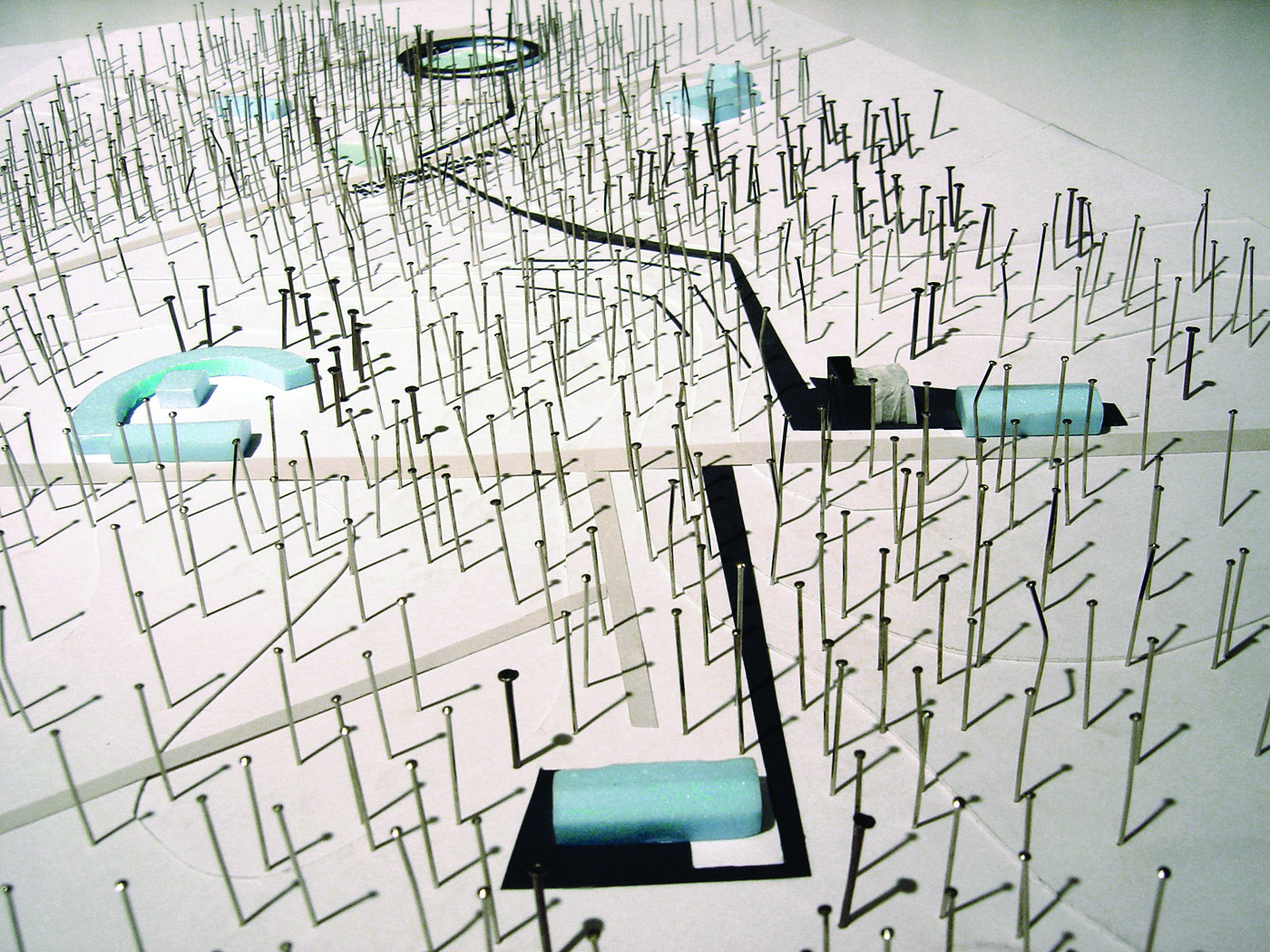
Hostel Wadi
Kasterlee, BE
2007/2013
Client: Flemish Government, AFM
Program: Hostel (76 beds), public space
Team: U.degli Uberti, E.Giannotti, G.Pusch, W.Wambecq, K.Yoshida
In collaboration with: Dirk Jaspaert, Mark De Kooning (BAS), Dries Beys (ARA), Bruno Depré (IRS)
The competition to design the first part of the 'Contact Strip’ is an important step in the implementation of the Hoge Rielen Master Plan. In Hoge Rielen, the Contact Strip is considered a major public space. Along the main road, all public facilities are located. People occupy this area to meet or simply to pass through. The main intention of the master plan was to give some thickness to that line, where could be possible to organize occasional events, green spaces and water points; and to allocate amenities and main public buildings along it. But more than a physical act, the 'Contact Strip is the idea of an extended centrality that works as a guide for future changes that the emerging programs of the leisure center could bring. Today, several years after the completion of the master plan, the programs of the first part of the 'Contact Strip' have slightly changed since the establishment of the master plan. When we introduced the study projects on the site - the hotel at the north edge of the pond, the transformation of the pavilion nr 4 into a multifunctional space in the south and finally, the open space between the reception and the cafeteria, the 'Contact Strip' was considered enriched by these new spaces and facilities that are transversal to the main direction of the existing public sequence. This new spatial condition and the role of the 'Contact Strip' are reinforced by its connection to the cross-links, which are also linked to another crossing, forming a thick, clear mesh. One of these new time project events is Hostel Wadi. By its circular shape it creates a central interior space, a naturalness circumscribed and contained and where the atmosphere is different from the rest of the park. This device allows to establish a special relationship between the users and the hostel itself. Actually, even if the rooms are open to the outside (towards the park), they are serviced by an internal corridor on the outskirts of this central space, that it is separated only by large continuous berries leaving the enjoyment of the views to this last. The interior is a green microcosm that also function as a Wadi collecting rainwater from the building.
Regatta
Antwerp, BE
2006/...
Client: City of Antwerp / Vooruitzich SA (public - private)
Program: Public space / park
Team: U.degli Uberti, M.Devolder, S.Geeraert, S.Peluso, G.Pusch, K.Yoshida, G. Vanneste, Q. Zhang, J. De Vlam, M. Lamberts, N. Fredrick
In collaboration with: Dries Beys (ARA), Atudiebureel Stockmans (Antwerp)
The project area in Antwerp Regatta is unique in that it offers the relationship between the urban and public space. The strength lies in the fine mesh of the public space at the local level which gives access to the park by a consistent materialization park that stretches along the Galgenweel along the Scheldt. This network provides ecological continuities between the park and the river and the forest below. These are the natural logic which help draw the plan public spaces. In the neighbourhood courses are organized and prioritized. Some axes promoting access by car and parking, while others remain completely pedestrian and linking public open space, rear gardens and homes. Treatment materials soil and vegetation makes this device readable. The plotted paths are designed to give priority to alternative modes and slow the car. Of '' wadis '' provide natural continuities and from the park and play a buffer role for the recovery of rainwater. Various building plots are subject to various projects by architects, ensuring diversity in the types and morphology of the proposed buildings. To ensure the transition between the park and the village, the east-west links are strengthened. The entrances to the park are a series of places that announces '' something else ''This announcement is made by the presence of materials of the park extend linearly along the footpaths. These places are also equipped with useful features such as bicycle parking, fountains, etc... A change of vegetation also has the character of the nearby park. The use and combination of materials is the result of sustained attention to the continuity of the village and the park. This gives a real character to the street and public spaces without becoming eclectic.
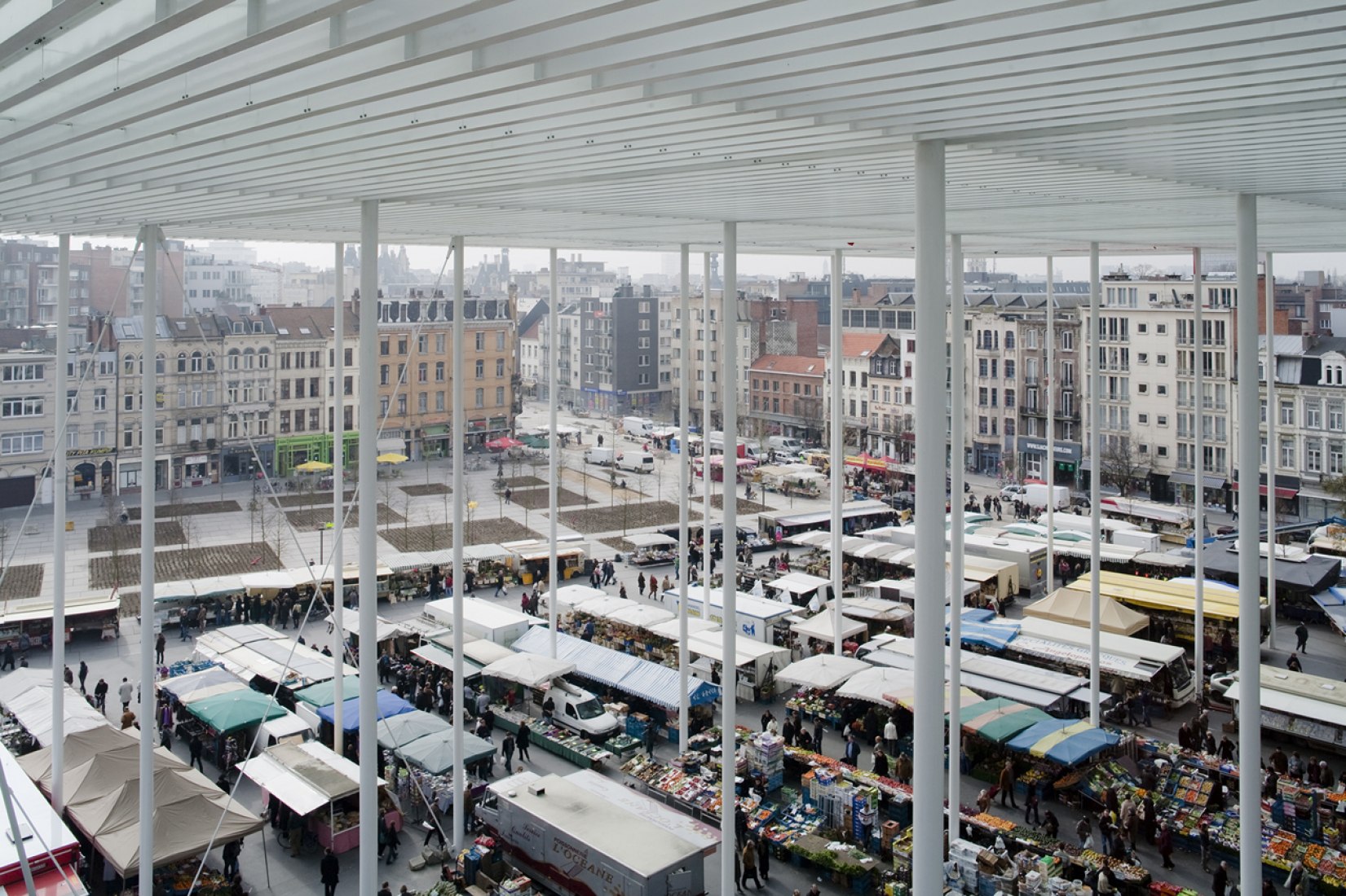
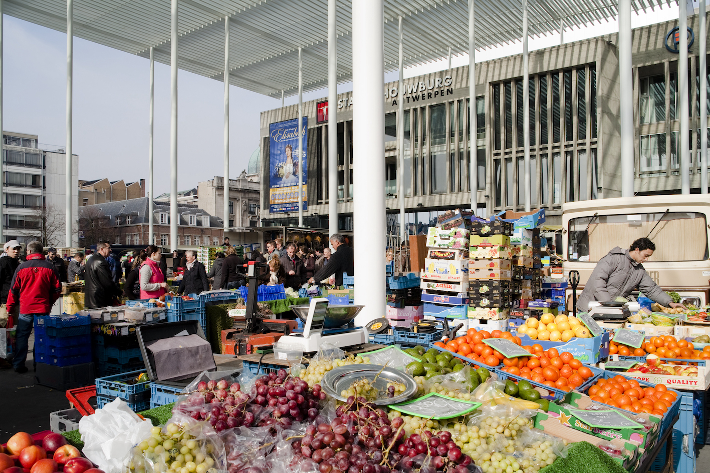
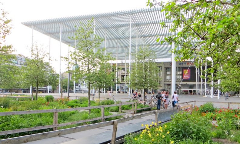
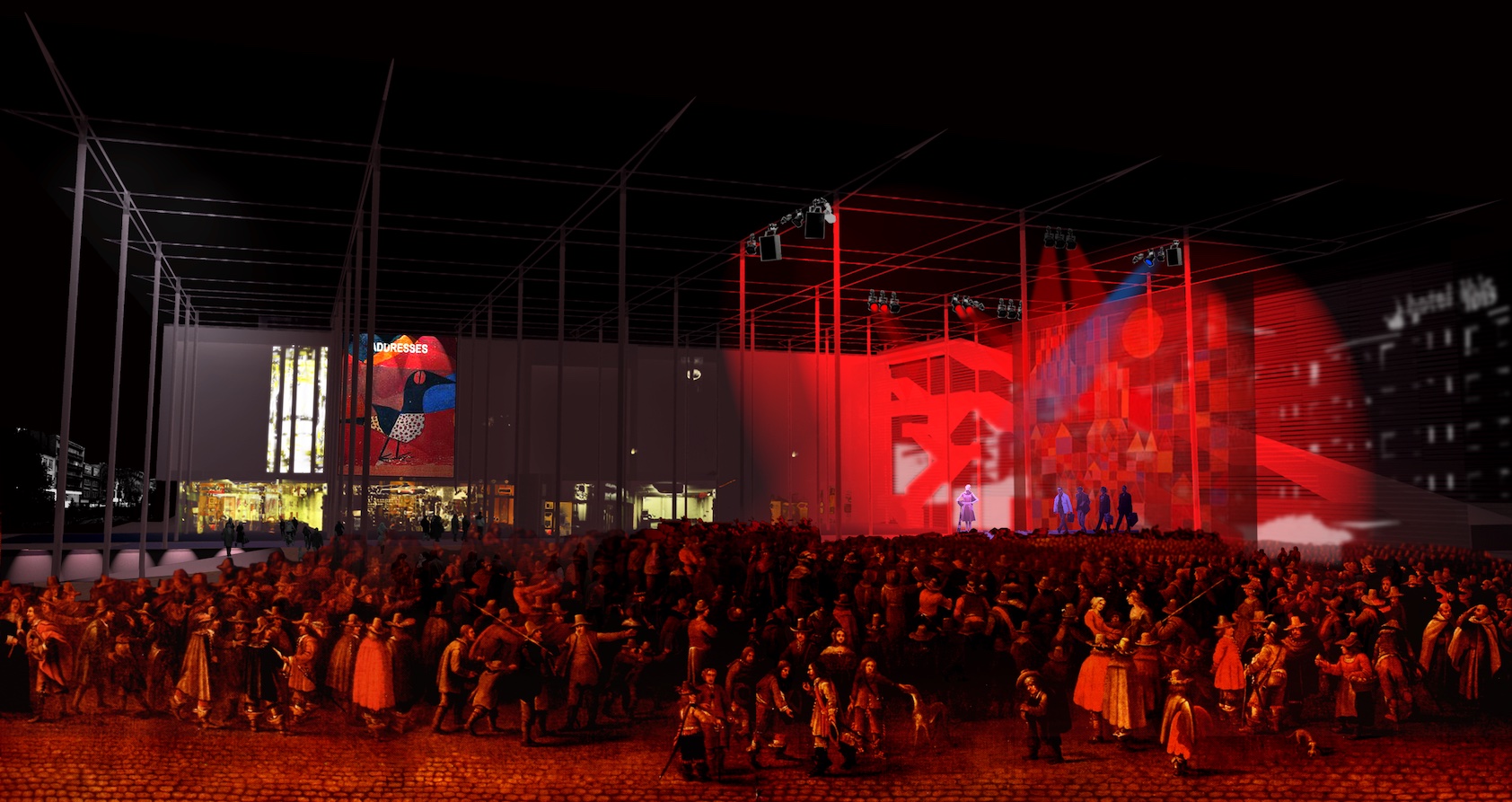
Theatreplein
Antwerp, BE
2004/2008
Client: City of Antwerp
Program: Public space
Team: U.degli Uberti, S.Geeraert, E.Giannotti, G.Pusch, K.Yoshida
In collaboration with: Dirk Jaspaert, Marc de Kooning (BAS), Dries Beys (ARA)
Today, the Theatre Square in Antwerp is a boundless space, where it is difficult to calculate the distances and to find one's bearings: a space without limits. A huge space, even if disproportional, should not be necessarily filled up and built; it should be correctly interpreted in the visible and invisible measurements which are usually the product of the site's history and of the different choices taken on it. The project articulates the square in 4 major spaces: the garden in the south part, a covered square in the north part, the mall at the west side all along the Oudewaart square and an equipped space at the east along the Meis street. The gardens become an area for infiltration of rain water. Between the garden, conceived as a playground, and the façade of the cafés and bars a platform in wood becomes a multifunctional space. The design of the square, in coloured concrete, eliminates all the existing barriers: accessible to everybody, the square becomes a whole surface, 2% of ramp, which links the entry of the theatre to the very nearby boulevards. The margins of the square have a different design according to their character: along the Maria Pijpelincx street, Graanmarkt and Oud Waart square the existing pavement and trees were maintained; along the Meis street the entry at the underground parking was reorganized, along with the bicycle parking and the bus stop. A part of the square is covered: the cover, supported by a very slim steel colonnade, makes the space comfortable for the weekly market. The existing security stairs are demolished and substituted by new ones which creates a virtual façade of the covered space towards the Meis street.
ZAC de la Courrouze
Rennes, FR
2003/…
Client: Rennes Metropole
Program: Masterplan / housing development / public space /infrastructure
Team: E.Alfier, M.Ballarin, S.Bodria, D.Chang, A.Calò, A.Carlesso, I.Cogliano, U.degli Uberti, U.Dufour, S. Dussin, T.Fait, C.Greco, G.Lambrechts, A.Lefèvre, T.Lombardo, C.Neidhardt, T.Medina Amaral, A.Pagnacco, S.Peluso, G.Pusch, L.Rudko, A.Tafilica, S.Urbano, K.Yoshida
In collaboration with: Charles Dard, Amco et Pierre Bazin-Aubépine, Gwenael Desnos
Rennes, Brittany region capital, is a fast-growing city and, as a consequence, is subject to a strong housing and equipment demand. The query of the assignment was for a new city part design (140 ha, 4500 new housings, 100.000 m2 of service, the necessary equipment…) in a previous military area characterized by an important natural asset. Based on a careful observation of places and topography, the project claims the necessity of considering the different ways and styles of life and mix them (''mixité'' concept); it considers the orientation of different buildings and their projected shadows, first step for an in-depth study of energetic problems. That's why this peculiar project stands up against the rhetoric of iconic architectural solutions and try to give an answer to the functional, social, and visual complexity of contemporary society. A project of this scale, that mobilises a number of actors and means, cannot be realized in a short time; it requires a flexible and strategic approach that allows a phase implementation. For these reasons parts of the project are conceived as definitive, for example the design of the open spaces giving a strong structure to the urban space, other parts, like buildings and private gardens, as more flexible units, where future changes can happen. In the first case the project principal element is the 'green stream': a system of large open spaces that links the centre of the city to the country side through the Courrouze area; in the second case it is the sequence of private spaces, semi-private and public gardens: the patchwork of mixed uses placed side to side with the different building types.
Structure plan Antwerp
Antwerp, BE
2003/2007
Client: City of Antwerp
Program: Urban planning
Team: M.Ballarin, A.Calò, N.Dattomo, C.Nitti, F.Vanin
In collaboration with: IRIS Consulting
the new structure plan study for the city of Antwerp; a strategic and pioneer plan for urban planning tradition of Flanders. The city of Antwerp lived splendid ages, not only in the 19th century, but also more recently in the 20’s and 30’s until the 60’s. Since then, a substantial part of its population has abandoned the city and moved to the countryside. A huge part of the city centre was occupied by new population with very different origins. All that and the lack of politics for integration has provoked a social tension that caused a visible, even though ambiguous, decline of the city in the last 2 decades. «Comment vivre ensemble» “How to live together” becomes the principal theme of the plan. This goal cannot find its solution in an urban plan only, even though it is conceived with a strong commitment in social and economic issues. But it can help if it's able to find the strategies and the priority interventions and study their feasibility on site and through time. The plan is conceived through two ideal means: on one side the 'images', on the other side the 'scenarios'. The 'images', based on both the city history and more recent interesting reflections (like the ecological ones) are the guidelines for future action and in particular for the construction of a 'vision'; the 'scenarios', are a “what could happen if ….” Analysis system: they allow to push further the project through a collective involvement of city actors and users getting over traditional exclusively data-based previsions. In this framework the plan adopts a strategy of renovatio urbis: in a general structure of urban space strategic projects are developed

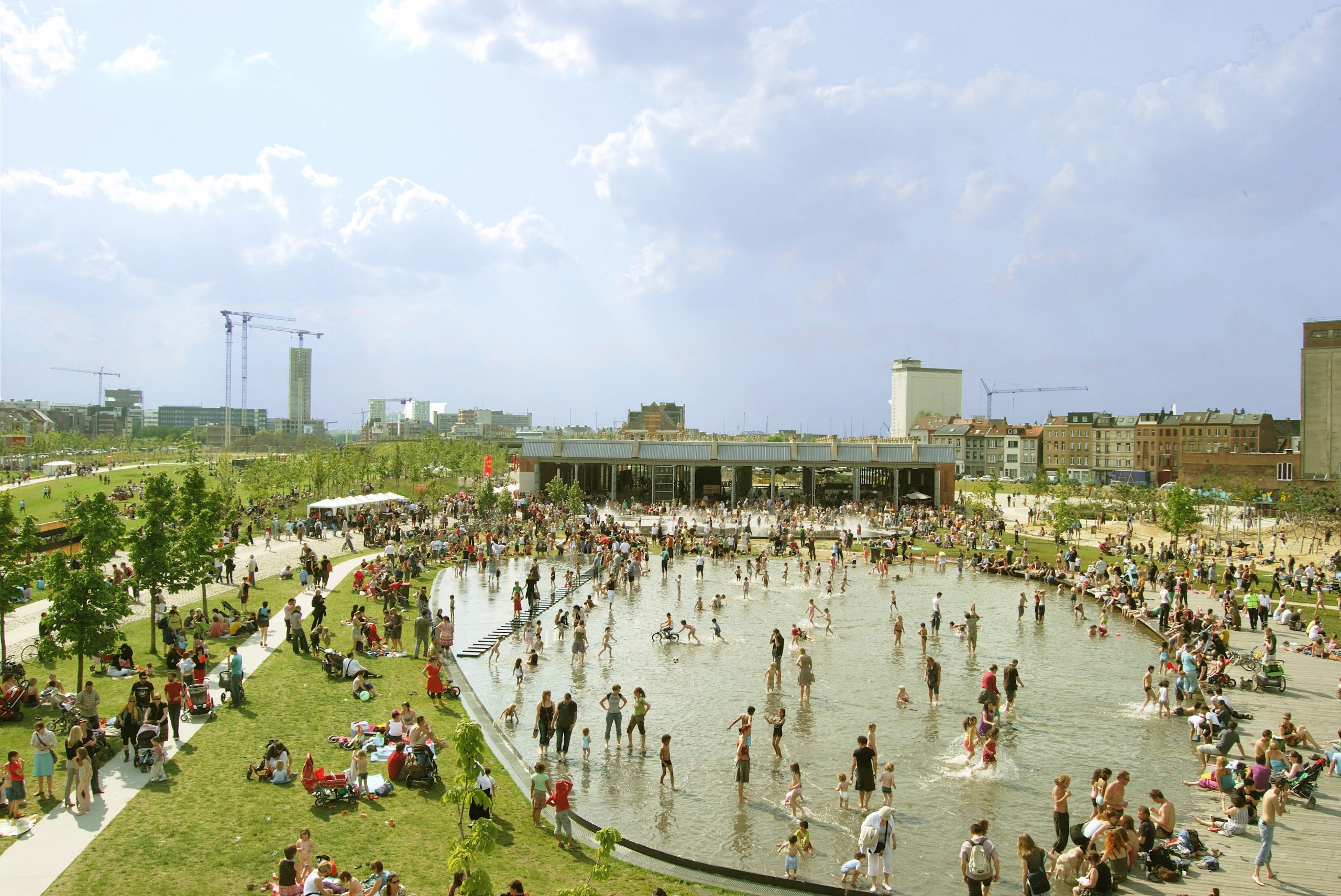
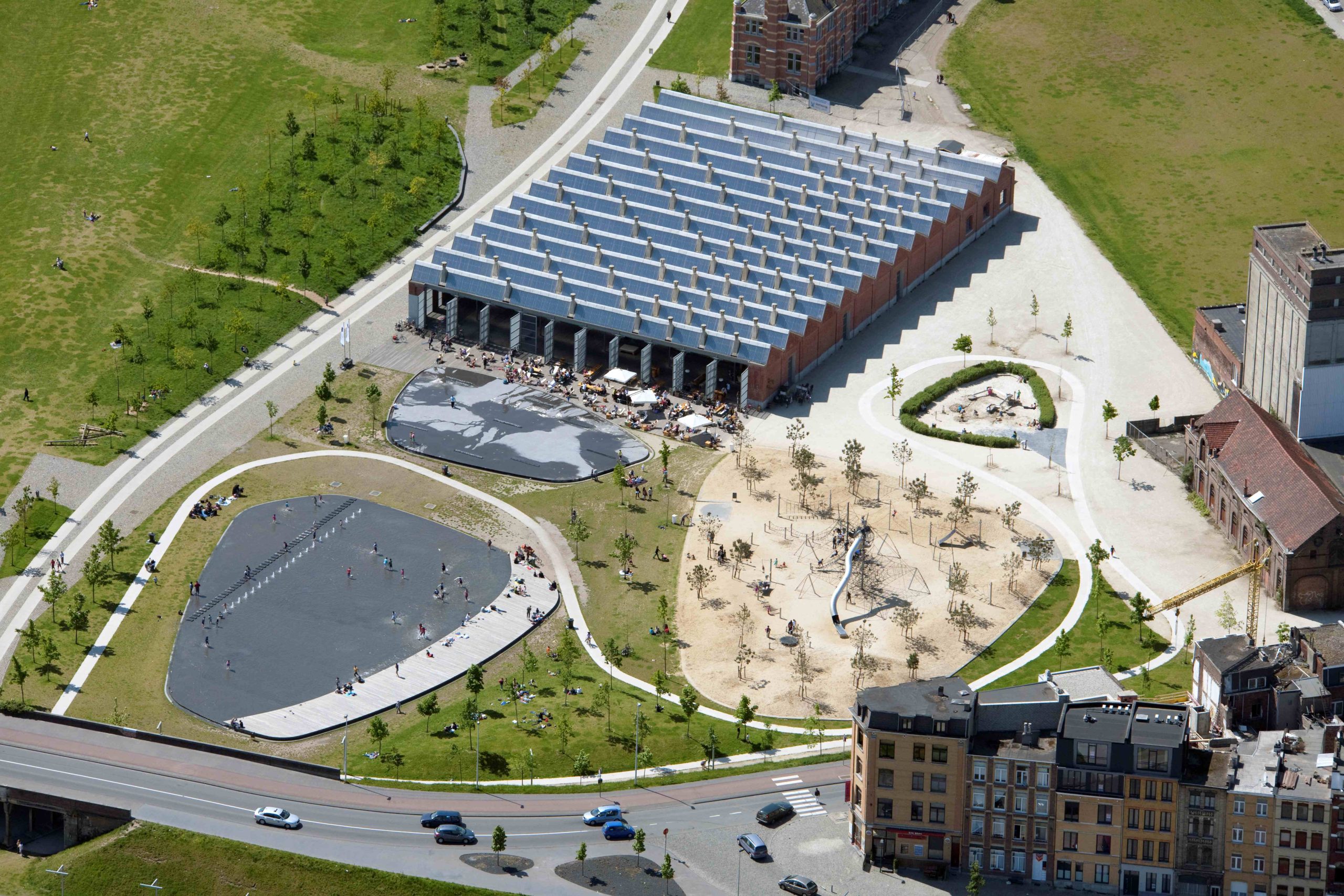
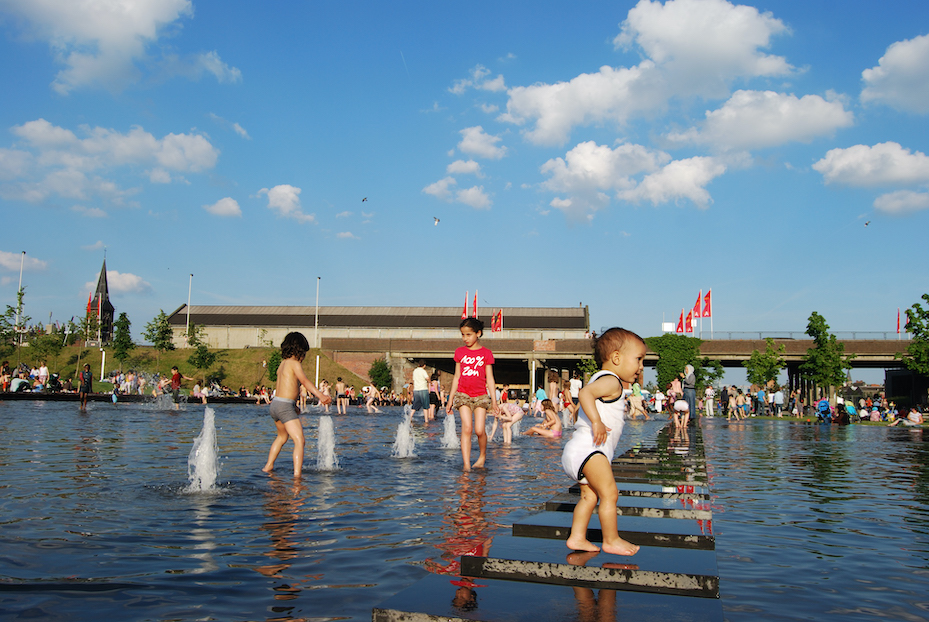
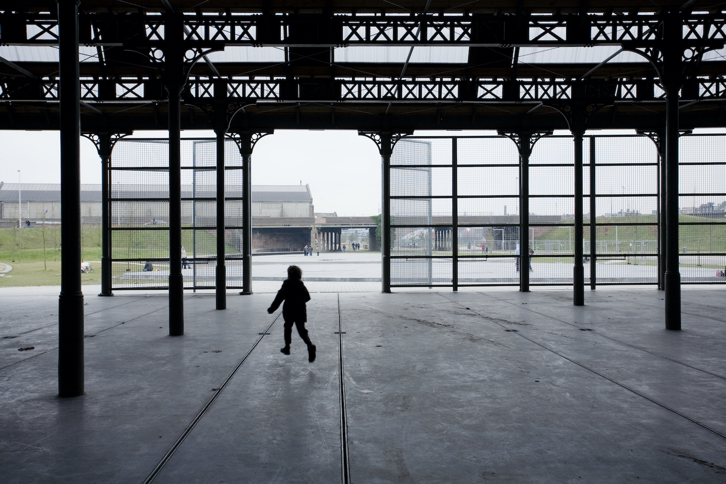
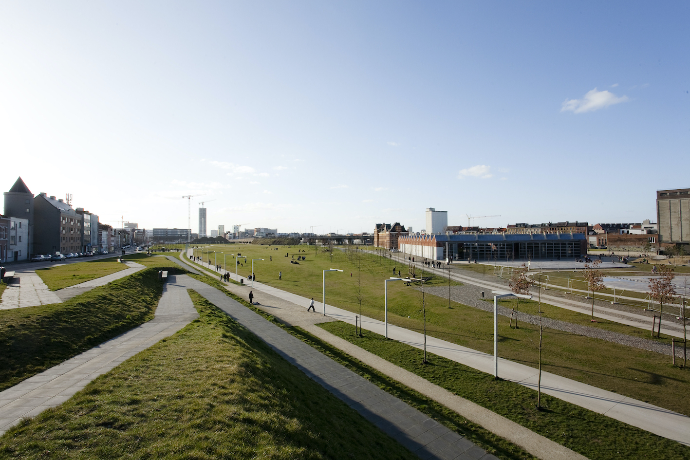
Park Spoor Noord
Antwerp, BE
2003/2009
Client: City of Antwerp
Program: Public space
Team: E.Alfier, K.Boon, A.Carlesso, G.De Roia, U.degli Uberti, U.Dufour, L.Fabian, T.Fait, S.Geeraert, A.Moro, C.Nitti, G.Pusch, K.Yoshida, G.Zaccariotto
In collaboration with: IRIS Consulting, Pieter Kromwijk, Meertens and Steffens
Nowadays a park is a «social space», a place for many everyday activities, a city part that can specially contribute to give a clear structure to the whole city and metropolis. The project for the new park in an area (about 24 ha) previously used by Belgian national rails is characterized by: -un uninterrupted space along the previous platform (1,7 km) to maintain the possibility of a connection (ecological as well as of communication) between Schelde river and the huge cultivated fringe spaces of the city. - the concentration of planned surfaces (200.000 m2 of housing, equipment’s, offices and commerce) in the west part towards the big boulevards. Two principles of implantation could co-exist at the same time: the campus (free objects in a park) and the tissue (the idea of an urban continuity). Here they are proposed as provisional conditions, with possible succession and not opposed to each other. Design of open spaces was conceived as in a constant natural evolution, in harmony with the process of implementation and life that will take place in it. - the integration of the two existing viaducts in a new topography that had also the secondary but important purpose of promoting the clearance of coal ashes polluted land.
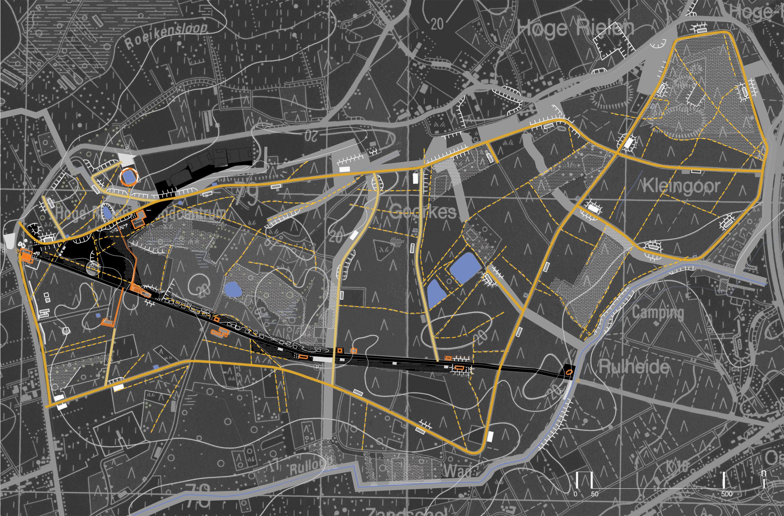
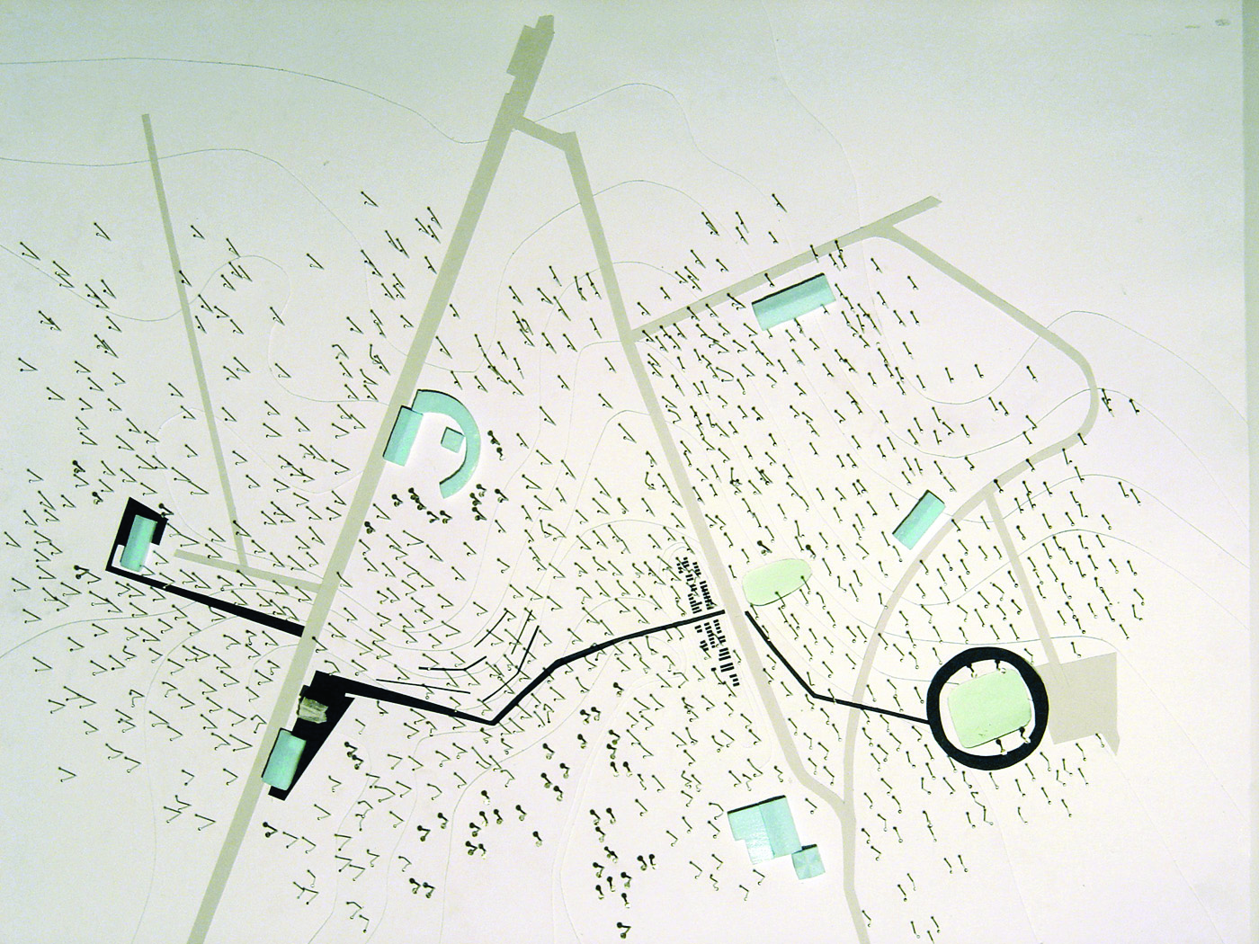
Hoge Rielen
Kasterlee, BE
2002/2007
Client: City of Antwerp
Program: Masterplan
Team: U.Dufour, L.Fabian, G.Lambrechts, J. Leenknegt, T.Lombardo, P.Ochelen, G.Pusch, U.degli Uberti, G.Zaccariotto
In collaboration with: Dirk Jaspaert, Mark de Koonig (BAS), ARA
Hoge Rielen was a military camp during the World War II. Protected sheds, pools of water in case of accident ... all this inside a forest once exploited for its timber, necessary material for the neighbouring metallurgical plants. After the war Hoge Rielen was transformed into a reception area for youth internships and summer camps. This destination has remained unchanged until today, but the success of the camp brought the need to improve the site. Some specific actions such as the expansion of the sheds, the renewal of the theatre, the building of a small hotel, the design of a versatile venue, etc…and general environmental improvements like water management, vegetation, footpaths and sports fields maintenance were considered in the project. The master plan, resulting from the competition winner project, currently under construction, pays great attention to atmospheres that are encounter in the camp and refer to the main present elements: the military background, the nature and the today’s young people who inhabit the place. Following the master plan Studio has developed detailed plans for the 'Contact Strip', the Hostel, the renovation of the theatre and the poly -functional site.
City port of Saint-Nazaire
Saint-Nazaire, FR
2002/2004
Client: Municipality of Saint-Nazaize
Program: Urban planning
Team: E.Alfier, M.Ballarin, U.degli Uberti, U.Dufour, T.Lombardo, A.Moro, G.Pusch,
In collaboration with: Olivier Chaumont
Saint-Nazaire, completely destroyed during the World War II, was re-constructed in a rational, but rather trivial, way. The project has the ambition to propose a strong image based on the reappropriation of 'mythical' places from the past, when Saint-Nazaire was the departure port of steamships to America. The project became a reflection on the three identities of the city. The identity of port city, which means the city in the past that was destroyed due to the presence of a Nazi submarine base; the identity of a specific place, the rock 'du Petit Maroc', heart of the city; the identity of relations, the Nantes - Saint-Nazaire metropolis, which is defining a new dimension of the city and the territory and their mutual relations. We propose a scenario of renovatio urbis for these reasons, which means a series of punctual operations that has the force to modify the wat the city 'works' as a whole and the role of a single part of the city apart from the whole city. The presence of the city cultural centre in the old station, of the open-air museum on the roof of the submarine base, of the new commercial centre in the block of “Maison du people”; of the contemporary art centre in Petit Maroc with the development of a new part of city on the port platform...They all add to the existing urban structure with complex places that strengthen its simple structure. The network of public spaces animated by these operations define a new vision of the city of Saint-Nazaire.
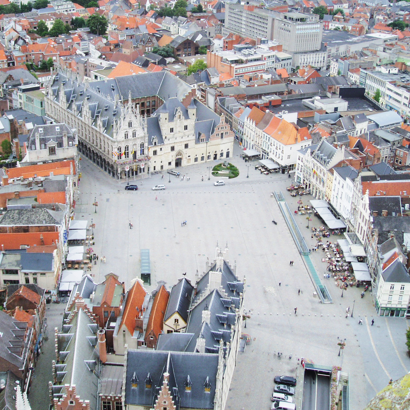
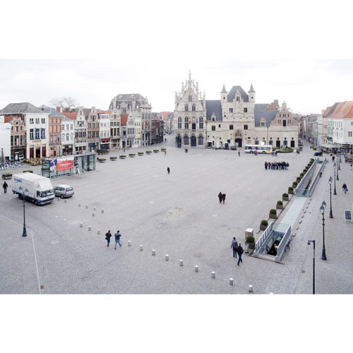
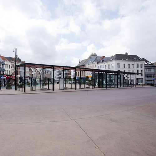
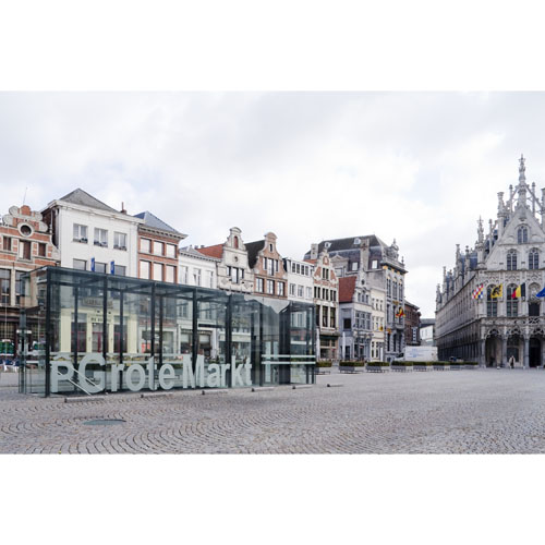
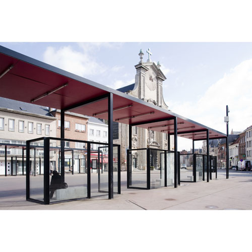
Grote Markt and the central space in Mechelen
Mechelen, BE
2002/2012
Client: City of Mechelen
Program: Public space
Team: K.Boon, M.D'Ambros, G.De Roia, U.degli Uberti, U.Dufour, L.Fabian, S.Geeraert, R.Miglietta, P.Ochelen, G.Pusch, W.Wambecq, K.Yoshida, G.Zaccariotto
In collaboration with: N.V. GILUCO
From the Veemarkt to the cathedral of Sint Rombouts the open spaces go through the most internal and old area of the city; orthogonal to these spaces an axis links the north and south gate of the city, the Dijle river at the south and the old canal which substituted it to the north. All along these axes, between the Cattle Market and the Cathedral, there are the most significant places of the city: the cathedral, the old city hall, the Big Square, the new city hall and the market. Defined by the very architecture front, these spaces invited a silent design, minimal, but very carefully-treated that enables the more various social practices to take place. A design that uses the minimal level differences of the ground to give an identity to the different parts of these spaces (the places of the terraces and the cafés, the waiting places and the bus routes, the places of relaxing and rest) and which makes effort to include the spaces of existing underground parking in the logic of public space, with slits that can give natural light to the underground.
Along the Dijle
Mechelen, BE
2000/2005
Client: City of Mechelen
Program: Public space
Team: K.Boon, M.D'Ambros, G.De Roia, U.degli Uberti, U.Dufour, L.Fabian, E.Giannotti, R.Miglietta, P.Ochelen, G.Pusch, G.Zaccariotto
In collaboration with: N.V. GILUCO
A public space, it is not just a surface a series of street furniture, facilities, ... It is first and foremost a place, space and volume. Beethoven Street in Lamot area is an external volume that organizes different functions and uses of public space. But even more important is that it is a vital space in the city of Mechelen. Located along the Dyle between the shopping streets, the Lamot site with its new modern art museum, a major new cultural centre will be. The space museum, which overlooks the river and the cathedral is an important public space in the centre of the main network places Mechelen. In the future, the old brewery Lamot, located along the Dyle between two trade routes, a contemporary art museum and waterfront homes act as an important cultural node. The museum, which will overlook the Dyle, is in the middle of the system capacity and is therefore clearly an important public place in Mechelen. Today, after the demolition of the wing of the brewery from the 30s, the site needs a new coherence, defining both openings and interior public spaces. The site entrance on the side of Guldenstraat will be marked by a new public building to replace the old angle Guldenstraat and Beethovenstraat building. This building manages its location and height, the visibility of the site and completes the front of the Guldenstraat as prescribed by the Directorate of Monuments and Sites. On the ground floor we find a terrace. On the first-floor spaces are available for small exhibitions or conferences while floors are reserved for offices. Fluid public space rises from underground parking, along the narrow streets of the old brewery to the next level.
'Falck' ex-steel factory
Milan, BE
1999
Client: ASMM
Program: Public space
Team: A.Alì, A.Boschetti, N.Goffi, A.Longo, N.Privileggio, M Secchi
In collaboration with: /
The concept of the park has always been a way to simultaneously evaluate the city and the natural environment. The restructuring process relies on a strategy of sharing spaces. A new space fragmentation leads to new dimensions that are more flexible and adaptable over time. Structure is chosen as the framework to guide the conversion process. The size and direction of the network is connected to the way the site drainage is achieved: a drainage system oriented along the direction of the water and following the main direction of the plain north of Milan. S-parkling is a park whose spine is made up of industrial roads that have been shaped by the movement of industrial machinery. S-parkling is then one of the ecologies of the project, together with the porous city, the islands of high technology and ecological linkage of the Lambro River where multiple programs work together. S-parkling won the 1999 first prize in the international competition.

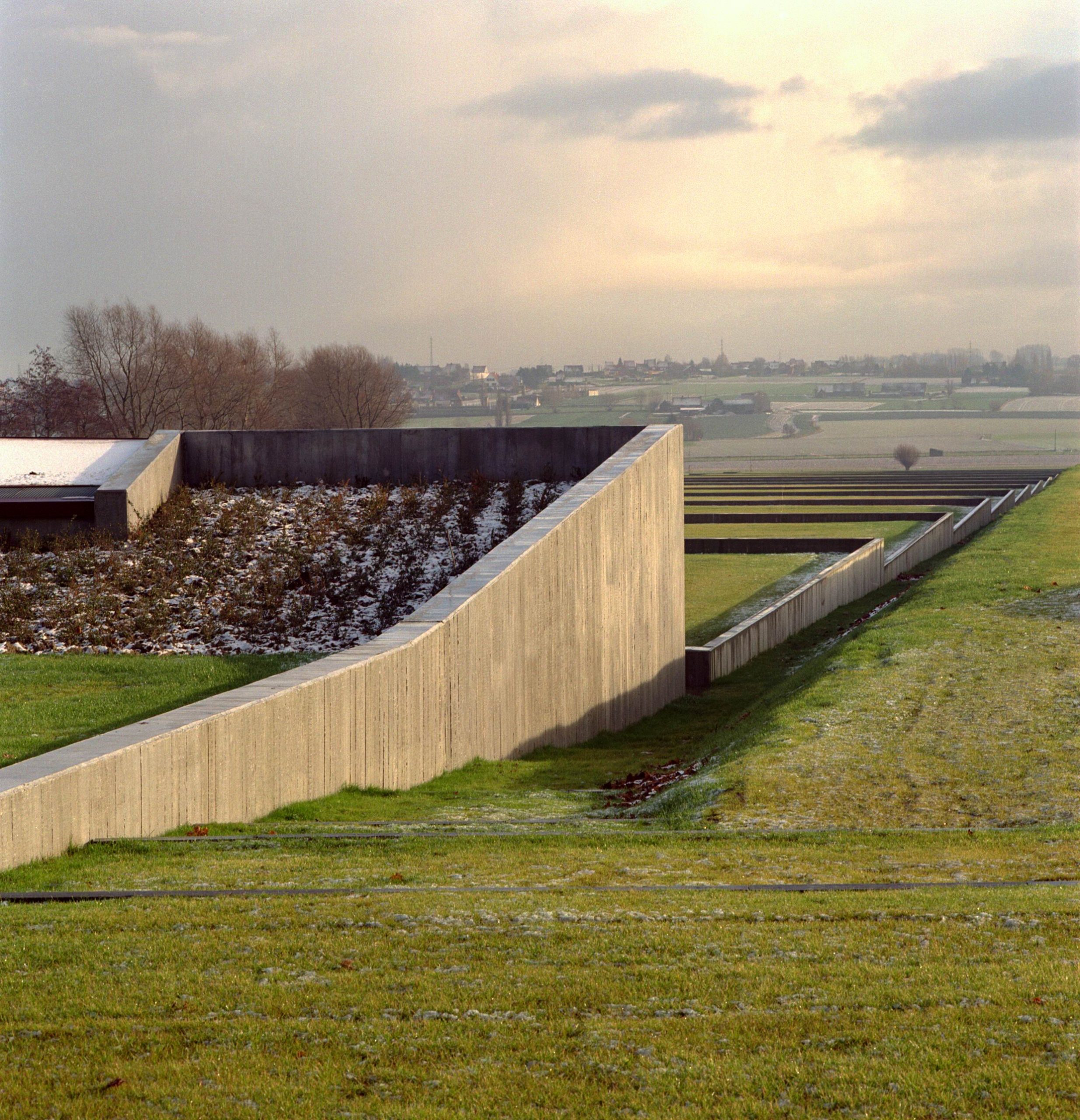
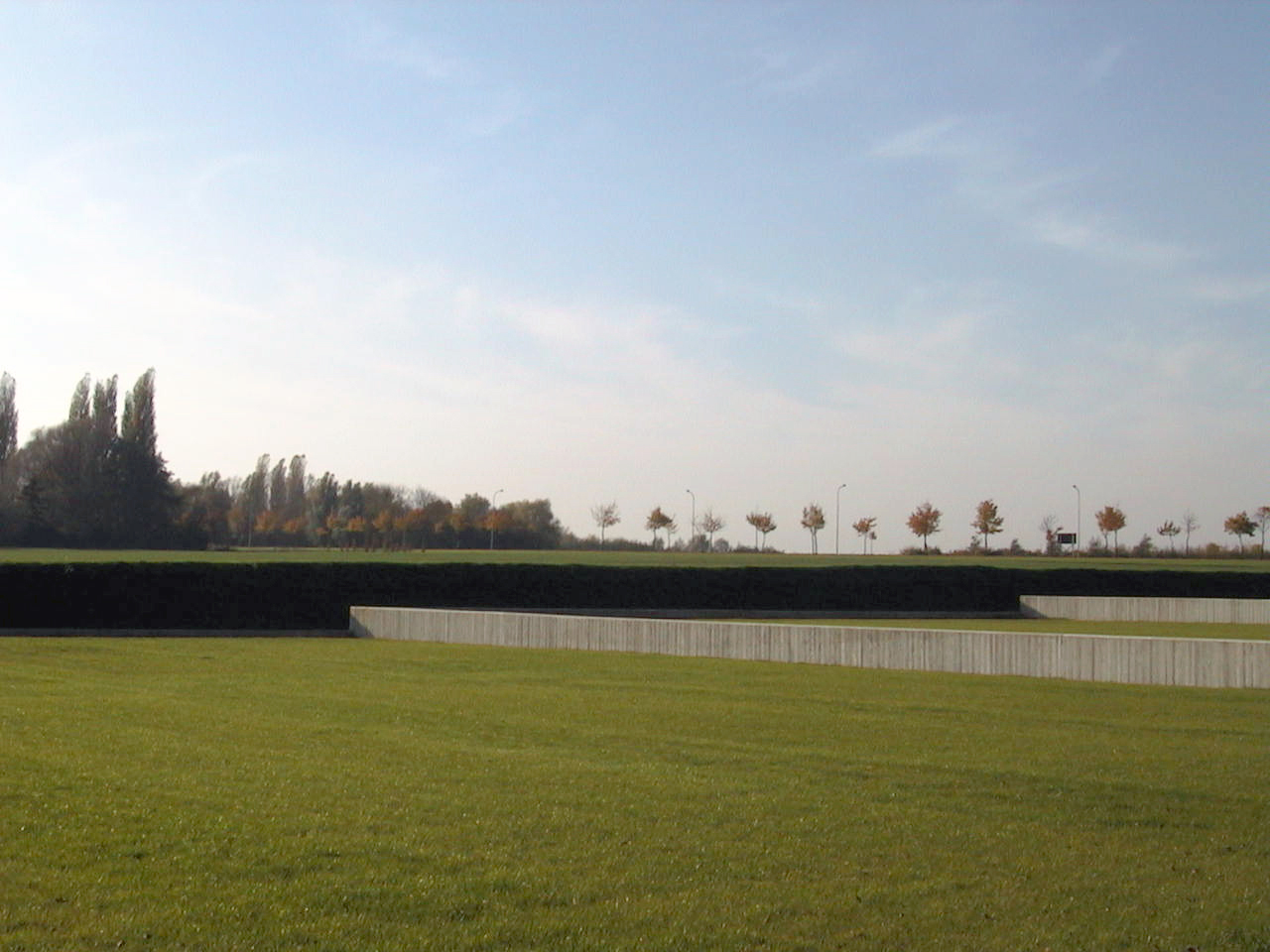
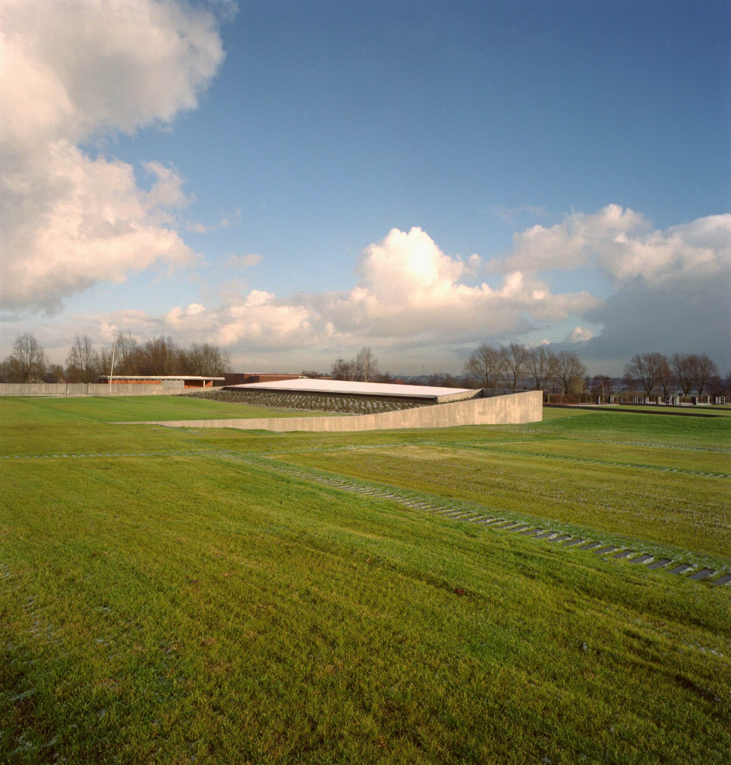
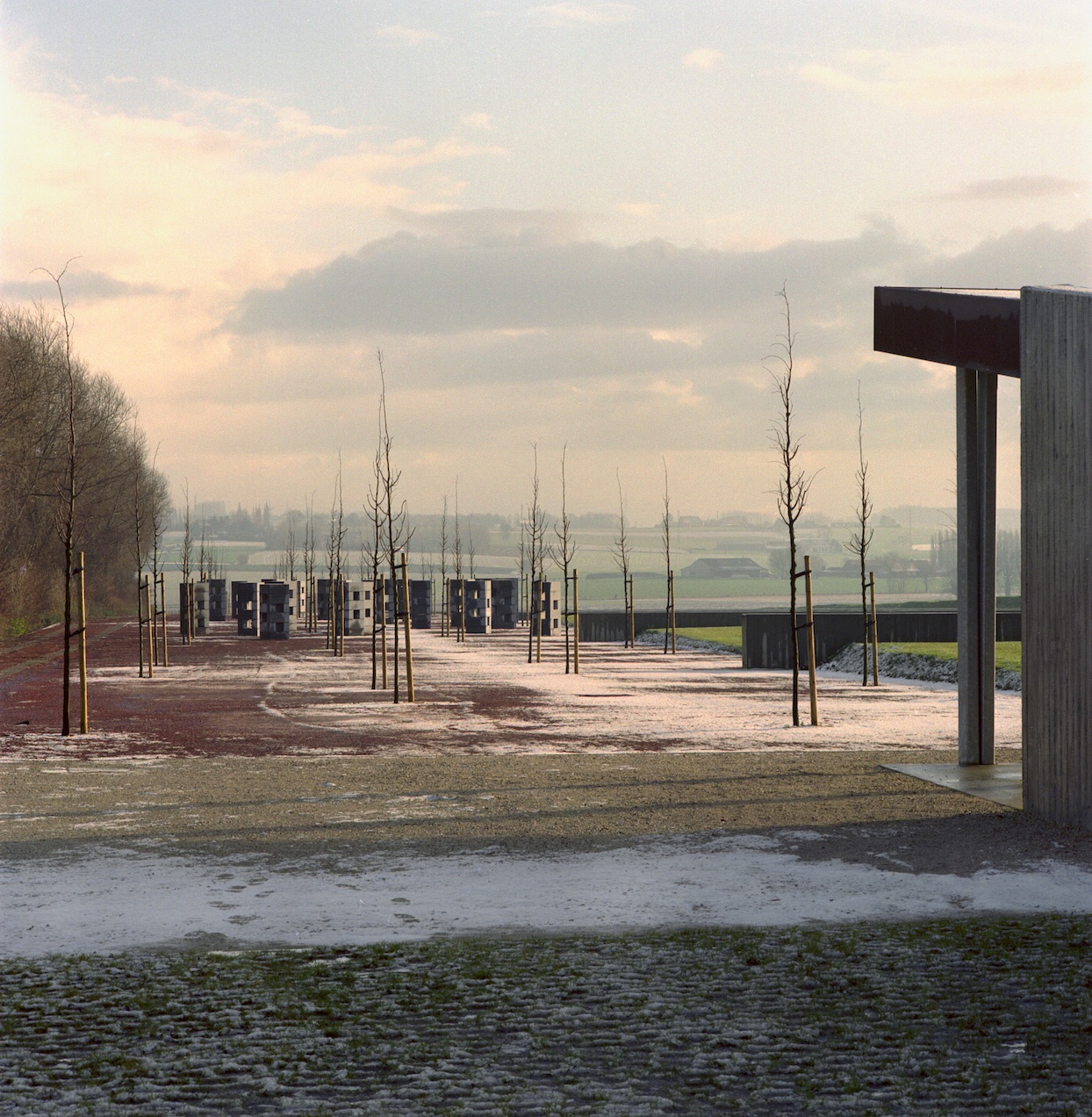
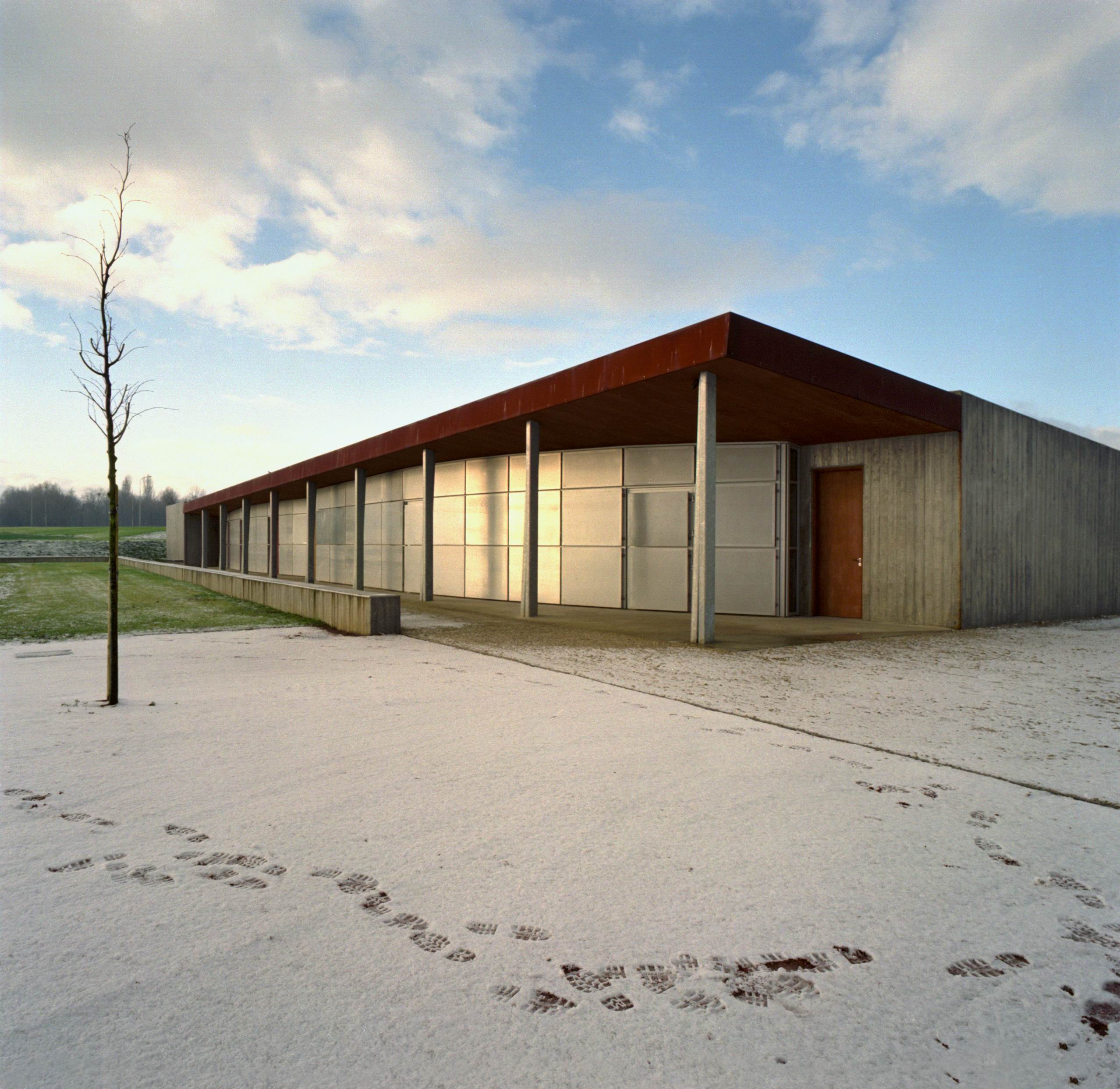
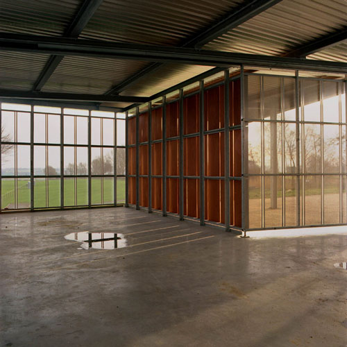
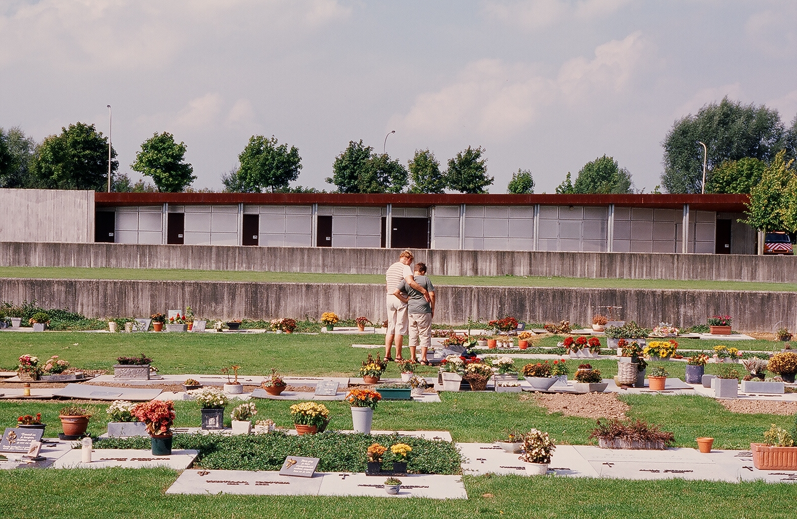
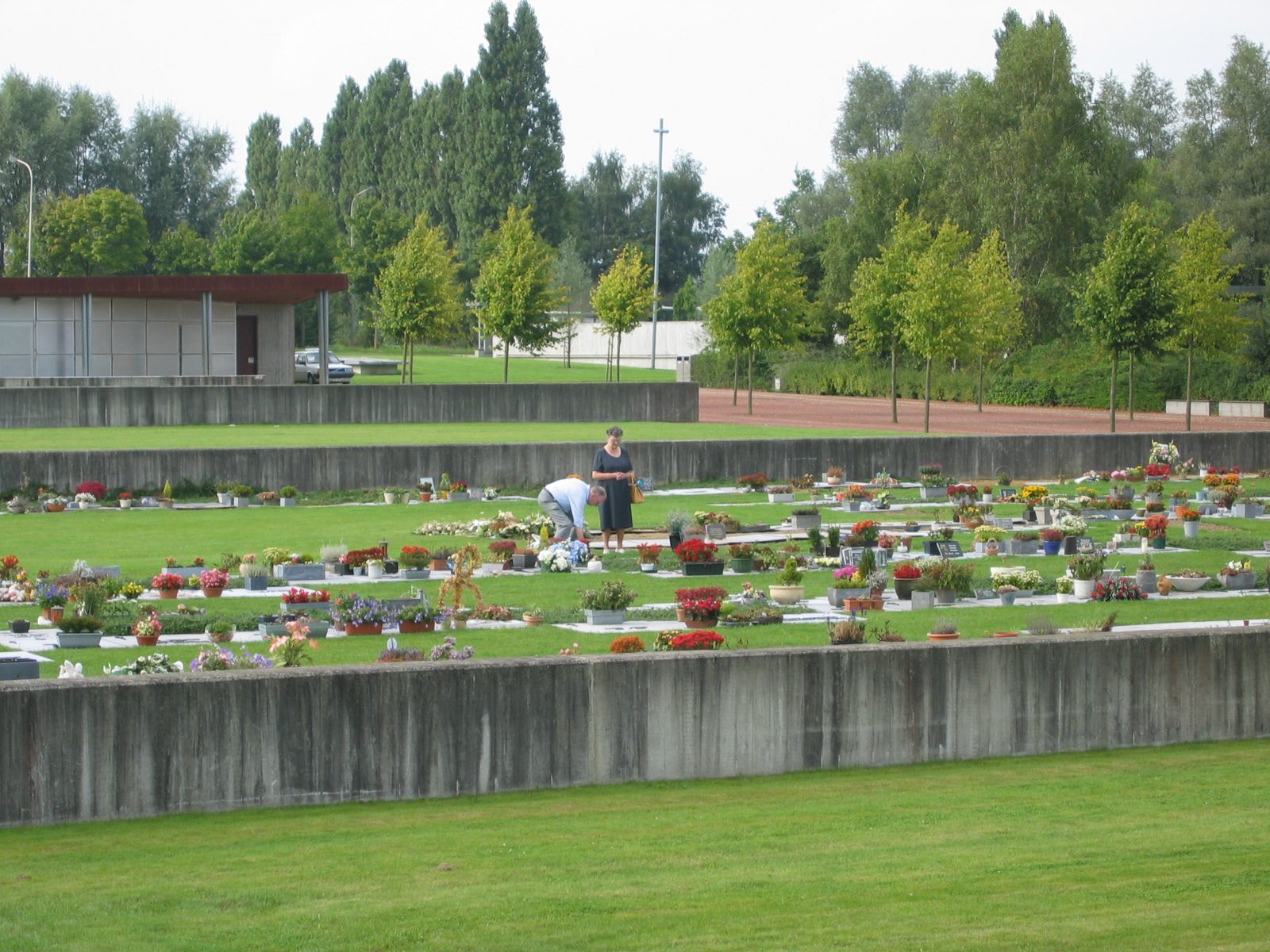
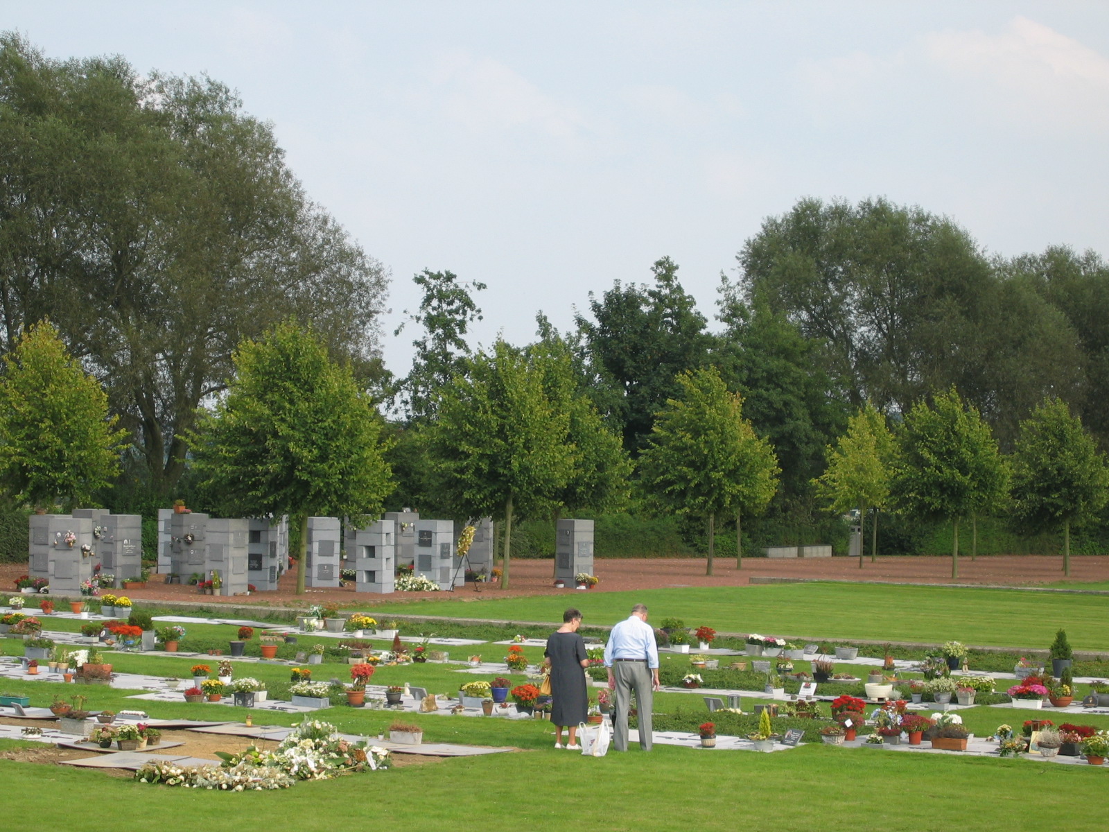
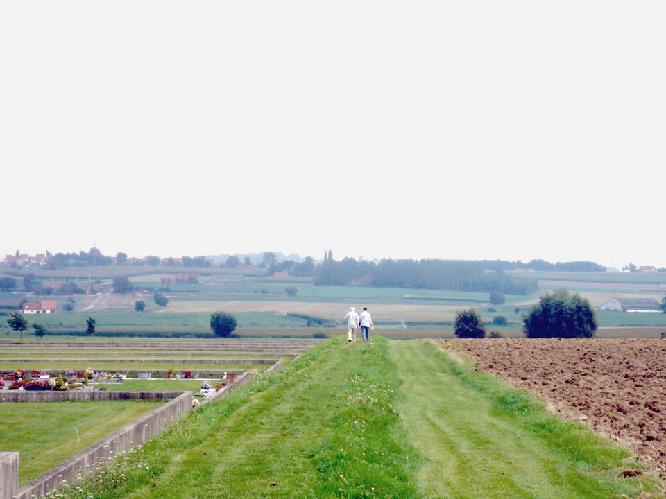
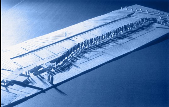
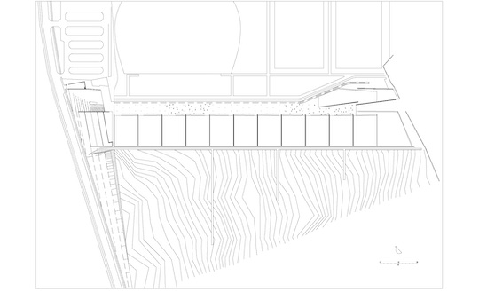
Cemetery of Kortrijk
Kortrijk, BE
1993/1999
Client: City of Kortrijk
Program: Public space/service
Team: Giovanna Comana, Greta Giunta, Nardo Goffi, Giorgio Manzoni, Barbara Martino, Annacarla Secchi, Tom van Mighiem
In collaboration with: Ann Cnockaert, Phlippe Cnockaert, Griet Robyn, Paul Vandeputte
The new cemetery site is on sloping terrain in the southern area of the city. Beyond the crest that marks the natural limits of the city and along which the road runs, the view onto the countryside opens out: the gentle terrain soars and slopes in broad still 'waves' up to reaching the following crest. This undulating Flemish landscape is crossed by a furrow that drives one's gaze towards the bottom of the valley: a route made out of broad flat regular surfaces partially cut into the terrain. The cemetery is totally embedded in the landscape, and is situated at the end of a public thoroughfare that crosses the town of Kortrijk from north to south. A long furrow, separates it off from the land art park. At the entrance a thick wall marks where the cemetery begins. The earth shifting was reduced to a minimum and used to clarify the way the cemetery is laid out: a broad ramp, configured as a sloping square mark the entrance. On one side lies a chamber of ceremonies with related facilities. The structures are covered by surface in corten steel that just peeks up above the terrain, revealing a face of glass panels and a metal grill that opens out onto the valley. A slit separates the chamber of ceremonies from the terrain. It allows the light to filter through and at night becomes a luminous line traced on the ground. Another luminous line along the walls beside the entrance reveals the depth of the square. Award: European Union Prize for Contemporary Architecture - Mies van der Rohe award - nominated -, 2001 Photgraphy: Carine Demeter (Syb’l S Pictures)